|
|
|
|
|
| M1 A1 | Princes Highway, West Gate Freeway, CityLink, Monash Freeway & Princes Freeway (M1 / A1) - Rosedale to Sale |
Statistics:
Route Numbering:
 1
1General Information:
M1 / A1 is a major route that crosses roughly from east to west in Victoria. The standard varies from single carriageway rural highway to full freeway standard.
Princes Highway (East):
The eastern section of the Princes Highway connects Traralgon to the Gippsland area and also Victoria's northeast. It's mostly undivided rural highway, generally one lane each way with occasional overtaking lanes. Several of the towns serviced by the route are very popular tourist destinations.
History:
Click here for the former alignment between Rosedale and Sale
| Rosedale to Sale | Sale to Rosedale | |||
| Preview: | Description: | Preview: | Description: | |
 |
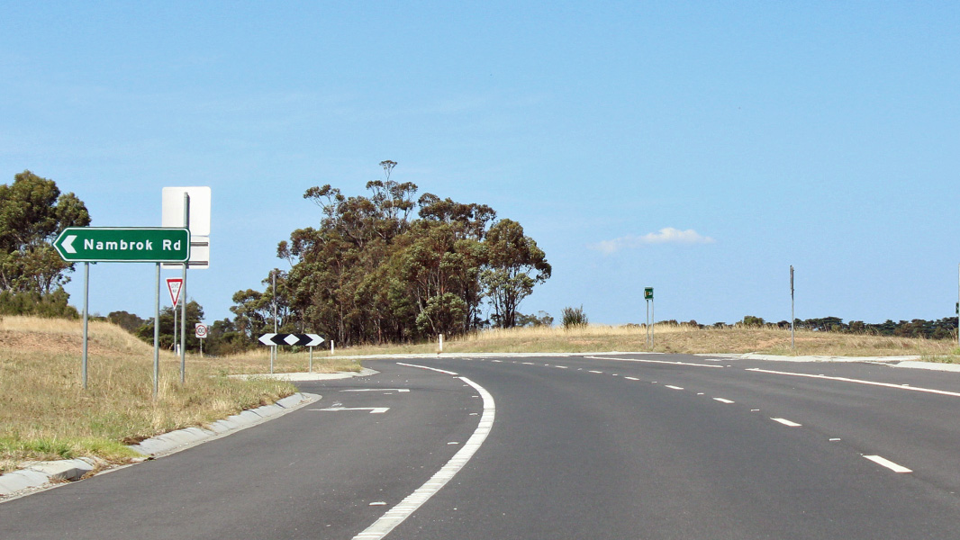
End Divided Road: End of divided road at Nambrok, September 2009. Image © Paul Rands |
 |
Intersection Directional Sign: ID sign at Sale at the junction with Myrtlebank-Bengworden Rd (C106), Janaury 2017. Image © Huang Milton Collection |
|
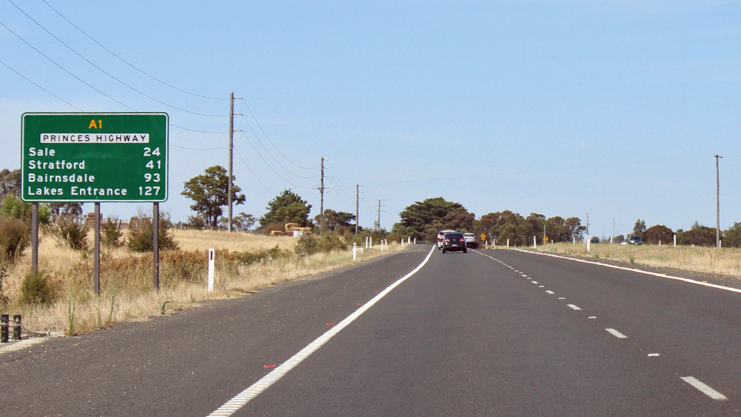 |
Distance Sign: RD sign on Princes Hwy at Nambrok, January 2017. Click here for a photo by Paul Rands of this location from September 2009. Image © Huang Milton Collection |
 |
Services Sign: Services sign on Princes Hwy at Sale, October 2008. Image © Darren Hodges |
|
 |
Advance Directional Sign: AD sign at Nambrok, approaching Nambrok Rd, Janaury 2017. Image © Huang Milton Collection |
 |
Sale: Princes Highway (A1) as it passes through Sale, October 2008. Image © Darren Hodges |
|
 |
Nambrok Road: Corner of Princes Hwy (A1) and Nambrok Rd in Nambrok, Janaury 2017. Image © Huang Milton Collection |
 |
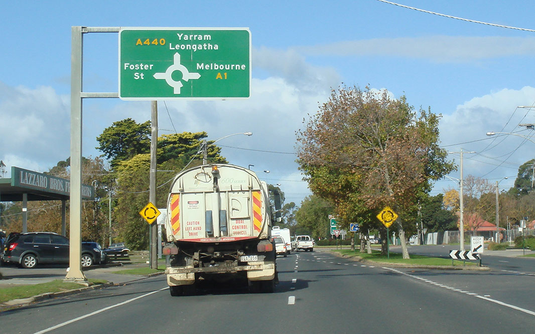
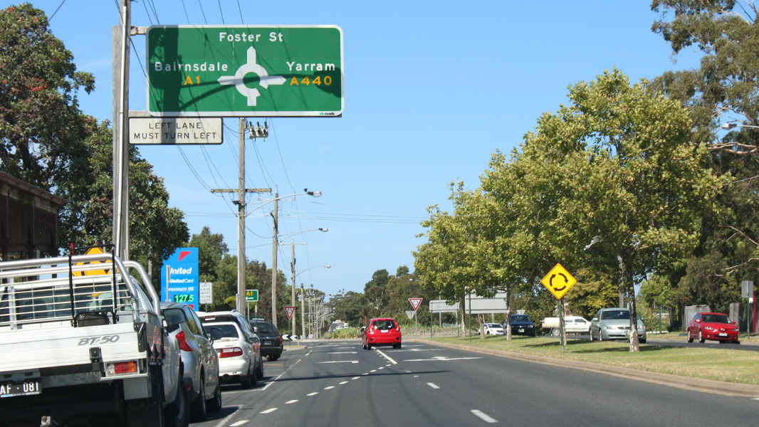
Advance Directional Signs: AD signs on the Princes Hwy (A1) as it approaches the roundabout with South Gippsland Hwy (A440) and Foster St in Sale, December 2013. Click here for a photo of this location by Darren Hodges from October 2008. Image © Michael Greenslade |
|
 |
Supplemental Advance Directional Sign: Supplemental AD sign at Nambrok for the junction with Maffra-Rosedale Rd (C487), September 2009. Image © Paul Rands |
 |
Advance Directional Signs: AD sign on the Princes Hwy (A1) approaching the roundabout with South Gippsland Hwy (A440) and Foster St in Sale, May 2011. Image © Paul Rands |
|
 |
Advance Directional Sign: AD sign at Nambrok for the junction with Maffra-Rosedale Rd (C487), Janaury 2017. Image © Huang Milton Collection |
 |
Intersection Directional Sign: ID sign assembly at the roundabout with South Gippsland Hwy (A440) and Foster St in Sale, May 2011. A1 turns right at this location Image © Paul Rands |
|
 |
Maffra-Rosedale Road Intersection: Corner of Princes Hwy (A1) and Maffra-Rosedale Rd (C487) at Nambrok, Janaury 2017. Image © Huang Milton Collection |
 |
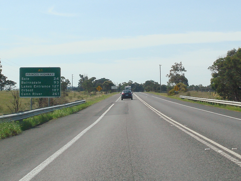
Reassurance Directional Sign: Distance sign at Sale, May 2011. Image © Paul Rands |
|
 |
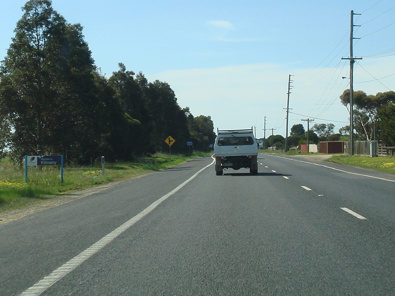
Central Gippsland Drain No 2: Princes Hwy (A1) as it crosses Central Gippsland Drain No 2 at Kilmany, September 2009. Image © Paul Rands |
 |
Reassurance Directional Sign: Distance sign at Sale, December 2013. Image © Michael Greenslade |
|
 |
Advance Directional Sign: AD sign at Kilmany approaching Sale-Toongabbie Rd, Janaury 2017. Image © Huang Milton Collection |
|||
 |
Sale-Toongabbie Road Intersection: Corner of Princes Hwy (A1) and Sale-Toongabble Rd at Kilmany, September 2009. Image © Paul Rands |
|||
 |
Welcome Sign: Tourism sign welcoming motorists to the Gippsland Lakes region, Kilmany, Janaury 2017. Image © Huang Milton Collection |
|||
 |
Entering Kilmany: Princes Hwy as it enters the town of Kilmany, September 2009. Image © Paul Rands |
|||
 |
Advance Directional Sign: Incorrectly coloured AD sign approaching Velore Rd in Kilmany, September 2009. Image © Paul Rands |
|||
 |
Advance Directional Sign: AD sign at Fulham approaching Hopkins Rd, January 2017. Click here for a photo by Paul Rands of this location from September 2009. Image © Huang Milton Collection |
|||
 |
Advance Directional Sign: AD sign at Fulham approaching Sale-Heyfield Rd (C491), January 2017. Click here for a photo by Paul Rands of this location from September 2009. Image © Huang Milton Collection |
|||
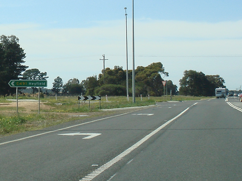
 |
Sale-Heyfield Road Intersection: Corner of Princes Hwy (A1) and Sale-Heyfield Rd (C491) at Fulham, January 2017. Click here for a photo by Paul Rands of this location from September 2009. Image © Huang Milton Collection |
|||
 |
Services Sign: Services sign at Fulham for Sale, September 2009. Image © Paul Rands |
|||
 |
Reassurance Directional Sign: Distance sign with tourism-related destinations, Warruk, Janaury 2017. Image © Huang Milton Collection |
|||
 |
Entering Sale: Princes Hwy (A1) announcing the town of Sale but in the town of Wurruk, September 2009. Image © Paul Rands |
|||
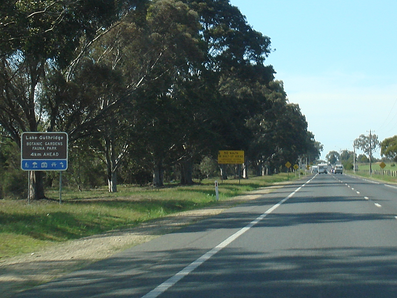 |
Advance Directional Sign: AD sign at Wurruk for Lake Guthridge, September 2009. Image © Paul Rands |
|||
 |
Advance Directional Sign: AD sign at Wurruk, approaching Hunt Pl, Janaury 2017. Image © Huang Milton Collection |
|||
 |
Hunt Place Intersection: Corner of Princes Hwy (A1) and Hunt Pl in Wurruk, January 2017. Click here for a photo by Paul Rands of this location from September 2009. Image © Huang Milton Collection |
|||
 |
Entering Wurruk: Princes Hwy as it enters the town of Wurruk, September 2009. Image © Paul Rands |
|||
 |
Sale Causeway: Princes Hwy as it crosses the Sale Causeway, September 2009. Image © Paul Randse |
|||
 |
Thomson River: Princes Hwy at Sale as it crosses Thomson River, September 2009. Image © Paul Rands |
|||
 |
Sale CBD: Princes Hwy (A1) as it passes through the Sale CBD, near Raymond St and Punt Ln, September 2009. Image © Paul Rands |
|||
 |
Advance Directional Sign: AD sign in Sale approaching South Gippsland Hwy (A440) and Forster St, Janaury 2017. Image © Huang Milton Collection |
|||
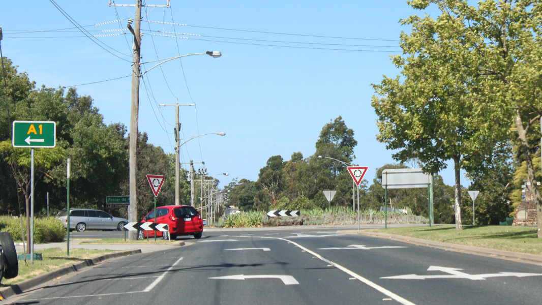 |
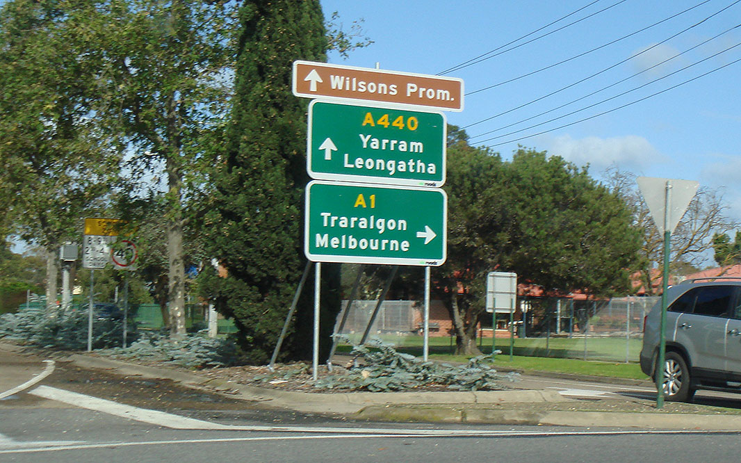
Trailblazer: A1 trailblazer at the roundabout with South Gippsland Hwy (A440) and Forster St, January 2017. Click here for a photo by Paul Rands of the old NR1 trailblazer in this location from September 2009. A1 turns left at this junction. Image © Huang Milton Collection |
|||
 |
South Gippsland Hwy, Princes Hwy & Forster St Junction: Intersection directional sign at the roundabout with South Gippsland St (A440), Princes Hwy (A1) and Forster St in Sale, September 2009. Image © Paul Rands |
|||
 |
South Gippsland Hwy, Princes Hwy & Forster St Junction: Intersection directional sign at the roundabout with South Gippsland St (A440), Princes Hwy (A1) and Forster St in Sale, September 2009. Image © Paul Rands |
|||
 |
Approaching Macalister Street: Princes Hwy (A1) at Sale approaching the intersection with Macalister St, September 2009. Image © Paul Rands |
|||
 |
Advance Directional Sign: AD sign on Princes Hwy (A1) approaching Raglan St (C498 and TD15) in Sale, September 2009. Image © Paul Rands |
|||
 |
Raglan Street Intersection: Intersection directional sign on the roundabout with Raglan St (C498 and TD15) at Sale, September 2009. Image © Paul Rands |
|||
 |
Raglan Street Intersection: Intersection directional sign on the roundabout with Raglan St (C498 and TD15) at Sale, September 2009. Image © Paul Rands |
|||
 |
Advance Directional Sign: AD sign on Princes Hwy (A1) at Sale, approaching the intersection with Maffra-Sale Rd (C492), January 2017. Click here for a photo by Paul Rands of this location from September 2009. Image © Huang Milton Collection |
|||
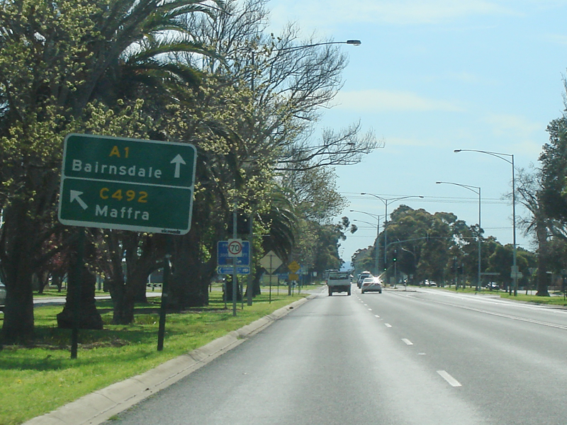
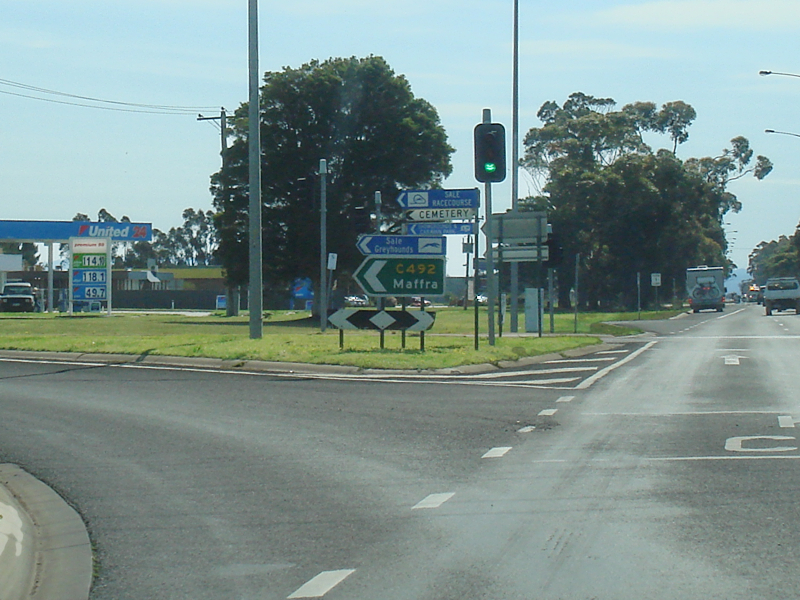 |
Maffra-Sale Road Intersection: Corner of Princes Hwy (A1) and Maffra-Sale Rd (C492) at Sale, September 2009. Image © Paul Rands |
|||
 |
Intersection Directional Sign: ID sign facing Maffra-Sale Rd (C492) at Sale, Janaury 2017. Image © Huang Milton Collection |
|||
|
Advance Directional Sign: AD sign at Sale approaching the junction with Myrtlebank Road and Bengworden Road (C106), Janaury 2017. Image © Huang Milton Collection |
|||
| Click here for the continuation of A1 between Sale and Bairnsdale Click here for the continuation of A1 between Morwell and Rosedale |
||||
1 Viseth Uch
2 Vicroads Road Management Plan, 30 October 2004
Last updated: 19-Aug-2020 13:23
This site © Paul Rands. All rights reserved. Some portions © (copyright) by their respective and credited owners. Permission must be obtained before using any images from this site. For details, please email by clicking here.