|
|
|
|
|
| C415 | Mt Dandenong Road & Mt Dandenong Tourist Road (C415) |
Statistics:
Route Numbering:

General Information:
C415 is a windy undivided route through the Dandenong Ranges in Melbourne's east. It passes through very picturesque terrain and services residential, commercial and bushland areas, and provides access to several tourist attractions.
Multiplexes along the route include:

| Upper Ferntree Gully to Montrose | Montrose to Upper Ferntree Gully | |||
| Preview: | Description: | Preview: | Description: | |
 |
Advance Directional Sign: AD sign on Mt Dandenong Tourist Rd (C415) at Montrose approaching the roundabout with Leith Rd (C401) & Montrose Rd, August 2015. The C401 duplex starts at this junction. Image © Paul Rands |
 |
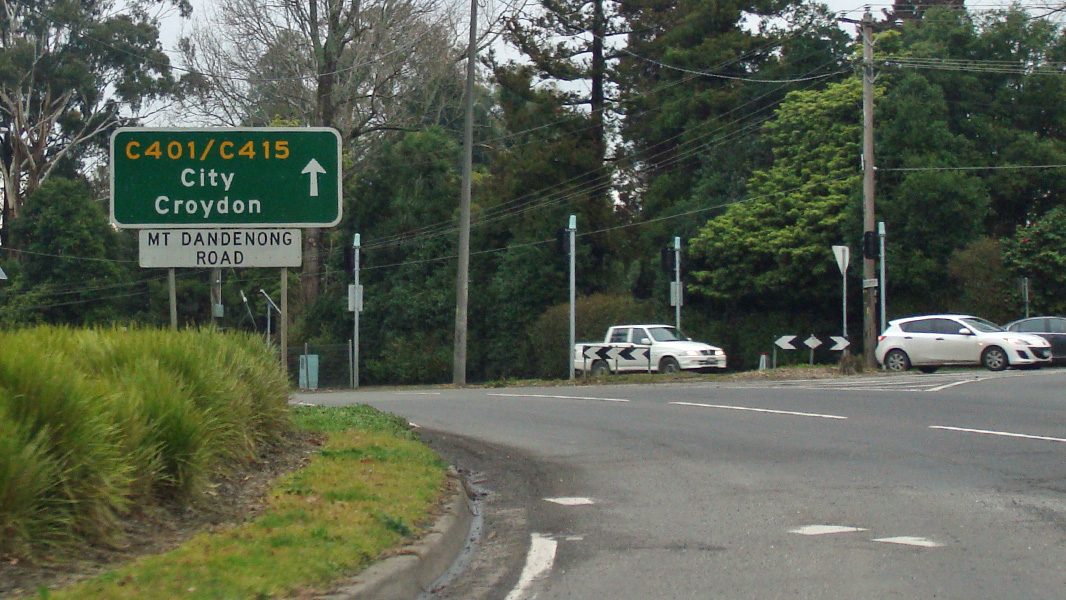
Advance Directional Sign: AD sign on Mt Dandenong Rd (C401 / C415) at Montrose approaching the roundabout with Leith Rd (C401) and Montrose Rd, August 2015. Image © Paul Rands |
|
 |
Intersection Directional Sign: ID sign at the corner of Mt Dandenong Tourist Rd (C415), Montrose Rd & Leith Rd (C401) at Montrose, August 2015. The C401 duplex starts at this junction. Image © Paul Rands |
 |
Intersection Directional Sign: ID sign on the roundabout with Mt Dandenong Rd (C401 / C415), Leith Rd (C401) and Montrose Rd at Montrose, August 2015. Image © Paul Rands |
|
 |
Reassurance Directional Sign: Distance sign at Montrose, August 2015. Image © Paul Rands |
|||
 |
Ridge Road: Corner of Mt Dandenong Tourist Rd (C415) and Ridge Rd (C403) at Kalorama, August 2015. Image © Paul Rands |
|||
| Click here for the continuation of Mt Dandenong Rd as Metropolitan Route 62 | ||||
1 VicRoads Road Maintenance Category - Road List Version 1, September 2012
Last updated: 12-Feb-2019 18:49
This site © Paul Rands. All rights reserved. Some portions © (copyright) by their respective and credited owners. Permission must be obtained before using any images from this site. For details, please email by clicking here.