|
|
|
|
|
| B500 | Great Alpine Road (B500) |
Statistics:
Route Numbering:


General Information:
The Great Alpine Road stretches from the Gippsland coast at Bairnsdale across Victoria’s alpine country and ends in Wangaratta.
The route is rural highway standard is quite windy through the mountainous regions it passes through. Sections of the route were formerly known as Omeo Highway between Lucknow and Omeo, formerly known as Ovens Highway between Bright and Wangaratta.
History:

| Lucknow to Wangaratta | Wangaratta to Lucknow | |||
| Preview: | Description: | Preview: | Description: | |
 |
Start B500: Sign indicating start of Great Alpine Rd (B500) at Lucknow, May 2011. Image © Paul Rands |
 |
Distance Sign: RD sign at Wangaratta, January 2008. Image © Viseth Uch |
|
 |
Distance Sign: RD sign at Lucknow, May 2011. Image © Paul Rands |
 |
Advance Directional Sign: AD sign at Wangaratta East approaching the interchange with Hume Fwy (M31), January 2008. Image © Viseth Uch |
|
 |
Advance Directional Sign: AD sign at Lucknow approaching Eastwood Rd and Lanes Rd, May 2011. Image © Paul Rands |
 |
Intersection Directional Sign: ID sign at the Hume Fwy (M31) interchange at Wangaratta East, January 2008. Image © Viseth Uch |
|
 |
Distance Sign: RD sign at Lucknow, May 2011. Image © Paul Rands |
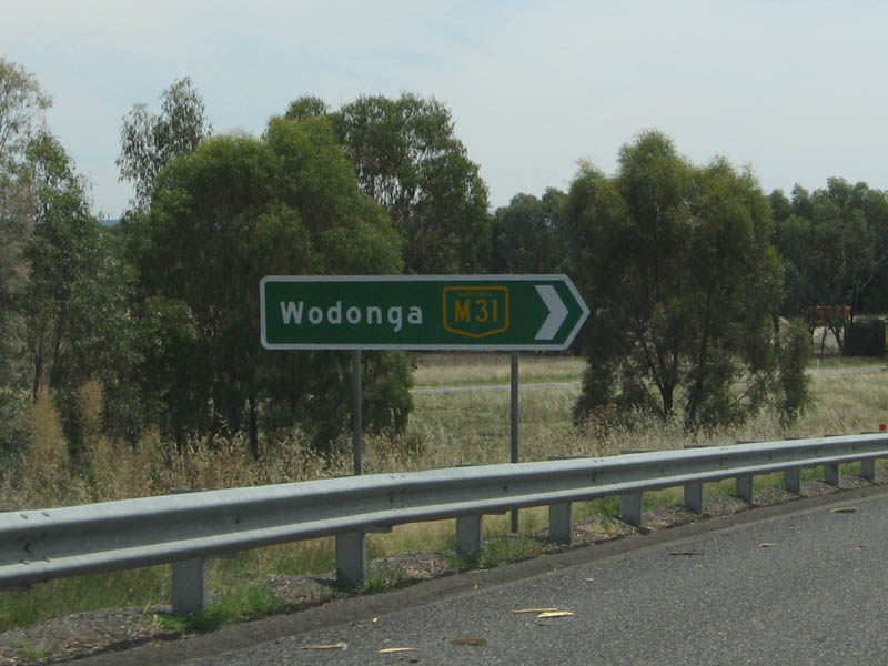 |
Intersection Directional Sign: ID sign at the Hume Fwy (M31) interchange at Wangaratta East, January 2008. Image © Viseth Uch |
|
 |
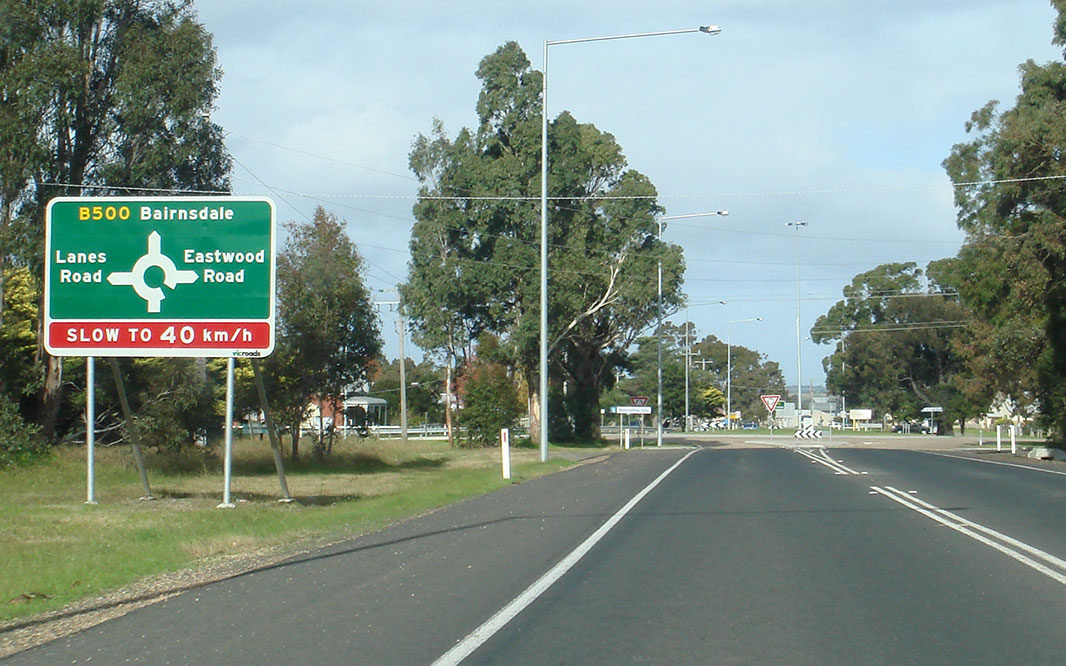
Eastwood Road & Lanes Road: ID sign on the roundabout with Eastwood Rd & Lanes Rd, Lucknow, May 2011. Image © Paul Rands |
 |
Intersection Directional Sign: ID sign at the Hume Fwy (M31) interchange at Wangaratta East, January 2008. Image © Viseth Uch |
|
 |
Eastwood Road & Lanes Road: ID sign on the roundabout with Eastwood Rd & Lanes Rd, Lucknow, May 2011. Image © Paul Rands |
 |
Distance
Sign: RD sign at Porepunkah, September 2018. Image © Dean Sherry |
|
 |
Tourism Sign: Tourism sign for Great Alpine Rd (B500) at Lucknow, May 2011. Image © Paul Rands |
 |
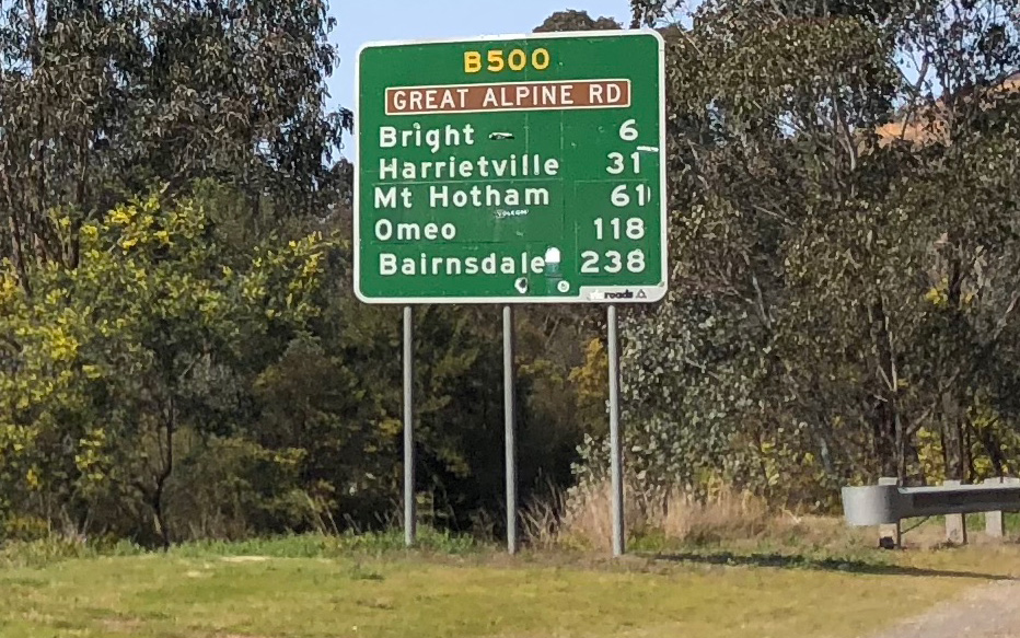
Distance Sign: RD sign at Bright, April 2005. Image © Viseth Uch |
|
 |
Road Conditions Sign: Road conditions sign at Lucknow, May 2011. Image © Paul Rands |
 |
Bright Area: B500 as it passes through the Bright area, April 2005. Image © Viseth Uch |
|
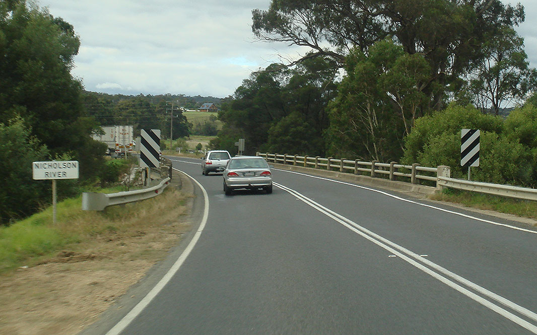 |
Nicholson River: Gt Alpine Rd (B500) crossing Nicholson River at Sarsfield, May 2011. Image © Paul Rands |
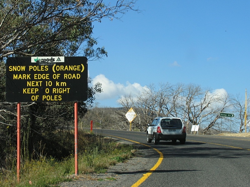 |
Snow Poles Sign: Sign at Mt Hotham near Dargo High Plains Rd explaining the use of orange poles to show the road route in snowy conditions, April 2005. Also note the yellow road markings, to show the road lanes in snowy conditions. Image © Viseth Uch |
|
 |
Supplemental Advance Directional Sign: Supplemental AD sign at Mossiface approaching Swan Reach Rd (C605), May 2011. Image © Paul Rands |
 |
Mt Hotham Area: Great Alpine Road as it winds its way through the Mt Hotham area, April 2005. Image © Viseth Uch |
|
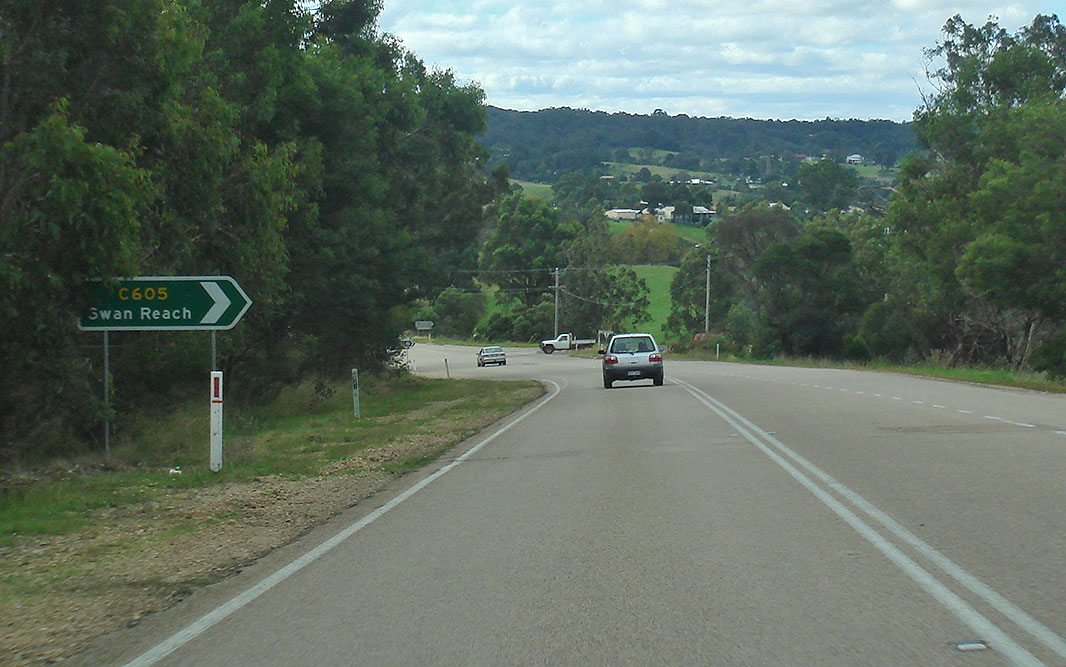 |
Advance Directional Sign: AD sign at Mossiface approaching Swan Reach Rd (C605), May 2011. Image © Paul Rands |
 |
Mt Hotham Area: Great Alpine Road as it winds its way through the Mt Hotham area, April 2005. Image © Viseth Uch |
|
 |
Swan Reach Road: Corner of Gt Alpine Rd (B500) and Swan Reach Rd at Mossiface, May 2011. Image © Paul Rands |
 |
Mt Hotham Area: Great Alpine Road as it winds its way through the Mt Hotham area, April 2005. Image © Viseth Uch |
|
 |
Supplemental Advance Directional Sign: Supplemental AD sign at Bruthen approaching Bruthen-Nowa Nowa Rd (C620), May 2011. Image © Paul Rands |
 |
Distance Sign: RD sign at Mt Hotham, with yellow text for snowy conditions, April 2005. Image © Viseth Uch |
|
 |
Advance Directional Sign: AD sign at Bruthen approaching Bruthen-Nowa Nowa Rd (C620), May 2011. Image © Paul Rands |
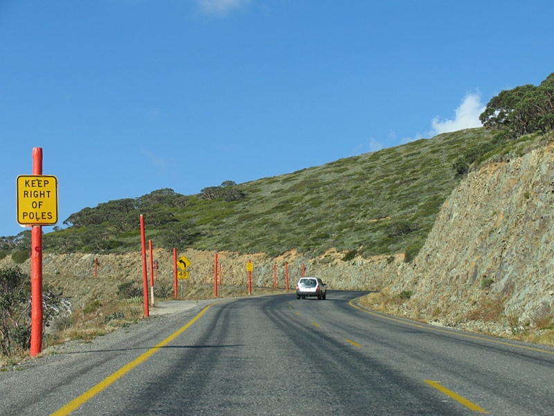 |
Mt Hotham Area: Great Alpine Road as it winds its way through the Mt Hotham area, April 2005. Image © Viseth Uch |
|
 |
Bruthen-Nowa Nowa Road: Gt Alpine Rd (B500) at the junction with Bruthen Nowa-Nowa Rd at Bruthen, May 2011. B500 turns left at this location. Image © Paul Rands |
 |
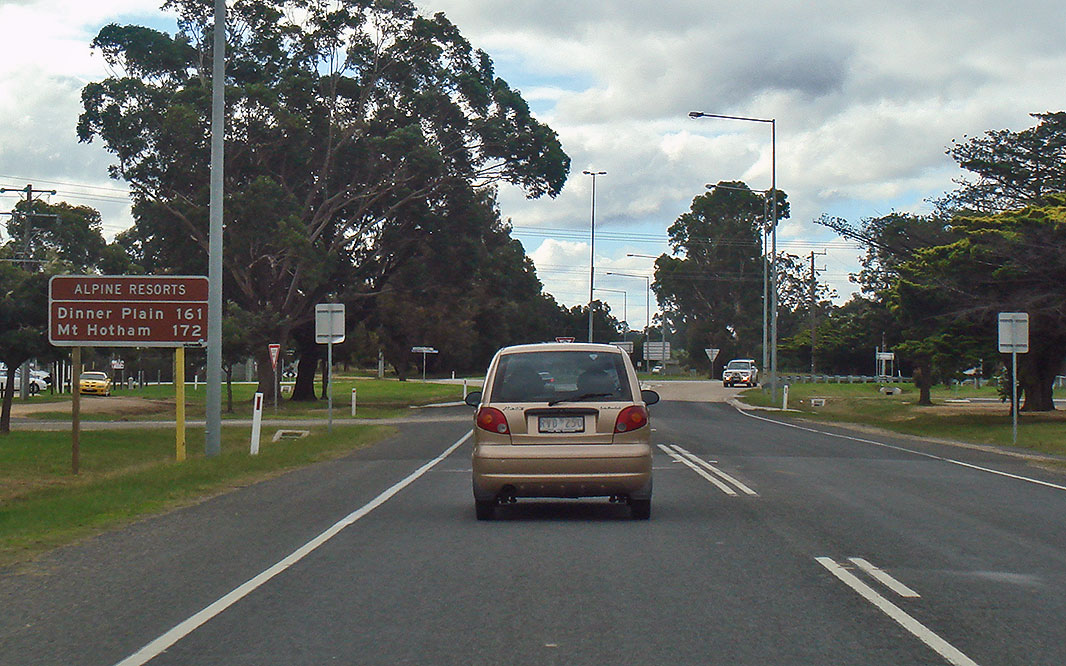
Dinner Plain Area: B500 as it passes through the Dinner Plain area, April 2005. Image © Viseth Uch |
|
 |
Reassurance Directional
Sign: Distance sign at Bruthen, December 2013. Image © Michael Greenslade |
 |
Accident Zone Warning Sign: Sign between Dinner Plain and Omeo indicating a section of road prone to crashes, April 2005. Image © Viseth Uch |
|
 |
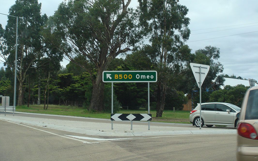
Advance Directional Sign: AD sign at Omeo approaching Swifts Creek-Omeo Road, April 2005. Image © Viseth Uch |
|||
 |
Advance Directional
Sign: AD sign at Bruthen approaching Bruthen-Nowa Nowa Rd (C620), December 2013. B500 turns right at this intersecton. Image © Michael Greenslade |
|||
 |
Bruthen Town Centre: Great Alpine Rd (B500) as it passes through Bruthen, December 2013. Image © Michael Greenslade |
|||
 |
Reassurance Directional
Sign: Distance sign at Bruthen, May 2011. Image © Paul Rands |
|||
 |
Swan Reach Road: Corner of Gt Alpine Rd (B500) and Swan Reach Rd at Mossiface, May 2011. Image © Paul Rands |
|||
 |
Swan Reach Road: Corner of Gt Alpine Rd (B500) and Swan Reach Rd at Mossiface, May 2011. Image © Paul Rands |
|||
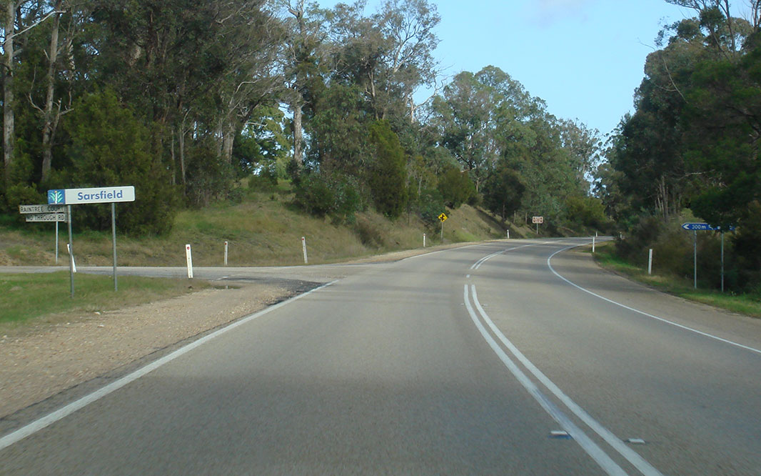 |
Entering Sarsfield: Gt Alpine Rd (B500) as it enters the town of Sarsfield, May 2011. Image © Paul Rands |
|||
 |
Fruit Fly Control Sign: Quarantine restriction sign at Sarsfield, May 2011. Image © Paul Rands |
|||
 |
Fruit Fly Control Sign: Quarantine restriction sign at Sarsfield, May 2011. Image © Paul Rands |
|||
 |
Nicholson River: Gt Alpine Rd (B500) crossing Nicholson River at Sarsfield, May 2011. Image © Paul Rands |
|||
 |
Tourism Sign: Tourism sign at Sarsfield, May 2011. Image © Paul Rands |
|||
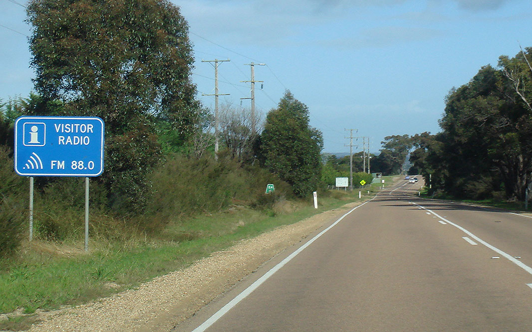 |
Visitor Radio Sign: Sign indicating frequency for the local tourism radio station, Lucknow, May 2011. Image © Paul Rands |
|||
 |
Advance Directional Sign: AD sign at Lucknow approaching Eastwood Rd and Lanes Rd, May 2011. Image © Paul Rands |
|||
 |
Entering Bairnsdale City: Sign indicating Bairnsdale City as Gt Alpine Rd (B500) enters the suburb of Lucknow, May 2011. Image © Paul Rands |
|||
 |
Eastwood Road & Lanes Road: ID sign on the roundabout with Eastwood Rd & Lanes Rd, Lucknow, May 2011. Image © Paul Rands |
|||
 |
Eastwood Road & Lanes Road: ID sign on the roundabout with Eastwood Rd & Lanes Rd, Lucknow, May 2011. Image © Paul Rands |
|||
 |
Entering Lucknow: Gt Alpine Rd (B500) entering the suburb of Lucknow, May 2011. Image © Paul Rands |
|||
 |
Advance Directional Sign: AD sign at Lucknow approaching Princes Hwy (A1), May 2011. Image © Paul Rands |
|||
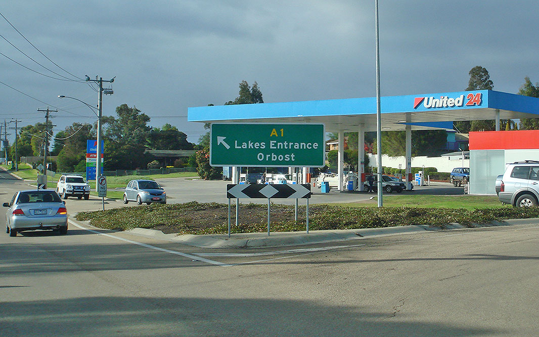 |
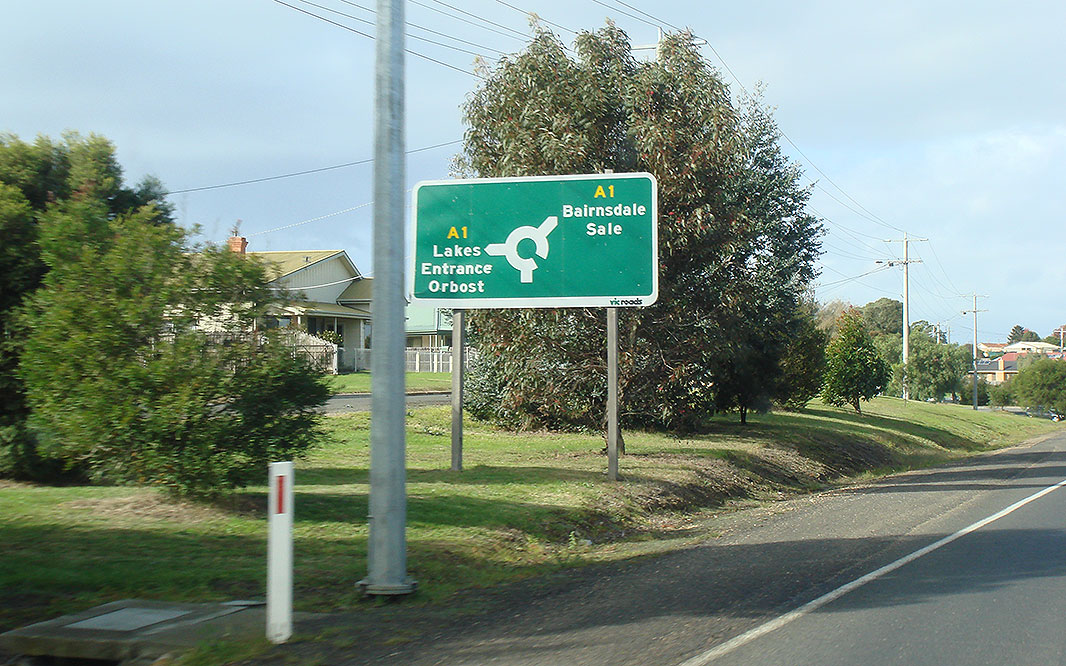
Intersection Directional Sign: ID sign on the roundabout with Princes Hwy (A1) at Lucknow, May 2011. This is the eastern terminus of B500. Image © Paul Rands |
|||
1 Vicroads
Road Management Plan, 30 October 2004
2 Victorian Heritage Database, Cobungra
River Bridge
3 Minister of Public Transport, Media
Release, $397,000 Safety Upgrade for Great Alpine Road, 30 November 2004
Last updated: 19-Aug-2020 21:27
This site © Paul Rands. All rights reserved. Some portions © (copyright) by their respective and credited owners. Permission must be obtained before using any images from this site. For details, please email by clicking here.