|
|
|
|
|
| B90 | Tod Highway (B90) |
Statistics:
Route Numbering:
General Information:
The Tod Hwy acts as a connector from the Princes Hwy (NH-A1) to the halfway point of B100 on the Eyre Peninsula. It services a number of South Australia's small wheatbelt towns and localities and is of a rural road / rural highway standard. It is named after Robert Tod who explored the area in 1839. The route is used as a main access point for the grain terminals at Port Lincoln.
The Tod Highway's highest elevation along its length is 148m and the lowest point is at 51.7m above sea level.
| Fountain to Kyancutta | Kyancutta to Fountain | |||
| Preview: | Description: | Preview: | Description: | |
 |
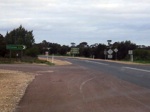
Distance Sign: RD sign near the intersection with the Flinders Hwy (B100) at Fountain. June 2007. Image © Darrin Smith |
 |
Distance Sign: RD sign as you start along the Tod Hwy from Kyancutta, June 2007. Image © Darrin Smith |
|
 |
Advance Directional Sign: The highway is named after Mrs Sylvia Birdseye, a pioneer bus operator in SA. This is the first South Australian highway to be named after a woman. 1 For more detailed information, click here. Image © Darrin Smith |
|||
 |
Birdseye Hwy junction (B91) at Lock: The intersection with the Birdseye Highway, which runs from Cowell to Elliston. June 2007. Image © Darrin Smith |
|||
 |
Advance Directional Sign: AD sign at Cummins as you approach the intersection with The Bratten Way. June 2007. Image © Darrin Smith |
|||
 |
Southern Terminus: ID sign assembly facing the Tod Hwy at Fountain as it meets the Flinders Highway (B100) at Fountain. June 2007. Image © Darrin Smith |
|||
1 South Australian Parliament
Last updated: 09-Feb-2019 4:02
This site © Paul Rands. All rights reserved. Some portions © (copyright) by their respective and credited owners. Permission must be obtained before using any images from this site. For details, please email by clicking here.