|
|
|
|
|
| B82 | Horrocks Highway (B82) - Rochester To Gladstone |
Statistics:
Route Numbering:
General Information:
Formerly signposted as Main North Road and Quorn-Wilmington Road, B82 is entirely rural highway standard and passes through a number of small farming towns between Gawler into South Australia's Flinders Ranges.
Multiplexes along the route include:
| Rochester to Gladstone | Gladstone to Rochester | |||
| Preview: | Description: | Preview: | Description: | |
 |
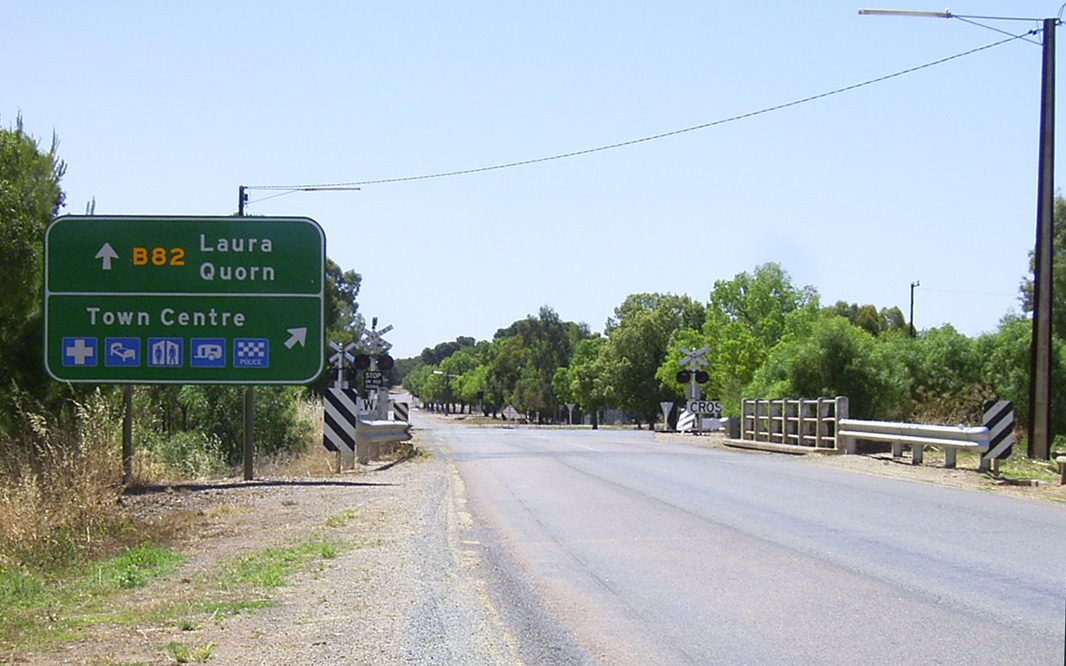
Yacka: Northbound as you pass through the town of Yacka. December 2007. Image © Paul Rands |
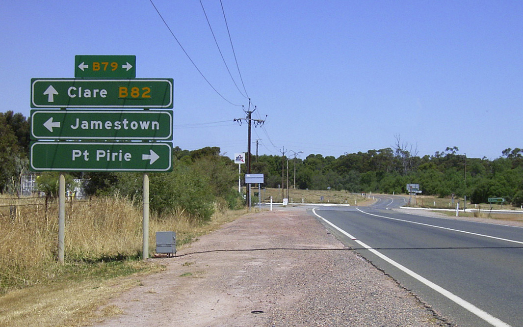 |
Advance Directional Sign: AD sign at Gladstone approaching Wilkins Hwy (B79), December 2003. Image © Michael Greenslade |
|
 |
Broughton River: Leaving Yacka as you cross the Broughton River, northbound. December 2007 Image © Paul Rands |
 |
Reassurance Directioanl Sign: Distance sign at Gladstone, December 2003. Image © Michael Greenslade |
|
 |
Advance Directional Sign: Heading north at Gulnare, as you approach the beginning of the B64 duplex. June 2007. Image © Darrin Smith |
 |
Intersection Directional Sign: ID sign assembly facing Goyder Hwy (B64) at Gulnare, as it meets Horrocks Hwy (B82), July 2019. Image © Ben Winkler |
|
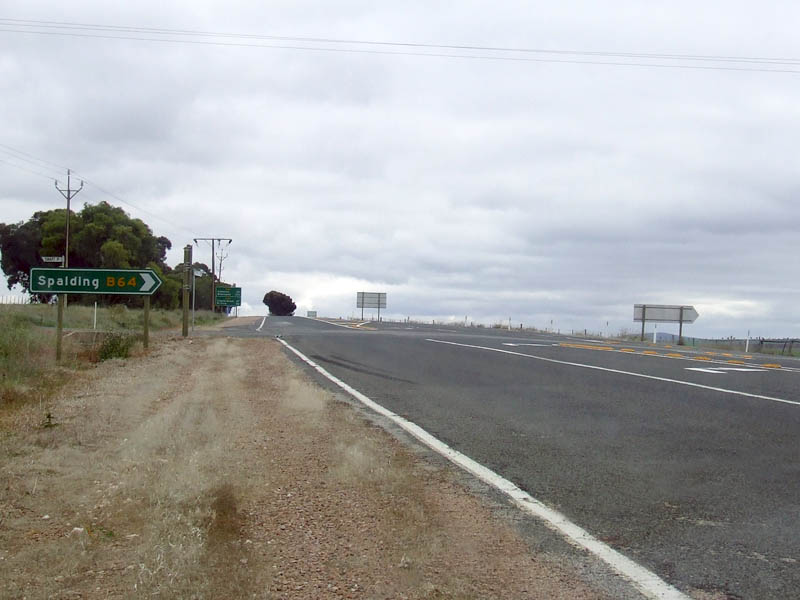 |
Gulnare-Spalding Road Intersection: Northbound at Gulnare, where the B64 duplex starts, June 2007. Image © Darrin Smith |
|||
 |
Distance Sign: Northbound RD sign at Gulnare, November 2016. Click here for a photo of this location by Paul Rands from December 2007. Image © Paul Rands |
|||
 |
Tourism Sign: Brown tourism supplementary AD sign indicating various destinations as you approach the Goyder Hwy, Gulnare. December 2007. Image © Paul Rands |
|||
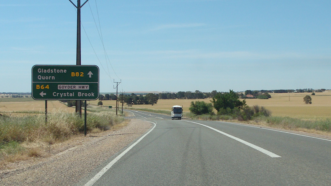 |
Advance Directional Sign: Northbound approaching the Goyder Hwy intersection (B64), November 2016. Click here for a photo of this location by Paul Rands from December 2007. Image © Paul Rands |
|||
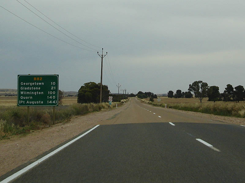 |
Distance Sign: Northbound RD sign after the end of the B64 duplex / Goyder Hwy junction, December 2007. Image © Paul Rands |
|||
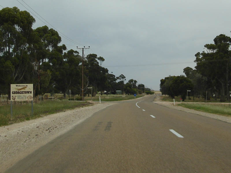 |
Entering Georgetown: Northbound as you enter Georgetown near Dump Road and Lang Street, December 2007. Image © Paul Rands |
|||
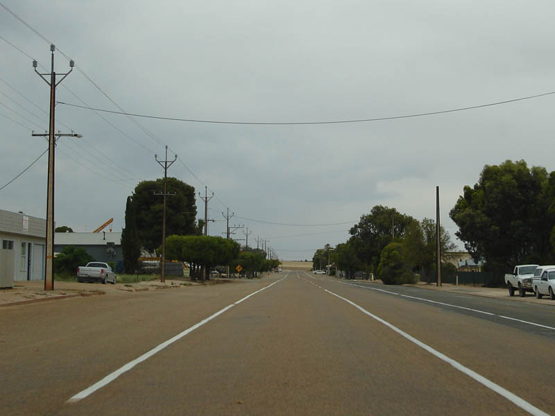 |
Georgetown Town Centre: Northbound through Georgetown, December 2007. Image © Paul Rands |
|||
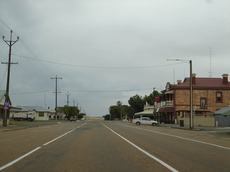 |
Georgetown Town Centre: Northbound through Georgetown, December 2007. Image © Paul Rands |
|||
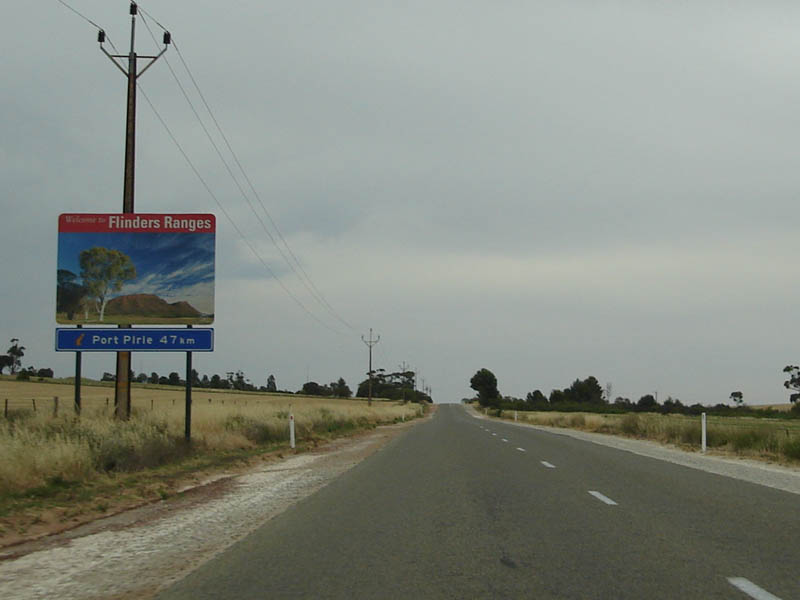 |
Welcome to the Flinders Ranges: Northbound tourism sign at Georgetown, December 2007. Image © Paul Rands |
|||
 |
Welcome to the Flinders Ranges: Northbound tourism sign at Georgetown, December 2007. Image © Paul Rands |
|||
 |
Entering Gladstone: Northbound as you enter the town of Gladstone, December 2007. Image © Michael Greenslade |
|||
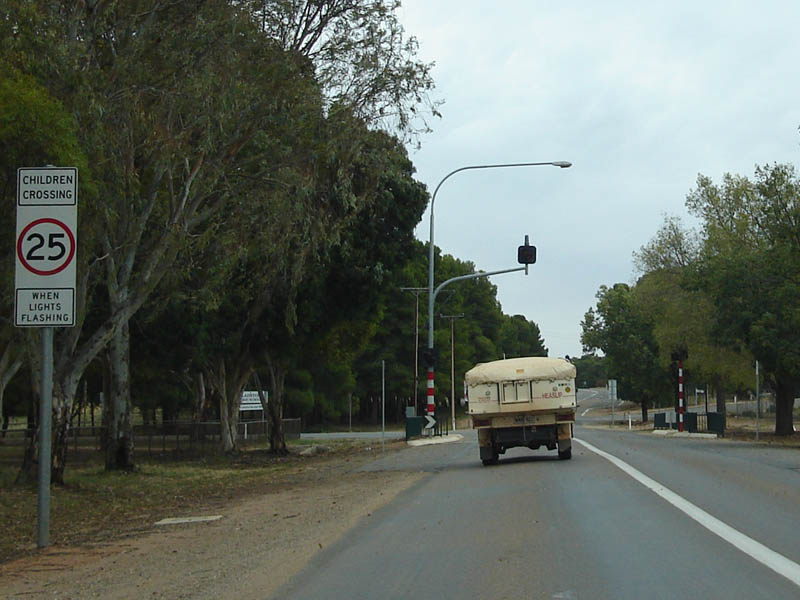 |
Northbound in Gladstone: Northbound near the school crossing, as you drive through Gladstone, December 2007. Image © Paul Rands |
|||
 |
Advance Directional Sign: Northbound AD sign approaching Park Terrace and Gladstone-Pirie Road (B79), December 2007. Image © Paul Rands |
|||
 |
Park Terrace / Gladstone-Pirie Road Intersection: Northbound in the town of Gladstone, December 2007. Image © Paul Rands |
|||
 |
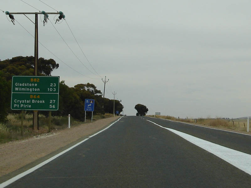
Distance Sign: RD sign as you leave the town of Gladstone, December 2007. Click here for a photo of this location by Michael Greenslade from December 2003. Image © Paul Rands |
|||
| Click here for the continuation of B82 between Quorn and Gladstone Click here for the continuation of B82 between Rochester and Giles Corner |
||||
1 Location SA Map Viewer
Last updated: 08-Dec-2020 10:25
This site © Paul Rands. All rights reserved. Some portions © (copyright) by their respective and credited owners. Permission must be obtained before using any images from this site. For details, please email by clicking here.