|
|
|
|
|
| B201 | Old Sturt Highway (B201) |
Statistics:
Route Numbering:


General Information:
B201 is the former Sturt Highway through Berri and surrounding towns. The B201 is the old Alternate National Route 20, which came about during the 1990s when the Sturt Highway was re-routed to pass through Monash.
Just 4 km north of the Berri town centre, you'll find one of the Australian classic 'big' tourist attractions: The Big Orange.
The route has many remnants / relics from its days as the original highway, as can be seen in the photos below. Also included below is a map of the route, which is not clickable like others within the site.
History:

Click here for photos of the former alignment at Berri
| Berri to Barmera | Barmera to Berri | |||
| Preview: | Description: | Preview: | Description: | |
 |
Old Distance Sign: Southbound at Berri is this old RD sign with ALT-NR20 shield, the coverplate hides the 'Sturt Hwy' name. December 2007. Image © Paul Rands |
 |
Advance Directional Sign: AD sign at Berri approaching Bookpurnong Rd (B55), December 2003. Image © Michael Greenslade |
|
 |
Entering Berri: Southbound heading into the town of Berri. December 2007. Image © Paul Rands |
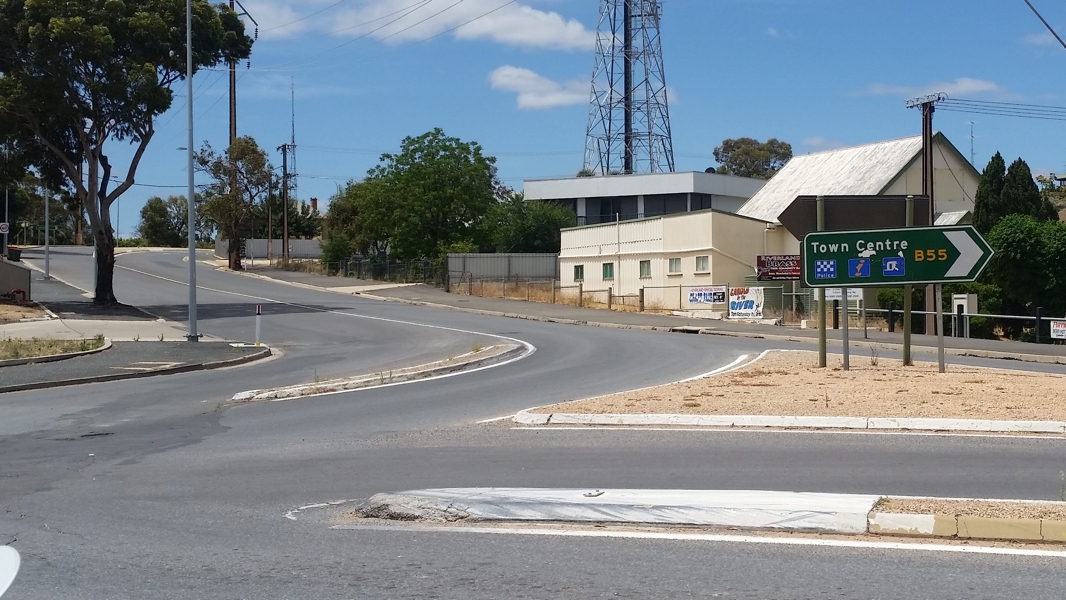 |
Bookpurnong Road: Corner of Old Sturt Hwy (B201) and Bookpurnong Rd (B55) at Berri, November 2016. Image © Paul Rands |
|
 |
Crash Markers Sign: Southbound indicating special crash markers, Berri, December 2007. Image © Paul Rands |
 |
Intersection Directional Sign : ID sign near Zante Rd at Berri, November 2016. Image © Paul Rands |
|
 |
Distance Sign: Old RD sign with 'Sturt Hwy' and old route number coverplated at Berri, December 2007. Image © Paul Rands |
 |
Intersection Directional Sign : ID sign assembly facing Vaughan Tce, Berri, November 2016. Image © Paul Rands |
|
 |
Advance directional Sign: Southbound approaching the Kay Av & Jellett Rd intersection in Berri, November 2016. Image © Paul Rands |
 |
Intersection Directional Sign : ID sign assembly near Vaughan Tce, Berri, November 2016. Image © Paul Rands |
|
 |
Kay Avenue Intersection: Southbound at the Kay Av intersection in Berri, November 2016. Image © Paul Rands |
 |
Advance directional Sign: AD signapproaching the Kay Av & Jellett Rd intersection in Berri, November 2016. Image © Paul Rands |
|
 |
AD sign : Advance directional sign on Kay Av, approaching Old Sturt Hwy (B201) and Jellett Rd at Berri, November 2016. Image © Paul Rands |
 |
Reassurance Directional Sign: Distance sign after Kay Av and Jellett Rd at Berri, November 2016. Image © Paul Rands |
|
 |
Handpainted Fingerboards: Handpainted fingerboards at the junction wtih Kay Av and Jellett Rd at Berri, November 2016. Image © Paul Rands |
 |
Old Intersection Directional Signs: Old NR20 signs facing Sheill Road in Berri. November 2016. Click here for a photo by Paul Rands of this location from December 2007. Image © Paul Rands |
|
 |
Reassurance Directional Sign : Distance sign after Kay Av, Berri, November 2016. Image © Paul Rands |
 |
Old Intersection Directional Signs: Old NR20 signs facing Hoskin Road in Berri. November 2016. Click here for a photo by Paul Rands of this location from December 2007. Image © Paul Rands |
|
 |
Intersection Directional Sign : ID sign facing Zante Rd at Berri, November 2016. Image © Paul Rands |
 |
Advance Directional Sign: Northbound approaching the intersection with Sturt Highway, Berri. December 2007. Image © Paul Rands |
|
 |
Directional Sign: Southbound sign acting as a reassurance in the town of Berri. November 2016. Click here for a photo by Paul Rands of this location from December 2007. Image © Paul Rands |
 |
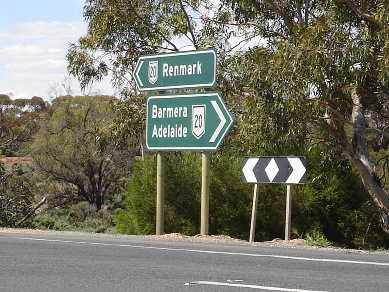
Sturt Hwy Inersection: Northbound at Berri as B201 terminates with A20, December 2007. Image © Paul Rands |
|
 |
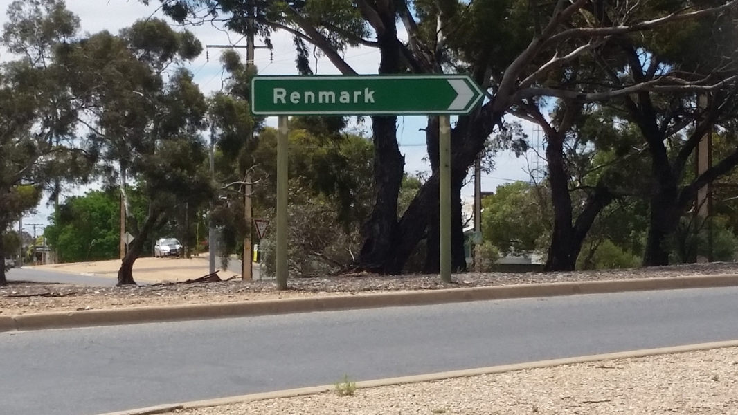
Approaching Bookpurnong Rd: Southbound in Berri approaching Bookpurnong Rd, B55. Note the old ALT-NR20 shield. November 2016. Click here for a photo by Paul Rands of this location from December 2007. Image © Paul Rands |
|||
 |
Bookpurnong Rd: Southbound in Berri at the junction with Bookpurnong Rd, B55. Note the old ALT-NR20 shield. November 2016. Click here for a photo by Paul Rands of this location from December 2007. Image © Paul Rands |
|||
 |
Distance Sign: Distance sign after the Bookpurnong Rd (B55) intersection, December 2003. Image © Michael Greenslade |
|||
 |
Advance Directional Sign: AD sign approaching Fuller and Jury Roads in Berri, December 2007. Image © Paul Rands |
|||
 |
Advance Directional Sign: Old AD sign with ALT-NR20 shield, approaching Winkie Road, Glossop, December 2007. Image © Paul Rands |
|||
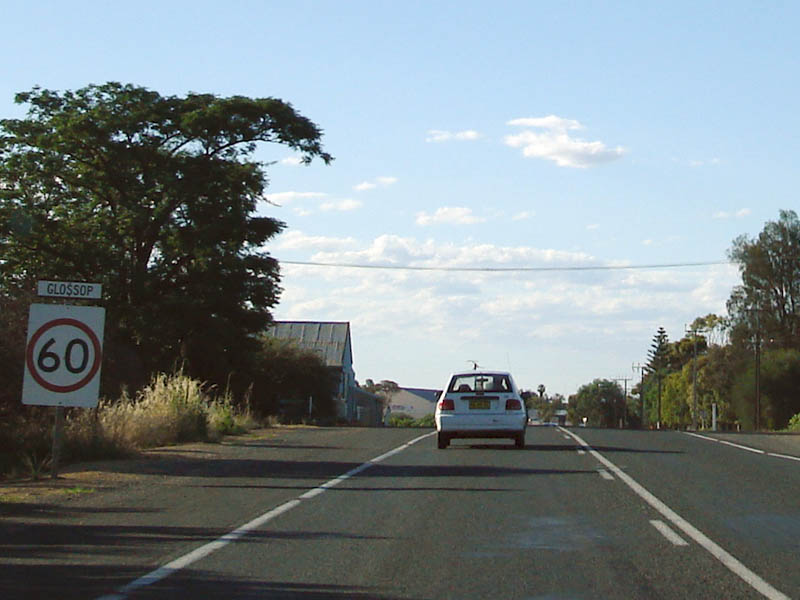 |
Entering Glossop: Driving into the town of Glossop, December 2007. Image © Paul Rands |
|||
 |
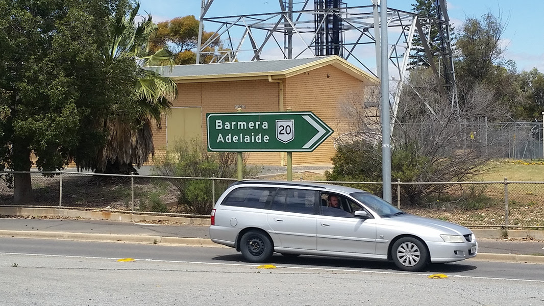
Advance Directional Sign: AD sign approaching the Sturt Highway near Barmera, December 2007. Image © Paul Rands |
|||
 |
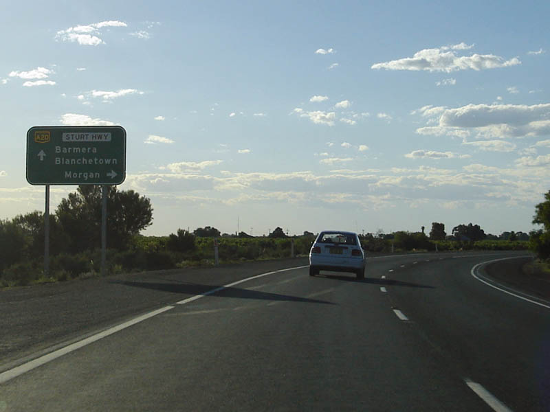
End B201: The southern terminus of the Old Sturt Hwy, between Glossop and Barmera, December 2007. Image © Paul Rands |
|||
Last updated: 08-Dec-2020 12:32
This site © Paul Rands. All rights reserved. Some portions © (copyright) by their respective and credited owners. Permission must be obtained before using any images from this site. For details, please email by clicking here.