 |
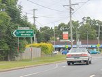
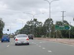
Advance Directional Sign:
AD sign on Browns Plains Rd (SR94) at Browns Plains approaching Parkland Av and Waller Rd, March 2010.
Image © Rob Tilley
|
 |
Wembley Road:
Browns Plains Rd (SR94) at the junction with Wembley Rd in Browns Plains, March 2010.
Image © Rob Tilley
|
 |
Advance Directional Sign:
AD sign on Browns Plains Rd (SR94) at Marsden approaching Third Av and Trulson Dr, March 2010.
Image © Rob Tilley
|
 |
Third Avenue & Trulson Drive:
Corner of Browns Plains Rd (SR94), Third Av and Trulson Dr at Marsden, March 2010.
Image © Rob Tilley
|
 |
Advance Directrional Sign:
AD sign with missing SR94 shield at Marsden, March 2010. SR94 becomes Chambers Flat Rd and veers left at the roundabout.
Image © Rob Tilley
|
 |
Advance Directional Sign:
AD sign on Chambers Flat Rd (SR94) approaching Kingston Rd (SR94 / SR95) at Kingston, March 2010. SR94 turns right at this junction and duplexes with SR95, note the missing route numbers from the sign.
Image © Rob Tilley
|
 |
Intersection Directional Sign:
ID sign assembly at the corner of Kingston Rd (SR94 / SR95) and Chambers Flat Rd (SR94) in Kingston, March 2010.
Image © Rob Tilley
|
 |
Reassurance Directional Sign:
Distance sign on Kingston Rd (SR94 / SR95) at Loganlea, March 2010.
Image © Rob Tilley
|
 |
Advance Directional Sign:
AD sign on Kingston Rd (SR94 / SR95) approaching Loganlea Rd, Tygum Rd and Brisbane-Beenleigh Rd (SR94 / SR95) at Waterford West, March 2010.
Image © Rob Tilley
|
 |
Advance Directional Sign:
AD sign on Brisbane-Beenleigh Rd (SR94 / SR95) approaching Nerang St (SR95) at Waterford, March 2010. SR95 duplex ends at this intersection.
Image © Rob Tilley
|
 |
Nerang Street:
Corner of Brisbane-Beenleigh Rd (SR94) and Nerang St (SR95) at Waterford, March 2010.
Image © Rob Tilley
|
 |
Distance Sign:
RD sign on Brisbane-Beenleigh Rd (SR94) at Waterford, March 2010.
Image © Rob Tilley
|
 |
Station Road Interchange:
Brisbane-Beenleigh Rd (SR94) at the Station Rd interchange in Bethania, March 2010. SR94 becomes Logan River Rd from this junction.
Image © Rob Tilley
|
 |
Distance Sign:
RD sign on Logan River Rd (SR94) at Bethania, March 2010.
Image © Rob Tilley
|
 |
Advance Directional Sign:
AD sign on Logan River Rd (SR94) approaching Boundary St (SR92), Hammel St (SR92 / SR94) and George St in Beenleigh, March 2010. SR94 turns right here and duplexes with SR92.
Image © Rob Tilley
|
 |
Intersection Directional Sign:
ID sign on the roundabout with Logan River Rd (SR94), Boundary St (SR92), Hammel St (SR92 / SR94) and George St in Beenleigh, March 2010. SR94 turns right here and duplexes with SR92.
Image © Rob Tilley
|
 |
Intersection Directional Sign:
ID sign on the roundabout with Logan River Rd (SR94), Boundary St (SR92), Hammel St (SR92 / SR94) and George St in Beenleigh, March 2010. SR94 turns right here and duplexes with SR92.
Image © Rob Tilley
|


