|
|
|
|
|
| Beenleigh-Redland Bay Road, Serpentine Creek Road, Cleveland-Redland Bay Road, Bloomfield Street, Russell Street & Waterloo Street (State Route 47) |
Statistics:
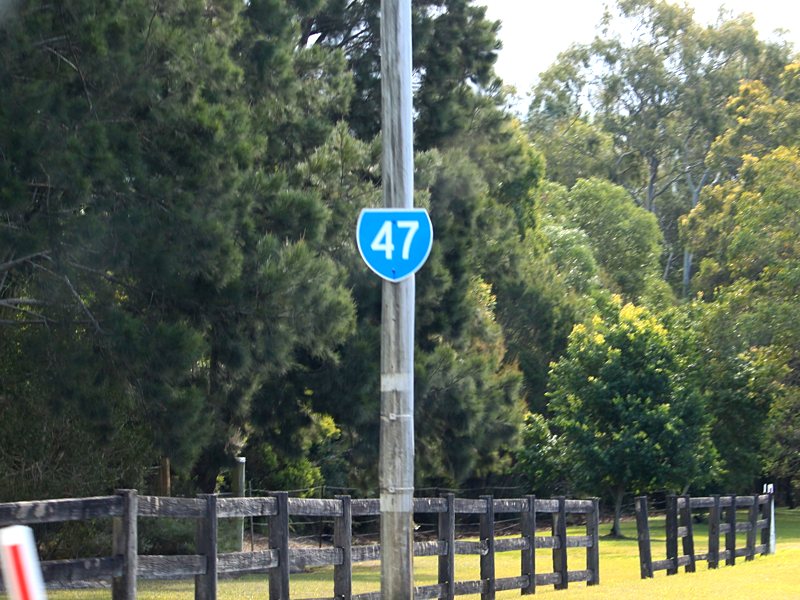
Route Numbering:

General Information:
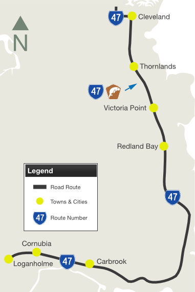
State Route 47 is an arterial route in Brisbane's bayside. It connects coastal suburbs with Pacific Motorway (M1) the main route between Brisbane and the New South Wales border.
Within Cleveland and Loganholme, the route is divided, but beyond that it's undivided for most of its remainder. The route passes through residential, commercial, rural and bushland areas.
Multiplexes along the route include:
History:
| Loganholme to Cleveland | Cleveland to Loganholme | |||
| Preview: | Description: | Preview: | Description: | |
 |
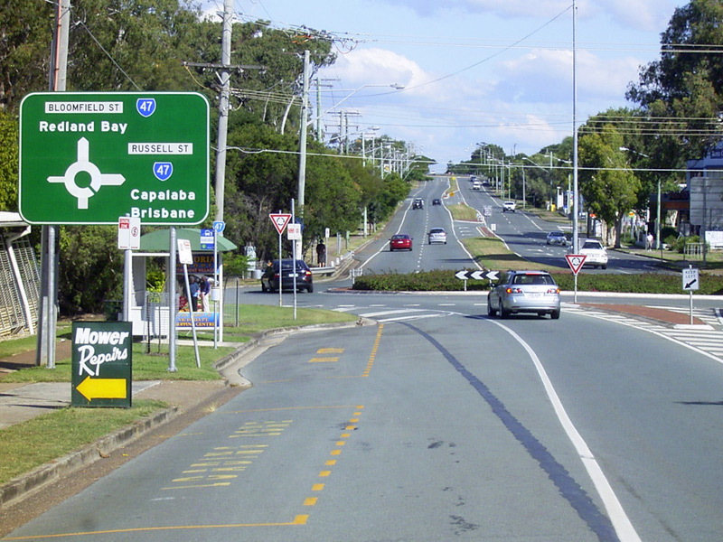
Reassurance
Directional Sign: Distance sign on Beenleigh-Redland Bay Rd (SR47) at Carbrook, October 2016. Click here for a photo of this location by Michael Greenslade from May 2006. Image © Dean Sherry |
 |
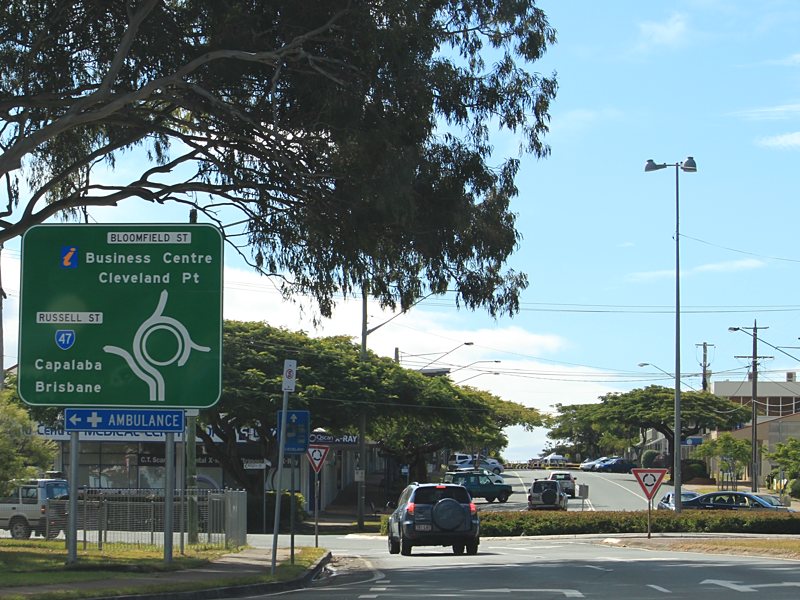
Advance
Directional Sign: AD sign on Bloomfield St (unnumbered) at Cleveland, approaching Bloomfield St (SR47) and Russell St (SR47), May 2006. Image © Michael Greenslade |
|
 |
Advance
Directional Sign: AD sign on Serpentine Ck Rd (SR47) approaching Cleveland-Redland Bay Rd (SR47) and the unnumbered section of Serpentine Ck Rd, October 2016. Image © Dean Sherry |
 |
Advance
Directional Sign: AD sign at Thornlands approaching Boundary Rd (SR21), May 2006. The SR21 duplex begins at this intersection. Image © Michael Greenslade |
|
 |
Advance
Directional Sign: AD sign on Cleveland-Redland Bay Rd (SR47) approaching German Church Rd at Redland Bay, October 2016. Image © Dean Sherry |
 |
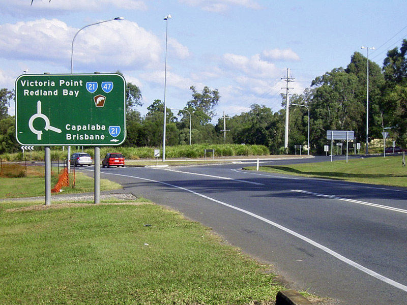
Black
Advance Directional Sign: Black AD sign at Victoria Point approaching Colburn Rd (SR21), May 2006. The SR21 duplex ends at this intersection. This sign has since been replaced. Image © Michael Greenslade |
|
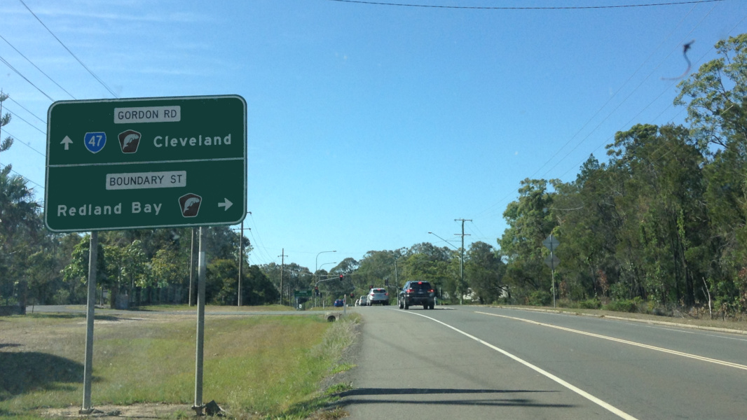 |
Advance
Directional Sign: AD sign on Gordon Rd (SR47) approaching Boundary St at Redland Bay, October 2016. Image © Dean Sherry |
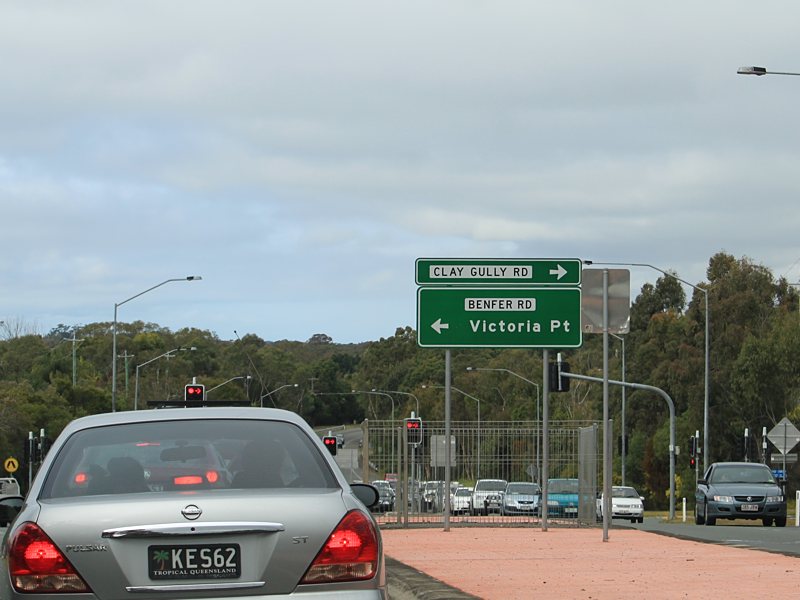 |
Advance
Directional Sign: AD sign on Cleveland-Redland Bay Rd (SR47) approaching Benfer Rd and Clay Gully Rd at Victoria Point, July 2011. Image © Rob Tilley |
|
 |
Advance
Directional Sign: AD sign at Victoria Point, approaching Benfer Rd, October 2016. Image © Dean Sherry |
 |
Black
Advance Directional Sign: Black AD sign at Redland Bay approaching Double Jump Rd, May 2006. This sign has since been replaced. Image © Michael Greenslade |
|
 |
Black
Reassurance Directional Sign: Black distance sign at Thornlands, May 2006. This sign has since been removed and the road widened. Image © Michael Greenslade |
 |
Black
Advance Directional Sign: Black AD sign at Redland Bay approaching Serpentine Creek Rd, May 2006. This sign has since been replaced. Image © Michael Greenslade |
|
 |
Trailblazer: SR47 trailblazer at Thornlands on Cleveland-Redland Bay Rd, July 2011. Image © Rob Tilley |
|
 |
Advance
Directional Sign: AD sign at Redland Bay on Serpentine Creek Rd approaching Cleveland-Redland Bay Rd (SR47), May 2006. Image © Michael Greenslade |
 |
Trailblazer: Southern Moreton Bay Tourist Drive trailblazer near South St at Thornlands on Cleveland-Redland Bay Rd, July 2011. Image © Rob Tilley |
|||
 |
Trailblazer: SR47 trailblazer at Cleveland on Cleveland-Redland Bay Rd, July 2011. Image © Rob Tilley |
|||
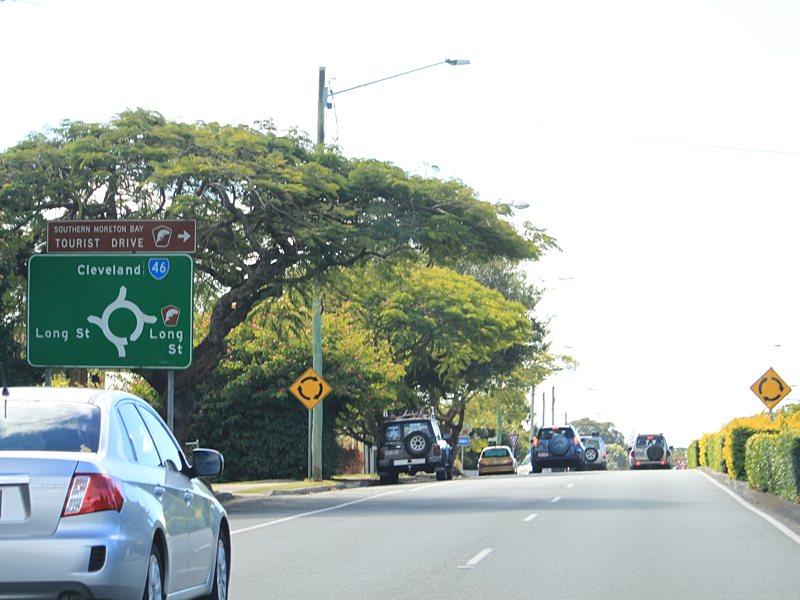 |
Advance
Directional Sign: AD sign with incorrect SR46 shield approaching Long St at Cleveland, July 2011. The Southern Moreton Bay Tourist Drive duplex ends at this junction. Image © Rob Tilley |
|||
 |
Intersection
Directional Sign: ID sign assembly at the corner of Bloomfield St (SR47) and Long St at Cleveland, July 2011. Image © Rob Tilley |
|||
 |
Trailblazer: SR47 trailblazer at Cleveland on Bloomfield St, near Long St, July 2011. Image © Rob Tilley |
|||
 |
Advance
Directional Sign: AD sign on Bloomfield St (SR47) approaching Russell St (SR47) at Cleveland, July 2011. SR47 turns left at this junction. Image © Rob Tilley |
|||
 |
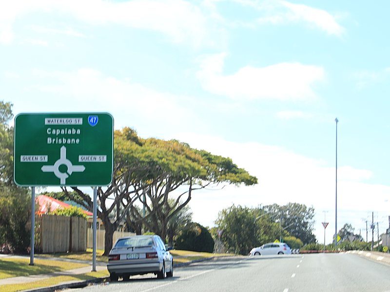
Advance
Directional Sign: AD sign on Russell St (SR47) approaching Waterloo St (SR47) in Cleveland, July 2011. SR47 turns right at this junction. Image © Rob Tilley |
|||
 |
Advance
Directional Sign: AD sign on Waterloo St (SR47) at Cleveland approaching Queen St, July 2011. Image © Rob Tilley |
|||
|
Advance
Directional Sign: AD sign on Waterloo St (SR47) in Cleveland approaching Middle St, July 2011. Image © Rob Tilley |
|||
 |
Advance
Directional Sign: AD sign on Waterloo St (SR47) approaching Shore St West (SR22 / Southern Moreton Bay Tourist Drive) at Cleveland, July 2011. This junction is the northern terminus of SR47. Image © Rob Tilley |
|||
1 Transport
& Main Roads, Queensland state-controlled roads and region maps,
Metropolitan Region: east
2 Queensland Government, Ministerial
Media Statements, Minister for Transport and Main Roads, Victoria Point
Intersection upgrade, 27 March 2007
3 Transport & Main Roads, Projects,
Redlands Corridor Program Section C: Cleveland Redland Bay Road Upgrade
Last updated: 01 Nov 2019 14:54
This site © Paul Rands. All rights reserved. Some portions © (copyright) by their respective and credited owners. Permission must be obtained before using any images from this site. For details, please email by clicking here.