|
|
|
|
|
| Gold Coast Highway (State Route 2) - Surfers Paradise to Helensvale - Former Alignment: Surfers Paradise to Labrador |
Statistics:
Route Numbering:


General Information:
The Gold Coast Highway is the former Pacific Highway route between the NSW border and Helensvale.
The route is a mix of divided and undivided urban highway, which passes mostly along the coast, right through the heart of the Gold Coast. The route passes through light industrial areas, as well as commercial, residential and tourist areas.
History:
This page concentrates on the former alignment between Surfers Paradise and Labrador
| Labrador to Biggera Waters | Biggera Waters to Labrador | |||
| Preview: | Description: | Preview: | Description: | |
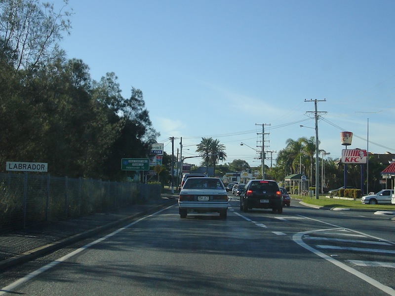 |
Entering
Labrador: Former 2-lane alignment as it enters Labrador, near Marine Pde, March 2006. Image © Paul Rands |
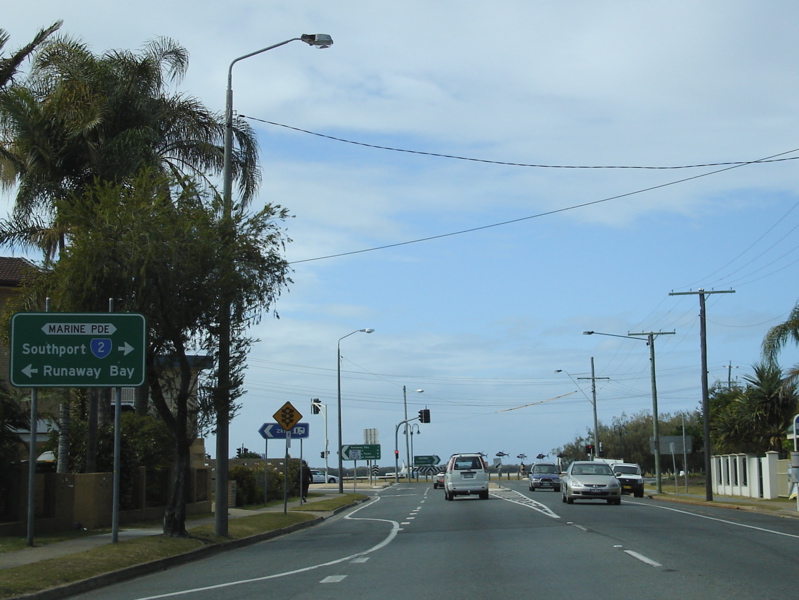 |
Advance
Directional Sign: AD sign approaching Marine Pde in Labrador, July 2007. Image © Paul Rands |
|
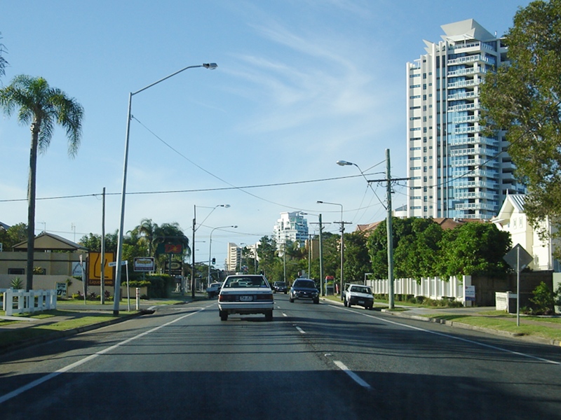 |
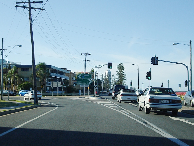
Labrador: Gold Coast Hwy (SR2) when it was a 2-lane alignment, passing through Labrador, March 2006. Image © Paul Rands |
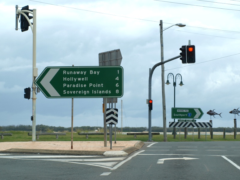 |
marine
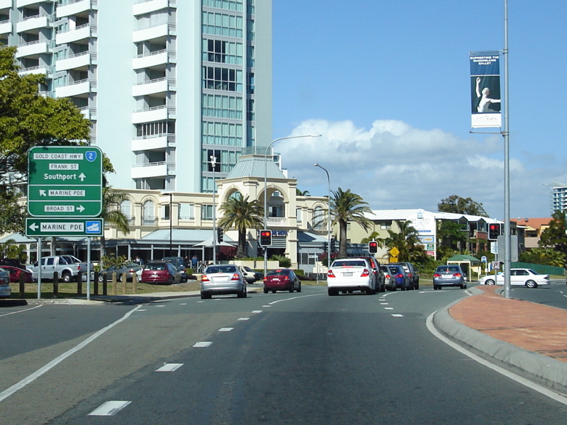
Parade: Corner Marine Parade and Gold Coast Highway (SR2) at Labrador, March 2009. Image © Rob Tilley |
|
 |
Advance
Directional Sign: AD sign near Parker St, approaching Marine Pde in Labrador, March 2006. Image © Paul Rands |
 |
Distance
Sign: Reassurance directional sign at Labrador, near Parker St, July 2007. Image © Paul Rands |
|
 |
Marine
Parade: Gold Coast Hwy (SR2) as it veers left, past Marine Pde in Labrador, March 2006. Image © Paul Rands |
 |
Advance
Directional Sign: AD sign at Labrador approaching Marine Pde, July 2007. Image © Paul Rands |
|
 |
Reassurance Directional Sign: RD sign on Gold Coast Hwy (SR2) when it was split into a one way system using Ferny Av for northbound traffic and Surfers Paradise Blvd for southbound traffic, Main Beach, March 2005. Image © Michael Greenslade |
|||
 |
Main Beach: Gold Coast Hwy (SR2) when it was split into a one way system using Ferny Av for northbound traffic and Surfers Paradise Blvd for southbound traffic, approaching Pandanus Av, Main Beach, March 2005. Image © Michael Greenslade |
|||
1 Transport
and Main Roads, Queensland state-controlled roads and region maps, South Coast Region: front
2 Transport and Main Roads,
From Bulldust to Beef Roads and Beyond: Main Roads –The first 50 years
3 Transport and Main Roads,
Head Office Mapping Section, via email correspondence.
4
Transport and Main Roads,
Projects, Gold Coast Highway - Labrador Government Road to Stevens Street Upgrade
Last updated: 04-Aug-2019 0:13
This site © Paul Rands. All rights reserved. Some portions © (copyright) by their respective and credited owners. Permission must be obtained before using any images from this site. For details, please email by clicking here.