|
|
|
|
|
| Gold Coast Highway (State Route 2) - NSW Border to Surfers Paradise |
Statistics:
Route Numbering:


General Information:
The Gold Coast Highway is the former Pacific Highway route between the NSW border and Helensvale.
The route is a mix of divided and undivided urban highway, which passes mostly along the coast, right through the heart of the Gold Coast. The route passes through light industrial areas, as well as commercial, residential and tourist areas.
History:
Click here for photos between New South Wales border and Tugun featuring National Route 1 Pacific Highway signage.
| NSW Border to Surfers Paradise | Surfers Paradise to NSW Border | |||
| Preview: | Description: | Preview: | Description: | |
 |
Advance
Directional Sign: Freeway green AD sign on Musgrave St in Bilinga at the interchange with Gold Coast Hwy (SR2), February 2009. Image © Rob Tilley |
 |
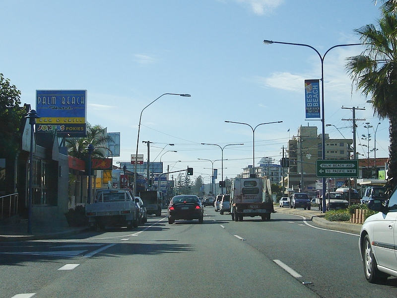
Australia
Avenue: Gold Coast Hwy (SR2) at the Australia Av junction at Broadbeach, July 2007. Image © Paul Rands |
|
 |
Advance
Directional Sign: AD sign on Musgrave St in Bilinga at the interchange with Gold Coast Hwy (SR2) February 2009. Image © Rob Tilley |
 |
Advance
Directional Sign: AD sign near Elizabeth Av in Broadbeach approaching Margaret Av and Hooker Blvd (SR90), July 2007. Image © Paul Rands |
|
 |
Advance
Directional Sign: AD sign approaching Terminal Dr in Bilinga, February 2009. Image © Rob Tilley |
 |
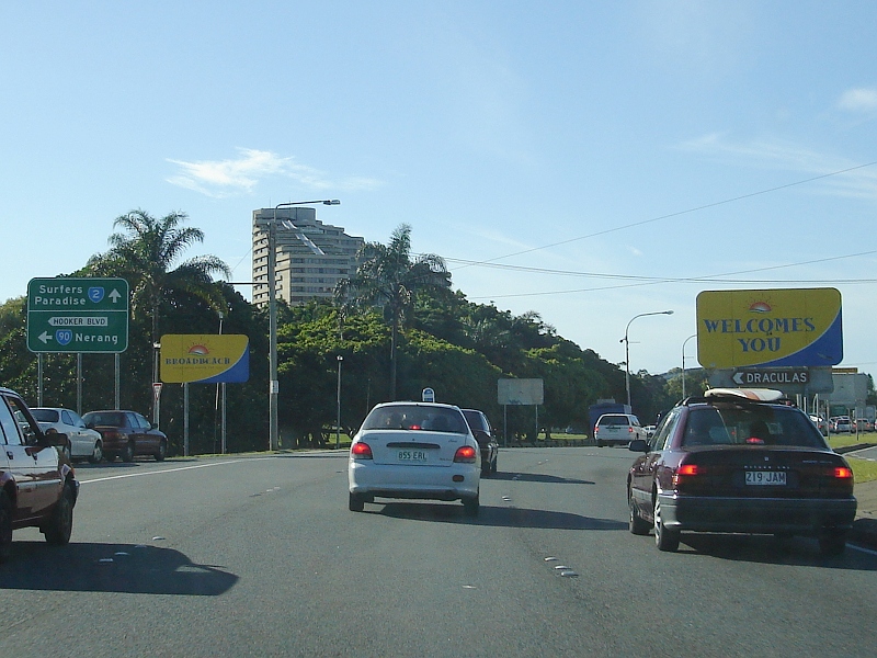
Hooker
Boulevard & Margaret Av: Gold Coast Hwy (SR2) at the Hooker Blvd (SR90) and Margaret Av junction in Broadbeach, July 2007. Image © Paul Rands |
|
 |
Terminal
Drive: Gold Coast Hwy (SR2) at the junction with Terminal Dr in Bilinga, February 2009. Image © Rob Tilley |
 |
Hooker
Boulevard & Margaret Av: Gold Coast Hwy (SR2) at the Hooker Blvd (SR90) and Margaret Av junction in Broadbeach, July 2007. Image © Paul Rands |
|
 |
Flat
Rock Road: Gold Coast Hwy (SR2) as it crosses Flat Rock Ck and approaching Flat Rock Rd in Currumbin, March 2006. Image © Paul Rands |
 |
Mermaid
Beach: Gold Coast Hwy (SR2) near Montana Rd at Mermaid Beach, July 2007. Image © Paul Rands |
|
 |
Currumbin
Creek: Gold Coast Hwy (SR2) as it crosses Currumbin Ck via Estuary Bridge at Currumbin, March 2006. Image © Paul Rands |
 |
Advance
Directional Sign: AD sign at Mermaid Beach approaching Markeri St, July 2007. Image © Paul Rands |
|
 |
Advance
Directional Sign: AD sign at Currumbin approaching Duringan St, February 2009. Image © Rob Tilley |
 |
Advance
Directional Sign: AD sign at Burleigh Heads approaching West Burleigh Rd (SR80), July 2007. Image © Paul Rands |
|
 |
Thrower
Drive: Gold Coast Hwy (SR2) at the junction with Thrower Dr in Palm Beach, February 2009. Image © Rob Tilley |
 |
West
Burleigh Road: Intersection directional sign assembly at the junction with West Burleigh Rd (SR80) at Burleigh Heads, May 2005. Image © Rob Tilley |
|
 |
Advance
Directional Sign: AD sign on Thrower Dr in Palm Beach approaching Gold Coast Hwy (SR2), May 2005. Image © Rob Tilley |
 |
Distance
Sign: RD sign at Burleigh Heads, May 2005. Image © Rob Tilley |
|

|
Palm
beach: Gold Coast Hwy (SR2) as it passes through the town of Palm Beach, March 2006. Image © Paul Rands |
 |
Tallebudgera
Creek: Gold Coast Hwy (SR2) as it crosses Tallebudgera Ck at Burleigh Heads, July 2007. Image © Paul Rands |
|
 |
Palm
Beach: Gold Coast Hwy (SR2) near Palm Beach Av in Palm Beach, March 2006. Image © Paul Rands |
 |
Tallebudgera
Drive: Gold Coast Hwy (SR2) at Palm Beach at the Tallebudgera Dr intersection, May 2005. Image © Rob Tilley |
|
 |
Trailblazer: State Route 2 trailblazer near 19th Av in Palm Beach, March 2006. Image © Rob Tilley |
 |
Palm
Beach: Gold Coast Hwy (SR2) in the Palm Beach town centre near 23rd Av, May 2005. Image © Rob Tilley |
|
 |
Tallebudgera
Drive: Gold Coast Hwy (SR2) at Palm Beach approaching Tallebudgera Dr, March 2006. Image © Paul Rands |
|
Palm
Beach: Gold Coast Hwy (SR2) in the Palm Beach area, July 2007. Image © Paul Rands |
|
 |
Intersection
Directional Sign: ID sign at Ikkina Rd at Burleigh Heads, February 2009. Image © Rob Tilley |
 |
Thrower
Drive: Gold Coast Hwy (SR2) at the Thrower Dr junction in Palm Beach, July 2007. Image © Paul Rands |
|
 |
West
burleigh Road: Intersection direction sign at the junction with West Burleigh Rd (SR80) at Burleigh Heads, February 2009. Image © Rob Tilley |
 |
Currumbin
Creek: Gold Coast Hwy (SR2) as it crosses Currumbin Ck via Estuary Br, July 2007. Image © Paul Rands |
|
 |
West Burleigh Road: Intersection direction sign at the junction with West Burleigh Rd (SR80) at Burleigh Heads, February 2009. Image © Rob Tilley |
 |
Advance
Directional Sign: AD sign at Currumbin on Duringan St (SR98) approaching the Gold Coast Hwy (SR2) interchange, July 2007. Image © Paul Rands |
|
 |
Distance
Sign: RD sign at Burleigh Heads, February 2009. Image © Rob Tilley |
 |
Advance
Directional Sign: AD sign at Currumbin on Duringan St (SR98) approaching the Gold Coast Hwy (SR2) interchange, July 2007. Image © Paul Rands |
|
 |
Advance
Directional Sign: AD sign approaching Christine Av in Burleigh Heads, February 2009. Image © Rob Tilley |
 |
Advance
Directional Sign: AD sign at Currumbin on Duringan St (SR98) approaching the Gold Coast Hwy (SR2) interchange, July 2007. Image © Paul Rands |
|
 |
Christine
Avenue: Gold Coast Hwy (SR2) at the junction with Christine Av in Burleigh Heads, February 2009. Image © Rob Tilley |
 |
Intersection
Directional Sign: ID sign at Currumbin on Duringan St (SR98) at the Gold Coast Hwy (SR2) interchange. Click here for a photo by Rob Tilley from May 2005 of the previous sign. Image © Paul Rands |
|
 |
Miami
Town Centre: Gold Coast Hwy (SR2) as it passes through Miami, near Toombul Av and Kratzman Av, March 2006. Image © Paul Rands |
 |
Trailblazer: SR2 trailblazer approaching Tomewin St at Currumbin, July 2007. Image © Paul Rands |
|

|
Mermaid
Beach: Gold Coast Hwy (SR2) as it passes through Mermaid Beach, March 2006. Image © Paul Rands |
 |
Flat
Rock Creek: Gold Coast Hwy (SR2) as it crosses Flat Rock Ck at Tugun, July 2007. Image © Paul Rands |
|
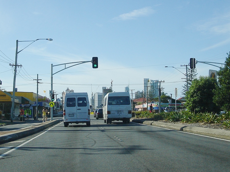 |
Mermaid
beach: Old mast arm signals in the Mermaid Beach town centre near Glenelg Av and Venice St, March 2006. Note the unusual installation of a pedestrian crossing sign at the signals. Image © Paul Rands |
 |
Advance
Directional Sign: AD sign on Stewart Av (former Pacific Hwy (NR1)) at Tugun approaching Gold Coast Hwy (SR2), February 2009. Image © Rob Tilley |
|
 |
Advance
Directional Sign: AD sign approaching Hooker Blvd (SR90) & Margaret Av at Mermaid Beach, March 2006. Image © Paul Rands |
 |
Intersection
Directional Sign: ID sign on Stewart Av at Tugun at the Gold Coast Hwy (SR2) junction, February 2009. Image © Rob Tilley |
|
 |
Hooker
Boulevard: Gold Coast Hwy (SR2) at the Hooker Blvd & Margaret Av junction in Mermaid Beach, March 2006. Note the rounder mast arm signal, common to the Gold Coast. Image © Paul Rands |
 |
Intersection
Directional Sign: ID sign on Stewart Av at Tugun at the Gold Coast Hwy (SR2) junction, February 2009. Note the remnant NR1 shield and Pacific Hwy (Mwy is an error) patch. Image © Rob Tilley |
|

|
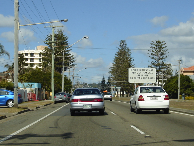
Distance
Sign: Reassurance directional sign at Mermaid Beach, March 2006. Image © Paul Rands |
 |
Advance
Directional Sign: AD sign with incorrect font approaching Toolona St in Tugun, March 2006. Image © Paul Rands |
|
 |
Broadbeach: Gold Coast Hwy (SR2) as it passes through Broadbeach, near St Kilda Av, March 2006. Image © Paul Rands |
 |
Distance
Sign: RD sign near the Tugun shopping strip with remnant NR1 and Pacific Hwy panel, February 2009. Image © Rob Tilley |
|

|
Entering
Bilinga: Gold Coast Hwy (SR2) as it enters the town of Bilinga, March 2006. Image © Paul Rands |
|||
 |
Advance
Directional Sign: AD sign at Bilinga approaching Loongana Av, February 2009. Image © Rob Tilley |
|||
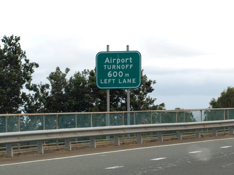
 |
Advance
directional Sign: AD sign at Bilinga approaching the Musgrave St interchange, February 2009. Musgrave St was once part of the Pacific Hwy. Image © Rob Tilley |
|||
 |
Advance Directional Signs: AD signs approaching Musgrave St in Bilinga, May 2012. Click here for a photo from March 2006 of the old freeway green AD signs this gantry replaced. Image © Rob Tilley |
|||
 |
Musgrave
Street: Intersection directional sign at the Musgrave St interchange in Bilinga, February 2009. Image © Rob Tilley |
|||
| Click here for the continuation of SR2 between Surfers Paradise and Helensvale Click here for the continuation of Gold Coast Hwy (SR2) in New South Wales |
||||
1 Transport
and Main Roads, Queensland state-controlled roads and region maps, South Coast Region: front
2 Transport and Main Roads,
From Bulldust to Beef Roads and Beyond: Main Roads –The first 50 years
3 Sam Laybutt (Ozroads)
4 Transport and Main Roads,
Head Office Mapping Section, via email correspondence.
5 Courier Mail, Tugun bypass opens - finally, 3 June 2008
6 Queensland Government, Ministerial
Media Statements, Gold Coast Highway upgrade and bus lanes commissioned,
27 August 2009
7
Transport and Main Roads, Projects, Gold Coast Highway Southern Corridor – Bilinga
Interchange Proposed Works
8 GoldLinQ, Constructing Light Rail,
Project Timeline
Last updated: 04-Aug-2019 0:54
This site © Paul Rands. All rights reserved. Some portions © (copyright) by their respective and credited owners. Permission must be obtained before using any images from this site. For details, please email by clicking here.