|
|
|
|
|
 |
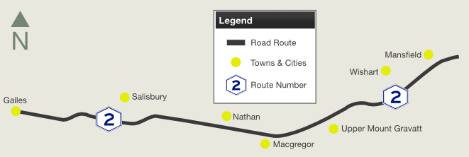
Granard Road, Riawena Road, Kessels Road & Mt Gravatt-Capalaba Road (Metroad 2) |
Statistics:
Route Numbering:

General Information:
Metroad 2 is a divided arterial road in the southern suburbs of Brisbane.
The route acts as a connector between several major roads in the city, including Ipswich Mwy (M7), Gateway Mwy (M1), Beaudesert Rd (NR13) and also links the city's eastern and western suburbs. It's a priority freight route that forms part of the Brisbane Urban Corridor. As such, it supports a large number of both commuter and heavy vehicle movements. 2
History:
| Rocklea to Mansfield | Mansfield to Rocklea | |||
| Preview: | Description: | Preview: | Description: | |
 |
Trailblazer: Metroad 2 trailblazer on Riawena Rd at Salisbury, July 2011. Image © Rob Tilley |
 |
Distance
Sign: RD sign at Wishart incorrectly showing SR21, July 2011. Image © Rob Tilley |
|
 |
Advance
Directional Sign: AD sign on Kessels Rd (Metroad 2) at Robertson approaching Mains Rd (SR36), July 2011. Image © Rob Tilley |
 |
Advance
Directional Sign: AD sign on Mt Gravatt-Capalaba Rd (Metroad 2) at Wishart approaching Broadwater Rd, June 2009. Image © Rob Tilley |
|
 |
Advance
Directional Sign: AD sign on Kessels Rd (Metroad 2) at Robertson approaching Mains Rd (SR36), July 2011. Image © Rob Tilley |
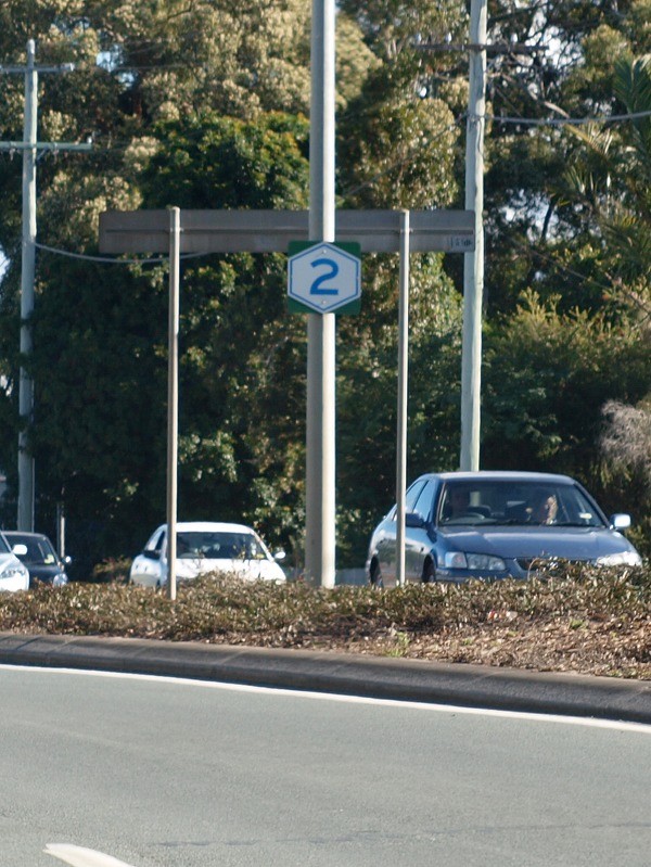 |
Trailblazer: Metroad 2 trailblazer in the Wishart area, June 2009. Image © Rob Tilley |
|
 |
Intersection
Directional Sign: ID sign on Kessels Rd (Metroad 2) at Robertson at the junction with Mains Rd (SR36), July 2011. Image © Rob Tilley |
 |
Trailblazer: Metroad 2 trailblazer in the Wishart area, June 2009. Image © Rob Tilley |
|
 |
Intersection
Directional Sign: ID sign on Kessels Rd (Metroad 2) at Robertson at the junction with Mains Rd (SR36), July 2011. Image © Rob Tilley |
 |
Trailblazer: Metroad 2 trailblazer in the Wishart area, June 2009. Image © Rob Tilley |
|
 |
Distance
Sign: Reassurance directional sign on Kessels Rd at Macgregor after the Mains Rd junction, July 2011. Image © Rob Tilley |
 |
Advance
Directional Sign: AD sign at Wishart approaching Dawson Rd and Newnham Rd (SR41), June 2009. Image © Rob Tilley |
|
 |
Advance
Directional Sign: AD sign near Cremin St at Upper Mt Gravatt, approaching the junction with Logan Rd (SR95) (former NR1) and Mt Gravatt-Capalaba Rd (Metroad 2), July 2011. Image © Rob Tilley |
 |
Old
Trailblazer: Old trailblazer assembly at Wishart at the junction with Newnham Rd (SR41) and Dawson Rd (SR41), June 2009. Image © Rob Tilley |
|
 |
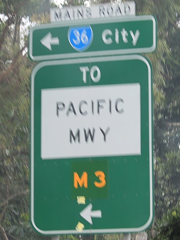
Trailblazer: M3 trailblazer at the junction with Logan Rd (SR95) at Upper Mt Gravatt, July 2011. Image © Rob Tilley |
 |
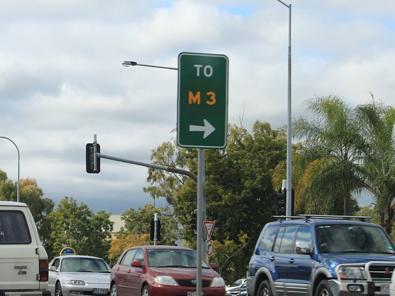
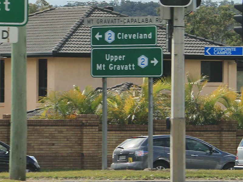
Intersection
Directional Sign: ID sign assembly at the junction of Logan Rd (SR95), Mt Gravatt-Capalaba Rd (Metroad 2) and Kessels Rd (Metroad 2) at Upper Mt Gravatt, June 2009. Image © Rob Tilley |
|
 |
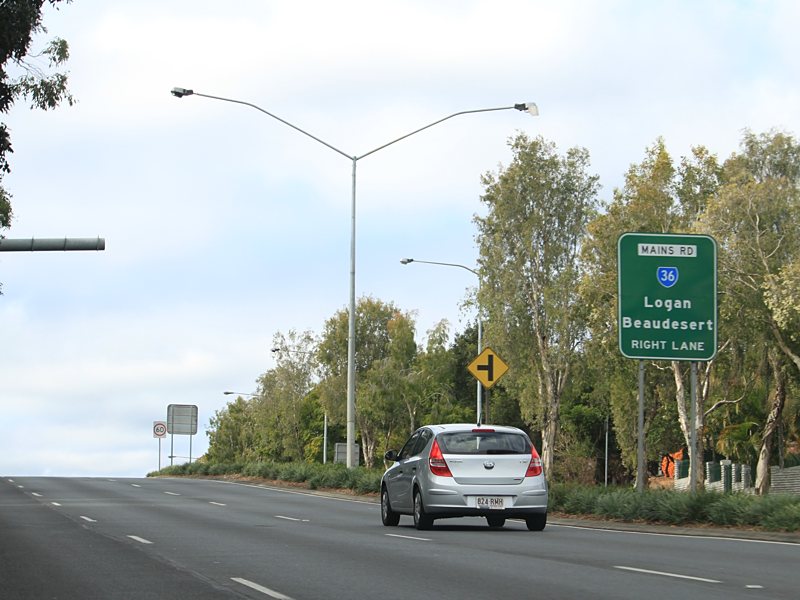
Logan
Road: Corner of Kessels Rd (Metroad 2), Mt Gravatt-Capalaba Rd (Metroad 2) and Logan Rd (SR95) at Upper Mt Gravatt, July 2011. Image © Rob Tilley |
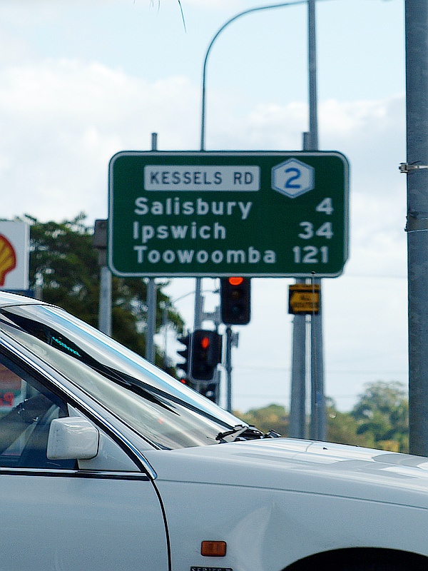 |
Distance
Sign: RD sign on Kessels Rd at Upper Mt Gravatt, June 2009. Image © Rob Tilley |
|
 |
Distance
Sign: RD sign at Upper Mt Gravatt, July 2011. Image © Rob Tilley |
 |
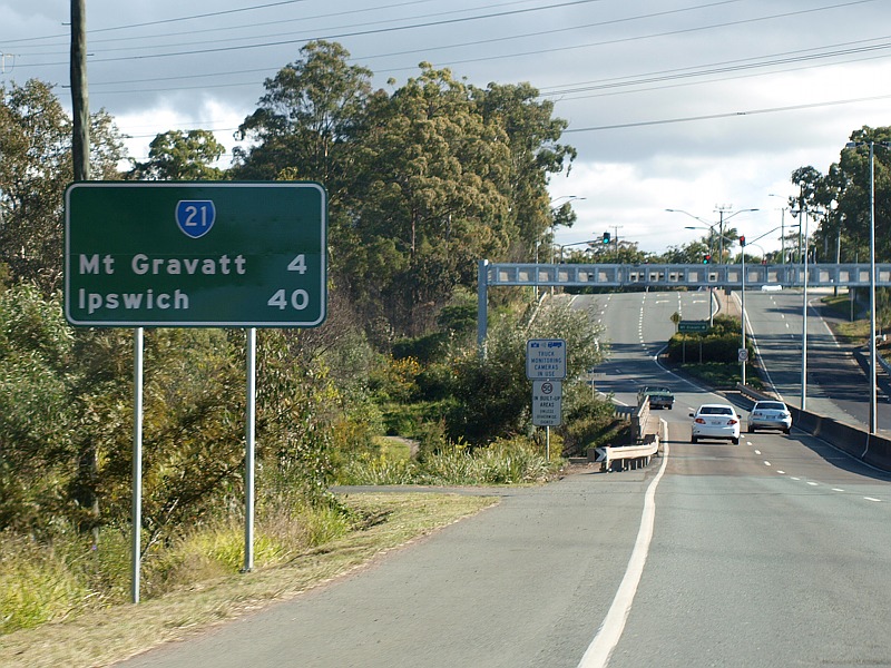
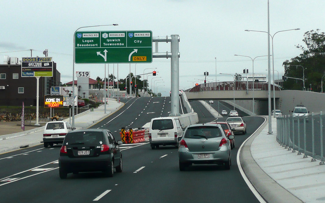
Advance Directional Sign: AD sign at Macgregor approaching Mains Rd (SR36), May 2014. Image © Paul Rands |
|
 |
Trailblazer: Metroad 2 trailblazer near Tryon St in Upper Mt Gravatt, July 2011. Image © Rob Tilley |
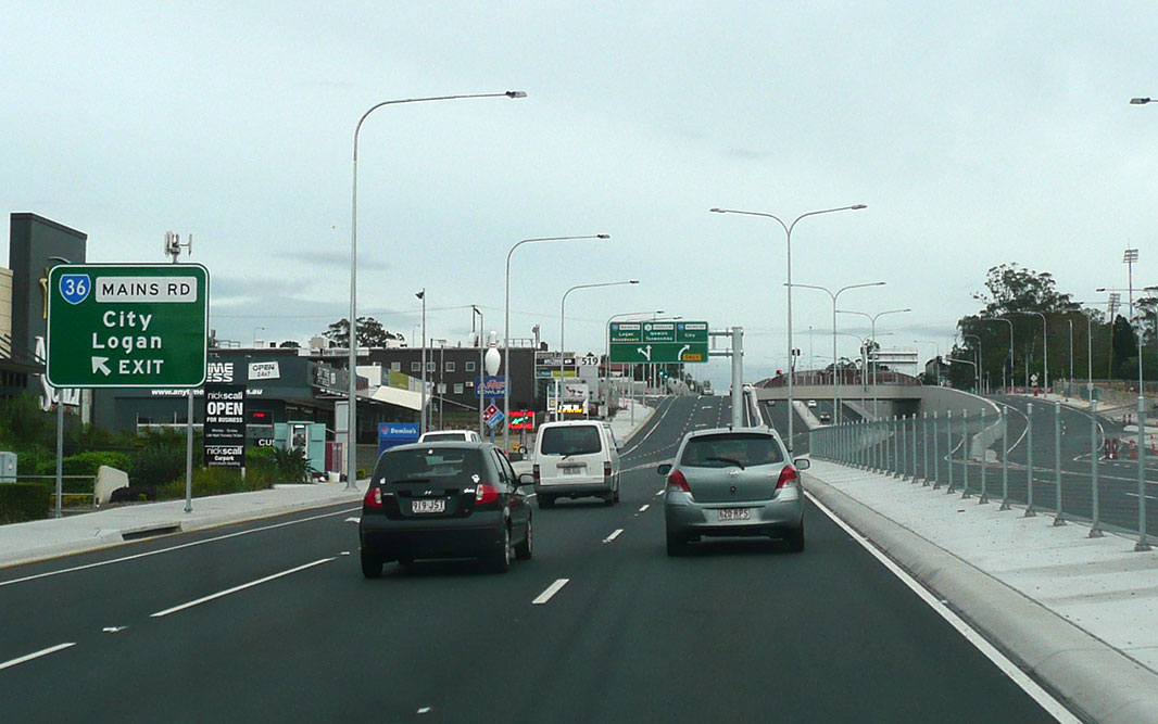 |
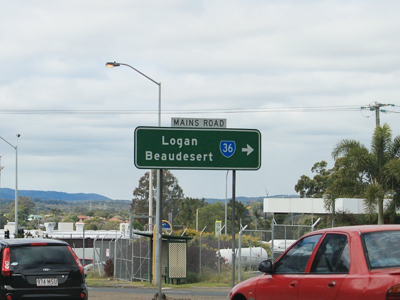
Mains Road: Kessels Rd (Metroad 2) at the Mains Rd (SR36) interchange, Macgregor, May 2014. Image © Paul Rands |
|
 |
Advance
Directional Sign: AD sign at Wishart approaching Broadwater Rd, July 2011. Image © Rob Tilley |
 |
Mains Road: Kessels Rd (Metroad 2) at the Mains Rd (SR36) interchange, Macgregor, May 2014. Image © Paul Rands |
|
 |
Broadwater
Road: Corner of Mt Gravatt-Capalaba Rd (Metroad 2) and Broadwater Rd at Wishart, July 2011. Image © Rob Tilley |
 |
Advance Lane Sign: Lane allocation sign on Granard Rd (Metroad 2) approaching Balham Rd in Rocklea, March 2012. Image © Paul Rands |
|
 |
Advance
Directional Sign: AD sign assembly close to the junction on Broadwater Rd approaching Mt Gravatt-Capalaba Rd (Metroad 2) at Wishart, July 2011. Image © Rob Tilley |
 |
Advance Directional Sign: AD sign taken from the Balham Rd intersection in Rocklea, as Granard Rd (Metroad 2) approaches the Ipswich Mwy (M7) and Ipswich Rd (A7) interchange, March 2012. Image © Paul Rands |
|
 |
End
Metroad 2 500m: Sign at Bulimba Ck in Mansfield approaching the interchange with Gateway Mwy (M1) and the SR21 section of Mt Gravatt-Capalaba Rd, July 2011. Image © Rob Tilley |
|||
 |
Advance
Directional Sign: AD sign at Mansfield approaching the interchange with Gateway Mwy (M1) and the SR21 section of Mt Gravatt-Capalaba Rd, July 2011. Image © Rob Tilley |
|||
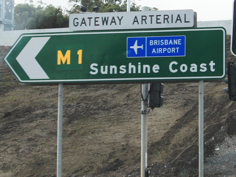 |
Intersection
Directional Sign: ID sign at the interchange with Gateway Mwy (M1) and Mt Gravatt-Capalaba Rd (SR21) at Mansfield, July 2011. The sign shows Gateway Arterial in error, the round hasn't been called Gateway Arterial Rd since the 1990s. Image © Rob Tilley |
|||
 |
Intersection
Directional Sign: ID sign at the interchange with Gateway Mwy (M1) and Mt Gravatt-Capalaba Rd (SR21) at Mansfield, July 2011. Image © Rob Tilley |
|||
| Click here for the decommissioned section of Metroad 2 (Ipswich Motorway) between Gailes and Dinmore | ||||
1 Transport and Main Roads, Metropolitan Road Region Map, September 2011
2 Transport and Main Roads,
Projects, Beatty and Balham Road Intersections - Pavement
Rehabilitation
3 Trent Thomson
4 Transport and Main
Roads, Beatty and Balham Road Intersections Pavement
rehabilitation works on Granard Road, April 2011
Last updated: 15-Aug-2020 16:02
This site © Paul Rands. All rights reserved. Some portions © (copyright) by their respective and credited owners. Permission must be obtained before using any images from this site. For details, please email by clicking here.