|
|
|
|
|
 |
Brisbane Road, Queen Victoria Road, Brisbane Street, Limestone Street, East Street, Churchill Street & Warwick Road (Business National Route 15) - Decommissioned |
Statistics:
Route Numbering:


General Information:
National Route Business 15 was the former Cunningham Highway alignment through the Ipswich city centre. When the Southern Ipswich Bypass opened in the 1980s, National Route 15 was shifted to it, and the old route renumbered to BUS-NR15.
The route consists mainly of suburban arterial road standard, and many signs are still installed showing BUS-NR15 on them, even though the route was decommissioned some time prior to April 2011. 2 With the decommissioning of the route, SR39 and SR62 now end at a unnumbered route.
A small 100 metre section of the route now forms part of the Cobb and Co Tourist Drive.
History:

| Dinmore to Yamanto | Yamanto to Dinmore | |||||
| Preview: | Description: | Preview: | Description: | |||
 |
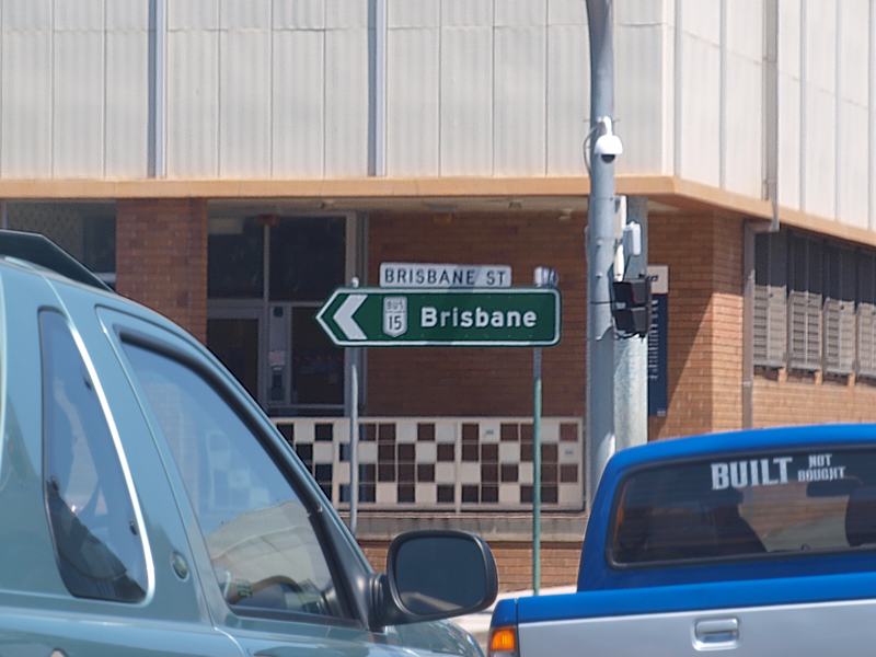
Advance Directional
Sign : AD sign on East St (SR38) in Ipswich approaching Brisbane St (former BUS-NR15), October 2009. Image © Rob Tilley |
 |
Advance Directional Sign : AD sign on Brisbane Rd approaching South Station Rd (SR39) at Booval, June 2012. Image © Justin Cozart |
|||
 |
Intersection Directional
Sign: ID sign at the junction of East St (SR38) and Brisbane St (former BUS-NR15) in Ipswich, October 2009. Image © Rob Tilley |
 |
Reassurance Directional Sign : Distance sign at Booval, June 2012. Image © Justin Cozart |
|||
 |
Advance Directional
Sign : AD sign in Ipswich CBD approaching Limestone St (former BUS-NR15 and SR62 / Cobb & Co Tourist Drive), October 2009. Image © Rob Tilley |
 |
Trailblazer: BUS-NR15 trailblazer at Ebbw Vale, June 2012. Image © Justin Cozart |
|||
 |
Limestone Street: Corner of East St and Limestone St (former BUS-NR15 and SR62 / Cobb & Co Tourist Drive) in Ipswich, October 2009. Image © Rob Tilley |
 |
Ramp Metering Signal: Ramp metering signal at Dinmore approaching River Rd, Aberdare St and Cunningham Hwy (M15), June 2012. Note the obselete NH15 shield. Image © Justin Cozart |
|||
 |
Limestone Street: Corner of East St and Limestone St (former BUS-NR15 and SR62 / Cobb & Co Tourist Drive) in Ipswich, October 2009. Image © Rob Tilley |
 |
Intersection Directional Sign : ID sign at Dinmore at the junction with River Rd, Aberdare St and Cunningham Hwy (M15), June 2012. Note the obselete NH15 shield. Image © Justin Cozart |
|||
 |
Advance Directional
Sign : AD sign on East St approaching Churchill St in Ipswich. BUS-NR15 used to turn left at this junction. October 2009. Image © Rob Tilley |
|||||
 |
Warwick Road: Corner of Churchill St and Warwick Rd in Ipswich, BUS-NR15 used to turn right at this junction. October 2009. Image © Rob Tilley |
|||||
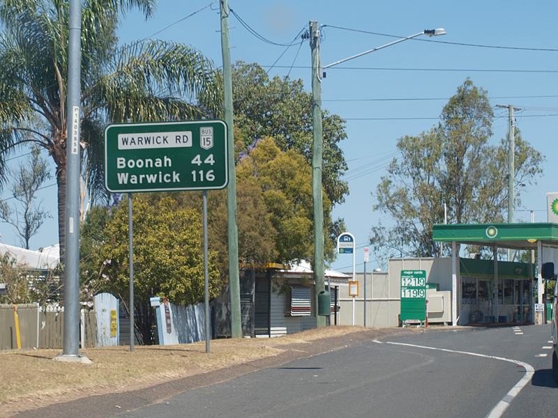
 |
Distance Sign: RD sign on Warwick Rd at Ipswich, October 2009. Image © Rob Tilley |
|||||
 |
Advance Directional
Sign : AD sign on Warwick Rd approaching Moffatt St in Ipswich, October 2009. Image © Rob Tilley |
|||||
 |
Advance Directional
Sign: Older style AD sign approaching the Salisbury Rd (SR39) roundabout in Ipswich, October 2009. Image © Rob Tilley |
|||||
 |
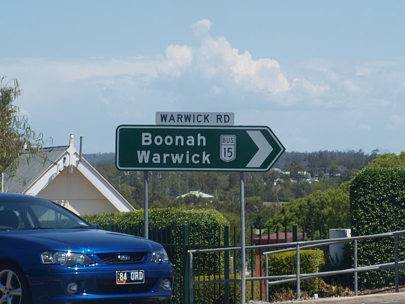
Salisbury Road: Corner of Warwick Rd (BUS-NR15) and Salibury Rd (SR39) at Ipswich, October 2009. Image © Rob Tilley |
|||||
 |
Salisbury Road: Older ID sign at the corner of Warwick Rd (BUS-NR15) and Salibury Rd (SR39) at Ipswich, October 2009. Image © Rob Tilley |
|||||
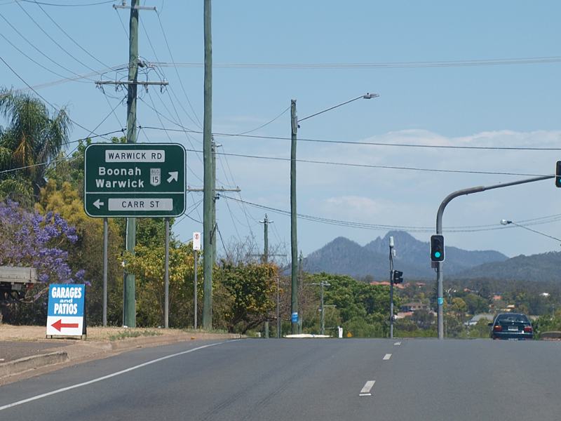 |
Advance Directional
Sign : AD sign on Warwick Rd approaching Carr St in Ipswich, October 2009. Image © Rob Tilley |
|||||
 |
Carr Street: Intersection directional sign at the corner of Warwick Rd (BUS-NR15) and Carr St in Ipswich, October 2009. Image © Rob Tilley |
|||||
 |
Carr Street: Intersection directional sign at the corner of Warwick Rd (BUS-NR15) and Carr St in Ipswich, October 2009. Image © Rob Tilley |
|||||
 |
Advance Directional
Sign : AD sign at Churchill approaching Lobb St, October 2009. Image © Rob Tilley |
|||||
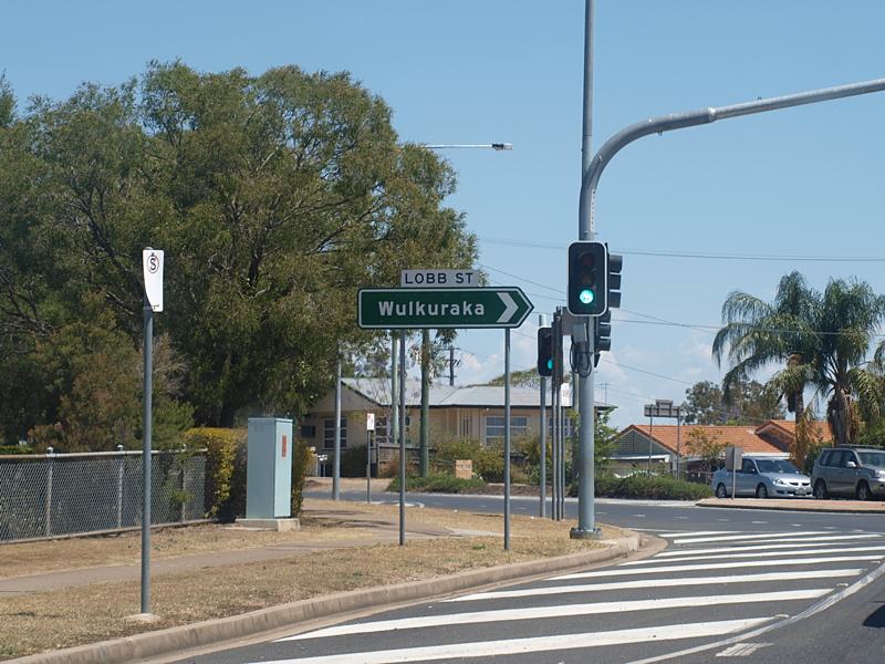 |
Lobb Street: Corner of Warwick Rd (BUS-NR15) and Lobb St in Churchill, October 2009. Image © Rob Tilley |
|||||
 |
Distance Sign: RD sign after the Lobb St junction in Churchill, October 2009. Image © Rob Tilley |
|||||
 |
Trailblazer: BUS-NR15 trailblazer near Winston St in Yamanto, October 2009. Image © Rob Tilley |
|||||
 |
Advance Directional
Sign : AD sign on Warwick Rd (BUS-NR15) approaching the southern terminus of the route, the interchange with Cunningham Hwy (M15 / NH15) and Centenary Hwy (A5) at Yamanto, October 2009. Image © Rob Tilley |
|||||
1 Department of
Transport and Main Roads, The State Road Network of Queensland at 30 June
2010 Map
2 Sam Laybutt (OzRoads),
from correspondence from Department of Transport and Main Roads regarding
the status of Business - National Route 15, April 2011
3 University of Southern Queensland, Library,
The construction
of the southern Ipswich bypass from Saunders Street to Deebing Creek thesis
by Elton John Walker
Last updated: 14-Feb-2019 22:05
This site © Paul Rands. All rights reserved. Some portions © (copyright) by their respective and credited owners. Permission must be obtained before using any images from this site. For details, please email by clicking here.