|
|
|
|
|
| M1 A1 | Pacific Motorway, Gateway Motorway & Bruce Highway (M1 / A1) - Reedy Creek to Gaven |
Statistics:
Route Numbering:

General Information:
The M1 / A1 corridor is the main coastal route from the NSW border to the northern tip of the east coast of Australia, and links major cities and towns with Brisbane, and beyond the NSW border, Sydney.
Pacific Motorway:
The M1 portion of the Pacific Motorway bypasses the suburban areas of the Gold Coast and outer Brisbane areas, and passes through residential, commercial and industrial areas, and features a number of service roads to cater to some of the industrial and commercial zones.
The section from Brisbane to Springwood is formerly known as the South Eastern Freeway.
The Pacific Motorway passes several Gold Coast tourist attractions such as Warner Bros. Movie World, Wet 'n' Wild Water World, and Dreamworld.
The route features twin tunnels bypass the Tugun area as it crosses into NSW.
History:
Pacific Motorway:
- 1930s: Pacific Highway named. 2
- March 1977: Work on the Nerang Bypass commenced. 3
- 6 April 1979: Nerang Bypass was opened by Russ Hinze. 3
- 1990: Nerang to Mudgeeraba duplication commenced. 3
- 1992: Mudgeeraba to Reedy Creek duplication commenced. 3
- October 2000: Motorway standard upgrade of Pacific Highway between the junction of Logan Motorway and Nerang opened to traffic. 4
- February 2008: Work upgrading the Nerang South Interchange (Exit 73) started. 5
- February 2009: Upgrade work started at Mudgeeraba (Exit 79). 5
- May 2012: Completion of widening from 4 to 6 lanes between Nerang and Varsity Lakes. Pacific Motorway (M1) upgrade planning: Nerang to Tugun
| Reedy Creek To Gaven | Gaven to Reedy Creek | |||
| Preview: | Description: | Preview: | Description: | |
 |
Supplemental Advance Directional Sign: Supplemental AD sign at Mudgeeraba approaching Robina Parkway & Somerset Drive, July 2007. Image © Paul Rands |
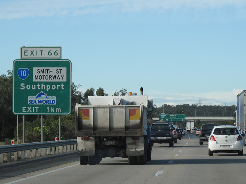 |
Advance Directional Sign: AD sign at Parkwood approaching Smith St Mwy (SR10), June 2012. Image © Justin Cozart |
|
 |
Advance Directional Sign: AD sign at Mudgeeraba approaching Robina Parkway & Somerset Drive Image © Paul Rands |
 |
Advance Directional Sign: AD sign at Parkwood approaching Smith St Mwy (SR10), June 2012. Click here for a photo by Rob Tilley of this location from May 2005. Image © Justin Cozart |
|
 |
Robina Parkway & Somerset Drive: Pacific Mwy (M1) at the Robina Parkway and Somerset Drive interchange, Mudgeeraba, July 2007. Image © Paul Rands |
 |
Smith Street Motorway: Pacific Mwy (M1) at the Smith St Mwy (SR10) interchange at Arundel, March 2006. Image © Paul Rands |
|
 |
Distance Sign: Exit distance sign within the Robina Pkwy and Somerset Dr interchange at Mudgeeraba, July 2007. Image © Paul Rands |
 |
Distance Sign: Reassurance directional sign near Smith St Mwy (SR10) at Arundel, showing distances to upcoming exits, March 2006. Image © Paul Rands |
|
 |
Supplemental Advance Directional Sign: Supplemental AD sign at Mudgeeraba approaching The Link Way (SR99), July 2007. Image © Paul Rands |
 |
Advance Directional Sign: AD sign at Molendinar approaching Southport-Nerang Rd (SR20) interchange, March 2006. Image © Paul Rands |
|
 |
Advance Directional Sign: AD sign near Mudgeeraba Creek at Mudgeeraba approaching The Link Way (SR99), July 2007. Image © Paul Rands |
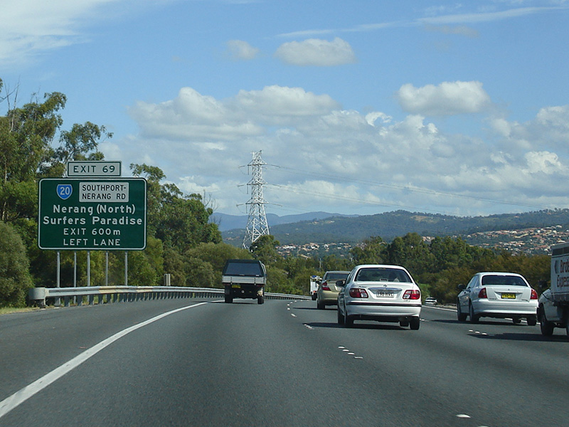 |
Advance Directional Sign: AD sign at Molendinar approaching Southport-Nerang Rd (SR20) interchange, March 2006. Image © Paul Rands |
|
 |
Mudgeeraba Road: Pacific Mwy (M1) at the Mudgeeraba Rd (SR42) interchange, Mudgeeraba, July 2007. Image © Paul Rands |
 |
Advance Directional Sign: AD sign at Molendinar approaching Nerang-Broadbeach Rd (SR90) interchange, March 2006. Image © Paul Rands |
|
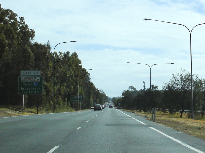 |
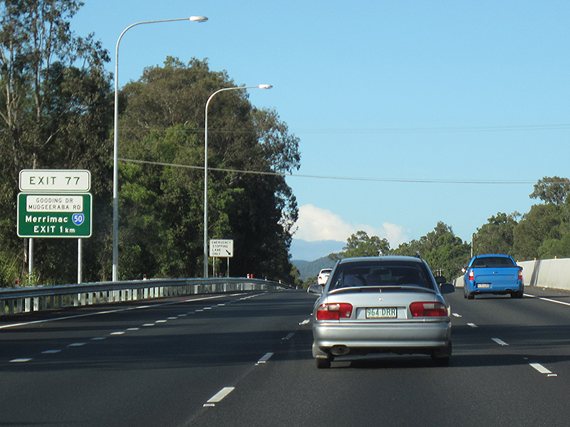
Advance Directional Sign: AD sign at Mudgeeraba for the Gooding Dr & Mudgeeraba Rd (SR50) interchange, July 2007. Image © Paul Rands |
 |
Advance Directional Sign: AD sign at Nerang approaching Nerang-Broadbeach Rd (SR90) interchange, June 2012. Image © Justin Cozart |
|
 |
Advance Directional Sign: AD sign at Mudgeeraba for the Gooding Dr & Mudgeeraba Rd (SR50) interchange, July 2007. Image © Paul Rands |
 |
Nerang-Broadbeach Road: Pacific Mwy (M1) at the interchange with Nerang-Broadbeach Rd (SR90) at Nerang, March 2006. Image © Paul Rands |
|
 |
Gooding Drive & Mudgeeraba Road: Pacific Mwy (M1) at the interchange with Gooding Dr / Mudgeeraba Rd (SR50) at Mudgeeraba, July 2007. Image © Paul Rands |
 |
Advance Directional Signs: AD signs on the Nerang-Broadbeach Rd (SR90) overpass at Nerang for the Pappas Way interchange, September 2017. Click here for a photo of this location by Paul Rands from March 2006. Image © Dean Sherry |
|
 |
Advance Directional Sign: AD sign at Mudgeeraba near Gooding Dr / Mudgeeraba Rd (SR50) for the interchange with Elysium Rd, July 2007. Image © Paul Rands |
 |
Advance Directional Sign: AD sign at Nerang for the Pappas Way interchange, June 2012. Image © Justin Cozart |
|
 |
Distance Sign: Exit distance sign at Worongary, July 2007. Image © Paul Rands |
 |
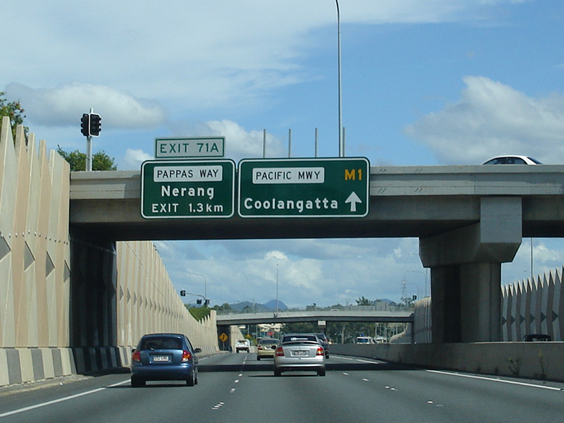
Pappas Way: Pacific Mwy (M1) at the Pappas Way interchange, Nerang, September 2017. Click here for a photo of this location by Justin Cozart from June 2012. Image © Dean Sherry |
|
 |
Advance Directional Sign: AD sign approaching the interchange with Elysium Rd at Worongary, July 2007. Image © Paul Rands |
 |
Advance Directional Sign: AD sign at Nerang for Nielsens Rd (SR40) and Alexander Dr (SR40) interchange, June 2012. Image © Justin Cozart |
|
 |
Distance Sign: RD sign at Worongary, July 2007. Image © Paul Rands |
 |
Advance Directional Sign: AD sign at Nerang for Nielsens Rd (SR40) and Alexander Dr (SR40) interchange, June 2012. Image © Justin Cozart |
|
 |
Elysium Road Interchange: Pacific Mwy (M1) at the Elysium Rd interchange, Worongary, July 2007. Image © Paul Rands |
 |
Nielsens Road & Alexander Drive: Pacific Mwy (M1) at the Nielsens Rd and Alexander Dr (SR40) interchange, Nerang, June 2012. Click here for a photo by Paul Rands of this location from March 2006. Image © Justin Cozart |
|
 |
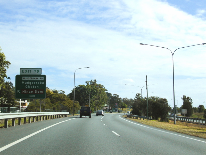
Advance Dirctional Sign: AD sign at Worongary for the Nielsens Rd (SR40) / Alexander Dr (SR40) interchange, July 2007. Image © Paul Rands |
 |
Advance Directional Sign: AD sign at Carrara for Elysium Rd interchange, March 2006. Image © Paul Rands |
|
 |
Supplementary Advance Dirctional Sign: Supplementary AD sign at Worongary for the Nielsens Rd (SR40) / Alexander Dr (SR40) interchange, July 2007. Image © Paul Rands |
 |
Advance Directional Sign: AD sign at Carrara for Elysium Rd interchange, June 2012. Image © Justin Cozart |
|
 |
Advance Dirctional Sign: AD sign at Worongary for the Nielsens Rd (SR40) / Alexander Dr (SR40) interchange, July 2007. Image © Paul Rands |
 |
Elysium Road: Pacific Mwy (M1) at the interchange with Elysium Rd, Carrara, June 2012. Image © Justin Cozart |
|
 |
Nielsens Road & Alexander Drive Interchange: Pacific Mwy (M1) at the Nielsens Rd (SR40) and Alexander Dr (SR40) interchage at Worongary, July 2007. Image © Paul Rands |
 |
Advance Directional Sign: AD sign at Merrimac for the Gooding Dr & Mudgeeraba Rd (SR50) interchange, June 2012. Click here for a photo by Paul Rands of this location from March 2006. Image © Justin Cozart |
|
 |
Advance Directional Sign: AD sign at Highland Park for the Nerang-Broadbeach Rd (SR90) interchange, July 2007. Image © Paul Rands |
 |
Advance Directional Sign: AD sign at Merrimac for the Gooding Dr & Mudgeeraba Rd (SR50) interchange, June 2012. Image © Justin Cozart |
|
 |
Advance Directional Sign: AD sign at Highland Park for the Nerang-Broadbeach Rd (SR90) interchange, July 2007. Image © Paul Rands |
 |
Gooding Drive & Mudgeeraba Road: Pacific Mwy (M1) at the Gooding Dr & Mudgeeraba Rd (SR50) interchange at Merrimac, June 2012. Image © Justin Cozart |
|
 |
Nerang-Broadbeach Road: Pacific Mwy (M1) at the interchange with Nerang-Broadbeach Rd (SR90) at Nerang, July 2007. Image © Paul Rands |
 |
Distance Sign: RD sign showing distances to upcoming exits, June 2012. Click here for a photo by Paul Rands of this location from March 2006. Image © Justin Cozart |
|
 |
Advance Directional Signs: AD signs at Nerang on the Nerang-Broadbeach Rd (SR90) overpass for the Southport-Nerang Rd (SR20) interchange, July 2007. Image © Paul Rands |
 |
Advance Directional Sign: AD sign at Merrimac for the Robina Town Centre Dr & Mudgeeraba Rd (SR42) interchange, March 2006. Image © Paul Rands |
|
 |
Advance Directional Signs: AD sign at Nerang near Nerang River for the Southport-Nerang Rd (SR20) interchange, July 2007. Image © Paul Rands |
 |
Distance Sign: Reassurance directional sign at Merrimac, March 2006. Image © Paul Rands |
|
 |
Southport-Nerang Road: Pacific Mwy (M1) at the Southport-Nerang Rd (SR20) interchange at Nerang, July 2007. Image © Paul Rands |
 |
Advance Directional Sign: AD sign at Robina for the Robina Town Centre Dr & Mudgeeraba Rd (SR42) interchange, June 2012. Image © Justin Cozart |
|
 |
Advance Directional Sign: AD sign at Gaven for Smith St Mwy (SR10), July 2007. Image © Paul Rands |
 |
Supplemental Advance Directional Sign: Supplemental AD sign at Robina for the Robina Town Centre Dr & Mudgeeraba Rd (SR42) interchange, June 2012. Image © Justin Cozart |
|
 |
Smith Street Motorway: Pacific Mwy (M1) at the Smith St Mwy (SR10) interchange at Gaven, July 2007. Image © Paul Rands |
 |
Supplemental Advance Directional Sign: Supplemental AD sign at Robina for the Robina Town Centre Dr & Mudgeeraba Rd (SR42) interchange, June 2012. Image © Justin Cozart |
|
 |
Distance Sign: Reassurance directional sign showing distances to upcoming exits, Gaven, July 2007. Image © Paul Rands |
 |
Supplemental Advance Directional Sign: Supplemental AD sign at Robina for the Robina Town Centre Dr & Mudgeeraba Rd (SR42) interchange, June 2012. Click here for a photo by Paul Rands of this location from March 2006. Image © Justin Cozart |
|
 |
Advance Directional Sign: AD sign at Gaven approaching Gold Coast Hwy (SR2), July 2018. Image © Rob Tilley |
 |
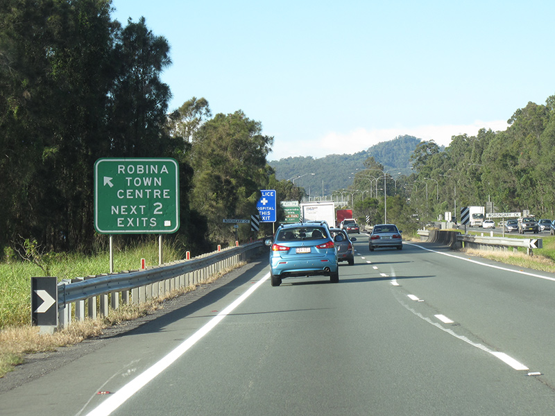
Robina Town Centre Drive & Mudgeeraba Road: Pacific Mwy (M1) at the interchange with Robina Town Centre Dr and also Mudgeeraba Rd (SR42) at Robina, June 2012. Image © Justin Cozart |
|
 |
Supplemental Advance Directional Sign: Supplemental AD sign at Gaven approaching Gold Coast Hwy (SR2),July 2018. Image © Rob Tilley |
 |
Advance Directional Sign: AD sign with curiously placed and designed road name patch at Robina for the Robina Pkwy & Somerset Dr interchange, June 2012. Click here for a photo by Rob Tilley of this location from February 2009. Image © Justin Cozart |
|
 |
Supplemental Advance Directional Sign: Supplemental AD sign at Gaven approaching Gold Coast Hwy (SR2),July 2018. Image © Rob Tilley |
 |
Distance Sign: RD sign at Robina, March 2006. Image © Paul Rands |
|
 |
Supplemental Advance Directional Sign: Supplemental AD sign at Gaven approaching Gold Coast Hwy (SR2), July 2007. Image © Paul Rands |
 |
Advance Directional Sign: AD sign at Robina for the Robina Pkwy & Somerset Dr interchange, February 2009. Image © Rob Tilley |
|
 |
Advance Directional Sign: AD sign at Gaven approaching Gold Coast Hwy (SR2), July 2018. Image © Rob Tilley |
 |
Robina Parkway & Somerset Drive Interchange: Pacific Mwy (M1) at the interchange with Robina Pkwy and Somerset Dr at Robina, February 2009. Image © Rob Tilley |
|
 |
Gold Coast Highway Interchange: Pacific Mwy (M1) at the Gold Coast Hwy (SR2) interchange at Gaven, July 2018. |
 |
Advance Directional Sign: AD sign at Robina for Reedy Ck Rd (SR80) interchange, March 2006. Image © Paul Rands |
|
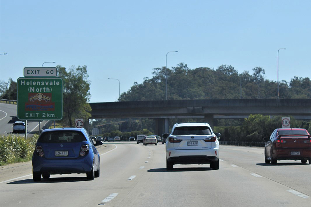 |
Gold Coast Highway Interchange: Pacific Mwy (M1) at the Gold Coast Hwy (SR2) interchange at Gaven, July 2018. Click here for a photo by Paul Rands of this location from July 2007. Image © Rob Tilley |
|||
| Click here for the continuation of Pacific Motorway (M1) between Gaven and Loganholme Click here for the continuation of Pacific Motorway (M1) between the NSW Border and Reedy Creek |
||||
1 Department of Transport and Main Roads, The State Road Network of Queensland, 30 June 2010
2 Bulldust, Beef & Beyond
3 Tyler Bullock
4 The Pacific Motorway Report: An investigation into the actions of the Department of Main Roads in relation to noise and safety issues concerning the Pacific Motorway. ISBN 978-0-9758442-9-8.
5 Department of Transport and Main Roads, Media Release, Pacific Motorway Upgrade, Community Update August 2009
Last updated: 18-Jul-2019 11:16
This site © Paul Rands. All rights reserved. Some portions © (copyright) by their respective and credited owners. Permission must be obtained before using any images from this site. For details, please email by clicking here.