|
|
|
|
|
 |
Barkly Highway (National Highway 66) |
Statistics:
Route Numbering:
General Information:
National Highway 66 is the main route linking major Northern Territory routes and towns with Queensland and the eastern seaboard. Passing through sparsely populated areas, the road is fully sealed, undivided and isolated.
The name Barkly Highway was in use during World War 2, originating from the major feature - Barkly Tableland - which the highway crosses. The Barkly Tableland was named by William Landsborough on 6 December 1861 (whilst exploring the western regions of Queensland) after Sir Henry Barkly, the then Governor of Victoria. 1
History:

| Tennant Creek to Queensland Border | Queensland Border to Tennant Creek | |||
| Preview: | Description: | Preview: | Description: | |
 |
Reassurance Directional Sign: Distance sign as Barkly Hwy (NH66) leaves Tennant Creek (Threeways), November 2016. Note the incorrect State Route shield. Image © Paul Rands |
 |
Queensland / Northern Territory Border: Barkly Hwy as it crosses the QLD / NT Border at Avon Downs, November 2016. Image © Paul Rands |
|
 |
Services Sign: Services sign at Tennant Creek, November 2016. Image © Paul Rands |
 |
Reassurance Directional Sign: Distance sign at Avon Downs, June 2018. Note the missing route number. Image © Dean Sherry |
|
 |
Services Sign: Services sign at Tennant Creek, November 2016. Note the incorrect State Route shield. Image © Paul Rands |
 |
Kilometre Plate: Kilometre plate at Avon Downs with distance to Sturt Highway, June 2018. Image © Dean Sherry |
|
 |
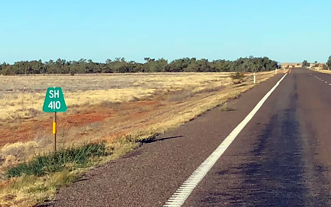
Kilometer Plate: The kilometre plates along the road show distance to the NT / QLD Border, not any towns, even though the next major town (Camooweal) is only a few km over the border, Warumungu, November 2016. Image © Paul Rands |
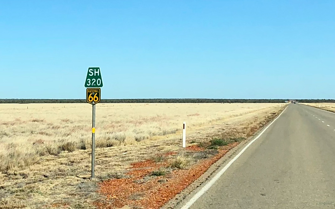 |
Kilometre Plate & Trailblazer: Kilometre plate and trailblazer at Ranken with distance to Sturt Highway, June 2018. Image © Dean Sherry |
|
 |
Services Sign: Services sign at Tablelands, November 2016. Image © Paul Rands |
 |
Advance Directional Sign: AD sign at Tablelands approaching Tablelands Hwy (SR11), June 2018. Note the missing route number. Image © Dean Sherry |
|
 |
Services Sign: Services sign at Tablelands, November 2016. Image © Paul Rands |
 |
Intersection Directional Sign: ID sign at the corner of Barkly Hwy (NH66) and Tablelands Hwy (SR11) at Tablelands, June 2018. Note the incorrect shaped route shield. Image © Dean Sherry |
|
 |
Distance / Services Sign: Combined services and distance sign at Tablelands, November 2016. Image © Paul Rands |
 |
Reassurance Directional Sign: Distance sign at Tablelands, June 2018. Image © Dean Sherry |
|
 |
Fuel Consumption Warning: Sign warning of fuel consumption increase in winds, Tablelands, November 2016. Image © Paul Rands |
|||
 |
Advance Directional Sign: AD sign at Tablelands approaching Tablelands Hwy (SR11), November 2016. Note the incorrect State Route shield and no shield for Tablelands Hwy. Image © Paul Rands |
|||
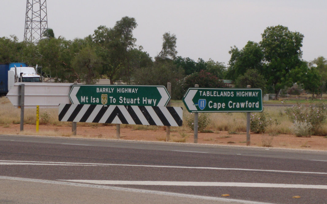 |
Intersection Directional Signs: ID signs at the corner of Barkly Hwy (NH66) and Tablelands Hwy (SR11) at Tablelands (Barkly Roadhouse), November 2016. Image © Paul Rands |
|||
 |
No Fuel for 260km: Warning sign to next fuel at Tablelands, November 2016. Image © Paul Rands |
|||
 |
Reassurance Directional Sign: Distance sign at Tablelands, November 2016. Note the incorrect colours used on the route shield. Image © Paul Rands |
|||
 |
Entering Lake Eyre Basin: Barkly Hwy (NH66) at Ranken as it enters the Lake Eyre (Kati Thanda) Basin, November 2016. Lake Eyre is the largest lake in Australia and perennial. Image © Paul Rands |
|||
 |
Reassurance Directional Sign: Distance sign at Ranken, November 2016. Note the missing route shield. Image © Paul Rands |
|||
 |
Avon Downs: Barkly Hwy (NH66) as it passes through Avon Downs, November 2016. Image © Paul Rands |
|||
 |
Avon Downs: Barkly Hwy (NH66) as it passes through Avon Downs, November 2016. Image © Paul Rands |
|||
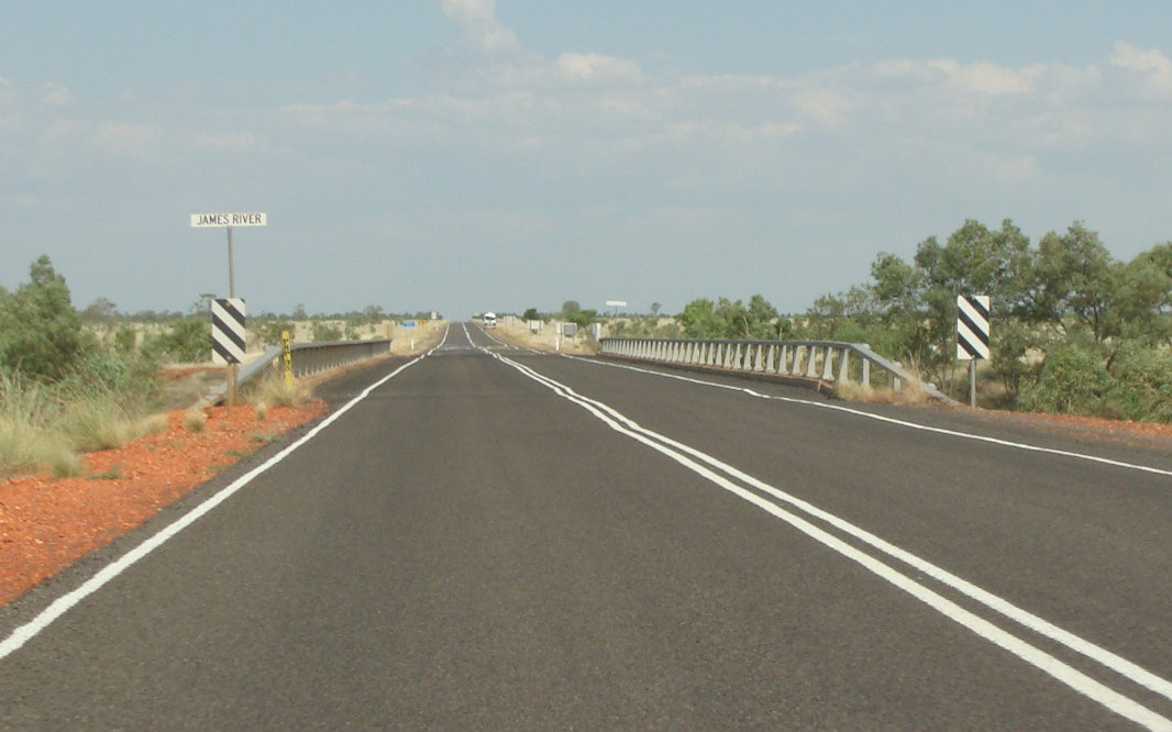 |
James River: Barkly Hwy (NH66) as it crosses James River at Avon Downs, November 2016. Image © Paul Rands |
|||
 |
Services Sign: Services sign at Avon Downs, November 2016. Image © Paul Rands |
|||
 |
Reassurance Directional Sign: Distance sign at Avon Downs, November 2016. Note the missing route shield. Image © Paul Rands |
|||
 |
Northern Territory / Queensland Border: Barkly Hwy (NH66) at Avon Downs, as it crosses into Queensland, November 2016. Image © Paul Rands |
|||
| Click here for the continuation of Barkly Hwy as A2 in Queensland | ||||
1 Northern Territory Government, NT Place Names Register, Barkly Highway
2 Northern Territory Library, The Track: 1000 Miles to War
3 Northern Territory Government, Media Release, Works on Barkly Highway to Reduce Future Flood Damage, 2 Oct 2009
Last updated: 06-Jul-2020 22:40
This site © Paul Rands. All rights reserved. Some portions © (copyright) by their respective and credited owners. Permission must be obtained before using any images from this site. For details, please email by clicking here.