|
|
|
|
|
| A1 | Stuart Highway & Victoria Highway (A1) |
Statistics:
Stuart Highway:
Victora Highway:
Route Numbering:


General Information:
The Stuart Highway is one of NT's most important routes, linking Darwin, Alice Springs and the populated areas of South Australia, including Adelaide.
Named for explorer John McDouall Stuart, the first European to cross Australia from South to North, and it generally follows his route. The Stuart Highway crosses the desert of Central Australia to savannah grasslands and tropical wetlands in the North. 1
The Victoria Highway, of which 469 km is located in the Northern Territory, forms part of the Australian Land Transport Network and is a component of the declared Darwin to Perth Corridor. 9
History:
The Stuart Highway began as a dirt track servicing the construction of the Overland Telegraph in the 1870s and served to link the railheads until World War II. 1
Construction of the telegraph line had required the development of a track along the line’s route, to enable wagons and other vehicles to travel with loads of posts, wire, and other materials. An area of approximately two chains width (about 40 metres) was cleared on either side of the line and this became “the track” – the only transport route south. 2
For the whole length of “the track” there were frequent deviations. Detours were made to reach watering places and wet season detours were developed to avoid low and boggy ground. Tracks were continually deviated and altered by “self-help” travellers. There was no formal development or maintenance of the road, beyond the Two and a Half Mile (Parap) in Darwin, until the late 1920s. 2
From 1936 a low standard dry weather road was developed from Darwin to Adelaide River, roughly along the present route of the Stuart Highway. From Adelaide River a similar low standard road was developed southward to the railhead at Larrimah. However, construction and maintenance of these roads was given a very low priority because the same route was served by the North Australia Railway line. 2
When war loomed it became apparent that the railway could not meet all defence requirements. Planners saw a need for an all weather road to service dispersed military installations, particularly airfields, in the immediate Darwin hinterland. So, from May 1941, the Darwin Adelaide River section (115km) was upgraded to an all weather gravel road standard. The work was done by the New South Wales Department of Main Roads. 2
By early 1943 traffic between Darwin and Adelaide River had reached 2000 vehicles per day, mostly heavy lorries. The gravel surface disintegrated under this traffic and so it was decided to provide a bitumen seal – 6.2m wide to Adelaide River and 4.8m wide from there to Larrimah. 2
Similar work was done by interstate Main Roads teams on southern section of the Stuart Highway, with the result that by 1944 the highway was bitumen sealed, although some sections were very narrow.2
- 1888: The first bridge over Adelaide River at Adelaide River constructed.
- 27 March 1980: The Edwin Verbung Bridge over Adelaide River was opened and became the primary road link over the river.
- 1987: Full seal (widening and upgrading) of the highway completed.
- December 2004: Work commences on the $6 million project to duplicate the Stuart Highway from Noonamah to the Cox Peninsula Road. The project involved constructing two additional lanes for a distance of 6km, creating two north-bound and two south-bound lanes. Other works included providing a formal intersection at the southern entry / exit to the Noonamah roadhouse, and a separate entry and exit at the northern approach, plus upgrades to the intersections of Elizabeth Valley Road, Keleson Road and Cox Peninsula Road. 3
- 2005: Construction of four additional overtaking lanes on the Stuart Highway between Darwin and Katherine. Two of the overtaking lanes are on the northbound section between Batchelor and Darwin. One just north of the Batchelor turnoff. The second just south of Acacia. The other two passing lanes are on the southbound section just north of Pine Creek and about 30 kilometres north of Katherine. 4
- April 2006: Official opening of the Noonamah to Cox Peninsula Road upgrade by Infrastructure and Transport Minister Dr Chris Burns and Senator Nigel Scullion. 4
- 7 July 2006: Removal of traffic signals on the inbound carriageway to provide unrestricted traffic flow at the Stuart Highway / Tulagi Road intersection at Yarrawonga. The junction was altered to a signalised seagull operation. Other project works included widening the road and building a new acceleration lane. 3
- 16 December 2013: An integrated red light and speed camera began operation on the Stuart Highway and Jenkins Road intersection at Humpty Doo. 5
- June 2014: Work began on upgrades to the intersection of the Stuart Highway and Bicentennial Road, and the intersection of the Victoria Highway and Bicentennial Road. 6
- May 2016: Completion of upgrade works at Amy Johnson Avenue / Stuart Highway intersection at Winnellie. The $572,000 project included an extension to the slip lane on the Amy Johnson Avenue approach to Stuart Highway and upgrades to the existing traffic signals at the intersection. 7
- July 2016: Completion of upgrade to Stuart Highway / Temple Terrace intersection including provision for access to Palmerston Regional Hospital. 8
- 1970: The Victoria River Highway Bridge was opened. 9
- 1974: Completion of sealing of the Highway to the Western Australia border was completed. 9
- 2005: Work begins on upgrading Victoria Hwy between to be less susceptible to flooding. The project involved the construction of new bridges and minor realignments of the highway at Victoria River, Joe Creek, Lost Creek and Sandy Creek bridge sites, raising two sections of the highway, and construction of two passing lanes. 4
- June 2014: Work began on upgrades to the intersection of the Stuart Highway and Bicentennial Road, and the intersection of the Victoria Highway and Bicentennial Road. 6
- November 2016: Project to raise the height of the bridges over Saddle Creek on Victoria Highway opened to traffic. 10
- July 2017: An upgrade of bridges at Big Horse and Little Horse Creeks on the Victoria Highway about 300 km west of Katherine near the township of Timber Creek. The works upgrade the roadway to a National Highway standard, improve flood immunity and access to the area and improve the road link between the Northern Territory and Western Australia. 11
| Daly Waters to Darwin | Darwin to Daly Waters | |||
| Preview: | Description: | Preview: | Description: | |
 |
Reassurance Directional Sign: Distance sign at Adelaide River, July 2017. Image © Michael Greenslade |
 |
Parap Road: Corner of Stuart Hwy (A1) and Parap Rd in Parap, July 2017. Image © Michael Greenslade |
|
 |
Entering Adelaide River: Stuart Hwy (A1) as it enters the town of Adelaide River, July 2017. Image © Michael Greenslade |
 |
Advance Directional Sign: AD sign on Stuart Hwy (A1) at Winnellie approaching Billeroy Rd, July 2017. Image © Michael Greenslade |
|
 |
Advance Directional Sign: AD sign approaching Dorat Rd (B23) at Adelaide River, July 2017. Image © Michael Greenslade |
 |
Reassurance Directional Sign: Distance sign at Berrimah, July 2017. Image © Michael Greenslade |
|
 |
Intersection Directional Sign: ID sign at the corner of Stuart Hwy (A1) and Dorat Rd (B23) at Adelaide River, July 2017. Image © Michael Greenslade |
 |
McMillans Road: Corner of Stuart Hwy (A1) and McMillans Rd at Knuckey Lagoon, July 2017. Image © Michael Greenslade |
|
 |
Intersection Directional Sign: ID sign at the corner of Stuart Hwy (A1) and Dorat Rd (B23) at Adelaide River, July 2017. Note the remnant NH1 shield. Image © Michael Greenslade |
 |
Advance Directional Sign: AD sign at Holtze approaching Roystonea Av, July 2017. Image © Michael Greenslade |
|
 |
Adelaide River : Old and current bridges over Adelaide River in the town of Adelaide River, July 2017. Image © Michael Greenslade |
 |
Advance Directional Sign: AD sign at Holtze approaching Roystonea Av, July 2017. Image © Michael Greenslade |
|
 |
Adelaide River: Stuart Hwy (A1) as it crosses Adelaide River via Edwin Verburg Bridge in the town of Adelaide River, with the railway trestle in the distance, July 2017. Image © Michael Greenslade |
 |
Supplemental Advance Directional Sign: Supplemental AD sign at Holtze approaching Roystonea Av, July 2017. Image © Michael Greenslade |
|
 |
Reassurance Directional Sign: Image © Michael Greenslade |
 |
Roystonea Avenue: Stuart Hwy (A1) at the Roystonea Av interchange, Holtze, July 2017. Image © Michael Greenslade |
|
 |
Advance Directional Sign: AD sign at Livingstone approaching Cox Peninsula Road (B34), September 2008. Image © Kate Pilling |
 |
Advaance Directional Sign: AD sign at Yarrawonga, approaching Glyde Point Rd and Temple Tce, July 2017. Image © Michael Greenslade |
|
 |
Intersection Directional Sign: ID sign at the Cox Peninsula Rd (B34) intersection in Livingstone, September 2008. Image © Kate Pilling |
 |
Advaance Directional Sign: AD sign at Humpty Doo, approaching Arnhem Hwy (A36), July 2017. Image © Michael Greenslade |
|
 |
Distance Sign: RD sign after the Cox Peninsula Road junction at Livingstone, November 2009. Image © Peter Renshaw |
 |
Reassurance Directional Sign: Distance sign at Humpty Doo, July 2017. Image © Michael Greenslade |
|
 |
Distance Sign: RD sign at Noonamah, September 2008. Image © Kate Pilling |
 |
Advaance Directional Sign: AD sign at Humpty Doo, approaching Jenkins Rd, July 2017. Image © Michael Greenslade |
|
 |
Reassurance Directional Sign: Image © Michael Greenslade |
 |
Advaance Directional Sign: AD sign at Hughes, approaching Cox Peninsula Rd (B34), July 2017. Image © Michael Greenslade |
|
 |
Advance Directional Sign: AD sign at Yarrawonga approaching the Tiger Brennan Dr (A15) interchange, July 2017. Image © Michael Greenslade |
 |
Reassurance Directional Sign: Distance sign at Coomalie Creek, July 2017. Note the remnant NH1 shield Image © Michael Greenslade |
|
 |
Entering Adelaide River: Stuart Hwy (A1) as it enters the town of Adelaide River, July 2017. Image © Michael Greenslade |
|||
 |
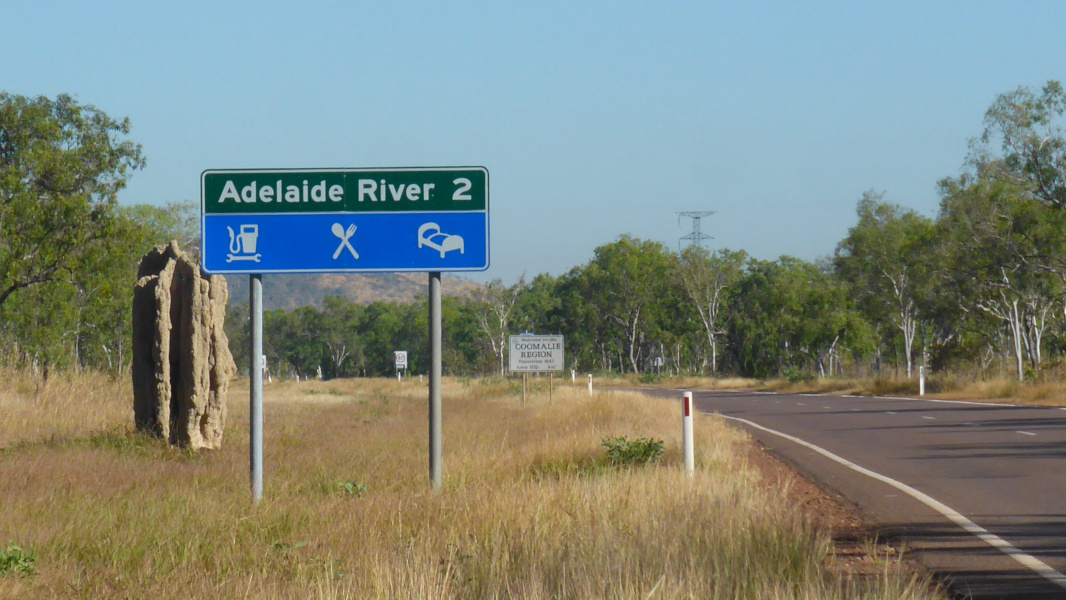
Reassurance Directional Sign: Distance sign at Adelaide River, July 2017. Note the missing route number. Image © Michael Greenslade |
|||
1 NT Government Chief Minister's Office
2 Litchfield Shire Council
3 Department of Planning & Infrastructure
4 Office of the Minister for Infrastructure and Transport
5 Litchfield Council, Red Light and Speed Camera now in operation on the Stuart Highway and Jenkins Road intersection, 16 December 2013
6 Department of Infrastructure, Regional Development and Cities, Improve Flood Immunity, Road Safety and Productivity on NT Highways - Katherine Heavy Vehicle Bypass, 22 February 2018
7 Department of Infrastructure, Planning and Logistics, Amy Johnson Avenue / Stuart Highway Intersection Works Complete, 23 May 2016
8 Department of Infrastructure, Planning and Logistics, Palmerston Road upgrades, 26 March 2018
9 Natural Resources, Environment, The Arts and Sport
10 Department of Infrastructure, Regional Development and Cities, Kimberley connection open in time for wet season, 30 November 2016
11 Department of Infrastructure, Planning and Logistics, Victoria Highway – Little Horse and Big Horse Creek Crossings and Road Upgrades, 2 October 2018
Last updated: 31-Dec-2018 20:28
This site © Paul Rands. All rights reserved. Some portions © (copyright) by their respective and credited owners. Permission must be obtained before using any images from this site. For details, please email by clicking here.
