Road Photos & Information: New South Wales
 |
|
Nass Street, Logan Street, Old Warwick Road, Mount Lindesay Road and Stanthorpe-Amosfield Road
(Tourist Drive 7) |
Statistics:
- Length: 55 km
- Northern Terminus: QLD-NSW border at Dalcouth, QLD.
- Southern Terminus: Corner of the New England Hwy (Rouse St (NH15)) and Nass Street, Tenterfield, NSW.
- Miscellaneous: Continues as Stanthorpe-Amosfield Road from Dalcouth to Stanthorpe, QLD
- Suburbs, Towns & Localities along route: Tenterfield, Leech's Gully, Boonoo Boonoo, Carrolls Creek, Bookookoorara Creek, Wilson's Downfall and Liston.
Route Numbering:
- Current:

- Road Authority Internal Classification: (Stanthorpe-Amosfield Road) Main Road 209 and (Mount Lindesay Road) Main Road 622 1
General Information:
Tourist Drive 7 is located between the border towns of Stanthorpe and Tenterfield, and passes through numerous rural areas, national parks and state forests. The route is somewhat windy and hilly.
The segment of TD7 from Tenterfield to Liston, formed part of what once the main road between Sydney and Brisbane and was known as Mount Lindesay Highway (with internal classification number, State Highway No 24). 2
History:
- 1929: Completion of Mt Lindesay Highway from Woodenbong to Mt Lindesay. This was done by the Department of Public Works 1929 2
- 1954: Main Sydney-Brisbane route (New England Hwy) moved to a new route from Tenterfield to Wallangarra. Old highway proclaimed State Highway 24 and named Mt Lindesay Hwy 2

 |
Start Tourist Drive 7:
Sign on the corner of Nass and Logan Street in Tenterfield, announcing the start of TD7 and listing distances to destinations both on and off TD7.
April 2007.
Image © Michael Gill |
 |
Black Distance Sign:
Black RD sign as you travel northbound on Logan Street in Tenterfield. April 2007.
Image © Michael Gill |
 |
Advance Directional Sign:
Westbound AD on Nass Street in Tenterfield, approaching the New England Hwy (NH15). April 2007.
Image © Michael Gill |
 |
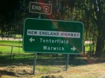
Intersection Directional Sign:
ID sign obscured by street light facing traffic from Nass Street (TD7) in Tenterfield, April 2007.
Image © Michael Gill |
1 Information courtest of Tenterfield Shire Council
2 Roads & Traffic Authority
Last updated: 08 Nov 2019 01:09
This site ©
Paul
Rands. All rights reserved. Some portions © (copyright) by their
respective and credited owners. Permission must be obtained before using
any images from this site. For details, please email by clicking
here.


