|
|
|
|
|
 |
Campbelltown Road, Moore-Oxley Bypass, Narellan Road, Gilchrist Drive, Kellicar Road, Geary Street, Menangle Road, Picton Road & Menangle Street (State Route 56) (Decommissioned) |
Statistics:
Route Numbering:


General Information:
State Route 56 is a route in southwestern Sydney.
North of Campbelltown, it's a mix of divided and undivided arterial road. South of Campbelltown, it's single-carriageway rural roadway.
The purpose of the route from Campbelltown to Casula is to service as feeder and connector road to the suburbs between those towns. South of Campbelltown, the route connects several small towns to the major centres of Campbelltown and Picton.
Multiplexes along the route include:
History:

| Picton to Liverpool | Liverpool to Picton | |||
| Preview: | Description: | Preview: | Description: | |
 |
Campbelltown: SR56 (Moore-Oxley Bypass) as it passes through Campbelltown near Dumaresq St, June 2006. Image © Paul Rands |
 |
Advance Directional Sign: Image © Paul Rands |
|
 |
Footbridge: Moore-Oxley Bypass (SR56) at Campbelltown, June 2006. Image © Paul Rands |
 |
Intersection Directional Sign: ID Sign assembly on the corner of Gilchrist Drive at Campbelltown, October 2006. Image © Paul Rands |
|
 |
Queen Street & Rudd Road: Corner of Moore-Oxley Bypass (SR56), Queen St and Rudd Rd in Campbelltown, June 2006. SR56 becomes Campbelltown Rd from this junction. Image © Paul Rands |
 |
Gilchrist Drive: Looking southwest at Campbelltown approaching the bridge over the railway and Menangle Road, October 2006. Image © Paul Rands |
|
 |
Blaxland Road: Cambelltown Rd (SR56) at Blaxland Rd in Campbelltown, June 2006. Image © Paul Rands |
 |
Advance Direcional Sign: Southbound AD sign approaching the intersection of Gilchrist Drive and Kellicar Road, Campbelltown, October 2006. Image © Paul Rands |
|
 |
Advance Directional Sign: AD sign at Cambelltown approaching Harbord Rd and Plough Inn Rd, June 2006. Image © Paul Rands |
 |
Kellicar Road intersection: Looking south through the Kellicar Road junction, which was originally constructed when the Macarthur Square shopping mall opened in the 1970s, October 2006. Image © Paul Rands |
|
 |
Harbord Road & Plough Inn Road: Campbelltown Rd (SR56) at Harbord Rd and Plough Inn Rd at Campbelltown, June 2006. Image © Paul Rands |
 |
Intersection Directional Sign: ID sign on the corner of Kellicar Road, Cambelltown, October 2006. Image © Paul Rands |
|
 |
Advance Directional Sign: AD sign approaching Rose Payten Dr at Woodbine, June 2006. Image © Paul Rands |
 |
Westbound on Kellicar Road: Looking towards the overhead section of Macarthur Square, Campbelltown, October 2006. Image © Paul Rands |
|
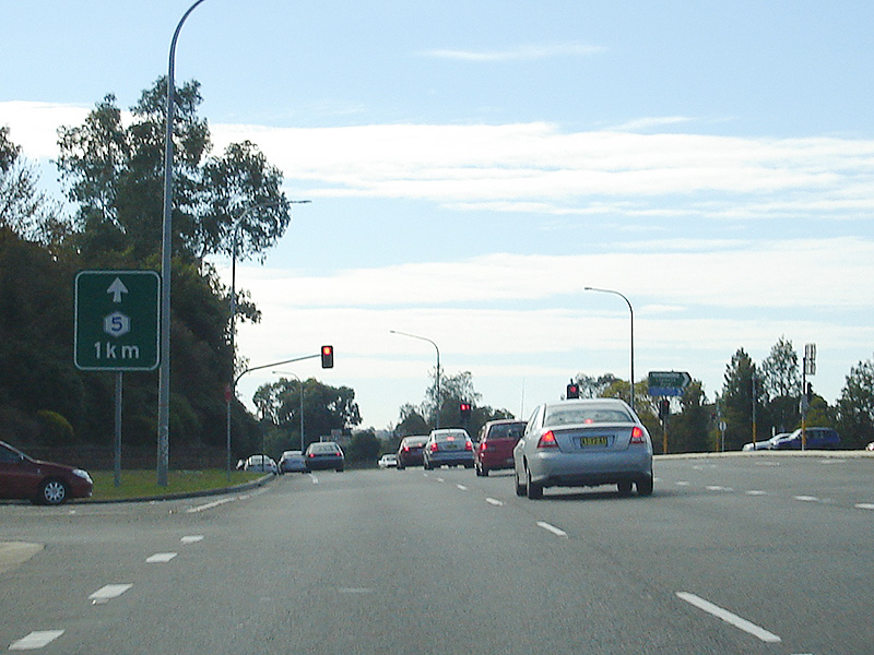 |
Supplemental Advance Directional Sign: Supplemental AD sign for Hume Hwy (South Western Fwy) (Metroad 5) near Rose Payten Dr in Woodbine, June 2006. Image © Paul Rands |
 |
Geary Street / Menangle Road Intersection: Approaching Menangle Road from Geary Street, Campbelltown, October 2006. Image © Paul Rands |
|
 |
Advance Directional Sign: AD sign for Hume Hwy (South Western Fwy) (Metroad 5) in Woodbine, June 2006. Image © Paul Rands |
 |
Glen Alpine Drive Roundabout: Looking southwest at Glen Alpine from Menangle Road, October 2006. Image © Paul Rands |
|
 |
Intersection Directional Sign: ID sign at Hume Hwy (Metroad 5) interchange in Woodbine, June 2006. Image © Paul Rands |
 |
Glen Alpine Drive: In the suburb of Glen Alpine, October 2006. Image © Paul Rands |
|
 |
Advance Directional Sign: AD sign on Campbelltown Rd (SR56) approaching Raby Rd at Minto, June 2006. Image © Paul Rands |
 |
Menangle Road: Looking southwest near Glen Alpine, October 2006. Image © Paul Rands |
|
 |
Distance Sign: Reassurance directional sign after Raby Rd junction at Minto, June 2006. Image © Paul Rands |
 |
Crossing the old Sydney Water Supply channel: Traveling southwest at Menangle Park, October 2006. Image © Paul Rands |
|
 |
Advance Directional Sign: AD sign approaching Ben Lomond Rd in Minto, June 2006. Image © Paul Rands |
 |
Crossing the South Western Freeway: Heading southwest approaching the bridge over the South Western Freeway / Hume Highway (NH31) at Menangle Park, October 2006. Image © Paul Rands |
|
 |
Advance Directional Sign: Cambelltown Rd (SR56) approaching St Andrews Rd and Bouddi St in Bow Bowing, June 2006. Image © Paul Rands |
 |
Main Southern Railway: Westbound under the railway line at Menangle Park, near the Nepean River, October 2006. Image © Paul Rands |
|
 |
Distance Sign: RD sign at Bow Bowing, June 2006. Image © Paul Rands |
 |
Nepean River: Image © Paul Rands
|
|
 |
Advance Directional Sign: AD sign approaching Williamson Rd and Hume Hwy (Metroad 5) interchange at Ingleburn, June 2006. Image © Paul Rands |
 |
Entering Menangle: Southbound on Menangle Road through the town of Menangle with LGA signange on left of shot, October 2006. Image © Paul Rands |
|
 |
Intersection Directional Sign: Image © Paul Rands |
 |
Black Fingerboard: Old black sign on the corner of Menangle Road, Woodbridge Road and Station Street in the Menangle town centre, October 2006. Image © Paul Rands |
|
 |
Intersection Directional Sign: Image © Paul Rands |
 |
Typical Conditions: The average view through Menangle town centre, October 2006. Image © Paul Rands |
|
 |
Denham Court Road: Cambelltown Rd (SR56) at the roundabout with Denham Court Rd at Denham Court, June 2006. Image © Paul Rands |
 |
Foot Onslow Creek: Crossing Foot Onslow Creek, looking southwest, October 2006. Image © Paul Rands |
|
 |
Advance Directional Sign: AD sign approaching Macdonald Rd at Ingleburn, June 2006. Image © Paul Rands |
 |
Crash Zone Sign: RTA signage indicating the high incidences of car accidents on the stretch of Menangle Road through the Menangle, Douglas Park and Razorback areas. Looking southwest at Menangle, October 2006. Image © Paul Rands |
|
 |
Distance Sign: RD sign at Ingleburn, June 2006. Image © Paul Rands |
 |
Menangle: Winding up through the hills, southwest of Menangle, October 2006. Image © Paul Rands |
|
 |
Hume Highway: Cambelltown Rd (SR56) as it crosses over Hume Hwy (Metroad 5) at Ingleburn, June 2006. Image © Paul Rands |
 |
Approaching Finns Road intersection: Looking south approaching the sweeping curve and intersection with Finns Road at Menangle, October 2006. Image © Paul Rands |
|
 |
Advance Directional Sign: AD sign on Cambelltown Rd at Casula approaching Glenfield Rd, June 2006. This section of Cambelltown Rd used to be a part of the connector between Hume Hwy and South Western Fwy. Image © Paul Rands |
 |
ID Sign: Intersection directional sign at the intersection with Finns Road, October 2006. Image © Paul Rands |
|
 |
Advance Directional Sign: AD sign at the Crossroads in Casula approaching Camden Valley Way (SR89) and the unnumbered Hume Hwy, June 2006. Image © Paul Rands |
 |
Distance Sign: Southbound RD sign after the Finns Road intersection, October 2006. Image © Paul Rands |
|
 |
The Crossroads: Campbelltown Rd (SR56) at the Crossroads in Casula, June 2006. This is the end of SR56. This junction was once deemed one of the most dangerous in Sydney, due to the traffic volumes it once carried. Image © Paul Rands |
 |
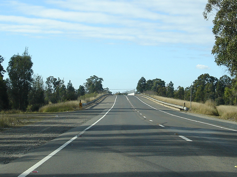
Southbound at Menangle: Traveling across the hilltop at Menangle, October 2006. Image © Paul Rands |
|
 |
Southbound at Menangle: Traveling across the hilltop at Menangle, October 2006. Image © Paul Rands |
|||
 |
Southbound at Menangle: Image © Paul Rands |
|||
 |
15km/h Speed Advisory: Image © Paul Rands |
|||
 |
Corner of Camden & Menangle Roads: Image © Paul Rands |
|||
 |
Westbound at Douglas Park: Image © Paul Rands |
|||
 |
Westbound at Douglas Park: Image © Paul Rands |
|||
 |
Westbound at Razorback : Image © Paul Rands |
|||
 |
Old Reduce Speed Sign: Image © Paul Rands |
|||
 |
Advance Directional Sign: Image © Paul Rands |
|||
 |
Intersection Directional Sign Assembly: Image © Paul Rands |
|||
1 Roads & Traffic Authority, Schedule of Classified Roads and State & Regional Roads, January 2011
2 Campbelltown City Council, Milestones, From the Crossroads to Campbelltown – Campbelltown Road
3 Campbelltown City Council, Library, Local Information, Leumeah, History of Leumeah
4 Camden Council Library, HistoryPix: Camden Photosearcher, Menangle Road Bridge
Last updated: 17-Dec-2019 0:55
This site © Paul Rands. All rights reserved. Some portions © (copyright) by their respective and credited owners. Permission must be obtained before using any images from this site. For details, please email by clicking here.