|
|
|
|
|
 |
Illawarra HIghway (National Route 48) - Albion Park to Robertson (Decommissioned) |
Statistics:
Route Numbering:


General Information:
The Illawarra Highway is a key link in the state's road network, connecting the Illawarra with the Southern Highlands, the Hume Highway and via the Hume Highway: Melbourne and southwestern New South Wales.
Consisting mostly of single carriageway undivided road, the route traverses Macquarie Pass, which is a narrow and windy section of road built to climb the Illawarra Escarpment. The route primarily services small rural and semi-rural communities.
Multiplexes along the route include:
History:
| Albion Park Rail to Robertson | Robertson to Albion Park Rail | |||
| Preview: | Description: | Preview: | Description: | |
 |
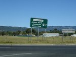
Advance Directional Sign: AD sign on Princes Hwy (NR1) at Yallah approaching Macquarie Rivulet and Illawarra Hwy (NR48), March 2010. Image © Paul Rands |
 |
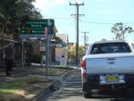
Advance Directional Sign: AD sign at Albion Park approaching Russell St, June 2010. Note the incorrect NH shield. Image © Paul Rands |
|
 |
Illawarra Highway & Princes Highway: Princes Hwy (NR1) at the Illawarra Hwy (NR48) junction at Albion Park Rail, March 2010. Image © Paul Rands |
 |
Russell Street: Corner of Illawarra Hwy (NR48) and Russell St in Albion Park, June 2010. Image © Paul Rands |
|
 |
Illawarra Highway & Princes Highway: Princes Hwy (NR1) at the Illawarra Hwy (NR48) junction at Albion Park Rail, November 2009. Click here for a photo from April 2006 of this junction prior to the signalisation of the roundabout. Image © Paul Rands |
 |
Advance Directional Sign: AD sign at Albion Park approaching Tongarra Rd (SR157) and Terry St, June 2010. Note the incorrect NH shield. Image © Paul Rands |
|
 |
Intersection Directional Sign: ID sign at the Illawarra Hwy (NR48) and Princes Hwy (NR1) roundabout at Albion Park Rail, April 2006. Image © Paul Rands |
 |
Tongarra Road & Terry Street: Illawarra Hwy (NR48) at the junction with Tongarra Rd (SR157 / TD8) and Terry St at Albion Park, June 2010. The TD8 duplex ends at this junction. Image © Paul Rands |
|
 |
Distance Sign: Reassurance directional sign at Albion Park Rail after the Princes Hwy (NR1) roundabout, April 2006. Image © Paul Rands |
 |
Distance Sign: RD sign leaving the Albion Park town centre, June 2010. Image © Paul Rands |
|
 |
Entering Albion Park: Illawarra Hwy (NR48) as it enters the town of Albion Park, April 2006. Image © Paul Rands |
 |
Flood Zone: Illawarra Hwy (NR48) at Albion Park on the flood plain between Albion Park town centre and Princes Hwy (NR1) in Albion Park Rail, June 2010. Image © Paul Rands |
|
 |
Tongarra Road & Terry Street: Illawarra Hwy (NR48) approaching Tongarra Rd (SR157 / TD8) and Terry St at Albion Park, April 2006. The TD8 duplex starts at this junction. Image © Paul Rands |
 |
Advance Directional Sign: AD sign at Albion Park Rail approaching Princes Hwy (NR1), June 2010. Image © Paul Rands |
|
 |
Tongarra Road & Terry Street: Illawarra Hwy (NR48) at the junction with Tongarra Rd (SR157 / TD8) and Terry St at Albion Park, April 2006. The TD8 duplex starts at this junction. Image © Paul Rands |
 |
Princes Highway: Corner of Illawarra Hwy (NR48) and Princes Hwy (NR1) at Albion Park Rail, June 2010. This is the eastern terminus of NR48. Image © Paul Rands |
|
 |
Albion Park CBD: Illawarra Hwy (NR48) as it passes through the Albion Park CBD, June 2010. Image © Paul Rands |
|||
 |
Russell Street: Illawarra Hwy (NR48) at the junction with Russell St in Albion Park, June 2010. Image © Paul Rands |
|||
 |
Distance Sign: RD sign at Albion Park near the bowling club, June 2013. Click here for a photo of this location from April 2006. Image © Paul Rands |
|||
 |
Tullimbar: Illawarra Hwy (NR48) as it passes through Tullimbar, April 2006. Image © Paul Rands |
|||
 |
Macquarie Rivulet: Illawarra Hwy (NR48) as it crosses Macquarie Rivulet, April 2006. Image © Paul Rands |
|||
 |
Macquarie Pass: Illawarra Hwy (NR48) at Tongarra approaching Macquarie Pass, April 2006. Image © Paul Rands |
|||
 |
Macquarie Pass: Illawarra Hwy (NR48) at Tongarra as makes its way up Macquarie Pass, April 2006. Image © Paul Rands |
|||
 |
Macquarie Pass: Illawarra Hwy (NR48) at Tongarra as makes its way up Macquarie Pass, April 2006. Image © Paul Rands |
|||
 |
Macquarie Pass: Illawarra Hwy (NR48) at Tongarra as makes its way up Macquarie Pass, April 2006. Image © Paul Rands |
|||
 |
Macquarie Pass Western End: The western end of Macquarie Pass, April 2006. Image © Paul Rands |
|||
 |
Mount Murray: Illawarra Hwy (NR48) at Mt Murray, April 2006. Image © Paul Rands |
|||
 |
Welcome Capital Country: Tourism based RD sign at Robertson, December 2007. Click here for a photo of the previous setup of this sign from April 2006. Image © Paul Rands |
|||
 |
Macquarie Rivulet: Illawarra Hwy (NR48) as it crosses Macquarie Rivulet at Robertson, June 2013. Click here for a photo of this location from April 2006. Image © Paul Rands |
|||
 |
Supplemental Advance Directional Sign: Supplemental AD sign at Robertson approaching Jamberoo Mtn Rd (SR80 / TD9), June 2013. Image © Paul Rands |
|||
 |
Supplemental Advance Directional Sign: Supplemental AD sign at Robertson approaching Jamberoo Mtn Rd (SR80 / TD9), June 2013. Image © Paul Rands |
|||
 |
Advance Directional Sign: AD sign at Robertson approaching Jamberoo Mountain Rd (SR80 / TD9), April 2006. Image © Paul Rands |
|||
 |
Vehicle Prohibition Sign: Image © Paul Rands |
|||
 |
Jamberoo Mountain Road: Corner of Illawarra Hwy (NR48) and Jamberoo Mtn Rd (SR80 / TD9) at Robertson, June 2013. Click here for a photo of this location from April 2006. The SR80 duplex begins here. Image © Paul Rands |
|||
 |
Distance Sign: RD sign at Robertson after the Jamberoo Mountain Rd junction, June 2013. Image © Paul Rands |
|||
 |
Entering Robertson: Illawarra Hwy (NR48) as it enter the Robertson town centre, April 2006. Image © Paul Rands |
|||
 |
Advance Directional Sign: AD sign in Robertson near Main St approaching Meryla St (TD15), April 2006. Image © Paul Rands |
|||
 |
Advance Directional Sign: AD sign in Robertson near Caalong St approaching Meryla St (TD15), April 2006. The TD15 duplex begins here. Image © Paul Rands |
|||
 |
Distance Sign: RD sign at Robertson, April 2006. Image © Paul Rands |
|||
 |
Distance Sign: RD sign at Robertson near Pearsons Ln, April 2006. The TD14 duplex ends at Pearsons Ln. Image © Paul Rands |
|||
| Click here for the continuation of National Route 48 between Robertson and Sutton Forest | ||||
1 Roads & Traffic Authority
Last updated: 05-Jan-2017 11:57
This site © Paul Rands. All rights reserved. Some portions © (copyright) by their respective and credited owners. Permission must be obtained before using any images from this site. For details, please email by clicking here.