|
|
|
|
|
 |
Oxley Highway (National Route 34) - Nevertire to Gilgandra (Decommissioned) |
Statistics:
Route Numbering:
General Information:
National Route 34 is a rural highway that connects the coast with western New South Wales. It features several important towns along the route, and also crosses the Great Dividing Range.
The route is mostly single carriageway and undivided, except around Port Macquarie, Moonbi and Tamworth. At its eastern end, the route is quite windy because of the difficult terrain created by the Great Dividing Range, beyond Moonbi, the route generally passes through fairly flat terrain, except in the Coonabarabran area.
The Oxley Highway is named after explorer John Oxley, who was the first European to explore much of inland New South Wales in 1818. He crossed the southern end of the northern tableland and camped on the Apsley River in 1818 near the present Walcha.
History:
| Nevertire to Gilgandra | Gilgandra to Nevertire | |||
| Preview: | Description: | Preview: | Description: | |
 |
Reassurance Directional Sign: Distance sign at Nevertire, August 2011. Click here for a photo of this location by Michael Greenslade from December 2003. Image © Paul Rands |
 |
Advance Directional Sign: AD sign on Marthaguy Rd at Tenandra approaching Oxley Hwy (NR34), December 2003. Image © Michael Greenslade |
|
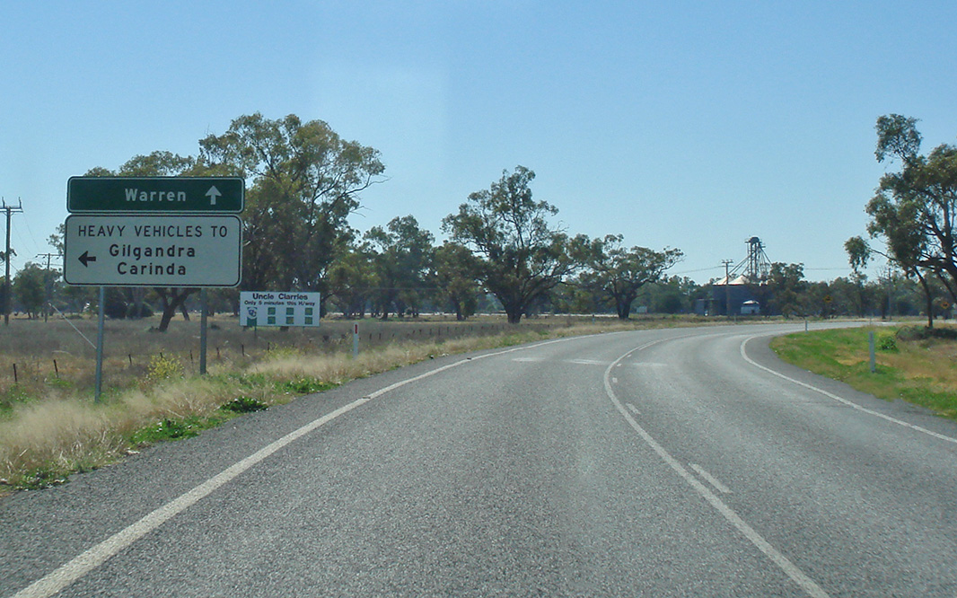 |
Advance Directional Sign: Heavy vehicle AD sign at Warren approaching Industrial Access Rd, August 2011. Image © Paul Rands |
 |
Entering Warren: Oxley Hwy (NR34) as it enters the town of Warren, December 2003. Image © Michael Greenslade |
|
 |
Industrial Access Road: Corner of Oxley Hwy (NR34) and Industrial Access Rd at Warren, August 2011. Image © Paul Rands |
 |
Advance Directional Sign: AD sign approaching Dubbo St in Warren, December 2003. Image © Michael Greenslade |
|
 |
Entering Warren: Oxley Hwy (NR34) as it enters the town of Warren, August 2011. Image © Paul Rands |
 |
Reassurance Directional Sign: Distance sign at Warren, December 2003. Image © Michael Greenslade |
|
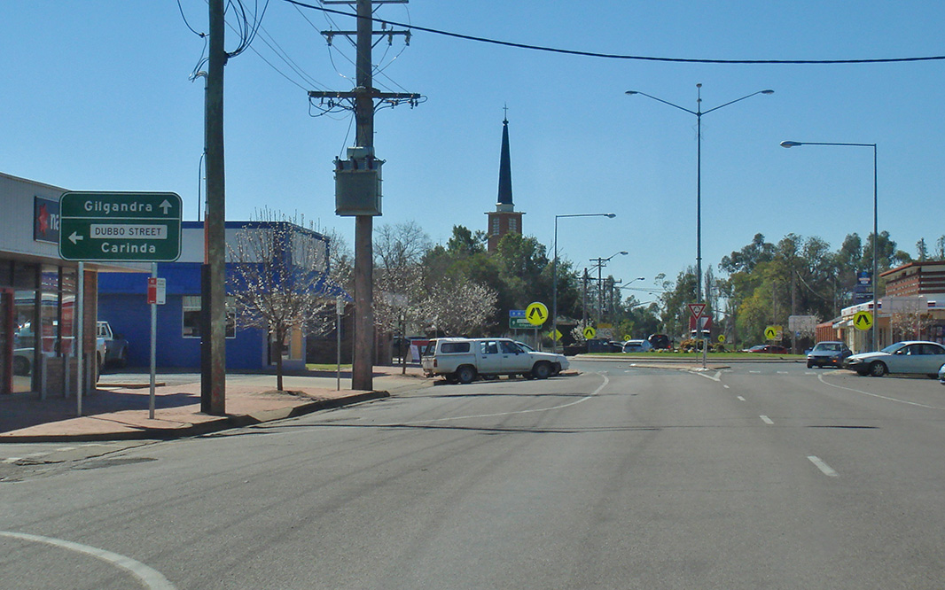 |
Advance Directional Sign: AD sign approaching Dubbo St in Warren, August 2011. Image © Paul Rands |
 |
Entering Nevertire: Oxley Hwy (NR34) as it enters the town of Nevertire, December 2003. Image © Michael Greenslade |
|
 |
Intersection Directional Sign: ID sign on the roundabout with Dubbo St in Warren, August 2011. Image © Paul Rands |
 |
Advance Directional Sign: AD sign at Nevertire approaching Mitchell Hwy (NR32) and Nevertire-Bogan Rd, August 2011. Image © Paul Rands |
|
 |
Advance Directional Sign: AD sign adjacent to Charles Sturt Bridge over Macquarie River at Warren approaching River Av and Milson St, August 2011. Image © Paul Rands |
|||
 |
River Avenue & Milson Street: Oxley Hwy (NR34) at the junction with River Av and Milson St, Warren, August 2011. Image © Paul Rands |
|||
 |
Reassurance Directional Sign: Distance sign at Warren, August 2011. Image © Paul Rands |
|||
 |
Reassurance Directional Sign: Distance sign at Warren, August 2011. Image © Paul Rands |
|||
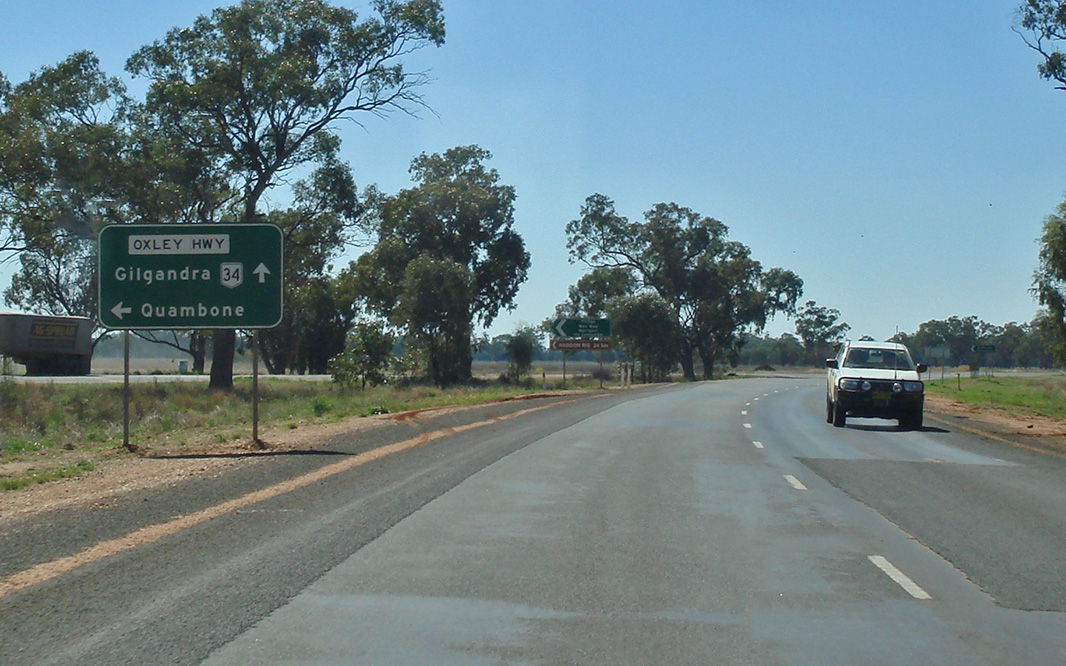 |
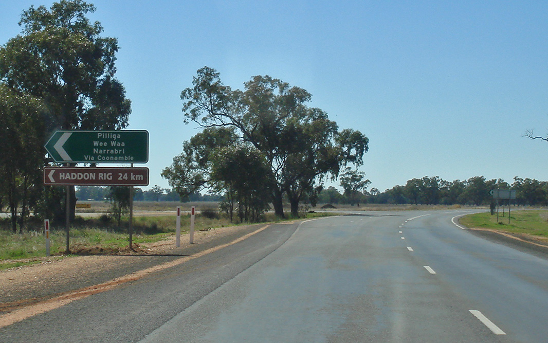
Advance Directional Sign: AD sign at Tenandra approaching Marthaguy Rd, August 2011. Image © Paul Rands |
|||
 |
Marthaguy Road: Corner of Oxley Hwy (NR34) and Marthaguy Rd at Tenandra, August 2011. Image © Paul Rands |
|||
 |
Marthaguy Road: Corner of Oxley Hwy (NR34) and Marthaguy Rd at Tenandra, August 2011. Image © Paul Rands |
|||
 |
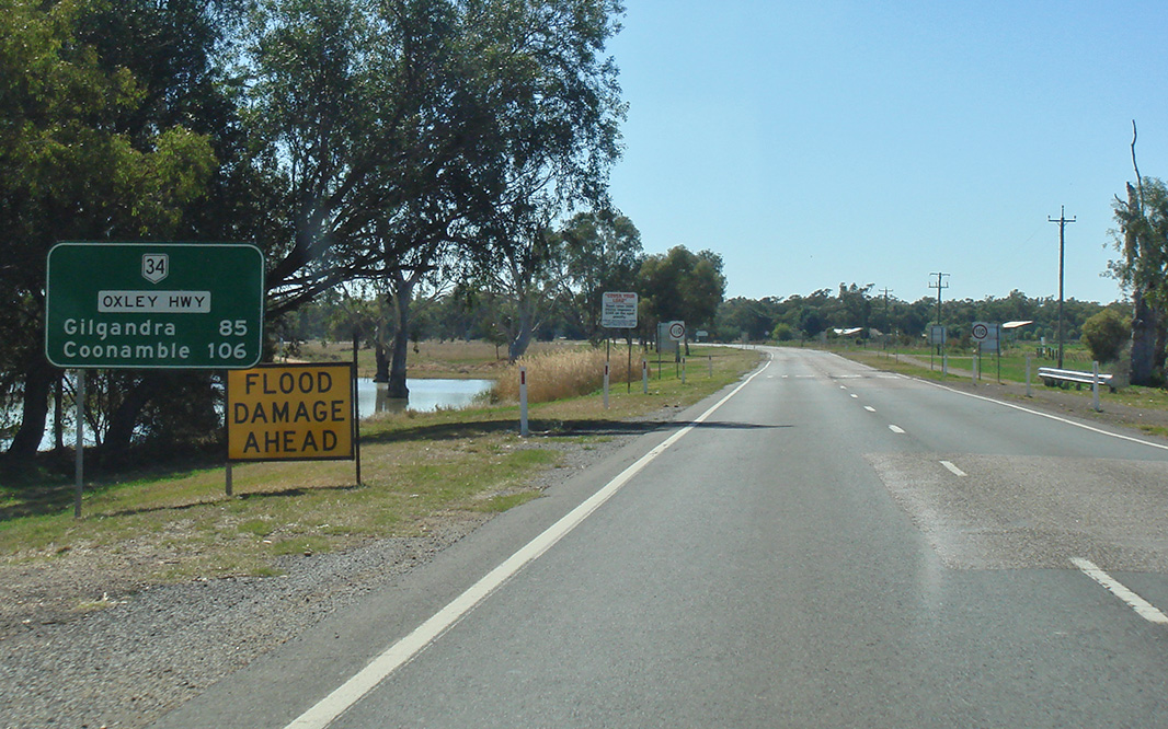
Reassurance Directional Sign: Distance sign at Tenandra, August 2011. Image © Paul Rands |
|||
 |
Castlebar Lane: Corner of Oxley Hwy (NR34) and Castlebar Ln at Tenandra, August 2011. Image © Paul Rands |
|||
 |
Advance Directional Sign: AD sign at Collie approaching Collie-Trangie Rd, August 2011. Image © Paul Rands |
|||
 |
Collie-Trangie Road: Corner of Oxley Hwy (NR34) and Collie-Trangie Rd at Collie, August 2011. Image © Paul Rands |
|||
 |
Black Intersection Directional Sign: Black ID sign at the junction with Berida-Bullagreen Rd at Collie, August 2011. Image © Paul Rands |
|||
| Click here for the continuation of National Route 34 between Gilgandra and Coonabarabran | ||||
1 Roads and Traffic Authority, Schedule of Classified Roads and State & Regional Roads, 31 January 2011
2 Department of Main Roads, Historical Roads of New South Wales, Oxley Highway, Extract from March 1953 issue of "Main Roads" journal.
Last updated: 10-Sep-2020 17:38
This site © Paul Rands. All rights reserved. Some portions © (copyright) by their respective and credited owners. Permission must be obtained before using any images from this site. For details, please email by clicking here.