|
|
|
|
|
 |
Newell Highway (National Highway 39) - Wyalong to Forbes (Decommissioned) |
Statistics:
Route Numbering:


General Information:
The Newell Highway is the longest highway in NSW, stretching from the Victorian border at Tocumwal to the Queensland border. It's the economic backbone for freight and livestock transporters, tourism operators, caravanners and holiday makers, emergency services, government, media and business owners. 2
The majority of the route is undivided roadway, with various overtaking sections where required.
The Newell Highway is named after HH Newell. He was the first commissioner for Main Roads in New South Wales. He passed away in 1941. 3 Prior to his appointment to the newly formed Main Roads Board on March 9, 1925, he was the District Engineer at the Wollongong branch of the Department of Public Works. 4
Multiplexes along the route include:
History:
| Wyalong to Forbes | Forbes to Wyalong | |||
| Preview: | Description: | Preview: | Description: | |
 |
Advance Directional Sign: AD sign approaching Mid Western Hwy (NR24) at Marsden, November 2010. Image © Rob Tilley |
 |
Advance Directional Sign: AD sign at Forbes approaching Dowling St, July 2007. Image © Ryan Nicholls |
|
 |
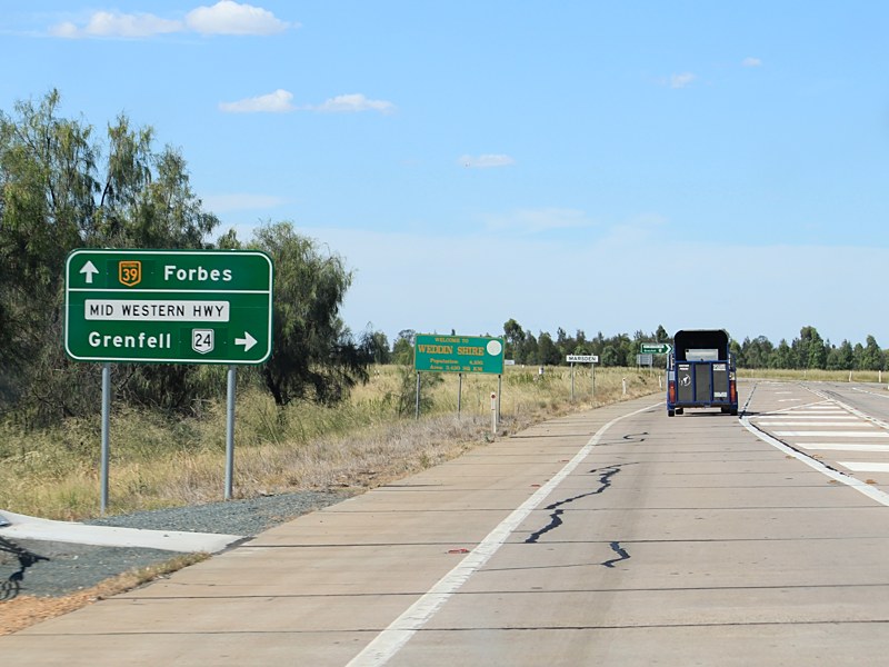
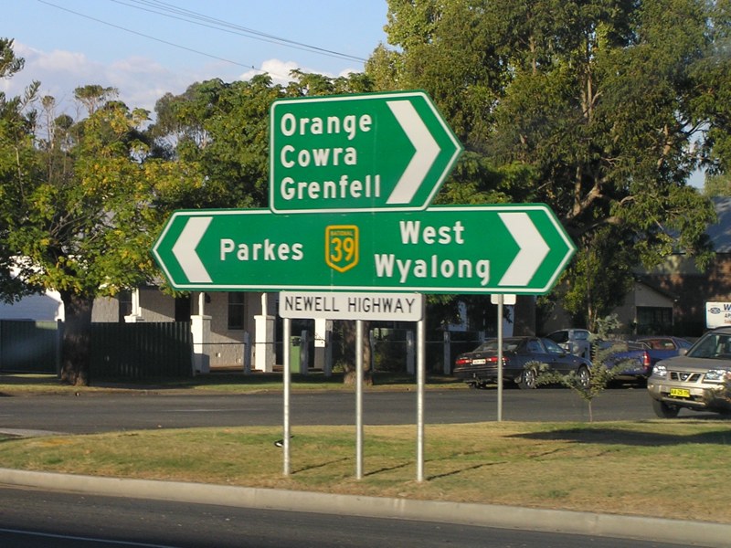
Mid Western Highway: Intersection directional sign at the junction with Mid Western Hwy (NR24) at Marsden, November 2010. Image © Rob Tilley |
 |
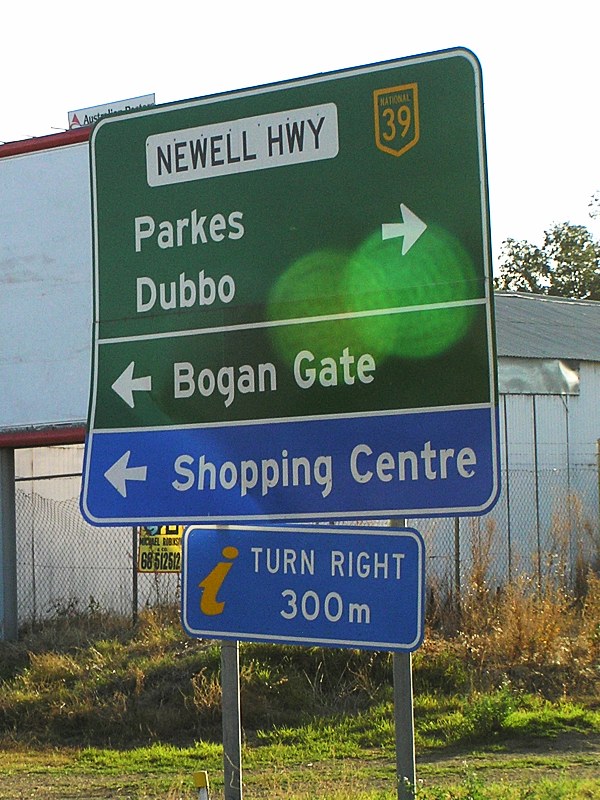
Dowling Street: Advance directional sign acting as an intersection directional sign at the junction with Dowling St in Forbes, May 2005. Image © Rob Tilley |
|
 |
Distance Sign: Reassurance directional sign at Marsden after the Mid Western Hwy (NR24) intersection, November 2010. Click here for photo from April 2005 of the previous version of this sign. Image © Rob Tilley |
 |
Intersection Directional Sign: ID sign near Oxford St in Forbes, May 2005. Image © Rob Tilley |
|
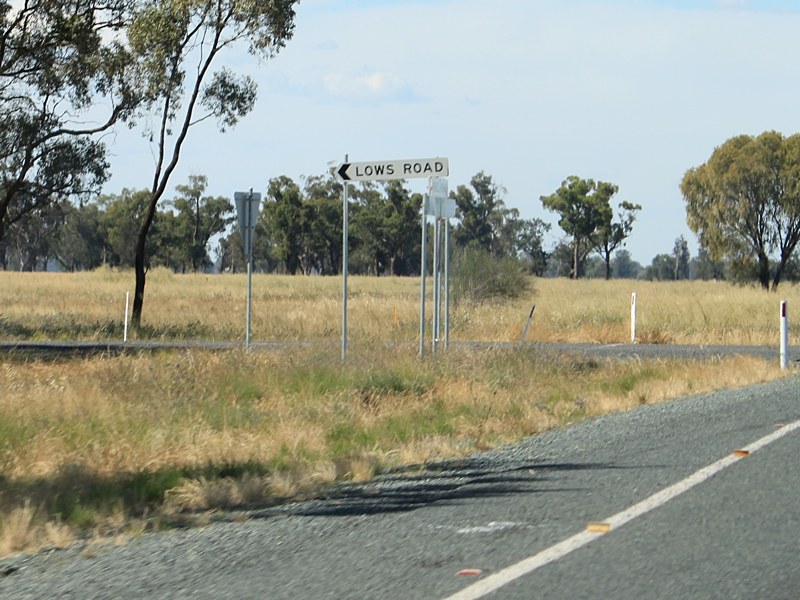 |
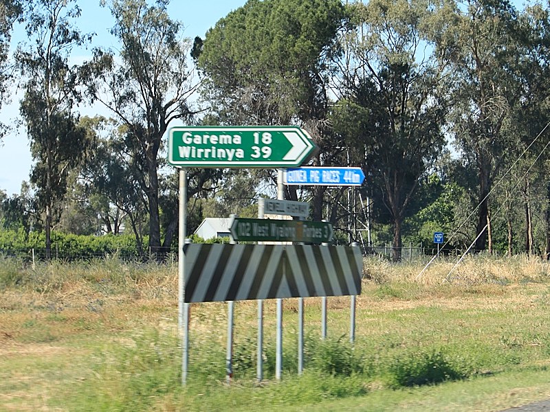
Lows Road & Bewleys Road: Signage on the Newell Hwy (NR39) at Wirrinya at the junction with Lows Rd and Bewleys Rd, November 2010. Image © Rob Tilley |
 |
Black Distance Sign: Black RD sign as you leave Forbes, May 2005. Image © Rob Tilley |
|
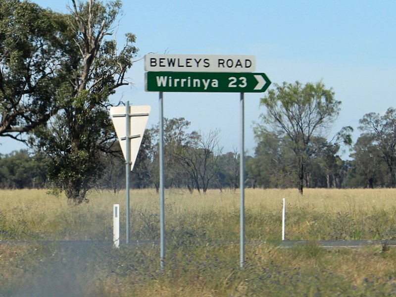 |
Lows Road & Bewleys Road: Signage on the Newell Hwy (NR39) at Wirrinya at the junction with Lows Rd and Bewleys Rd, November 2010. Image © Rob Tilley |
 |
Black Advance Directional Sign: Black AD sign approaching Lachlan Valley Way at Forbes, January 2004. Image © Michael Greenslade |
|
 |
Trailblazer: NH39 trailblazer at Wirrinya, November 2010. Image © Rob Tilley |
 |
Trailblazer: NH39 trailblazer near Bundaburrah, May 2005. Image © Rob Tilley |
|
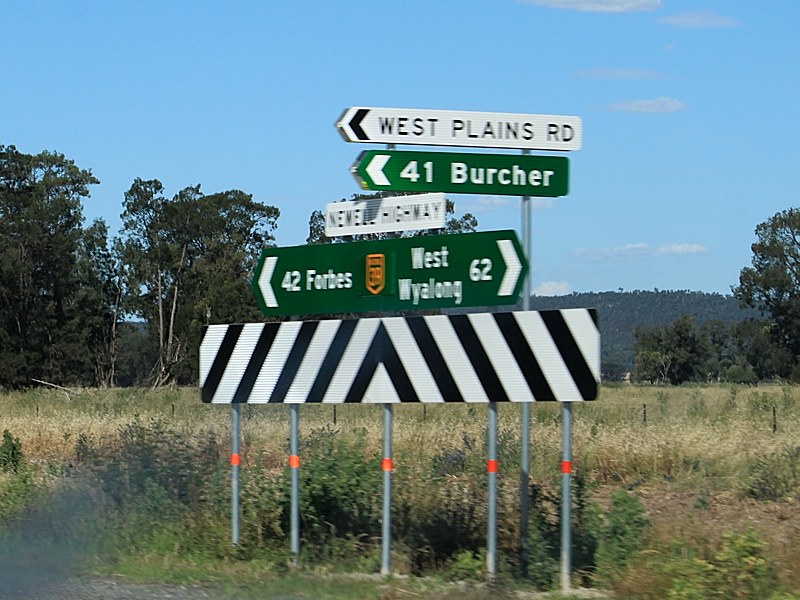 |
Intersection Directional Sign: ID sign at Weelong at the junction with West Plains Rd, November 2010. Image © Rob Tilley |
 |
Advance Directional Sign: AD sign approaching Mid Western Hwy (NR24) at Caragabal, May 2005. The NR24 duplex starts at this junction. Image © Rob Tilley |
|
 |
Intersection Directional Sign: ID sign at Weelong at the junction with Battery Hill Rd, November 2010. Image © Rob Tilley |
 |
Distance Sign: RD sign at Caragabal after the Mid Western Hwy (NR24) intersection, May 2005. Image © Rob Tilley |
|
 |
Intersection Directional Sign: ID sign at Weelong at the junction with Mt Tallabung Rd, November 2010. Image © Rob Tilley |
|||
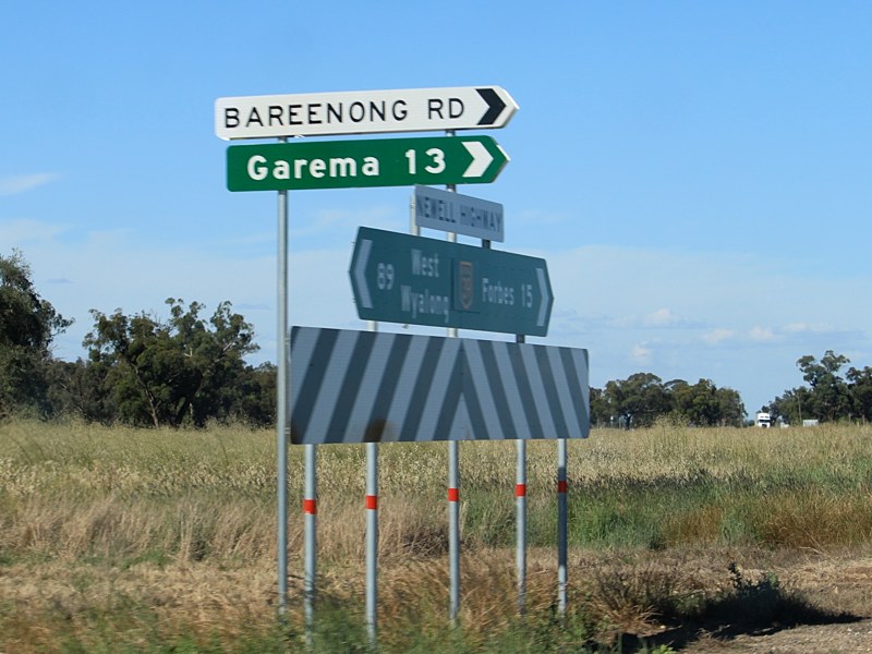 |
Intersection Directional Sign: ID sign at Bundaburrah at the junction with Bareenong Rd, November 2010. Image © Rob Tilley |
|||
 |
Advance Directional Sign: AD sign at Bundaburrah approaching Lachlan Valley Way, November 2010. Image © Rob Tilley |
|||
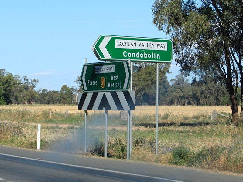 |
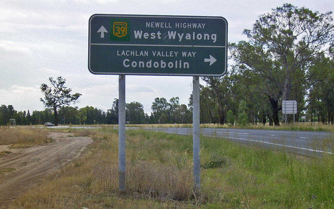
Lachlan Valley Way: Newell Hwy (NH39) at the junction with Lachlan Valley Way, Bundaburrah, November 2010. Image © Rob Tilley |
|||
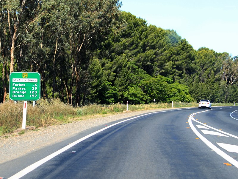 |
Distance Sign: RD sign at Bundaburrah after the Lachlan Valley Way junction, November 2010. Image © Rob Tilley |
|||
 |
Trailblazer: NH39 trailblazer near Forbes, November 2010. Image © Rob Tilley |
|||
 |
Advance Directional Sign: Newell Hwy (NH39) at Forbes approaching Wirrinya Rd, November 2010. Image © Rob Tilley |
|||
 |
Wirrinya Road: Intersection directional sign assembly at the junction with Wirrinya Rd at Forbes, November 2010. Image © Rob Tilley |
|||
 |
Entering Forbes: Newell Hwy (NH39) as it enters Forbes, November 2010. Image © Rob Tilley |
|||
 |
Advance Directional Sign: Newell Hwy (NH39) approaching Oxford St in Forbes, November 2010. Image © Rob Tilley |
|||
 |
Oxford Street: Newell Hwy (NH39) at the junction with Oxford St in Forbes, November 2010. Image © Rob Tilley |
|||
 |
Lake Forbes: Newell Hwy (NH39) at Forbes as it crosses Lake Forbes via Oxley Bridge, November 2010. Image © Rob Tilley |
|||
 |
Bedgerebong Road: Newell Hwy (NH39) in Forbes at the junction with Bedgerebong Rd, November 2010. Image © Rob Tilley |
|||
 |
Advance Directional Sign: AD sign near King St in Forbes approaching Camp St, November 2010. Click here for photo from April 2005 of the previous setup of this sign. Image © Rob Tilley |
|||
 |
Camp Street: Newell Hwy (NH39) at the junction with Camp St in Forbes, November 2010. Image © Rob Tilley |
|||
 |
Black Intersection Directional Sign: Black ID sign facing Camp St in Forbes, November 2010. Image © Rob Tilley |
|||
 |
Intersection Directional Sign: ID sign facing Court St in Forbes, November 2010. Image © Rob Tilley |
|||
 |
Intersection Directional Sign: ID sign facing Browne St in Forbes, April 2005. Image © Rob Tilley |
|||
 |
Advance Directional Sign: AD sign approaching Dowling St in Forbes, April 2005. NH39 turns right at this junction. Image © Rob Tilley |
|||
 |
Dowling Street: Intersection directional sign assembly at the Dowling St junction in Forbes, November 2010. Image © Rob Tilley |
|||
 |
Black Distance Sign: Black RD sign on the outskirts of Forbes, April 2005. Image © Rob Tilley |
|||
 |
Approaching Corriedale Street, Landrace Street & Saleyards: Unusual custom sign approaching Corriedale St, Landrace St and the saleyards, November 2010. Image © Rob Tilley |
|||
| Click here for the continuation of National Highway 39 between Forbes and Dubbo Click here for the continuation of National Highway 39 between Narrandera and Wyalong |
||||
1 Roads and Traffic Authority, Schedule of Classified Roads and State & Regional Roads, 31 January 2011
2 Roads and Traffic Authority, Road Projects, Western Region, Newell Highway
3 Department of Main Roads, Main Roads of New South Wales brochure
4 Department of Main Roads, The Roadmakers, A History of Main Roads in New South Wales, ISBN0 7240 0439 4
5 Roads & Traffic Authority, Rules & Regulations, Newell Highway Reduced Speed Limit
6 Roads & Traffic Authority, NSW Centre for Road Safety, Downloads, Newell Highway centreline marking trial display
Last updated: 08-Sep-2020 19:11
This site © Paul Rands. All rights reserved. Some portions © (copyright) by their respective and credited owners. Permission must be obtained before using any images from this site. For details, please email by clicking here.