|
|
|
|
|
 |
Science and Nature Loop (Tourist Drive 5) - Capital Hill to Stromlo (Decommissioned) |
Statistics:
Route Numbering:
General Information:
ACT Tourist Drive 5 is the Science and Nature loop, taking in attractions such as Tidbinbilla Nature Reserve, Deep Space Tracking Station, Cotter Dam, various nature parks and reserves, Lanyon Homestead, Cuppacumbalong and much more.
The route varies from freeway conditions along the Monaro Hwy and Adelaide Ave through to rural back roads along the southwestern part of the route, further away from urban areas.
History:
Click here for construction photos between Capital Hill and Stromlo
Click here for the former alignment between Capital Hill and Stromlo
| Capital Hill to Stromlo | Stromlo to Capital Hill | |||
| Preview: | Description: | Preview: | Description: | |
 |
Advance Directional Sign: AD sign on Capital Circle approaching Canberra Av (NR23), February 2011. Image © Paul Rands |
 |
Eucumbene Drive: Cotter Rd (TD5) at the junction with Eucumbene Dr at Wright, January 2014. Image © Paul Rands |
|
 |
Black Intersection Directional Sign: Black ID sign on State Circle at Capital Hill at the Adelaide Av (TD5) interchange, February 2011. Image © Paul Rands |
 |
Uriarra Road: Cotter Rd (TD5) at the junction with Uriarra Rd, January 2014. Uriarra Rd has since been truncated and the remaining portion forms part of Swallowtale Rd. Image © Paul Rands |
|
 |
Black Intersection Directional Sign: Black ID sign on State Circle at Capital Hill at the Adelaide Av (TD5) interchange, February 2011. Image © Paul Rands |
 |
Advance Directional Sign: AD sign at Weston approaching Streeton Dr, June 2013. This junction has since been upgraded to a multilane intersection with bus lanes. Image © Paul Rands |
|
 |
Advance Directional Sign: AD sign on State Circle at Deakin approaching the Adelaide Av (TD5) interchange, February 2011. Image © Paul Rands |
 |
Advance Directional Sign: AD sign at Weston approaching Streeton Dr, June 2013. This junction has since been upgraded to a multilane intersection with bus lanes. Image © Paul Rands |
|
 |
Distance Sign: RD sign on Adelaide Av (TD5) at Deakin, July 2006. Image © Paul Rands |
 |
Advance Directional Sign: AD sign at Weston approaching Kirkpatrick St and Dargie St, June 2013. Image © Paul Rands |
|
 |
Advance Directional Sign: AD sign at Deakin approaching the Novar St & Kent St interchange, July 2006. Image © Paul Rands |
 |
Advance Directional Sign: AD sign at Weston approaching Kirkpatrick St and Dargie St, June 2013. Image © Paul Rands |
|
 |
Hopetoun Circuit: Adelaide Av (TD5) at the Hopetoun Cct interchange at Deakin, February 2011. Click here for a photo from July 2006 showing this sign prior to coverplating. Image © Paul Rands |
 |
Advance Directional Sign: AD sign on Cotter Rd (TD5) approaching Tuggeranong Pkwy at Weston, June 2013. Image © Paul Rands |
|
 |
Advance Directional Sign: AD sign at Deakin approaching the Novar St & Kent St interchange, February 2011. Image © Paul Rands |
 |
Tuggeranong Parkway: Cotter Rd (TD5) at the Tuggeranong Pkwy interchange at Weston, June 2013. Image © Paul Rands |
|
 |
Intersection Directional Sign: ID sign on the Kent St and Novar St interchange at Deakin, November 2013. Click here for a photo from July 2006 of the previous sign. This interchange and Adelaide Avenue were both built in the 1960s as part of the Yarra Glen project. This eliminated an at-grade junction. Image © Paul Rands |
 |
Tuggeranong Parkway: Cotter Rd (TD5) at the Tuggeranong Pkwy interchange at Yarralumla, June 2013. Image © Paul Rands |
|
 |
Advance Directional Sign: AD sign at Deakin approaching the interchange with Cotter Rd (TD5) and Yarra Glen, February 2011. Image © Paul Rands |
 |
Yarralumula Woolshed: Cotter Rd (TD5) at the entrance to Yarralumla Woolshed and Equestian Centre, January 2014. Image © Paul Rands |
|
 |
Cotter Road: Cotter Road (TD5) and Yarra Glen interchange at Deakin, February 2011. Image © Paul Rands |
 |
Advance Directional Sign: AD sign at Yarralumla approaching McCulloch St, January 2014. Image © Paul Rands |
|
 |
Distance Sign: RD sign on Cotter Rd (TD5) at Curtin, February 2011. Image © Paul Rands |
 |
Intersection Directional Sign: ID sign at Yarralumla at the corner of Cotter Rd (TD5) and McCulloch St, January 2014. Image © Paul Rands |
|
 |
Intersection Directional Sign: ID sign facing Dudley St (TD2) in Curtin, February 2011. Image © Paul Rands |
 |
Advance Directional Sign: AD sign at Yarralumla approaching Lady Denman Dr, January 2014. Image © Paul Rands |
|
 |
Dunrossil Drive: Cotter Rd (TD2 / TD5) at Dunrossil Dr in Curtin, January 2014. Click here for a photo of this location from February 2011. Image © Paul Rands |
 |
Dunrossil Drive: Cotter Rd (TD5) at the Dunrossil Dr junction in Yarralumla, January 2014. Image © Paul Rands |
|
 |
Distance Sign: RD sign at Curtin, February 2011. Image © Paul Rands |
 |
Advance Directional Sign: AD sign approaching Dudley St in Yarralumla, January 2014. Image © Paul Rands |
|
 |
Advance Directional Sign: AD sign at Curtin approaching Lady Denman Dr, January 2014. Image © Paul Rands |
 |
Novar Street & Kent Street: Adelaide Av (TD5) as it approaches the Novar St and Kent St interchange at Yarralumla, February 2011. Image © Paul Rands |
|
 |
Advance Directional Sign: AD sign at Curtin approaching McCulloch St, January 2014. Image © Paul Rands |
 |
Advance Directional Sign: AD sign approaching Hopetoun Cct interchange at Yarralumla, February 2011. Image © Paul Rands |
|
 |
McCulloch Street: ID sign on Cotter Rd (TD5) at the McCulloch St junction in Curtin, February 2011. Image © Paul Rands |
 |
Advance Directional Sign: AD sign approaching the unnumbered section of State Circle at Yarralumla, February 2011. Image © Paul Rands |
|
 |
Yarralumla Woolshed: Intersection directional sign in Curtin at the entrance to Yarralumla Woolshed, January 2014. Image © Paul Rands |
 |
Advance Directional Sign: AD sign approaching the NR23 section of State Circle at Yarralumla, February 2011. Image © Paul Rands |
|
 |
Advance Directional Sign: AD sign on Cotter Rd (TD5) at Curtin approaching Tuggeranong Pkwy, February 2011. Image © Paul Rands |
 |
State Circle: Intersection directional sign at Yarralumla at State Circle (NR23), February 2011. Image © Paul Rands |
|
 |
Tuggeranong Parkway: Cotter Rd (TD5) at the Tuggeranong Pkwy interchange at Curtin, February 2011. Image © Paul Rands |
|||
 |
Tuggeranong Parkway: Cotter Rd (TD5) at the Tuggeranong Pkwy interchange at Curtin, February 2011. Image © Paul Rands |
|||
 |
Advance Directional Sign: AD sign at Weston approaching Kirkpatrick St, June 2013. Image © Paul Rands |
|||
 |
Advance Directional Sign: AD sign at Weston approaching Streeton Dr, June 2013. Image © Paul Rands |
|||
 |
Streeton Drive: Cotter Rd (TD5) at the Streeton Dr junction in Weston, June 2013. Image © Paul Rands |
|||
 |
Holder: Cotter Rd (TD5) as it passes through Holder, January 2014. Click here for a photo of this location from June 2013. Image © Paul Rands |
|||
 |
Reassurance Directional Sign: Distance sign on Cotter Rd (TD5) at Duffy, January 2014. Image © Paul Rands |
|||
 |
Uriarra Road: Corner of Cotter Rd (TD5) and Uriarra Rd in Duffy, January 2014. Click here for a photo of this location from February 2011. Image © Paul Rands |
|||
 |
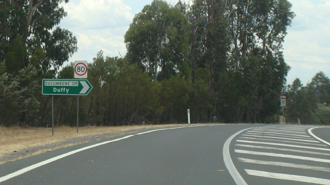
Eucumbene Drive: Corner of Cotter Rd (TD5) and Eucumbene Dr in Duffy, February 2011. Image © Paul Rands |
|||
 |
Next Petrol 44km: Sign at Duffy indicating next fuel is at Tharwa, 44km away, January 2014. Image © Paul Rands |
|||
| Click here for the continuation of Tourist Drive 5 between Stromlo and Tharwa | ||||
1 National Library of Australia
2 Canberra Liberal Party
Last updated: 16-Feb-2019 20:15
This site © Paul Rands. All rights reserved. Some portions © (copyright) by their respective and credited owners. Permission must be obtained before using any images from this site. For details, please email by clicking here.