|
|
|
|
|
Yulara is a tourist service town that is located is 18 kilometres by road from the world heritage site Uluṟu (Ayers Rock) and 55 kilometres from Kata Tjuṯa (the Olgas).
After self-government commenced in the Northern
Territory in 1978, development of the town became a major priority of the
Northern Territory Government. Between 1978 and 1981, basic infrastructure
(roads, water supply etc.) was built via the government's capital works
program. In 1980 the government set up the Yulara Development Company Ltd
to develop tourist accommodation, staff housing and a shopping centre. The
first stage of the resort was built between 1982 and 1984.
When the new facilities became fully operational in late 1984, the
Commonwealth Government terminated all leases for the old motels near
Uluṟu, and the area was rehabilitated by the then National Park Service.
| Preview: | Description: |

|
Kata Tjuṯa: View of Kata Tjuṯa (The Olgas) near Yulara, 2004. Image © Jamie Scuglia |

|
Uluṟu: Looking towards Uluṟu from the main viewing area near Yulara, 2004. The highest point of Uluṟu is 863 metres above sea level. Image © Jamie Scuglia |

|
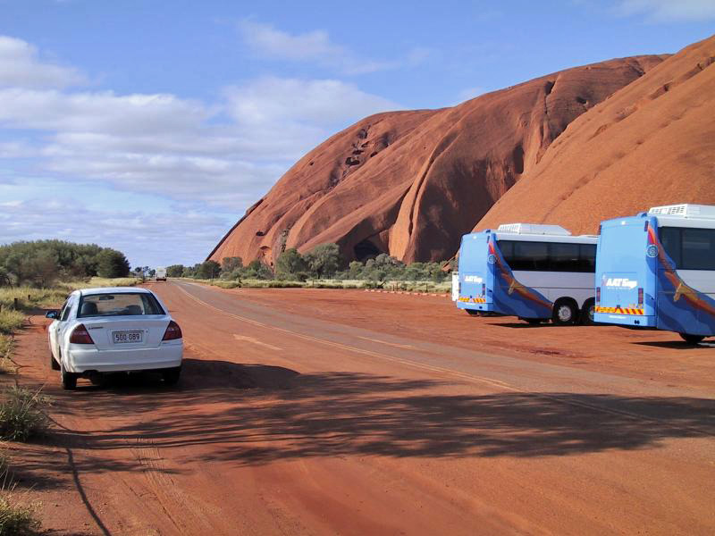
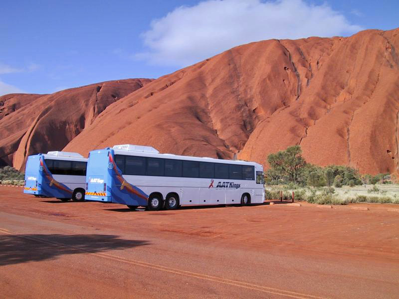
Uluṟu: Accessing Uluṟu is made easy by sealed roads practically leading right up to the base, 2004. Image © Jamie Scuglia |
|
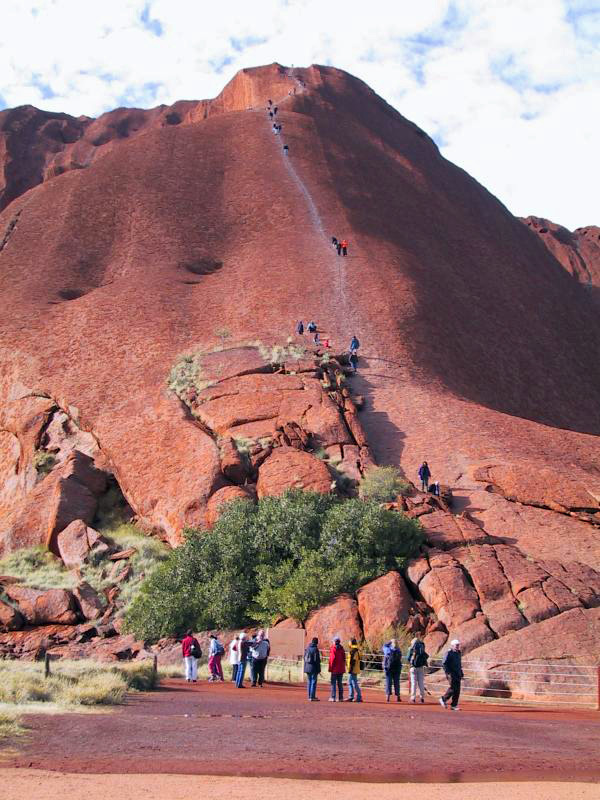
Uluṟu Climbing Trail: Tourists climbing Uluṟu, 2004. Visitors began climbing Uluṟu from the 1930s onwards, with the safety chain installed in the 1960s, however once the rock was returned to its traditional owners, they requested visitors to not climb the rock, as it was in violation Tjukurpa (Anangu law and culture). In 2019, all climbing activities were banned. Image © Jamie Scuglia |
|
Uluṟu: Accessing Uluṟu is made easy by sealed roads practically leading right up to the base, 2004. Image © Jamie Scuglia |
|
Uluṟu: Accessing Uluṟu is made easy by sealed roads practically leading right up to the base, 2004. Image © Jamie Scuglia |

|
Uluṟu: Accessing Uluṟu is made easy by sealed roads practically leading right up to the base, 2004. Image © Jamie Scuglia |

|
Uluṟu: One of several shelters near the walking trails around the base of Uluṟu, 2004. Image © Jamie Scuglia |

|
Uluṟu: View of Uluṟu from the base, 2004. Image © Jamie Scuglia |

|
Uluṟu: View of Uluṟu from the base, 2004. Image © Jamie Scuglia |
1 Australian Bureau of Statistics, 2016 Census QuickStats
Last updated: 14 Nov 2019 10:37
This site © Paul Rands. All rights reserved. Some portions © (copyright) by their respective and credited owners. Permission must be obtained before using any images from this site. For details, please email by clicking here.