|
|
|
|
|
Kiama is the largest coastal town between Nowra and Wollongong on NSW's south coast.
The town is nestled in the lowlands between the bald green hills and the rugged rocky coastline. The town is very cosmopolitan with many al fresco cafe's and an interesting esplanade main street. The town's main attraction is the blowhole, at Blowhole Point which spurts water up to 60m in the air and is floodlit at night. Amongst the many rocky outcrops, there are some fine beaches, making this place another great holiday destination, within close proximity to Sydney.
The name ‘Kiama’ has long been translated as “where the sea makes a noise”.
| Preview: | Description: |
 |
Kiama Town Centre: Terralong Street, Kiama, looking northwest, December 2013. Image © Michael Greenslade |
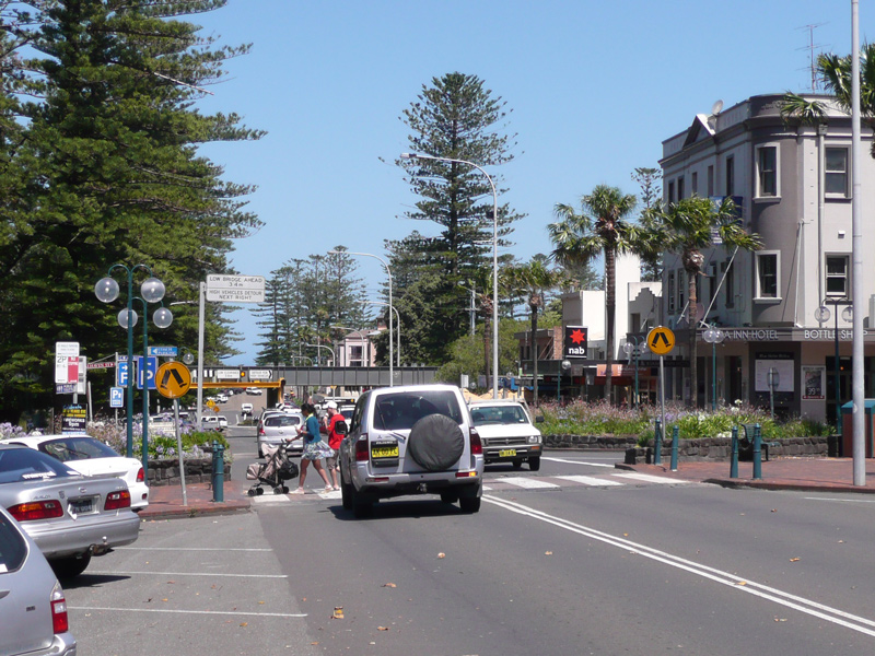 |
Kiama Town Centre: Terralong Street, Kiama, looking southeast, December 2013. Image © Michael Greenslade |
 |
Kiama Town Centre: Terralong Street, Kiama, looking southeast, December 2013. Image © Michael Greenslade |
 |
Manning Street: Manning St Kiama near the council chambers, looking towards Kiama Harbour, December 2013. Image © Michael Greenslade |
 |
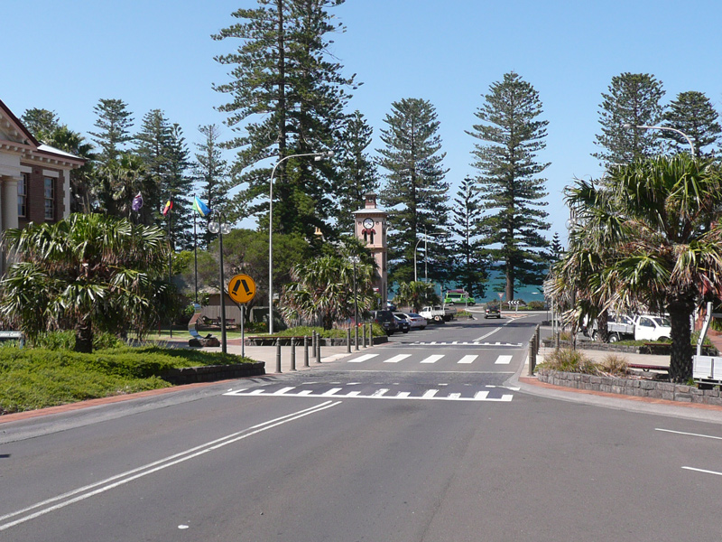
Bong Bong Street: Looking southeast towards Church Point at Kiama, December 2013. Image © Michael Greenslade |
 |
Kiama Harbour: Overlooking Kiama Harbour, December 2013. Image © Michael Greenslade |
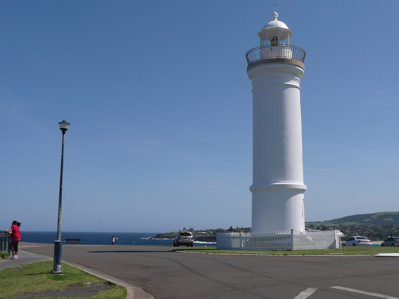 |
Kiama Lighthouse: Looking south at Kiama Lighthouse, December 2013. Image © Michael Greenslade |
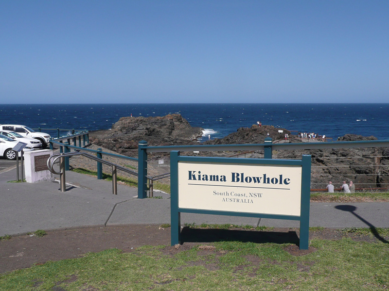 |
Kiama Blowhole: View of Kiama Blowhole, December 2013. It is a natural water and land feature formed from basalt lava flows and was first discovered by local Aboriginals who named it 'Khanterinte'. The blowhole was first written about by George Bass on 6 December 1797. Access to the blowhole is off Terralong St via Blowhole Point Rd. Image © Michael Greenslade |
 |
Kiama Blowhole: View of Kiama Blowhole, December 2013. It is a natural water and land feature formed from basalt lava flows and was first discovered by local Aboriginals who named it 'Khanterinte'. The blowhole was first written about by George Bass on 6 December 1797. Image © Michael Greenslade |
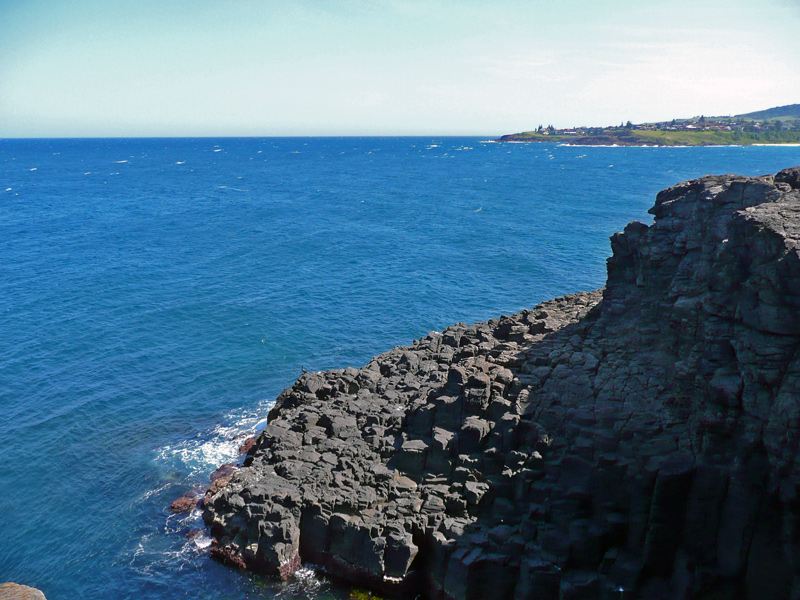 |
View to Church Point: View across Kiama Blowhole to Church Point, December 2013. Image © Michael Greenslade |
1 Australian Bureau of Statistics, 2016 Census QuickStats
Last updated: 21-Aug-2020 23:43
This site © Paul Rands. All rights reserved. Some portions © (copyright) by their respective and credited owners. Permission must be obtained before using any images from this site. For details, please email by clicking here.