|
|
|
|
|
 |
High Street & Leach Highway (State Route 7) |
Statistics:
Route Numbering:

General Information:
Leach Highway is an arterial road in Perth's southern and eastern suburbs. It connects the airport and industrial areas in the eastern suburbs with the port in Fremantle. It's dual carriageway for most of its length.
Multiplexes along the route include:
History:
Click here for some historical aerial photos on the State Library of Western Australia site

| Preview: | Description: |
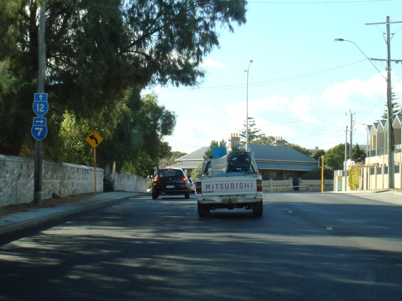 |
Ord Street: SR7 and SR12 trailblazers on Ord St (SR12) at Fremantle, approaching High St (SR7), June 2009. Image © Paul Rands |
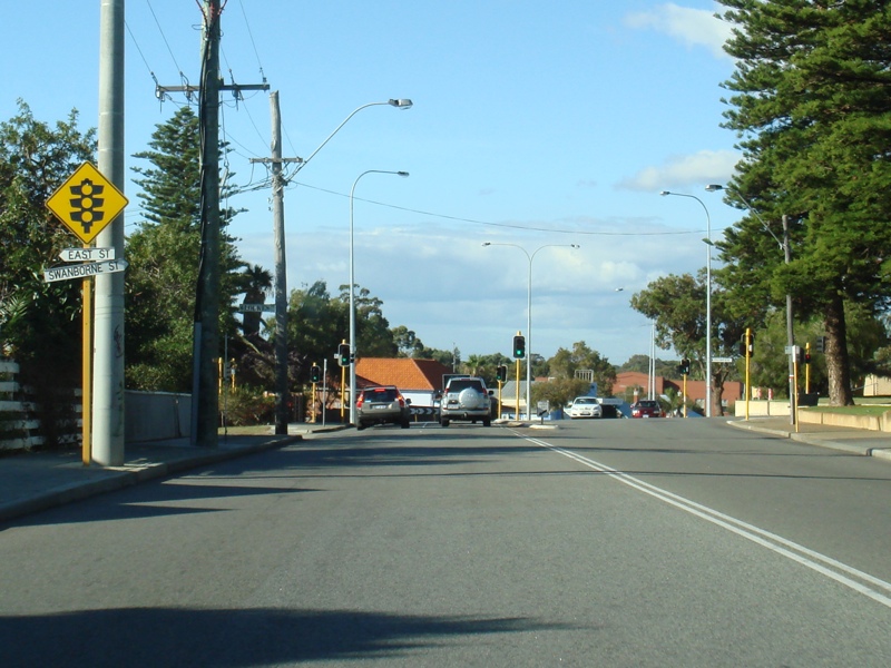 |
Approaching East Street & Swanbourne Street: High St (SR7) approaching East St & Swanbourne St in Fremantle, June 2009. Image © Paul Rands |
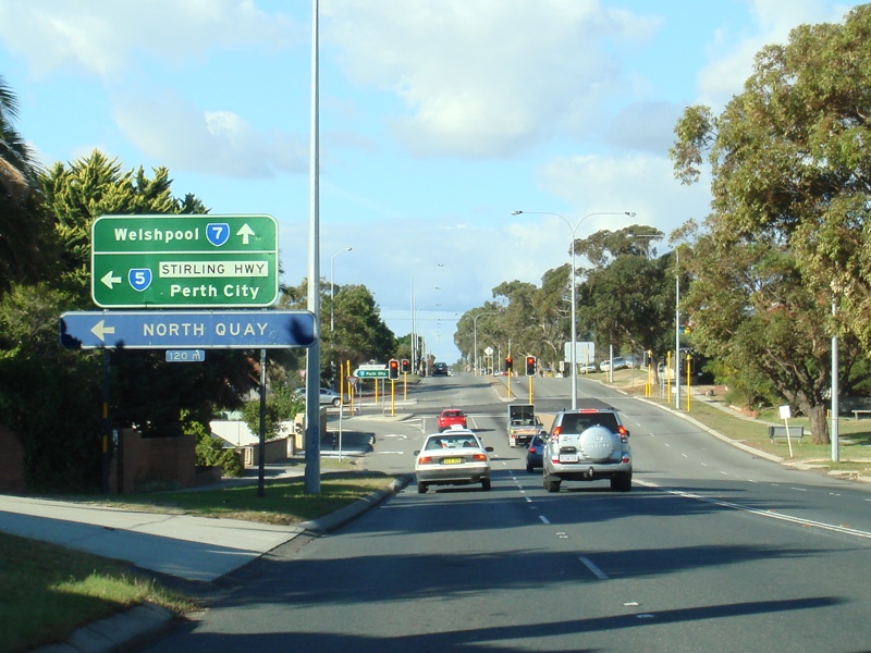 |
Advance Directional Sign: AD sign on High St (SR7) at Fremantle, approaching Stirling Hwy (SR5), June 2009. Image © Paul Rands |
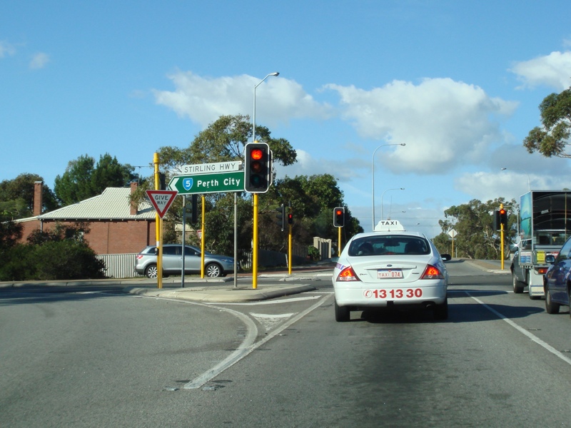 |
Stirling Highway Intersection: Corner of High St (SR7) and Stirling Hwy (SR5) at Fremantle, June 2009. Image © Paul Rands |
 |
Trailblazer: SR7 trailblazer at Fremantle after the Stirling Hwy (SR5) junction, June 2009. Image © Paul Rands |
 |
Approaching Carrington St: High St (SR7) at Palmyra approaching Carrington St, June 2009. SR7 changes name to Leach Hwy from this junction. Image © Paul Rands |
 |
Carrington Street: Corner of High St (SR7), Leach Hwy (SR7) and Carrington St in Palmyra, June 2009. Image © Paul Rands |
 |
Approaching Stock Road: Leach Hwy (SR7) as it approaches Stock Rd (NR1 and unnumbered sections) at Palmyra, June 2009. The NR1 duplex starts at this junction. Image © Paul Rands |
 |
Trailblazer Assembly: SR7 / NR1 trailblazer approaching Stock Rd in Palmyra, June 2009. Image © Paul Rands |
 |
Trailblazer Assembly: SR7 / NR1 trailblazer after Stock Rd, near Madden Cr in Melville, June 2009. Image © Paul Rands |
 |
Melville Area: Leach Hwy (SR7 / NR1) near Pott St in Melville, June 2009. Image © Paul Rands |
 |
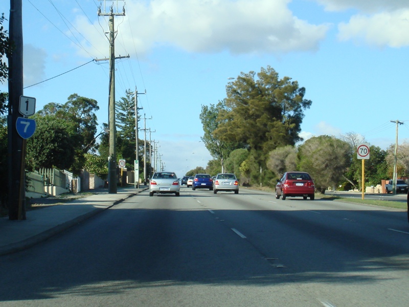
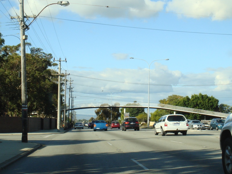
Myaree Area: Leach Hwy (SR7) as it passes through Myaree, June 2009. Image © Paul Rands |
 |
Approaching North Lake Road: Leach Hwy (SR7) near North Lake Rd at Myaree, June 2009. Image © Paul Rands |
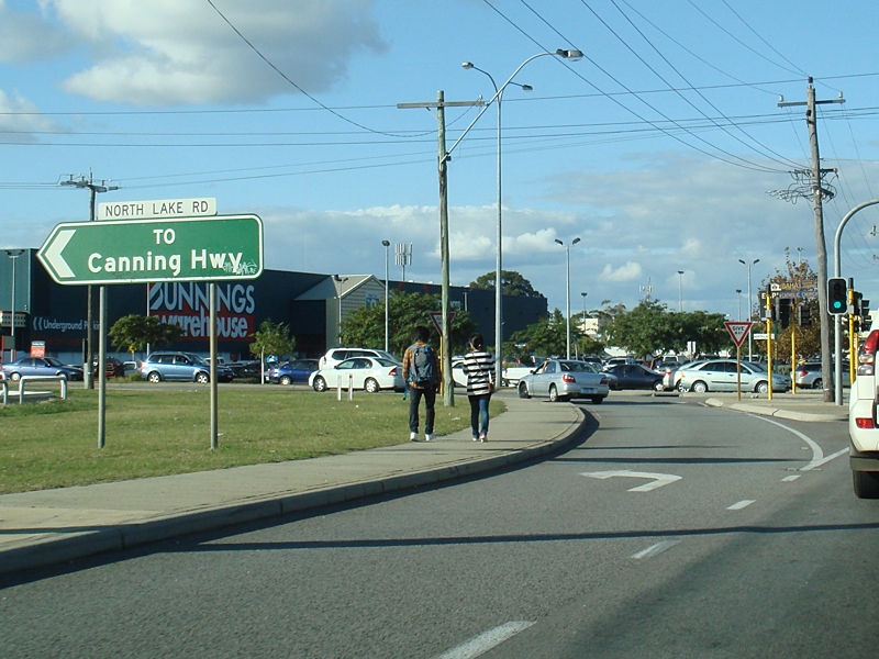 |
North Lake Road: Corner of Leach Hwy (SR7) and North Lake Rd in Myaree, June 2009. Image © Paul Rands |
 |
Approaching Riseley St: Leach Hwy (SR7) as it approaches Riseley St in Booragoon, June 2009. Image © Paul Rands |
 |
Trailblazer Assembly: SR7 / NR1 trailblazer approaching Riseley St in Booragoon, June 2009. Image © Paul Rands |
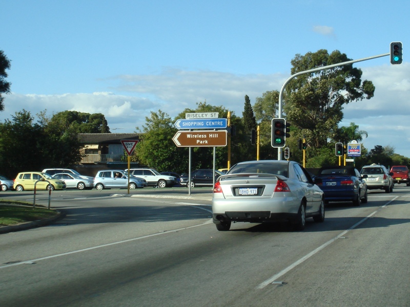 |
Riseley Street: Corner of Leach Hwy (SR7) and Riseley St in Booragoon, June 2009. Image © Paul Rands |
 |
Approaching Murdoch Drive: Leach Hwy (SR7 / NR1) approaching Murdoch Dr in Booragoon, June 2009. Image © Paul Rands |
 |
Murdoch Drive: Corner of Leach Hwy and Murdoch Dr in Booragoon, June 2009. Image © Paul Rands |
 |
Approaching Moolyeen Road: Leach Hwy (SR7 / NR1) approaching Moolyeen Rd in Brentwood, June 2009. Image © Paul Rands |
 |
Approaching Kwinana Freeway: Leach Hwy (SR7 / NR1) as it approaches Kwinana Fwy (SR2 / NR1) at Brentwood, June 2009. Image © Paul Rands |
 |
Freeway Green Prohibition Sign: Old freeway green sign Leach Hwy showing prohibited vehicles on the Kwinana Fwy, Brentwood, June 2009 Image © Paul Rands |
 |
Kwinana Freeway Interchange: Leach Hwy at the Kwinana Fwy interchange in Brentwood, June 2009. The NR1 duplex ends here and moves onto the Kwinana Fwy. Image © Paul Rands |
 |
Kwinana Freeway Interchange: Leach Hwy at the Kwinana Fwy interchange in Brentwood, June 2009. The NR1 duplex ends here and moves onto the Kwinana Fwy. Image © Paul Rands |
 |
Kwinana Freeway Interchange: Leach Hwy at the Kwinana Fwy interchange in Brentwood, June 2009. Image © Paul Rands |
 |
Kwinana Freeway Interchange: Leach Hwy at the Kwinana Fwy interchange in Brentwood, June 2009. Image © Paul Rands |
 |
Trailblazer: SR7 trailblazer at Brentwood, after the Kwinana Fwy interchange, June 2009. Image © Paul Rands |
 |
Bull Creek Drive: Corner of Leach Hwy (SR7) and Bull Creek Dr at Brentwood, June 2009. Image © Paul Rands |
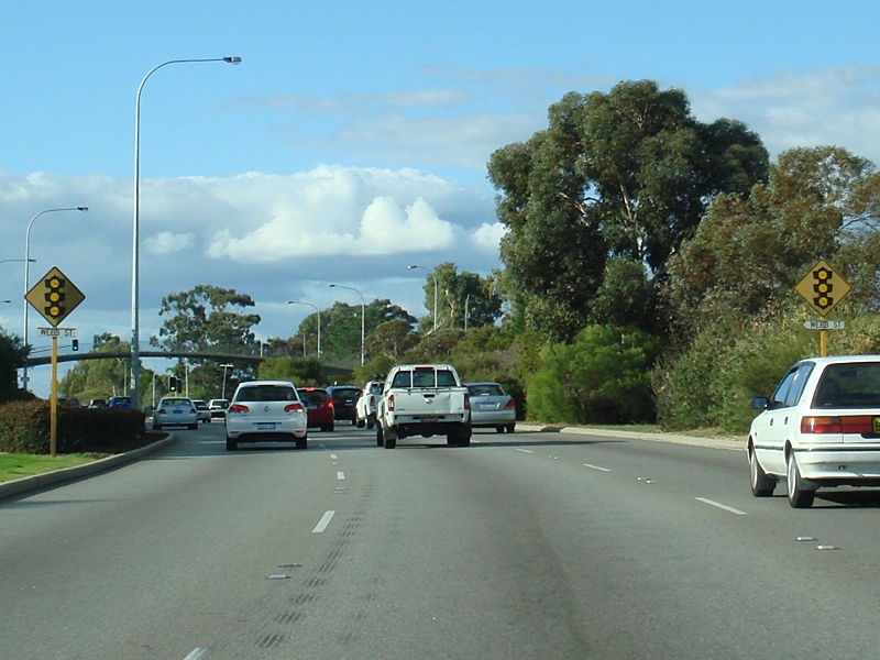 |
Approaching Webb Street: Old style traffic signal warning signs approaching Webb St in Rossmoyne, June 2009. Image © Paul Rands |
 |
Webb Street: Corner of Leach Hwy (SR7) and Webb St in Rossmoyne, June 2009. Image © Paul Rands |
 |
Approaching Karel Avenue: Corner of Leach Hwy (SR7) and Karel Av in Rossmoyne, June 2009. Image © Paul Rands |
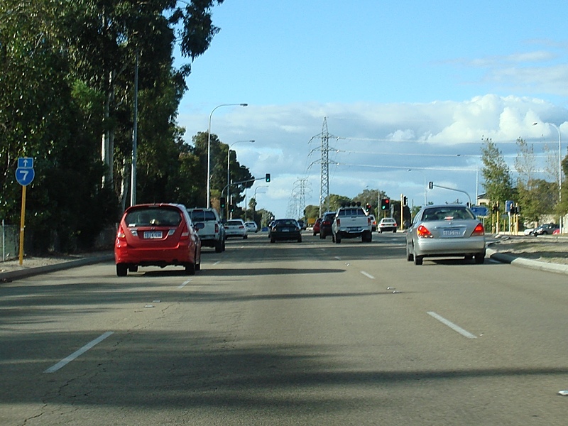 |
Trailblazer: SR7 trailblazer at Rossmoyne, approaching Karel Av, June 2009. Image © Paul Rands |
 |
Advance Directional Sign: AD sign at Shelley approaching High Road (SR27), July 2009. Image © Paul Rands |
 |
Trailblazer Assembly: SR7 and SR27 trailblazers at Shelley, approaching High Rd (SR27), June 2009. Image © Paul Rands |
 |
High Road Intersection: Corner of Leach Hwy and High Rd (SR27) at Shelley, July 2009. Image © Paul Rands |
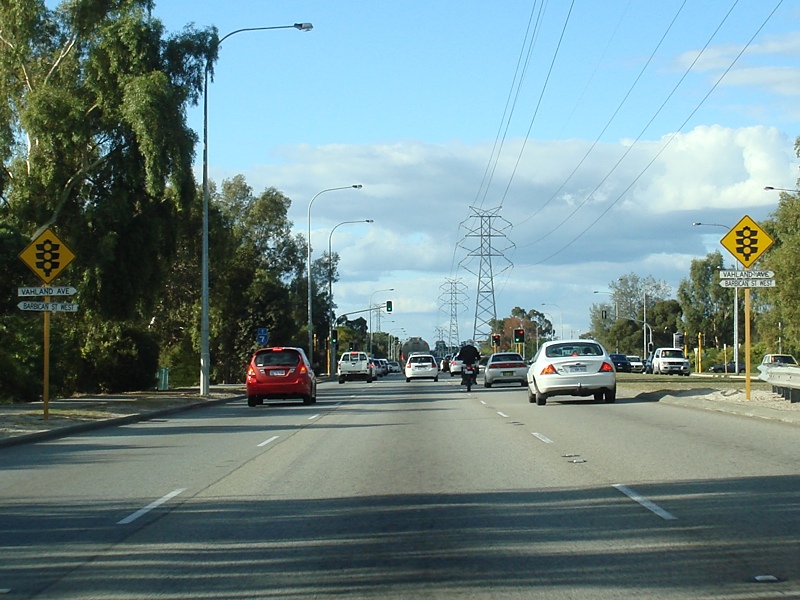 |
Approaching Vahland Av & Barbican St West: Leach Hwy (SR7) at Shelley approaching Vahland Av and Barbican St West, June 2009. Image © Paul Rands |
 |
Trailblazer: SR7 trailblazer at Shelley near the Vahland Av and Barbican St West intersection, June 2009. Image © Paul Rands |
 |
Advance Directional Sign: AD sign on Leach Hwy (SR7) at Shelley for the Centenary Av intersection, June 2009. Image © Paul Rands |
 |
Canning River: Leach Hwy (SR7) as it crosses the Canning River via Shelley Bridge at Shelley, June 2009. Image © Paul Rands |
 |
Centenary Avenue: Corner of Leach Hwy (SR7) and Centenary Av in Wilson, June 2009. Image © Paul Rands |
 |
Trailblazer: SR7 trailblazer at Wilson, after the Centenary Av junction, June 2009. Image © Paul Rands |
 |
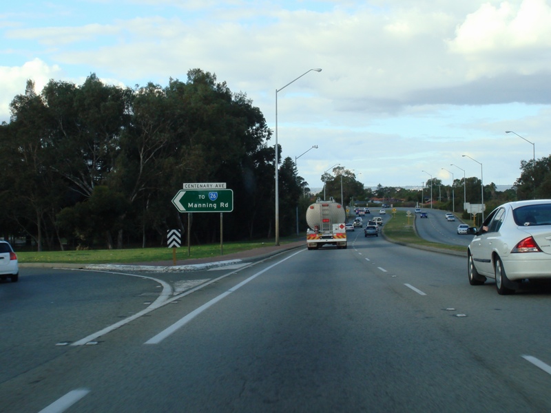
Advance Directional Sign: AD sign at Wilson approaching Manning Rd (SR26), June 2009. Image © Paul Rands |
 |
Approaching Albany Highway: Lane allocation sign approaching the interchange with Albany Hwy (SR30) at Bentley, June 2009. Image © Paul Rands |
 |
Advance Directional Sign: AD sign on Leach Hwy (SR7) at Welshpool approaching Welshpool Rd (former SR35), June 2009. Image © Paul Rands |
 |
Welshpool Road Intersection: Corner of Leach Hwy (SR7) and Welshpool Rd in Welshpool, June 2009. Image © Paul Rands |
 |
Advance Directional Sign: AD sign at Welshpool approaching Orrong Rd (SR8), June 2009. Image © Paul Rands |
 |
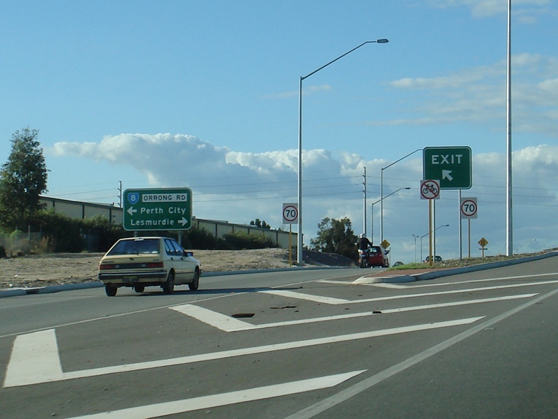
Orrong Road Interchange: Leach Hwy (SR7) at the Orrong Rd (SR8) interchange at Welshpool, June 2009. Image © Paul Rands |
 |
Orrong Road Interchange: Leach Hwy (SR7) at the Orrong Rd (SR8) interchange at Welshpool, June 2009. Image © Paul Rands |
 |
Advance Directional Sign: AD sign on Leach Hwy (SR7) at Cloverdale approaching Abernethy Rd (SR55), June 2009. Image © Paul Rands |
 |
Abernethy Road: Corner of Leach Hwy (SR7) and Abernethy Rd (SR55) at Cloverdale, June 2009. Image © Paul Rands |
 |
Supplemental Advance Directional Sign: Supplemental AD sign at Cloverdale approaching Tonkin Hwy (SR4), June 2009. Image © Paul Rands |
 |
Advance Directional Sign: AD sign showing lane allocations at Cloverdale, approaching Tonkin Hwy (SR4), June 2009. Image © Paul Rands |
 |
Tonkin Highway Junction: The end of SR7, at the intersection with Tonkin Hwy (SR4) at Cloverdale, June 2009. Image © Paul Rands |
1 Metropolitan Road Fact Sheet, 31 March 2008
2 Government of Western Australia, Department of Health, WA Health Libraries Network, Aerial photograph of the Leach Highway and the Highway Drive-In, Bentley, 6 Jan. 1979
3 Government of Western Australia, Ministerial Media Statements, Road Safety, More than 270 sites targeted under State Black Spot, 04 August 2002
4 Government of Western Australia, Ministerial Media Statements, Green light for Leach Highway Improvement Plan, 22 January 2004
5 Government of Western Australia, Planning & Infrastructure, Media Statements, Multi-million dollar interchange dramatically cuts crashes in Welshpool, 04 June 2007
6 Government of Western Australia, Ministerial Media Statements, $1.2million to improve Leach Highway and Stock Road intersection, 21 August 2007
Last updated: 08 Nov 2019 01:09
This site © Paul Rands. All rights reserved. Some portions © (copyright) by their respective and credited owners. Permission must be obtained before using any images from this site. For details, please email by clicking here.