|
|
|
|
|
 |
Charles Street, Wanneroo Road, Indian Ocean Drive (State Route 60) - Northbridge to Wanneroo |
Statistics:
Route Numbering:
General Information:
State Route 60 is a major arterial route from the Perth CBD, through Perth's northern suburbs to the northwest coastal towns and villages north of Perth.
The route is a mix of suburban arterial road, divided multi-laned road and single carriageway roadway and passes through mostly commercial, residential and agricultural lands as well as vast tracts of pine plantations and state forests.
Multiplexes along the route include:
History:
Wanneroo Road:
- 1964: Widening of Wanneroo Rd near Cape St at Tuart Hill. 2
- May 2003: Anti-skid treatments applied where Wanneroo Road intersects Ocean Reef Road, Beach Road, Morley Drive and Walcott Street. 3
- 2008: Extension of right turn lanes, construction of double right turn from Wanneroo Rd into Ocean Reef Rd westbound and a double left from Ocean Reef Rd into Wanneroo Rd northbound. Construction of a portion of Woodlake Retreat to form a four way intersection with Kingsway along with an associated right turn lane on Wanneroo Rd, widening of Kingsway and installation of traffic signals. Extension of right turn lanes and upgrade pedestrian facilities at the junction of Wanneroo Road / Amelia Street. Extension of right turn lanes at the corner of Wanneroo Rd / Hepburn Av and upgrade of pedestrian facilities. 4
- July 2008: Installation of traffic signals and pedestrian crossing facilities and the creation of a four-way intersection to allow a second access into Woodlake Retreat, plus the upgrade of street lights, construction of a left turn pocket out of Kingsway allowing traffic to queue in separate lanes, construction of a right turn pocket on Wanneroo Road into Woodlake Retreat and installation of footpaths, signs and pavement markings. 5
| Northbridge To Wanneroo | Wanneroo to Northbridge | |||
| Preview: | Description: | Preview: | Description: | |
 |
Mitchell Freeway Interchange: Intersection directional sign at the corner of Charles St (SR60), Mitchell Fwy (SR2) and Newcastle St at West Perth, April 2016. Image © Paul Rands |
 |
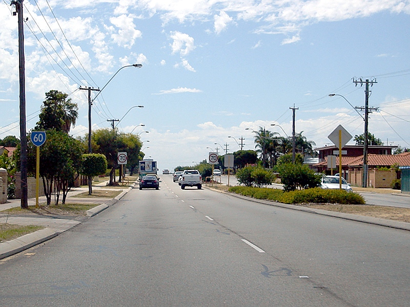
Approaching Hastings Street
& Conlan Avenue: Approaching the intersection with Hastings St & Conlan Av, Wanneroo. February 2009. Image © Paul Rands |
|
 |
Joondanna Area: Northbound approaching Wiluna Street, February 2009. Image © Paul Rands |
 |
Approaching Ocean Reef Road: Approaching the intersection with Ocean Reef Road (SR84) in Pearsall. February 2009. Image © Paul Rands |
|
 |
Tuart Hill Area: Northbound through the Tuart Hill area, Febraury 2009. Image © Paul Rands |
 |
Trailblazer Assembly: Trailblazers approaching the intersection with Ocean Reef Rd (SR84) at Pearsall, February 2009. Image © Paul Rands |
|
 |
Trailblazer: SR60 trailblazer after the intersection with Royal Street, Tuart Hill, February 2009. Image © Paul Rands |
 |
Intersection Directional Sign: ID sign on the corner of Ocean Reef Rd (SR84) and Wanneroo Rd (SR60) in Pearsall, February 2009. Image © Paul Rands |
|
 |
Approaching Morley Drive: Wanneroo Road, approaching the signalised intersection with Morley Drive (SR76) at Tuart Hill, February 2009. Image © Paul Rands |
 |
Prindiville Drive Intersection: Wanneroo Rd as it passes Prindiville Dr in Wangara, February 2009. Image © Paul Rands |
|
 |
Trailblazer Assembly: Trailblazer approaching the Morley Drive (SR76) intersection in Tuart Hill, February 2009. Image © Paul Rands |
 |
Trailblazer Assembly: Trailblazers as you approach Whitfords Av (SR83) at Wangara. The SR83 duplex begins at this intersection. February 2009. Image © Paul Rands |
|
 |
Approaching Amelia Street: Approaching the intersection with Amelia St in Balcatta, February 2009. Image © Paul Rands |
 |
Freeway Green Intersection
Directional Sign: Old 1980s freeway green ID sign for the Mitchell Fwy (SR2) at the intersection with Whitfords Rd (SR83) at Wangara, February 2009. Image © Paul Rands |
|
 |
Approaching Balcatta Road: Approaching the signalised junction with Balcatta Rd (SR78) in Balcatta, February 2009. Image © Paul Rands |
 |
Trailblazer Assembly: Trailblazer signs showing the SR83 duplex at Madely, between Whitefords Av and Gnangara Rd. February 2009. Image © Paul Rands |
|
 |
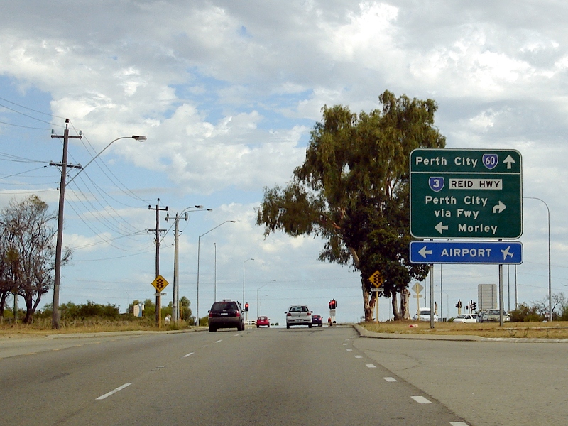
Advance Directional Sign AD sign after the Balcatta Rd junction as you approach Reid Hwy (SR3) in Balcatta, February 2009. Image © Paul Rands |
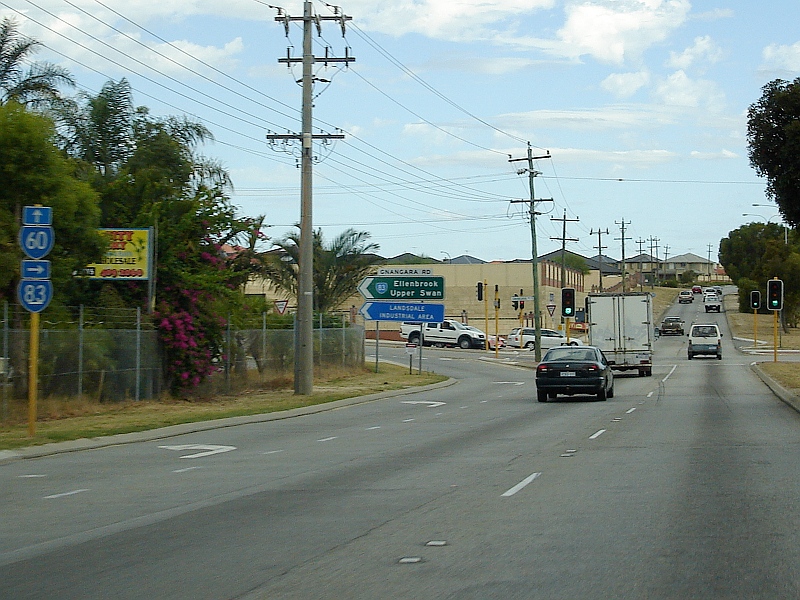
 |
Advance Directional Sign: AD sign approaching Gnangara Road at Madeley. February 2009. Image © Paul Rands |
|
 |
Reid Highway Intersection: Corner of Wanneroo Rd and Reid Hwy (SR3) at Balcatta, February 2009. Image © Paul Rands |
 |
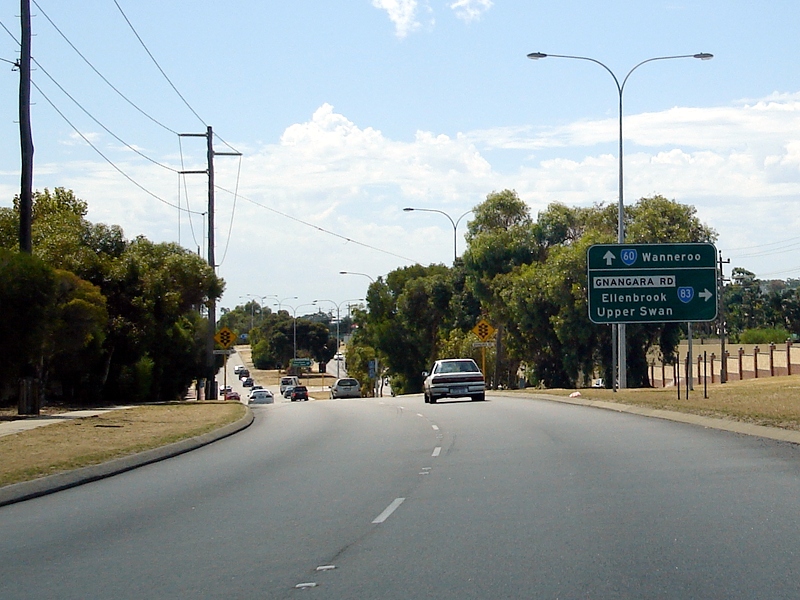
Gnangara road Intersection: Wanneroo Rd as it passes through the intersection with Gnangara Rd (SR83) at Madeley. The SR83 duplex ends here. Note the incorrectly placed arrow on the trailblazer assembly. February 2009. Image © Paul Rands |
|
 |
Distance Sign: RD sign after the Reid Hwy (SR3) junction at Hammersley, approaching the intersection with Camberwell Rd. February 2009. Note the ABC AM radio transmitter tower on the left of shot. Image © Paul Rands |
 |
The Kingsway Intersection: Wanneroo Road and The Kingsway in Madeley. February 2009. Image © Paul Rands |
|
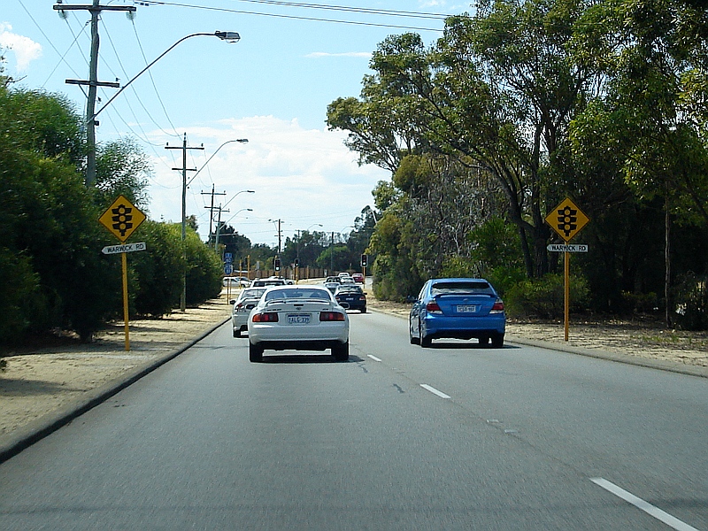 |
Approaching Warwick Road: Northbound in Warwick approaching Warwick Rd (SR81), February 2009. Image © Paul Rands |
 |
Advance Directional Sign: AD sign approaching Hepburn Av (SR82) in Madeley, February 2009. Image © Paul Rands |
|
 |
Trailblazer Assembly: Trailblazer assembly approaching Warwick Road (SR81) in Warwick, February 2009. The SR81 duplex begins from this junction. Image © Paul Rands |
 |
Trailblazer Assembly: Trailblazers approaching Hepburn Av (SR82) in Madeley, February 2009. Image © Paul Rands |
|
 |
Trailblazer: Trailblazer on Wanneroo Rd at Greenwood after Warwick Rd (SR81), April 2016. Image © Paul Rands |
 |
Unusual Warning Sign: Unusual sign indicating an opening in the median strip for U-turns, southbound on Wanneroo Rd at Marangaroo. February 2009. Image © Paul Rands |
|
 |
Approaching Marangaroo Road: Approaching the signalised intersection with Marangaroo Road (SR81) in Greenwood, February 2009. Image © Paul Rands |
 |
Trailblazer Assembly: Trailblazers approaching the junction with Marangaroo Rd (SR81) at Marangaroo. SR81 duplexes SR60 from this intersection. February 2009. Image © Paul Rands |
|
 |
Trailblazer Assembly: Trailblazer assembly approaching Marangaroo Road in Greenwood, February 2009. The SR81 duplex ends at this junction. Image © Paul Rands |
 |
Trailblazer Assembly: Trailblazers approaching the junction with Warwick Rd (SR81) at Marangaroo. The SR81 duplex with SR60 ends at this intersection. February 2009. Image © Paul Rands |
|
 |
Approaching Hepburn Avenue: Approaching the signalised junction with Hepburn Avenue (SR82) in Greenwood, February 2009. Image © Paul Rands |
 |
Intersection Directional Sign: ID sign at the intersection with Warwick Rd (SR81) in Marangaroo. February 2009. Image © Paul Rands |
|
 |
Trailblazer Assembly: Trailblazer assembly approaching Hepburn Av (SR82) in Greenwood, February 2009. Image © Paul Rands |
 |
Advance Directional Sign: AD sign approaching Reid Hwy (SR3), Balga, February 2009. Image © Paul Rands |
|
 |
Advance Directional Sign: AD sign approaching Gnangara Rd (SR83) in Kingsley, February 2009. Image © Paul Rands |
 |
Distance Sign: Reassurance directional sign after the Reid Hwy (SR3) intersection, Westminster, February 2009. Image © Paul Rands |
|
 |
Caption Title: Trailblazer on Wanneroo Rd (SR60) after Hepburn Av (SR82) at Greenwood, April 2016. Image © Paul Rands |
 |
Approaching Morley Drive: Approaching the signalised intersection with Morley Dr (SR76) in Nollamara. February 2009. Image © Paul Rands |
|
 |
Kingsway: Corner of Wanneroo Rd (SR60) and Kingsway at Madeley, April 2016. Image © Paul Rands |
 |
Trailblazers: Trailblazer assembly approaching the Morley Drive intersection in Nollamara, February 2009. Image © Paul Rands |
|
 |
Trailblazer Assembly: Trailblazers approaching the Gnangara Rd (SR83) junction in Kingsley, April 2016. Click here for a photo of this location by Paul Rands from February 2009. Image © Paul Rands |
 |
Yokine Area: Wanneroo Road heading southbound through Yokine, February 2009. Image © Paul Rands |
|
 |
Intersection Directional Sign: ID sign facing northbound traffic on Wanneroo Rd at the junction with Gnangara Rd (SR83) in KingsleyApril 2016. Click here for a photo of this location by Paul Rands from February 2009. The SR83 duplex starts at this intersection. Image © Paul Rands |
 |
Approaching London &
Charles Streets: Southbound approaching London Street. This intersection is where SR60 changes to Charles Street. Yokine, February 2009. Image © Paul Rands |
|
 |
Trailblazer Assembly: Trailblazer assembly approaching Ocean Reef Rd (SR84) at Wanneroo, April 2016. Image © Paul Rands |
 |
Approaching Walcott & Green
Streets: Charles Street approaching Walcott & Green Streets in North Perth, February 2009. Image © Paul Rands |
|
 |
Ocean Reef Road: Corner of Wanneroo Rd (SR60) and Ocean Reef Rd (SR84) at Wanneroo, April 2016. Image © Paul Rands |
 |
Walcott & Green Street
Junction: Corner of Charles St (SR60), Walcott & Green Streets (SR75) in North Perth. February 2009. Image © Paul Rands |
|
 |
Intersection Directional Sign: ID sign facing eastbound traffic on Ocean Reef Rd (SR84) at Wanneroo. February 2009. Image © Paul Rands |
 |
Approaching Scarborough Beach Road
& Angove Street: Approaching the non-numbered segment of Scarborough Beach Rd and also Angove St in North Perth, February 2009. Image © Paul Rands |
|
 |
Wanneroo Area: Wanneroo Rd as it passes through Wanneroo at Kirkstall Dr. February 2009. Image © Paul Rands |
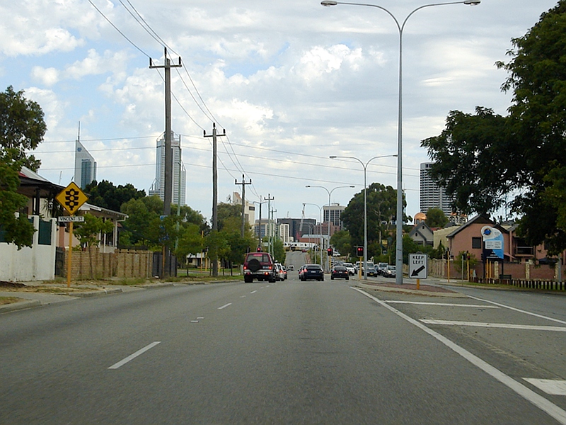 |
Approaching Vincent Street: SR60 as it approaches Vincent Street in North Perth, February 2009. Image © Paul Rands |
|
 |
Former Wanneroo Town Site: Wanneroo Rd as it passes the former Wanneroo town site, near the Wanneroo Showground at the corner of Ariti Av. February 2009. Image © Paul Rands |
 |
End SR60: Trailblazer assembly showing the end of State Route 60 as you approach its terminus at the intersection with Newcastle Street and Mitchell Freeway (SR2) in Northbridge. February 2009. Image © Paul Rands |
|
 |
Wanneroo: SR60 passing through the Wanneroo CBD, near Hasting Street and Conlan Avenue. February 2009. Image © Paul Rands |
|||
 |
Approaching Pinjar Road &
Neville Drive: Wanneroo Rd approaching the intersection with Pinjar Rd and Neville Dr in Wanneroo. February 2009. Image © Paul Rands |
|||
 |
End Divided Road: Approaching the end of divided roadway along Wanneroo Road in Wanneroo. February 2009. Image © Paul Rands |
|||
 |
Advance Directional Sign: AD sign approaching Joondalup Dr (SR85) at Wanneroo. February 2009. Image © Paul Rands |
|||
 |
Approaching Joondalup Drive: Wanneroo Rd approaching Joondalup Dr (SR85) in Wanneroo. February 2009. Image © Paul Rands |
|||
 |
Intersection Directional Sign: ID sign on the corner of Wanneroo Rd and Joondalup Dr (SR85) in Wanneroo. February 2009. Image © Paul Rands |
|||
 |
Intersection Directional Sign: ID sign on the corner of Wanneroo Rd and Joondalup Dr (SR85) in Wanneroo. February 2009. Image © Paul Rands |
|||
| Click here for the continuation of SR60 between Wanneroo and Lancelin | ||||
1 Main
Roads WA Metropolitan Fact Sheet, 31 March 2008
2 State Records Office of WA, Item 1964-03182-01RO - Roads Dedication Road Widening Of Wanneroo Road Near Cape St Tuart Hill City Of Stirling
3 Government of Western Australia, Media Statements, Anti-skid treatments on Wanneroo Road and Albany Highway, 13 May 2003
4 Main Roads WA 2007 2008 State Black Spot
Program List
5 Government of Western Australia, Media Statements, $1.2million upgrade set for the Wanneroo Road-Kingsway intersection, 18 July 2008
Last updated: 18-Jan-2019 5:42
This site © Paul Rands. All rights reserved. Some portions © (copyright) by their respective and credited owners. Permission must be obtained before using any images from this site. For details, please email by clicking here.