|
|
|
|
|

|
Kalamunda Road & Canning Road (State Route 41) |
Statistics:
Route Numbering:

General Information:
State Route 41 is a minor arterial road linking the Roe Hwy (SR3) with the Darling Scarp area west of Perth. It serves as an access road for Perth Airport, and provides the Perth Hills suburbs with access to the Perth central business district.
Starting as dual carriageway from its intersection with the Roe Highway (SR3) through to Hawtin Road. It then reverts to single carriageway and as it climbs the Darling Scarp.

| Preview: | Description: |
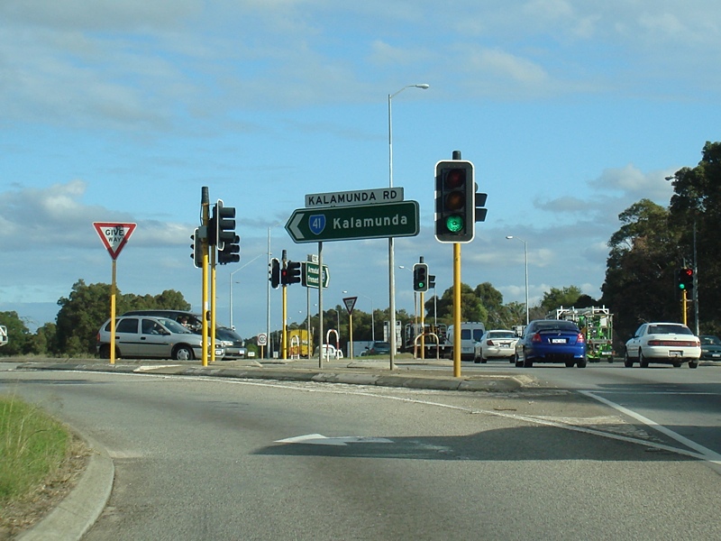 |
Intersection Directional Sign: ID sign on Roe Hwy (SR3) at Maida Vale at the junction with Kalamunda Rd (SR41), July 2009. Image © Paul Rands |
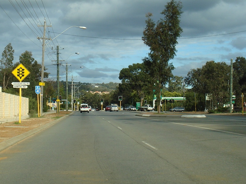 |
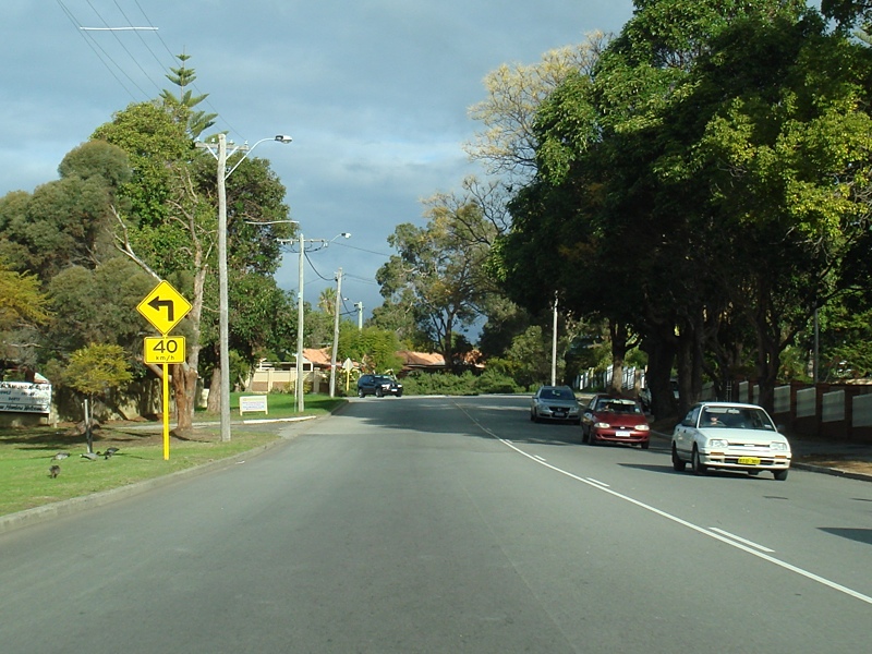
Approaching Gooseberry Hill Road & Hawtin Road: Kalamunda Rd approaching Gooseberry Hill Rd & Hawtin Rd in Maida Vale, July 2009. Image © Paul Rands |
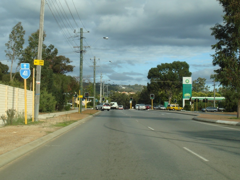 |
Trailblazer: SR41 trailblazer at Maida Vale near the Gooseberry Hill Rd & Hawtin Rd junction, July 2009. Image © Paul Rands |
 |
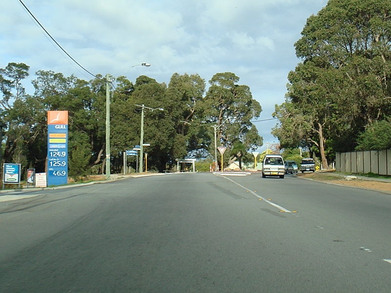
Trailblazer: TD207 trailblazer at Maida Vale after the Gooseberry Hill Rd & Hawtin Rd junction, July 2009. Image © Paul Rands |
 |
Entering The Perth Hills District: Kalamunda Rd as it enters the Perth Hills District at Gooseberry Hill, July 2009. Image © Paul Rands |
 |
Approaching Stirk Street & Headingly Road: Kalamunda Rd approaching Stirk St and Headingly Rd at Kalamunda,, July 2009. SR41 turns right at the roundabout and becomes Canning Rd (SR41). Image © Paul Rands |
 |
Approaching Recreation Road: Canning Rd (SR41) at Kalamunda approaching Recreation Rd, July 2009. Image © Paul Rands |
 |
Kalamunda Town Centre: Canning Rd as it passes through the Kalamunda town centre, July 2009. Image © Paul Rands |
 |
Kalamunda Area: SR41 as it passes through the residential area of Kalamunda, July 2009. Image © Paul Rands |
 |
Approaching Welshpool Road & Carmel Road: Canning Rd (SR41) approaching Carmel Rd and Welshpool Rd East (SR8) at Carmel, July 2009. Image © Paul Rands |
 |
Welshpool Road East Junction: Corner of Canning Rd (SR41) and Welshpool Rd (SR8) at Carmel, July 2009. Image © Paul Rands |
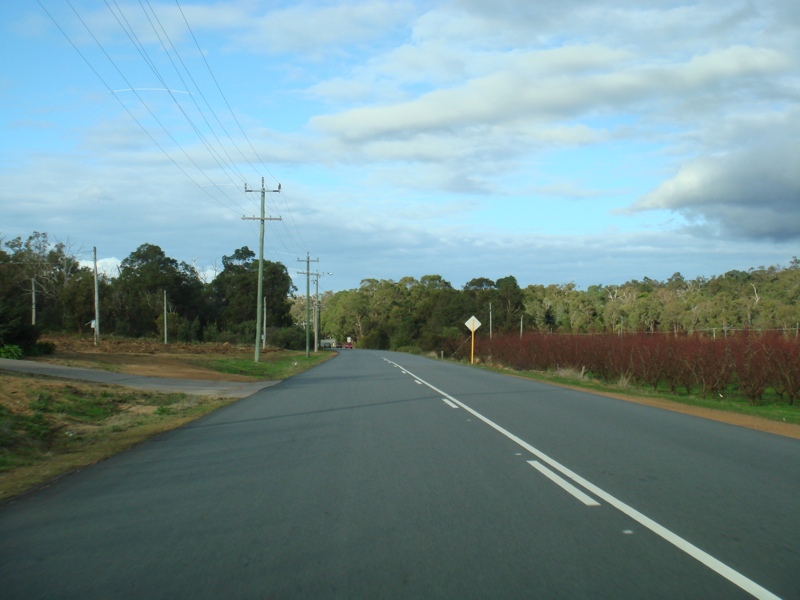 |
Pickering Brook Area: SR41 passing through the rural area of Pickering Brook, July 2009. Image © Paul Rands |
 |
Intersection Directional Sign: ID sign facing eastbound traffic on Canning Road at the intersection with Pickering Brook Road at Pickering Brook. December 2014. Click here for a photo of this location by Paul Rands from July 2009. Image © Terry Siva |
 |
Karragullen: Southbound approaching Old Station Road at Karragullen, near the Karragullen General Store, July 2009. Click here for a photo of this area taken in February 2008. Image © Paul Rands |
 |
O'Meagher Road: Southbound through the intersection with O'Meagher Road at Karragullen, July 2009. Image © Paul Rands |
 |
Advance Directional Sign: AD sign approaching the intersection with Brookton Hwy (SR40) at Karragullen, February 2008. Image © Paul Rands |
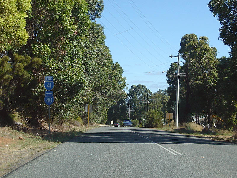 |
End SR40: Southbound end SR40 shield as you approach the intersection with Brookton Hwy at Karragullen, February 2008. Image © Paul Rands |
 |
Brookton Hwy Intersection: ID sign on the junction with Brookton Hwy (SR40) at Karragullen. February 2008. Image © Paul Rands |
Last updated: 08-Mar-2017 20:41
This site © Paul Rands. All rights reserved. Some portions © (copyright) by their respective and credited owners. Permission must be obtained before using any images from this site. For details, please email by clicking here.