Road Photos & Information: Western Australia
 |
|
Forrest Highway, Kwinana Freeway & Mitchell Freeway (State Route 2) - The Spectacles To Baldivis - Construction: Baldivis |
Statistics:
- Length: 140 km (Kwinana Fwy: 73 km) (The Spectacles to Baldivis: 13 km)
- Northern Terminus: Burns Beach Road (SR87) at Currambine
- Southern Terminus: Forrest Highway (former Old Coast Road and Perth-Bunbury Highway) (NR1) at Lake Clifton
- Suburbs, Towns & Localities along route: North Lake, Leeming, Bibra Lake, South Lake, Jandakot, Hammond Park, Aubin Grove, Wandi, Mandogalup, Anketell and The Spectacles.
Route Numbering:
- Current:

- Road Authority Internal Classfication: H15 Kwinana Freeway 1
General Information:
The Forrest Highway, along with the Kwinana and Mitchell Freeways, are without a doubt one of the most important road systems in the Perth metropolitan area, and the southwestern part of the state.
Running in a north-south direction, the freeways link the north and southern suburbs of Perth together plus the southern city of Mandurah and the state's southwest, but also act as a coastal link between the northern and southern parts of the state. Built in stages from the late 1950s the route has seen enormous changes / extensions and is continuously undergoing expansion to this day.
Unique to the freeway sections is the passenger railway line down the median of the road corridor, which in parts also travels alongside other modes of public transport such as buses.
The route varies from 2 to 3 lanes wide in each direction, with provision in most of the newer sections to have another 1 to 2 lanes to be added when required. Exits along the route are somewhat close together, this is probably due to the large number of suburbs state route 2 services, south of Baldivis, the spacings are longer.
When first planned, the Mitchell Fwy was called the Yanchep Highway, as its envisaged that eventually the route will connect to the town.
The photos on this page cover the Kwinana Freeway extension work in the Baldivis area.
Construction Background: 2
The New Perth Bunbury Highway involved the design and construction of 70.5 kilometres of dual carriageway
The route was constructed as a single project and will extend the dual carriageway from Kwinana Freeway at Safety Bay Road in Baldivis, around the eastern side of the Peel Inlet and Harvey Estuary to join the existing dual carriageway on Old Coast Road at Lake Clifton.
The route was constructed to freeway standard from Safety Bay Road to South Yunderup, a distance of 32 kilometres. The remainder of the route, 38 kilometres, was initially be built as a rural highway, with the ability to upgrade it in the future as traffic demands increase.
Funded by both the Commonwealth and State Government of Western Australia, the project doubled the length of the existing freeway network and provides a high standard inter-regional road link.
The route links Perth and the South West, bypassing the heavily populated areas in Mandurah and the Dawesville Peninsula, and avoiding inland communities on the existing highway.
Five interchanges were constructed at Safety Bay Road, Karnup Road, Paganoni Road, Lakes Road and Pinjarra Road.
Nine intersections were constructed and have the capacity to be upgraded to interchanges in the future. They are located at Beacham Road, Greenlands Road, Paull Road, Mills Road, Herron Point Road, Old Bunbury Road, Dorsett Road, Old Coast Road and Peppermint Grove Road.
In total, 19 bridges were built to grade separate the interchanges and extend the new Perth-Bunbury Highway over the Serpentine River, Nambeelup Brook, Murray River/Pinjarra Road, South Yunderup Road, Murray River floodplain, Harvey River and a number of Water Corporation drains
It is the largest infrastructure project ever undertaken by Main Roads Western Australia.
History:
- 1957: Commencement of construction of the Narrows Bridge and first stage of the Kwinana Fwy. 3
- 1967: Construction of the Kwinana Freeway in inner southern Perth suburbs. 3
- 3 December 1976: South Perth interchange opened. 7
- 1975: Additional land reserved for the future extension of the Kwinana Fwy. 4
- 19 July 1979: Kwinana Freeway / Canning interchange including Manning Road Bridge fully operational. 7
- October 1980: Narrows Bridge median lane opened to Northbound traffic. 7
- 29 March 1982: Narrows Bridge median lane opened to southbound peak traffic, thus becoming a reversible lane. 7
- 9 May 1982: Mt Henry Bridge and Kwinana Freeway extension (6.5 km) from Canning Bridge to South Street opened. 7
- February 1987: Introduction of bus lanes. 3
- 18 December 1989: Kwinana Fwy bus lane Canning Bridge to city opened. 7
- 14 July 1991: Kwinana Freeway from South St to Farrington Rd opened. 7
- 12 December 1991: Kwinana Freeway from Farrington Rd to Forrest Rd opened. 7
- November 1991: Kwinana Freeway bus lane extended from Canning Bridge to Mt Henry Bridge. 7
- 11 September 1994: Extension of Kwinana Freeway from Forrest Road to Thomas Road Kwinana opened on by Kim Beazley. 3
- 1999-2001: Construction of the South West Metropolitan Railway down the centre of the freeway alignment - this was done by relocating 16 kilometres of existing northbound carriageway 15 metres westwards. Also part of the works was the construction of a 12km freeway extension southwards from Thomas Road to Safety Bay Road, including interchanges at Mortimer and Mundijong Road and freeway overpasses at Millar Road. 6
- 12 March 2006: the connection of the Roe Highway Stage 7, from South Street to the Kwinana Freeway, officially opened to traffic. 7
- December 2006: Works commence on the Kwinana Freeway Extension from Safety Bay Road (SR18) Interchange at Baldivis to Pinjarra Road at North Yunderup. 8
- 20 September 2009: Completion of the 70 km Perth to Bunbury Highway project (Kwinana Fwy / Forrest Hwy) - bypassing the heavily populated areas in Mandurah and the Dawesville Peninsula, and avoiding the inland communities on South Western Highway. The route is freeway standard from Safety Bay Road to Pinjarra Road with the remainder of the route built as a divided rural highway. In the future as traffic demands increase, the highway will be upgraded to a freeway standard for its entire length. 7
 |
Foley Road Construction Zone:
Westbound at Baldivis approaching Kwinana Freeway (SR2). April 2009.
Image © Paul Rands
|
 |
Safety Bay Road Construction Zone:
Eastbound at Baldivis approaching Kwinana Freeway (SR2). June 2009.
Image © Paul Rands
|
 |
Safety Bay Road Construction Zone:
Eastbound at Baldivis approaching Kwinana Freeway (SR2). June 2009.
Image © Paul Rands
|
 |
Advance Directional Sign:
AD sign at Baldivis on Safety Bay Rd (SR18) approaching Kwinana Fwy (SR2). June 2009.
Image © Paul Rands
|
 |
Safety Bay Road / Kwinana Freeway Interchange:
Eastbound at Baldivis. June 2009.
Image © Paul Rands
|
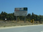 |
Roadworks Sign:
Sign at Baldivis near the former intersection with Folly Road indicating the extension of the Kwinana Freeway. December 2007.
Image © Paul Rands
|
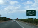 |
End of Freeway 500m:
Sign indicating at Baldivis the end of the freeway is 500 m ahead. Previously this location was signposted as End Of Freeway 1 km. The freeway was shortened slightly to allow works for connecting the existing freeway to the new Perth-Bunbury Highway project, January 2009.
Image © Tim Cole
|
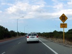 |
Rumble Strip Warning Sign:
Sign at Baldivis indicating audible lines placed across the road ahead, designed to warn of a hazard, January 2009.
Image © Tim Cole
|
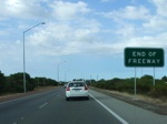 |
Temporary End of Freeway:
Sign indicating the temporary end of the Kwinana Fwy at Baldivis, January 2009.
Image © Tim Cole
|
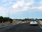 |
Traffic Switch:
Closed southbound carriageway of the Kwinana Fwy at Baldivis, and the temporary traffic switch to the side track around the construction site, January 2009.
Image © Tim Cole
|
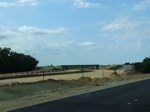 |
New Safety Bay Road Interchange:
Looking southbound at Baldivis at the Safety Bay Road (SR18) interchange, January 2009.
Image © Tim Cole
|
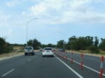 |
Side Track:
Approaching Safety Bay Road on the side track around the works zone at Baldivis, January 2009.
Image © Tim Cole
|
1 Main Roads WA Metropolitan Road Fact Sheet, 31 March 2008
2 Southern Gateway Alliance Web Site, retrieved 30 March 2009
3 State Library of Western Australia
4 Australasian Legal Information Institute
5 National Library of Australia
6 Australian Institute of Project Management
7 Main Roads WA
8 Southern Gateway Alliance Fact Sheet - Project Facts 01
Last updated: 08 Nov 2019 01:09
This site ©
Paul Rands. All rights reserved. Some portions © (copyright) by their respective and credited owners. Permission must be obtained before using any images from this site. For details, please email by clicking here.
