|
|
|
|
|

|
Robertson Dr, Bussell Hwy, Busselton Bypass, Brockman Hwy, Vasse Hwy, Pemberton-Northcliffe Rd, Wheatley Coast Rd & Middleton Rd (State Route 10) - Augusta To Shannon |
Statistics:
Route Numbering:
General Information:
State Route 10 is a connector route for the southwest region of Western Australia. It connects Bunbury to towns further south and south east filling the gap that isn't covered by National Route 1.
The route is most rural highway standard, with some divided 4 lane sections between Bunbury and Busselton. The Bussell Highway section of SR10 was named after the Bussell family, some of the region's first settlers. The Bussell Highway forms the main route servicing the coastal strip betwen Bunbury and Augusta. The road between Busselton and Margaret River is used on average by more than 4000 vehicles per day, with significantly more during summer and holiday periods. 1
SR10 extends beyond Busselton to Margaret River and eventually Augusta, near the southwestern most tip of Australia's mainland. About 20 km north of Augusta, SR10 also branches off and is part of the Brockman Highway, which travels in a south easterly direction eventually connecting with the Vasse Hwy which also forms part of the route between Pemberton and Nannup.
History:
| Augusta to Shannon | Shannon to Augusta | |||
| Preview: | Description: | Preview: | Description: | |
 |
Distance Sign: RD sign as you leave the town of Karridale. April 2011. Image © Peter Renshaw |
 |
Distance Sign: RD sign, looking southwest on Middleton Rd at Shannon. September 2008. This is the only mention of SR10 running along Middleton Road for its entire length. Image © Paul Rands |
|
 |
Blackwood River: SR10 crossing the Blackwood River at Alexandra Bridge. September 2008. Image © Paul Rands |
 |
Distance Sign: RD sign leaving Pemberton, after the unnumbered section of Vasse Hwy, April 2011. Image © Peter Renshaw |
|
 |
Tourism Sign: Sign welcoming motorist to the Blackwood River Valley region at Nillup. September 2008. Image © Paul Rands |
 |
Advance Directional Sign: AD sign at Biddelia approaching Stewart Rd, April 2011. Image © Peter Renshaw |
|
 |
Advance Directional Sign: AD sign approaching Sues Road and Chester Road as you travel eastbound at Darraup. April 2011. Image © Peter Renshaw |
 |
Stewart Road: Intersection directional sign facing Stewart Rd in Biddelia, April 2011. Image © Peter Renshaw |
|
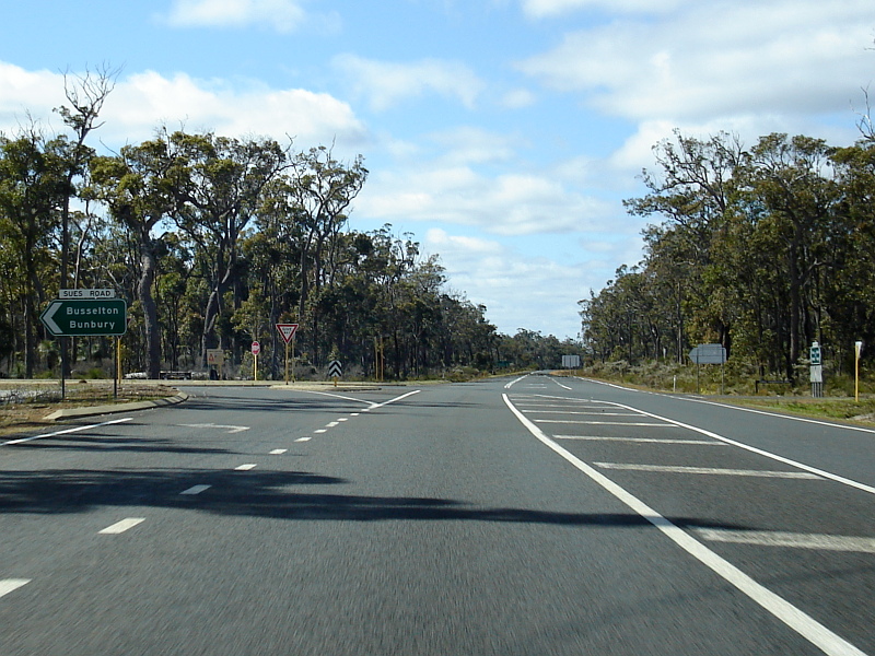 |
Sues & Chester Roads Intersection: Eastbound through the junction of Sues Road and Chester Road at Darradup. September 2008. Image © Paul Rands |
 |
Advance Directional Sign: Advance directional sign on Stewart Rd at Biddelia approaching Vasse Hwy (SR10), April 2011. Image © Peter Renshaw |
|
 |
Advance Directional Sign: Southbound AD sign on Chester Road as you approach Brockman Highway (SR10) at Darradup. August 2008. Image © Paul Rands |
 |
Distance Sign: RD sign at Biddelia, April 2011. Image © Peter Renshaw |
|
 |
Intersection Directional Sign: ID sign facing traffic from Chester Road near Nillup & Darradup. April 2011. Image © Peter Renshaw |
 |
Advance Directional Sign: AD sign at Darradup approaching Stewart Rd, April 2011. Image © Peter Renshaw |
|
 |
Distance Sign: Eastbound RD sign after the Chester Road intersection at Darradup. April 2011. Image © Peter Renshaw |
 |
Advance Directional Sign: AD sign at Darradup on Stewart Rd, approaching Brockman Hwy (SR10), April 2011. Image © Peter Renshaw |
|
 |
Advance Directional Sign: AD sign at Darradup approaching Stewart Rd, April 2011. Image © Peter Renshaw |
 |
Brockman Highway: Intersection directional sign facing Stewarts Rd at Darradup, April 2011. Image © Peter Renshaw |
|
 |
Distance Sign: RD sign at Darradup after Stewarts Rd, April 2011. Image © Peter Renshaw |
 |
Distance Sign: RD sign at Darradup after Stewarts Rd, April 2011. Image © Peter Renshaw |
|
 |
Welcome Sign: Tourist based welcome sign as you enter Nannup, just a few hundred metres from the Vasse Highway (SR104 / SR10) intersection. August 2008. Image © Paul Rands |
 |
Trailblazer: SR10 trailblazer at Karridale, April 2011. Image © Peter Renshaw |
|
 |
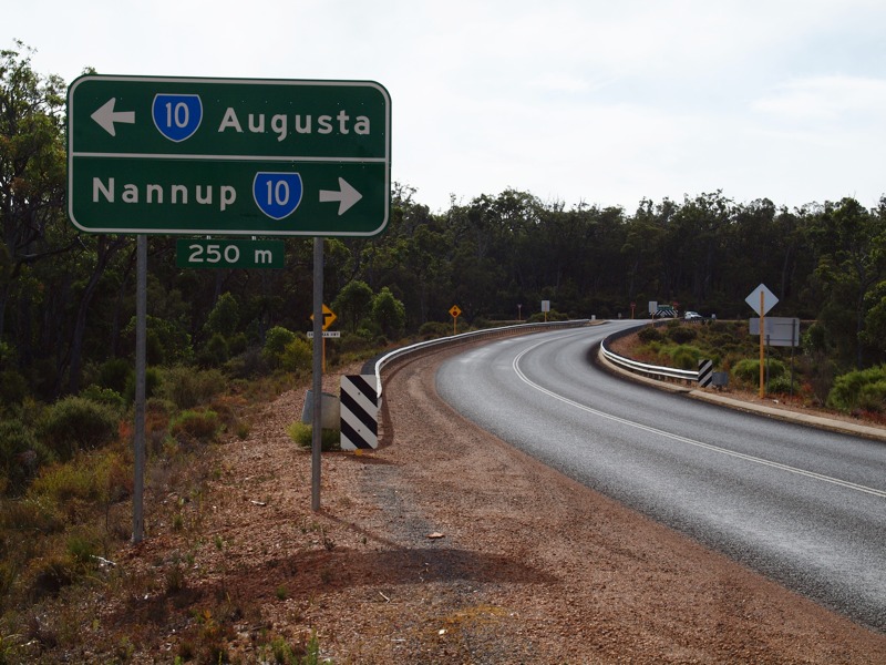
Advance Directional Sign: AD sign on Brockman Hwy (SR10) as you approach the junction with Vasse Hwy (SR10 / SR104) at Nannup. September 2008. Image © Paul Rands |
 |
Advance Directional Sign: AD sign on Brockman Hwy (SR10) approaching Bussell Hwy (SR10) at Karridale, April 2011. Image © Peter Renshaw |
|
 |
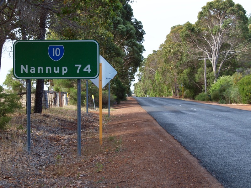
Distance Sign: Southbound RD sign on Vasse Hwy, located after the terminus of SR104 (Vasse Hwy) and the junction with Brockman Hwy (SR10), July 2008. Image © Paul Rands |
|||
 |
Distance Sign: RD sign at Biddelia after Stewarts Rd, April 2011. Image © Peter Renshaw |
|||
 |
Donnelly River: Vasse Hwy (SR10) as it crosses the Donnelly River at Peerabeelup. September 2008. Image © Paul Rands |
|||
 |
Peerabeelup: Vasse Hwy as it passes the resort area near Hopgarden Rd in Yeagarup. September 2008. Image © Paul Rands |
|||
 |
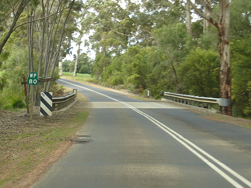
Old Vasse Road Junction: Vasse Hwy as it passes Old Vasse Road at Yeagarup. SR10 is crossed 3 times by this former main road. September 2008. Image © Paul Rands |
|||
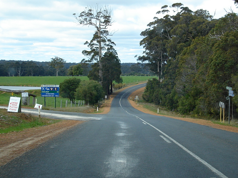 |
Channybearup Road Intersection: Vasse Highway at Yeagarup approaching Channybearup Road. September 2008. Image © Paul Rands |
|||
 |
Old Vasse Road: Approaching the intersection with Old Vasse Road at Yeagarup, near Pemberton. September 2008. Image © Paul Rands |
|||
 |
Advance Directional Sign: AD sign on the SR10 section of Vasse Hwy approaching Pemberton-Northcliffe Road (SR10) and the unnumbered segment of Vasse Hwy at Pemberton. April 2011. Image © Peter Renshaw |
|||
 |
Approaching Vasse Highway / Pemberton-Northcliffe Road: Looking southeast on Vasse Highway at Pemberton, approaching the intersection of Vasse Highway and Pemberton-Northcliffe Road. State Route 10 turns right at this intersection. July 2008. Image © Paul Rands |
|||
 |
Vasse Highway / Pemberton-Northcliffe Road Junction: Looking southeast on Vasse Highway at Pemberton, at the intersection of Vasse Highway and Pemberton-Northcliffe Road. State Route 10 turns right at this intersection. April 2011. Click here for a photo of this junction from July 2008. Image © Peter Renshaw |
|||
 |
Advance Directional Sign: AD sign on the unnumbered section of Vasse Hwy approaching Pemberton-Northcliffe Road (SR10) and the numbered segment of Vasse Hwy (SR10) at Pemberton. September 2008. Image © Peter Renshaw |
|||
 |
Pemberton-Northcliffe Rd / Vasse Hwy Junction: Unnumbered section of Vasse Hwy meeting the SR10 segment of Vasse Hwy and Pemberton-Northcliffe Rd (also SR10) at Pemberton. September 2008. Image © Paul Rands |
|||
 |
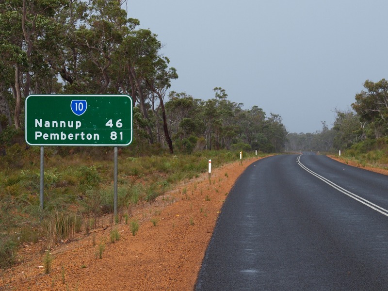
DIstance Sign: RD sign located after the Vasse Hwy / Pemberton-Northcliffe Rd intersection at Pemberton. This sign is located on Pemberton-Northcliffe Road as you leave Pemberton. September 2008. Image © Paul Rands |
|||
 |
Old Vasse Road: Pemberton-Northcliffe Rd (SR10) as it approaches the junction to Old Vasse Rd at Callcup. September 2008. Image © Paul Rands |
|||
 |
Old Vasse Road Intersection: Pemberton-Northcliffe Rd (SR10) as it passes the Old Vasse Rd intersection in Callcup. September 2008. Image © Paul Rands |
|||
 |
Warren River: SR10 as it crosses the Warren River at Callup. September 2008. Image © Paul Rands |
|||
 |
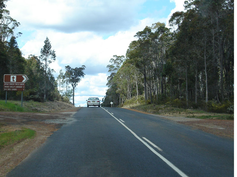
Typical Conditions in the Callcup Area: Pemberton-Northcliffe Road as it travels through the forests around Callcup. September 2008. Image © Paul Rands |
|||
 |
Rosemary Road Intersection: Approaching the level crossing and Rosemary Road at Crowea. September 2008. Image © Paul Rands |
|||
 |
Tramway Crossing: Tram crossing at Crowea. September 2008. Image © Paul Rands |
|||
 |
Entering Northcliffe: SR10 as it enters the town of Northcliffe. September 2008. Image © Paul Rands |
|||
 |
Trailblazer: Incorrect arrow on this eastbound trailblazer on Zamia Street (Pemberton-Northcliffe Road) in Northcliffe. September 2008. Image © Paul Rands |
|||
 |
Advance Directional Sign: Non standard AD sign approaching Wheatley Coast Road in Northcliffe. September 2008. Image © Paul Rands |
|||
 |
Wheatley Coast Road Intersection: Sign assembly on the corner of Pemberton-Northcliffe Rd (Zamia St), Muirillup Rd and Wheatley Coast Rd at Northcliffe. September 2008. Image © Paul Rands |
|||
 |
Advance Directional Sign: Non standard AD sign approaching the the intersection of Wheatley Coast Rd and Middleton Rd in Northcliffe. Despite the lack of route numbering, SR10 turns right at this junction. September 2008. Image © Paul Rands |
|||
 |
Gardner River: Looking east on Middleton Rd as you cross the Gardner River at Northcliffe. September 2008. Image © Paul Rands |
|||
 |
Typical Conditions at Northcliffe: This stretch of Middleton Rd is indicative of the rest of the route through Northcliffe, September 2008. Image © Paul Rands |
|||
 |
Gardner River: Looking east on Middleton Rd as you cross the eastern branch of the Gardner River at Northcliffe. September 2008. Image © Paul Rands |
|||
 |
Deaside Coast Road Intersection: Middleton Rd at the junction with Deaside Coast Rd in Shannon, September 2008. Image © Paul Rands |
|||
 |
State Route 10 Southern Terminus: Intersection directional sign assembly on the South Western Hwy (NR1) facing traffic travelling northest on Middleton Rd in Shannon, September 2008. Image © Paul Rands |
|||
| Click here for the continuation of State Route 10 between Busselton and Augusta | ||||
1 Main Roads WA
Last updated: 11-Sep-2016 23:10
This site © Paul Rands. All rights reserved. Some portions © (copyright) by their respective and credited owners. Permission must be obtained before using any images from this site. For details, please email by clicking here.