|
|
|
|
|
| Robertson Dr, Bussell Hwy, Busselton Bypass, Brockman Hwy, Vasse Hwy, Pemberton-Northcliffe Rd, Wheatley Coast Rd & Middleton Rd (State Route 10) - Bunbury to Capel |
Statistics:
Route Numbering:

General Information:
State Route 10 is a connector route for the southwest region of Western Australia. It connects Bunbury to towns further south and south east filling the gap that isn't covered by National Route 1.
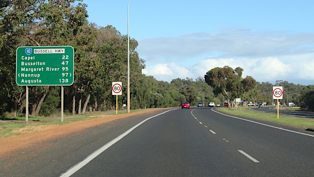
The route is most rural highway standard, with some divided 4 lane sections between Bunbury and Busselton. The Bussell Highway section of SR10 was named after the Bussell family, some of the region's first settlers. The Bussell Highway forms the main route servicing the coastal strip betwen Bunbury and Augusta. The road between Busselton and Margaret River is used on average by more than 4000 vehicles per day, with significantly more during summer and holiday periods. 1
SR10 extends beyond Busselton to Margaret River and eventually Augusta, near the southwestern most tip of Australia's mainland. About 20 km north of Augusta, SR10 also branches off and is part of the Brockman Highway, which travels in a south easterly direction eventually connecting with the Vasse Hwy which also forms part of the route between Pemberton and Nannup.
History:
| Bunbury to Capel | Capel to Bunbury | |||
| Preview: | Description: | Preview: | Description: | |
 |
AD Sign: Advance directional sign approaching Robertson Drive (South Western Hwy (SR10 / NR1) from Picton Road (SR20 / 107) at Glen Iris in Bunbury. December 2007. Image © Paul Rands |
 |
Dual Carriageway Ahead Sign: Image © Paul Rands |
|
 |
Reassurance Directional Sign: Distance sign at Davenport, April 2016. Image © Paul Rands |
 |
Start Dual Carriageway: Looking northbound at the beginning of the dual carriageways from Capel to Bunbury. December 2007. Image © Paul Rands |
|
 |
Supplemental Advance Directional Signs: Supplemental AD signs at College Grove approaching Bussell Hwy, April 2016. Image © Paul Rands |
 |
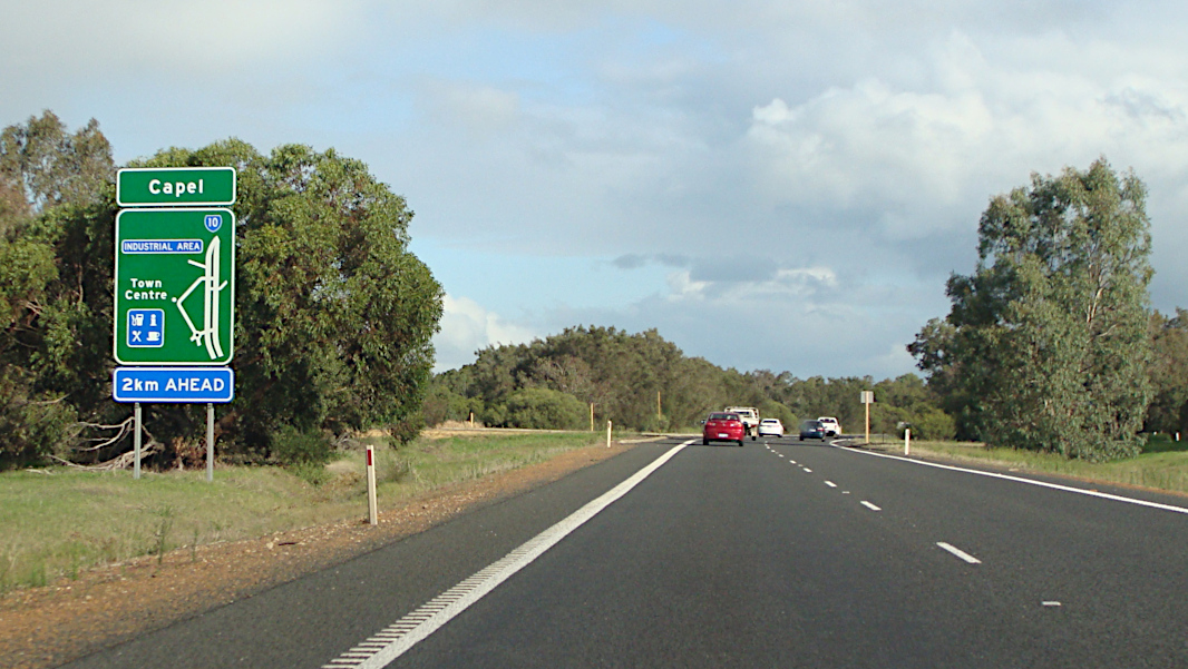
Services Sign: Services sign entering Capel. December 2007. Image © Paul Rands |
|
 |
Advance Directional Sign: AD sign at College Grove approaching the South West Health Campus, April 2016. Image © Paul Rands |
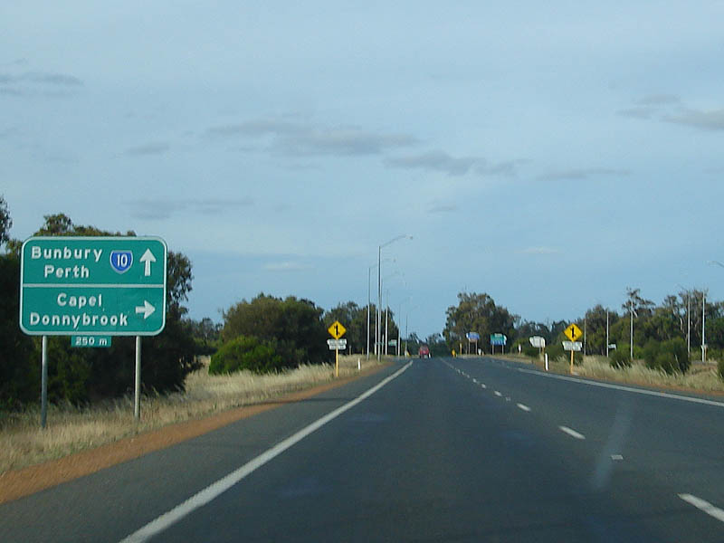 |
Advance Directional Sign: Sign approaching Capel Drive at Capel. December 2007. Image © Paul Rands |
|
 |
Advance Directional Signs: AD sign at College Grove approaching Bussell Hwy, April 2016. Image © Paul Rands |
 |
Capel Drive Intersection: Northbound carriageway as it passes through the Capel Dr intersection. December 2007. Image © Paul Rands |
|
 |
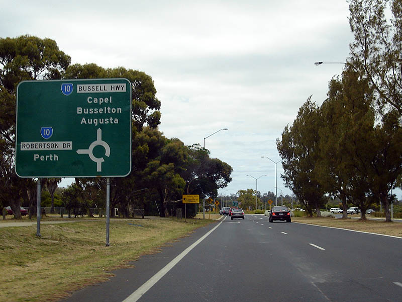
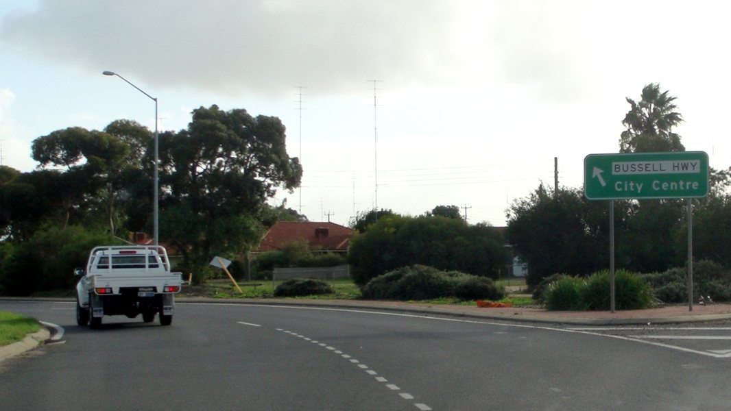
Intersection Directional Sign: ID sign on the roundabout with Bussell Hwy at College Grove, April 2016. SR10 changes name to Bussell Hwy at this location. Image © Paul Rands |
 |
Capel River: Crossing the Capel River at Capel. December 2007. Image © Paul Rands |
|
 |
Advance Directional Sign: Southbound AD un the unnumbered section of Bussell Hwy in Carey Park, approaching Robertson Dr / Bussell Hwy. December 2007. Image © Paul Rands |
 |
Capel Drive: Corner of Bussell Hwy (SR10) and Capel Dr at Capel, April 2016. Image © Paul Rands |
|
 |
Robertson Drive Roundabout: Perth exit on the SR10 roundabout at Carey Pk. December 2007. Image © Paul Rands |
 |
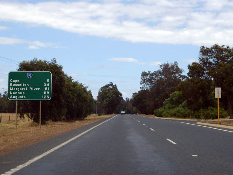
Distance Sign: RD sign after Capel Drive and Capel River at Capel. April 2016. Click here for a photo of this location by Paul Rands from December 2007. Image © Paul Rands |
|
 |
Distance Sign: RD sign as you head southbound at College Grove, just after the roundabout, April 2016. Image © Paul Rands |
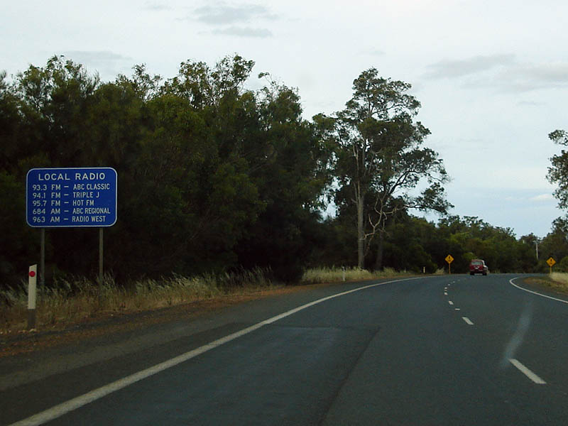 |
Radio Stations Sign: Sign indicating the radio frequencies in the Bunbury area. December 2007 at Elgin. Image © Paul Rands |
|
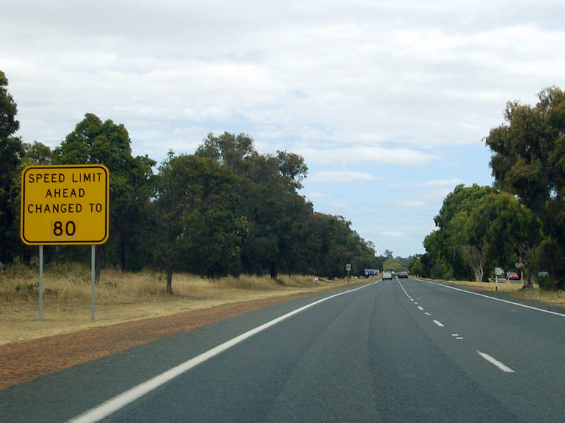 |
Speed Limit Changed Sign: Temporary warning sign indicating the speed limit has been changed to 80 km/h through the College Grove area, December 2007. Image © Paul Rands |
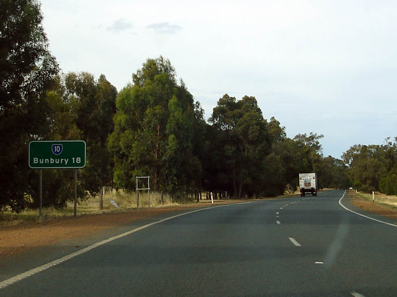 |
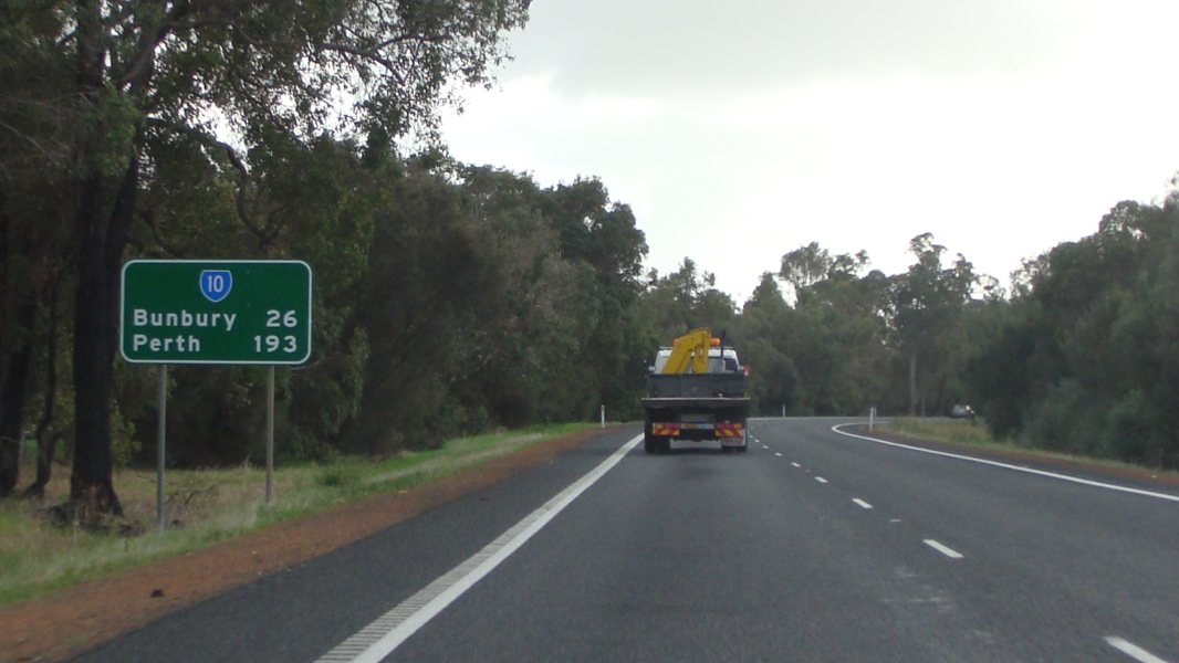
Distance Sign: Northbound RD sign at Elgin. December 2007. Image © Paul Rands |
|
 |
Distance Sign: Southbound RD sign after the Dalyellup turnoff. December 2007. Image © Paul Rands |
 |
Speed Change Warning: Sign indicating speed change at Dalyellup, April 2016. Image © Paul Rands |
|
 |
Reassurance Marker: Southbound trailblazer in the Dalyellup area, December 2007. Image © Paul Rands |
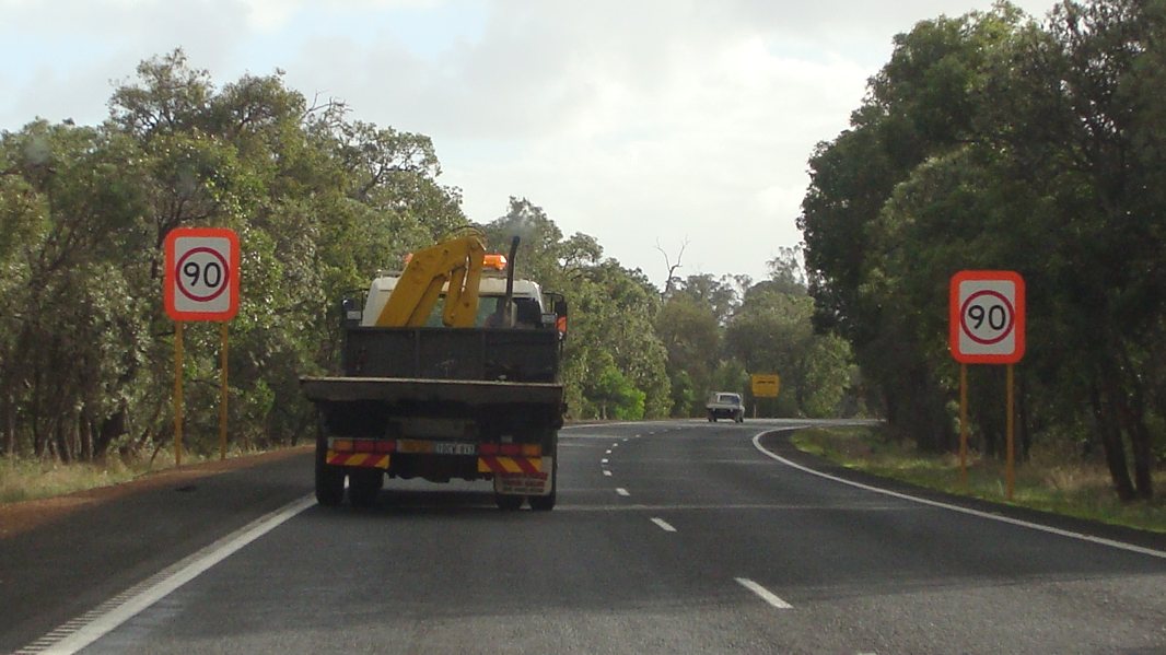 |
Entering 90km/h Zone: Special emphasised speed limit signs at Dalyellup, April 2016. Image © Paul Rands |
|
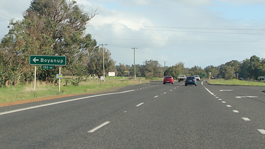 |
Advance Directional Sign: AD sign at Stratham approaching Boyanup West Rd, April 2016. Image © Paul Rands |
 |
City of Bunbury Sign: Council boundary signage at Dalyellup. December 2007. Image © Paul Rands |
|
 |
Trailblazer: Trailblazer at Stratham, April 2016. Image © Paul Rands |
 |
Roadwise Sign: Sign indicating local authorities working with road safety committees. December 2007 in Usher. Image © Paul Rands |
|
 |
Roberts Road: Corner of Bussell Hwy (SR10) and Roberts Rd at Stratham, April 2016. Image © Paul Rands |
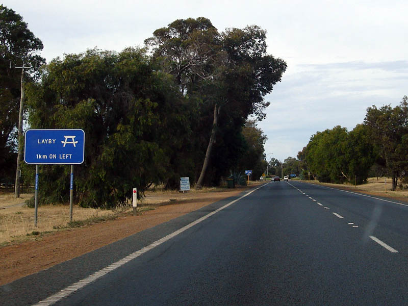 |
Lay By / Rest Area Sign: Signage indicating a rest area ahead at Usher. December 2007. Image © Paul Rands |
|
 |
Bypassed Town Sign: Bypassed town sign at Elgin approaching Capel Dr, April 2016. Image © Paul Rands |
 |
Advance Directional Sign: AD sign at Withers approaching South West Health Campus, April 2016. Image © Paul Rands |
|
 |
Services Sign: Services sign for Capel as you pass through Elgin, December 2007. Image © Paul Rands |
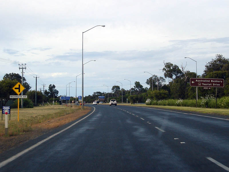 |
Approaching Washington Av: Northbound carriageway as it approaches Washington Avenue at Withers. December 2007. Image © Paul Rands |
|
 |
Advance directional Sign: Southbound approaching the junction with Capel Drive and Halls Road at Capel, April 2016. Click here for a photo of this location by Paul Rands from December 2007. Image © Paul Rands |
 |
Washington Avenue Intersection: Passing through the Washington Av junction at Withers. December 2007. Image © Paul Rands |
|
 |
Capel Drive and Halls Road Intersection: Southbound the intersection with Capel Drive and Halls Road at Capel, December 2007. Image © Paul Rands |
 |
Supplementary AD Sign: Approaching the Robertson Drive intersection at Withers. April 2016. Image © Paul Rands |
|
 |
Capel River: Southbound carriageway over the Capel River at Capel, December 2007. SR10 is mostly dual carriageway between Bunbury and Busselton. Image © Paul Rands |
 |
AD Sign: Advance directional sign approaching the Robertson Dr intersection at Withers. April 2016. SR10 turns right here. Image © Paul Rands |
|
 |
Approaching Capel Drive: Southbound approaching the southern end of Capel Drive on the Capel Bypass, December 2007. Image © Paul Rands |
 |
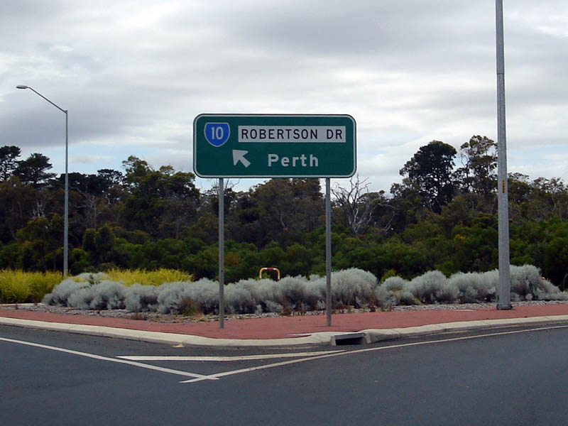
ID Sign: Intersection directional sign at Robertson Dr, as the unnumbered section of the Bussell Highway heads to the Bunbury city centre at Withers. April 2016. Image © Paul Rands |
|
 |
Advance Directional Sign: AD sign on Capel Dr at Capel approaching Bussell Hwy (SR10), April 2016. Image © Paul Rands |
 |
ID Sign: Robertson Dr ID sign at the roundabout in Carey Park. December 2007. Image © Paul Rands |
|
 |
Intersection Directional Sign: ID sign assembly facing Capel Dr at Capel, April 2016. Image © Paul Rands |
 |
Distance Sign: Eastbound RD sign at Carey Park near Underwood Street. December 2007. Image © Paul Rands |
|
 |
Distance Sign: Southbound RD sign after Capel Drive (southern end) at Capel. December 2007. Image © Paul Rands |
 |
Advance Directional Sign: AD sign for th Robertson Drive / South Western Highway intersection at Carey Park. This section of the SR10 is duplexed with NR1. December 2007. Image © Paul Rands |
|
 |
Approaching Tuart Drive: AD sign for Tuart Drive in Capel, December 2007. Image © Paul Rands |
 |
Signals Ahead Sign: Unusual red signals ahead warning sign as you approach the level crossing on Robertson Drive / Bunbury Bypass at Davenport - this is the main Bunbury to Perth railway line. December 2007. Image © Paul Rands |
|
 |
Tuart Drive Intersection: Southbound through the Tuart Drive intersection. December 2007. Image © Paul Rands |
 |
Level Crossing: The level crossing on Robertson Drive / Bunbury Bypass at Davenport - this is the main Bunbury to Perth railway line. December 2007. Image © Paul Rands |
|
 |
AD Sign: Advance directional sign approaching the Picton Road / South Western Highway (SR20) intersection at Glen Iris, December 2007. Image © Paul Rands |
|||
 |
Picton Rd / South Western Hwy intersection: Image © Paul Rands |
|||
| Click here for the continuation of SR10 between Capel and Busselton | ||||
1 Main Roads WA
Last updated: 19-Jan-2019 17:09
This site © Paul Rands. All rights reserved. Some portions © (copyright) by their respective and credited owners. Permission must be obtained before using any images from this site. For details, please email by clicking here.