|
|
|
|
|
 |
Coolgardie-Esperance Highway, Roe Highway, Great Eastern Highway Bypass & Great Eastern Highway (National Highway 94) - Sawyers Valley to Northam - Former Alignment: Northam |
Statistics:
Route Numbering:


General Information:
National Highway 94 is a major route in WA, directly linking the capital city of Perth with the mining and goldfield regions in the eastern part of the state, such as Kalgoorlie and Norseman, it also connects to National Highway 1, the Eyre Highway, which is the major link, via the Nullarbor Plain between the east and west coasts of Australia.
Outside of Perth, the route is bitumen paved single carriageway roadway. Some overtaking lanes exist along the route between Coolgardie and Perth's outer suburbs. Inside the metropolitan area, the route varies from mutli-lane arterial road to expressway standard.
The National Route 1 multiplex starts at Causeway at Burswood and ends at the intersection of Great Eastern Highway in Guildford. The State Route 3 multiplex starts at Great Eastern Highway, travels along Roe Highway before the multiplex ends at the traffic signals on the corner of Roe Highway and Great Eastern Highway Bypass at Hazelmere.
The highway generally runs parallel with the Mundaring to Kalgoorlie water pipeline, which pipes drinking water drawn from Mundaring Weir near Perth to Kalgoorlie.
This page looks at the bypassed section of highway in the Northam area.
Prior to the Northam Bypass being built, the Great Eastern Hwy passed through the centre of the town with heavy vehicles having to negotiate the main shopping area, including two railway crossings, four right angle turns and many busy intersections. These vehicles included B-Doubles and truck/trailer combinations up to 67.5 tonnes. The primary aim of the bypass was to divert through-traffic away from the townsite. 2
The Northam Bypass involved construction of a new road approximately 14.9 km long including eight bridges - 2 over rivers, 2 over railways and 4 over existing roads. The bypass starts from the old Great Eastern Highway to the west of Northam near the entrance to the Army camp. Passing north-east, it crosses the Northam-Toodyay Road via an overpass north-west of the Colebatch Road intersection and follows an alignment between the town wastewater treatment ponds and the cemetery. It is then carried on a 230-metre bridge over the standard gauge railway line, Avon River and Katrine Road. From Katrine Road, the bypass continues in a north-easterly direction, passing over the Irishtown Road before heading east to cross over the Northam-Pithara Road to the north of the airstrip. From the Northam-Pithara Road back to the existing Great Eastern Highway, the bypass follows a south-easterly alignment, passing north of the racecourse and a road train assembly area. The bypass route connects with the pre-existing highway east of the Katrine Highway. 2
History:

| Preview: | Description: |
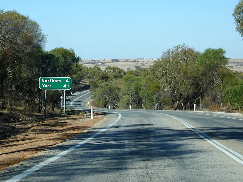 |
Distance Sign: RD sign on Mitchell Av at Northam, April 2009. Image © Paul Rands |
 |
Entering Northam: Mitchell Avenue (former highway) entering the town of Northam, April 2009. Image © Paul Rands |
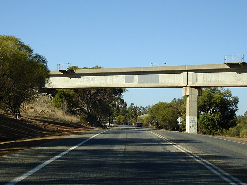 |
Railway Overpass: Mitchell Av as it passes under the railway at Northam, April 2009. Image © Paul Rands |
 |
Welcome Sign: Welcome sign on Mitchell Av in Northam, April 2009. Image © Paul Rands |
 |
Advance Directional Sign: AD sign showing remnant NH94 shield approaching Newcastle Rd (SR120) at Northam, April 2009. Image © Paul Rands |
 |
Intersection Directional Sign: ID sign and black fingerboards at the corner of Mitchell Av and Newcastle Rd at Northam, April 2009. Image © Paul Rands |
 |
Avon River: Newcastle Rd as it crosses Avon River, November 2008. Image © Paul Rands |
 |
Advance Directional Sign: AD sign with remnant NH94 shield at Northam on Newcastle Rd approaching Fitzgerald St and Gairdner St, November 2008. Image © Paul Rands |
 |
Intersection Directional Sign: ID sign with remnant NH94 shield at Northam at the corner of Newcastle Rd, Fitzgerald St and Gairdner St, November 2008. Image © Paul Rands |
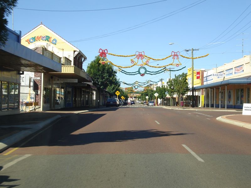 |
Northam Town Centre: Fitzgerald Street in the Northam CBD, November 2008. Image © Paul Rands |
 |
Black Advance Directional Sign: Black AD sign with remnant NH94 shield on Fitzgerald St approaching the junction with Peel Tce and Taylor St, November 2008. Image © Paul Rands |
 |
Advance Directional Sign: AD sign with remnant NH94 shield on Peel Tce (SR120) approaching Yilgarn Av in Northam, November 2008. Image © Paul Rands |
 |
Yilgarn Avenue Intersection: Corner of Peel Tce and Yilgarn Av in Northam, November 2008. Image © Paul Rands |
 |
Services Sign: Services sign for Road Train Assembly Area, Yilgarn Av in Northam, April 2018. Image © Paul Rands |
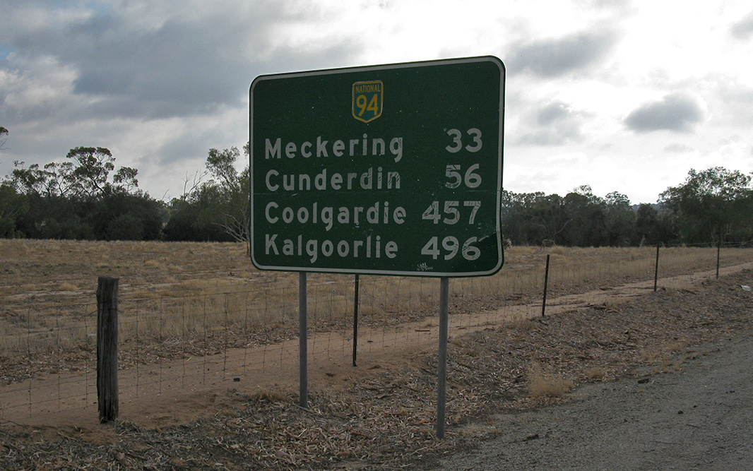 |
Reassurance Directional Sign: Distance sign with remnant NH94 shield on Yilgarn Av in Northam, April 2018. Image © Paul Rands |
1 UBD Concise Motoring Atlas of Australia, 3rd Edition, published by Universal Publishers Pty Ltd. ISBN 978-0-7319-2081-5.
2 Bureau of Transport and Regional Economics, Ex-post economic evaluation of National Highway projects, Case study 2: Northam Bypass Working paper 70.2
3 State Library of WA
Last updated: 20-Jul-2020 12:47
This site © Paul Rands. All rights reserved. Some portions © (copyright) by their respective and credited owners. Permission must be obtained before using any images from this site. For details, please email by clicking here.