|
|
|
|
|
| M3 | Eastern Freeway & Eastlink (M3) - Wantirna to Noble Park |
Statistics:
Route Numbering:
General Information:
M3 is a motorway standard route in Melbourne's eastern and south eastern suburbs, linking the Melbourne CBD with the Mornington Peninsula. The Eastern Freeway is untolled, however the Eastlink section of M3, from Nunawading to Seaford uses an electronic distance based tolling system.
Eastlink:
Eastlink is made up of the Eastern Freeway Extension, Ringwood Bypass and Scoresby Freeway. 1
The Eastlink section of the route features 17 interchanges and also twin tunnels at Donvale / Ringwood, under the Mullum Mullum valley - the Melba Tunnel and the Mullum Mullum Tunnel. Each tunnel is 1.6km long, contain three lanes that are 3.5m wide with a height clearance for vehicles of 4.65m. The tunnels have a gradient of up to 5.5% and are located up to 53m from surface level. 2
The route also features 3 traffic lanes in each direction for 33km from the Eastern Freeway to Thompson Road at Carrum Downs, and also has 103 structures, including 88 bridges. 3
History:
Click here for construction photos of Eastlink around the Burwood Highway area at Wantirna
| Noble Park to Wantirna | Wantirna to Noble Park | |||
| Preview: | Description: | Preview: | Description: | |
 |
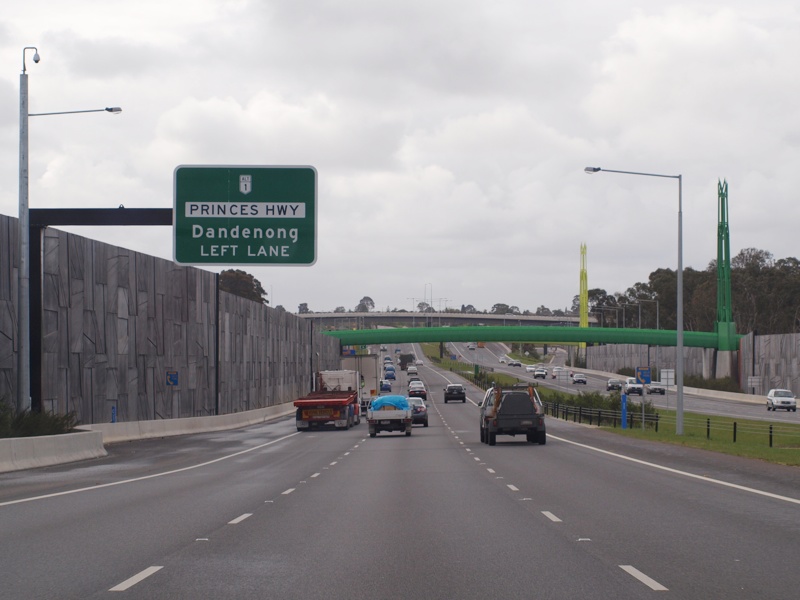
Advance Directional Sign: AD sign at Noble Park for the interchange with Princes Hwy (ALT-NR1), September 2009. Image © Rob Tilley |
 |
Advance Directional Sign: AD sign at Wantirna South for the High Street Road (MR24) interchange, June 2016. Image © Rob Tilley |
|
 |
Supplemental AD Sign: Supplemental advance directional sign approaching the interchange with Princes Hwy (ALT-NR1) at Noble Park, September 2009. Image © Rob Tilley |
 |
Supplemental Advance Directional Sign: Supplemental AD sign at Wantirna South for the High Street Road (MR24) interchange, June 2016. Image © Rob Tilley |
|
 |
E-Tag Signage: Sign showing where to obtain travel passes and e-tags to use with Eastlink and other tolled roads in Melbourne, Noble Park, September 2009. Image © Rob Tilley |
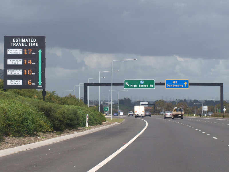 |
Travel Time Indicator: Sign showing driving times to selected interchanges. The green bar changes colour depending of traffic densities, Wantirna South, near High Street Road (MR24), September 2009. Image © Rob Tilley |
|
 |
Princes Highway Interchange: Northbound through the interchange with Princes Hwy at Noble Park, September 2009. Image © Rob Tilley |
 |
High Street Road Interchange: Looking southeast at Wantirna South, June 2016. Image © Rob Tilley |
|
 |
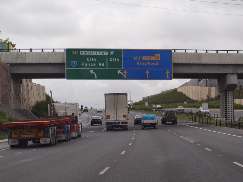
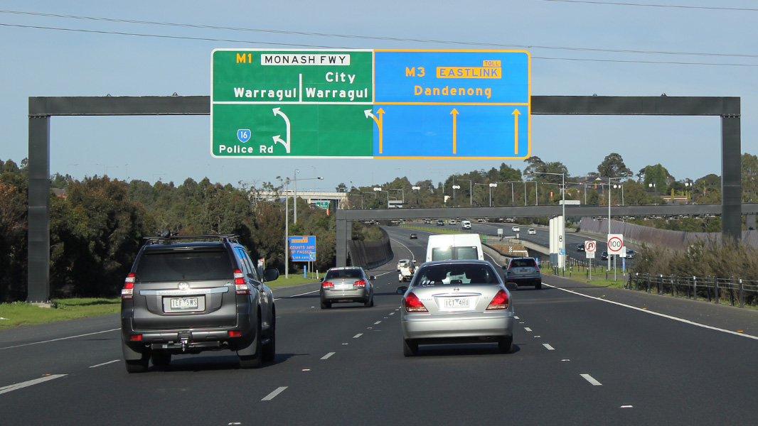
Advance Directional Sign & VMS: AD sign for the interchange with Monash Fwy (M1) and Police Rd (MR16), plus a variable message sign, Dandenong North, September 2009. Image © Rob Tilley |
 |
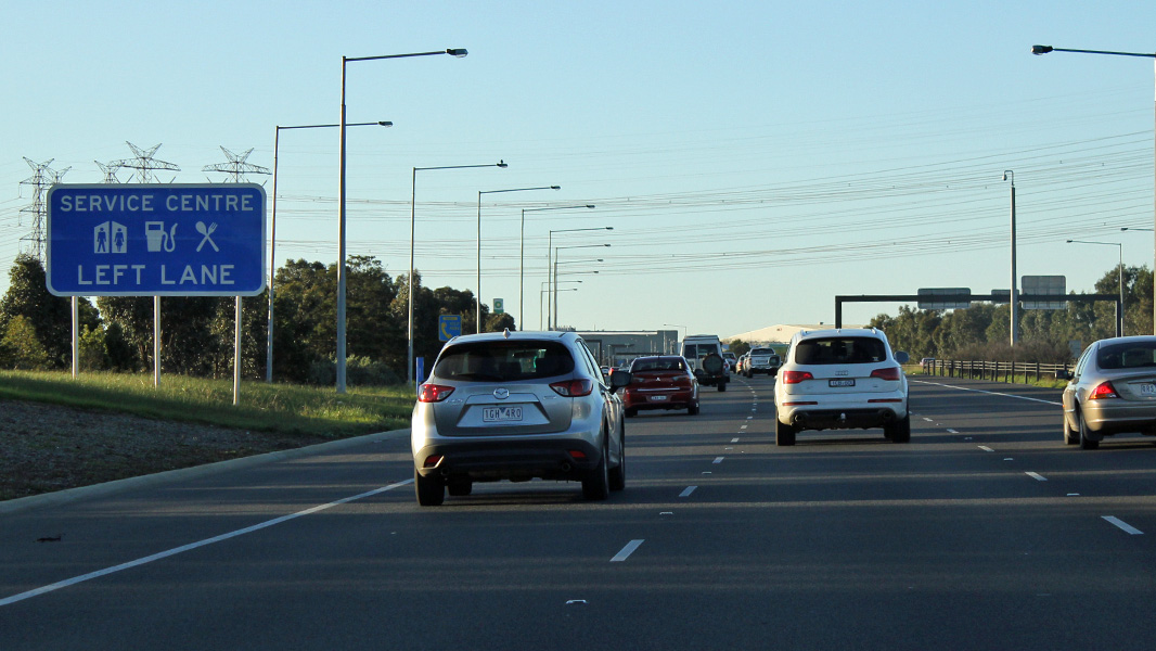
Advance Directional Sign: AD sign at Wantirna South for the Scoresby Service Centre, June 2016. Image © Rob Tilley |
|
 |
Travel Time Indicator: Sign showing driving times to selected interchanges. The green bar changes colour depending of traffic densities, Dandenong North, near Halton Road, September 2009. Image © Rob Tilley |
 |
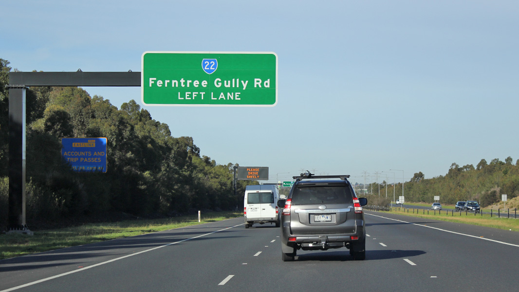
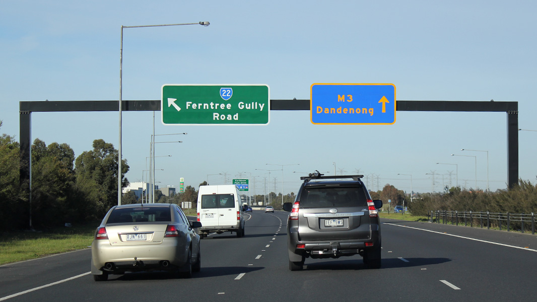
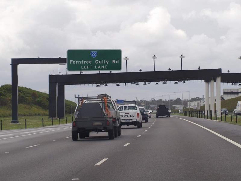
Advance Directional Sign: AD sign on the George St overpass at Wantirna South, for the Ferntree Gully Road (MR22) interchange, June 2016. Image © Rob Tilley |
|
 |
Advance Directional Sign: AD sign on the Halton Rd overpass at Dandenong North, for the interchange with Monash Fwy (M1) and Police Rd (MR16), September 2009. Image © Rob Tilley |
 |
Supplemental Advance Directional Sign: Supplemental AD sign for the Ferntree Gully Road (MR22) interchange, Scoresby, June 2016. Image © Rob Tilley |
|
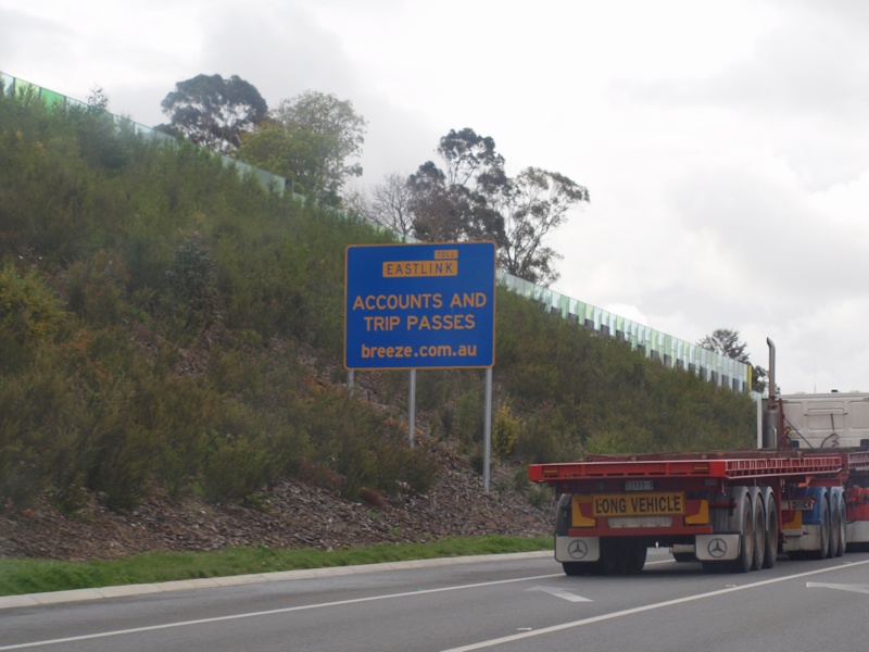 |
E-Tag Signage: Sign showing where to obtain travel passes and e-tags to use with Eastlink and other tolled roads in Melbourne, Dandenong North, September 2009. Image © Rob Tilley |
 |
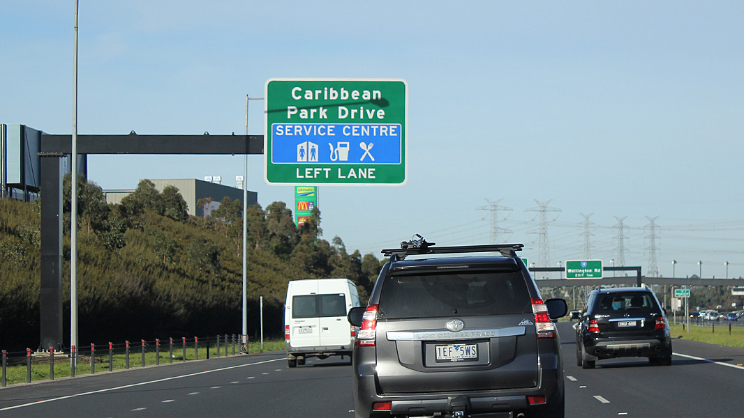
Advance Directional Sign: AD sign at Scoresby approaching Carribean Dr, January 2017. Click here for a photo by Rob Tilley of this location from June 2016 Image © Huang Milton Collection |
|
 |
Monash Fwy / Police Rd Interchange: Intersection directional sign over the lanes at the Monash Freeway (M1) and Police Road (MR16) interchange, Dandenong North, September 2009. Image © Rob Tilley |
 |
Ferntree Gully Road Interchange: Southbound through the Ferntree Gully Road (MR22) interchange at Scoresby, June 2016. Image © Rob Tilley |
|
 |
Monash Fwy Interchange: Northbound through the Monash Fwy interchange, Dandenong North, September 2009. Image © Rob Tilley |
 |
Advance Directional Sign: AD sign at Scoresby approaching Carribean Park Dr, June 2016. Image © Rob Tilley |
|
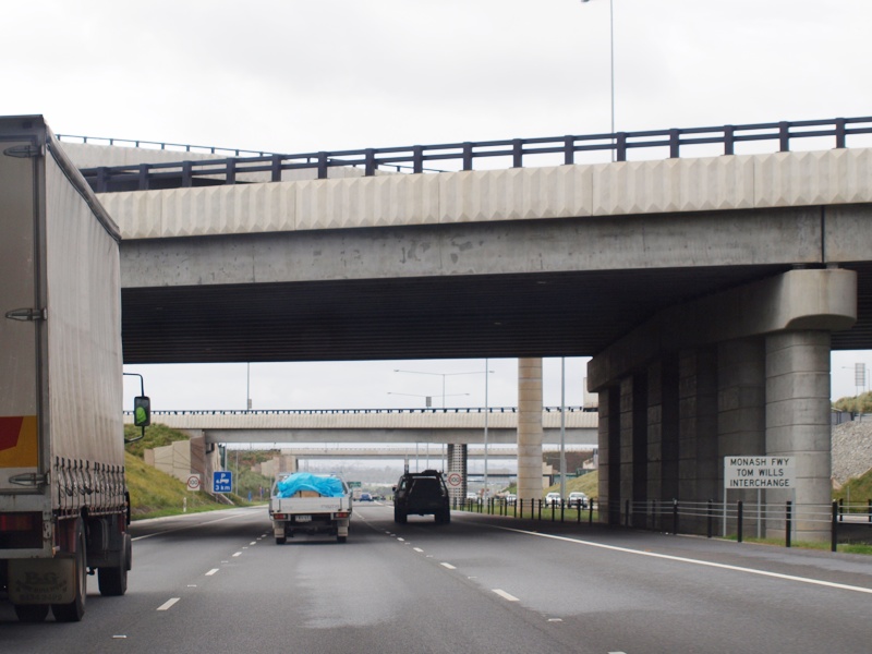 |
Monash Fwy Interchange: Northbound through the Monash Fwy interchange, Dandenong North, September 2009. Image © Rob Tilley |
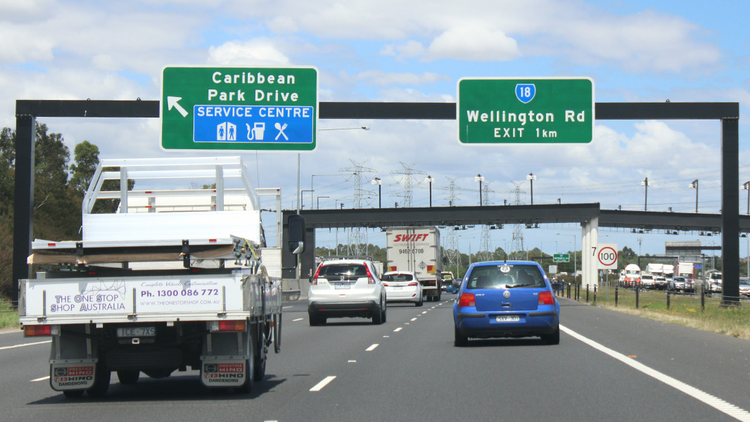 |
AD Sign: Advance directional sign at Scoresby for Wellington Road (MR18) interchange, January 2017. Click here for a photo by Rob Tilley of this location friom September 2009. Image © Huang Milton Collection |
|
 |
Advance Directional Sign: Service centre AD sign at Dandenong North, June 2016. Image © Rob Tilley |
 |
Supplemental AD Sign: Supplemental advance directional sign at Rowville approaching Wellington Road (MR18) interchange, June 2016. Image © Rob Tilley |
|
 |
AD Sign: Advance directional sign at Mulgrave for Wellington Road (MR18) interchange, September 2009. Image © Rob Tilley |
 |
Wellington Road Interchange: Looking southwest at Rowville, January 2017. Click here for a photo by Rob Tilley of this location from September 2009. Image © Huang Milton Collection |
|
 |
Supplemental AD Sign: Supplemental advance directional sign at Rowville approaching Wellington Road (MR18) interchange, September 2009. Image © Rob Tilley |
 |
Advance Directional Sign: Large diagrammatic AD sign at the Wellington Road interchange in Rowville for the interchange with Monash Fwy (M1) and Police Rd (MR16), June 2016. Image © Rob Tilley |
|
 |
Wellington Road Interchange: Looking northeast at Rowville, September 2009. Image © Rob Tilley |
 |
Supplemental AD Sign: Supplemental advance directional sign at Mulgrave approaching Monash Fwy (M1) and Police Rd (MR16), June 2016. Image © Rob Tilley |
|
 |
Advance Directional Sign: Service centre advance directional sign at Rowville near Wellington Rd (MR18), June 2016. Image © Rob Tilley |
 |
Police Road Exit: The off ramp to Police Road (MR16) at Mulgrave, June 2016. Image © Rob Tilley |
|
 |
Advance Directional Sign: Service centre advance directional sign at Rowville near Wellington Rd (MR18), June 2016. Image © Rob Tilley |
 |
Supplemental AD Sign: Supplemental advance directional sign at Dandenong North approaching Monash Fwy (M1), June 2016. Image © Rob Tilley |
|
 |
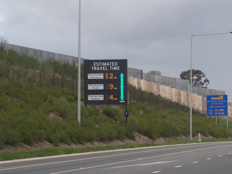
Travel Time Indicator: Sign showing driving times to selected interchanges. The green bar changes colour depending of traffic densities, Rowville, September 2009. Image © Rob Tilley |
 |
Monash Freeway Exit: Exit to Monash Fwy (M1) at Dandenong North, June 2016. Image © Rob Tilley |
|
 |
Advance Directional Sign: AD sign for the Ferntree Gully Road (MR22) interchange, Scoresby, June 2016. Click here for a photo by Rob Tilley of this location from September 2009. Image © Rob Tilley |
 |
Travel Time Indicator: Sign showing driving times to selected interchanges. The green bar changes colour depending of traffic densities, Dandenong North, September 2009. Image © Rob Tilley |
|
 |
Supplemental Advance Directional Sign: Supplemental AD sign for the Ferntree Gully Road (MR22) interchange, Scoresby, June 2016. Click here for a photo by Rob Tilley of this location from September 2009. Image © Rob Tilley |
 |
Advance Directional Sign: AD sign at Dandenong North for the interchange with Princes Hwy (ALT-NR1), June 2016. Image © Rob Tilley |
|
 |
Ferntree Gully Road Interchange: Northbound through the Ferntree Gully Road (MR22) interchange at Scoresby, June 2016. Click here for a photo by Rob Tilley of this location from September 2009. Image © Rob Tilley |
 |
Reassurance Directional Sign: Distance sign for upcoming exits, Dandenong North, June 2016. Image © Rob Tilley |
|
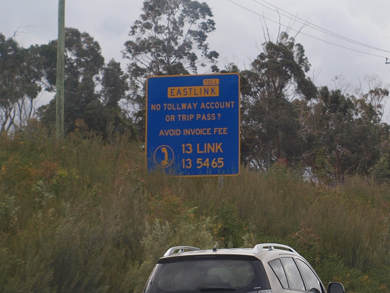 |
Toll Payment Sign: Sign indicating options for paying tolls if a motorist doesn't own an e-tag, Scoresby, September 2009. Image © Rob Tilley |
 |
Supplemental AD Sign: Supplemental advance directional sign approaching the interchange with Princes Hwy (ALT-NR1) at Dandenong North, June 2016. Image © Rob Tilley |
|
 |
Advance Directional Sign: AD sign on the George Street overpass at Scoresby for the High Street Road (MR24) interchange, September 2009. Image © Rob Tilley |
 |
Princes Highway Interchange: Southbound through the interchange with Princes Hwy at Dandenong North, June 2016. Image © Rob Tilley |
|
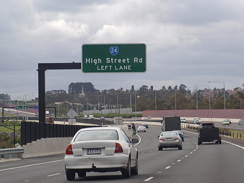 |
Supplemental Advance Directional Sign: Supplemental AD sign at Wantirna South for the High Street Road (MR24) interchange, September 2009. Image © Rob Tilley |
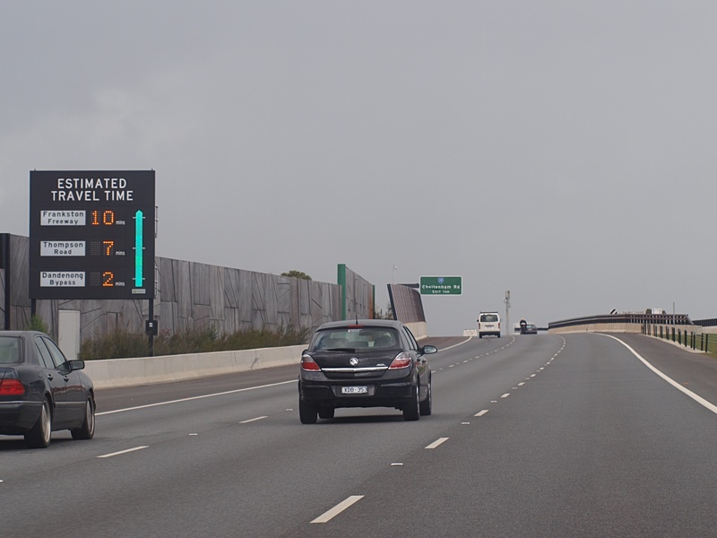 |
Travel Time Indicator: Sign showing driving times to selected interchanges. The green bar changes colour depending of traffic densities, Noble Park, September 2009.
Image © Rob Tilley |
|
 |
High Street Road Interchange: Looking northwest at Wantirna South, September 2009. Image © Rob Tilley |
 |
Advance Directional Sign: AD sign at Noble Park for the Cheltenham Road (MR10) interchange, June 2016. Image © Rob Tilley |
|
 |
Advance Directional Sign: AD sign on the off ramp to High St Rd (MR24) at Wantirna South, January 2017. Image © Huang Milton Collection |
|||
 |
Intersection Directional Sign: ID sign facing the off ramp to High St Rd (MR24) at Wantirna South, January 2017. Image © Huang Milton Collection |
|||
 |
AD Sign: Advance directional sign at Wantirna South for the Burwood Highway (MR26) interchange, September 2009. Image © Rob Tilley |
|||
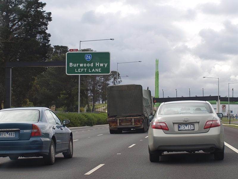 |
Supplemental AD Sign: Supplemental advance directional sign at Wantirna South for the Burwood Highway (MR26) interchange, September 2009. Image © Rob Tilley |
|||
 |
Burwood Highway Interchange: Northbound carriageway through the Burwood Hwy (MR26) interchange at Wantirna South, September 2009. Image © Rob Tilley |
|||
| Click
here for the continuation of M3 between Noble Park and Seaford Click here for the continuation of M3 between Wantirna and Nunawading |
||||
1 Maroondah
City Council,
Developing Maroondah, EastLink
2 Eastlink, Motorway
Info
3 Linking Melbourne Authority: Projects, Eastlink, Facts & Figures
4 Tim Cole
5 Minister of Transport, Media Release, Bracks Government Announces Mitcham-Frankston Freeway
Project, 23 September 2002
6 The Office of the Premier, Media Release, Mitcham-Frankston Freeway Must Be Tolled: Premier,
14 April 2003
Last updated: 14-Feb-2019 21:04
This site © Paul Rands. All rights reserved. Some portions © (copyright) by their respective and credited owners. Permission must be obtained before using any images from this site. For details, please email by clicking here.