|
|
|
|
|
| C136 | Cox Road, Thompson Road, Shannon Avenue & Barrabool Road (C136) |
Statistics:
Route Numbering:
General Information:
C136 is suburban route in the western Geelong area, southwest of Melbourne and is a mix of suburban arterial road and rural road, that services, residential, commercial, industrial and rural areas.
Shannon Avenue, earlier known as the West Melbourne Road, developed as an important transport route in the mid 19th century. Land subdivisions ensued, including further subdivisions in the early 20th century. These subdivisions, together with the arrival of the tram line in 1912 that terminated at the intersection of Aphrasia Street and Shannon Avenue, appear to have been the impetus for residential growth in the area during the Federation and interwar eras. 2
History:

| Corio to Barrabool | Barrabool to Corio | |||
| Preview: | Description: | Preview: | Description: | |
 |
Reassurance Directional Sign: Distance sign at Norlane, July 2009. Image © Tim Cole |
 |
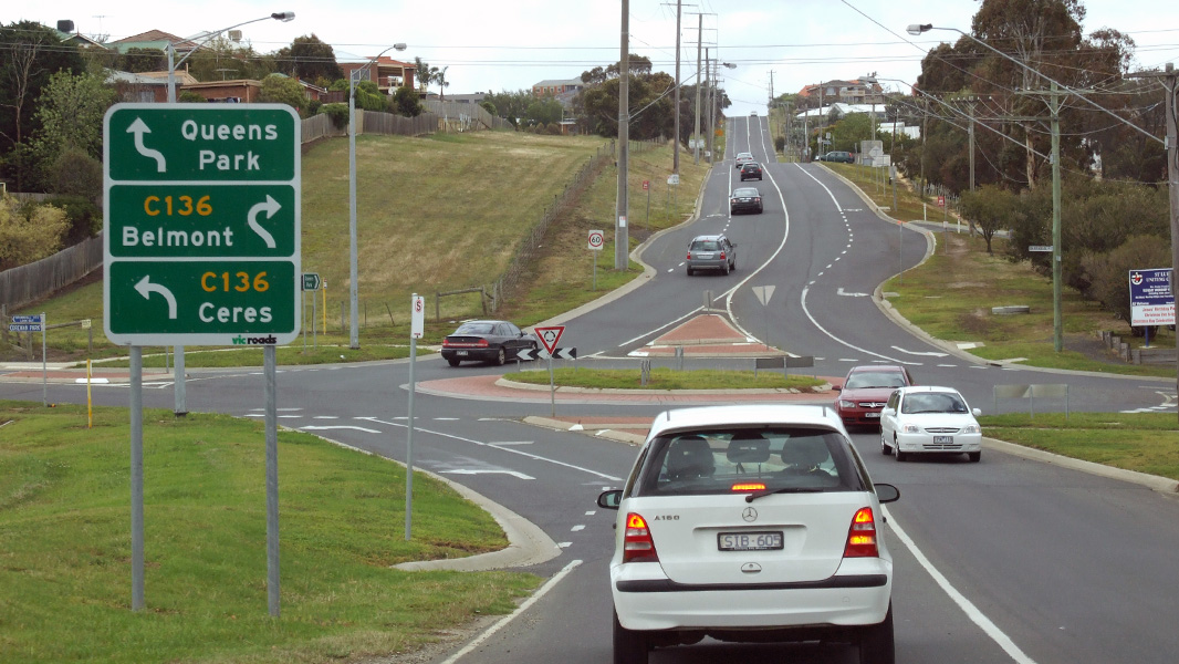
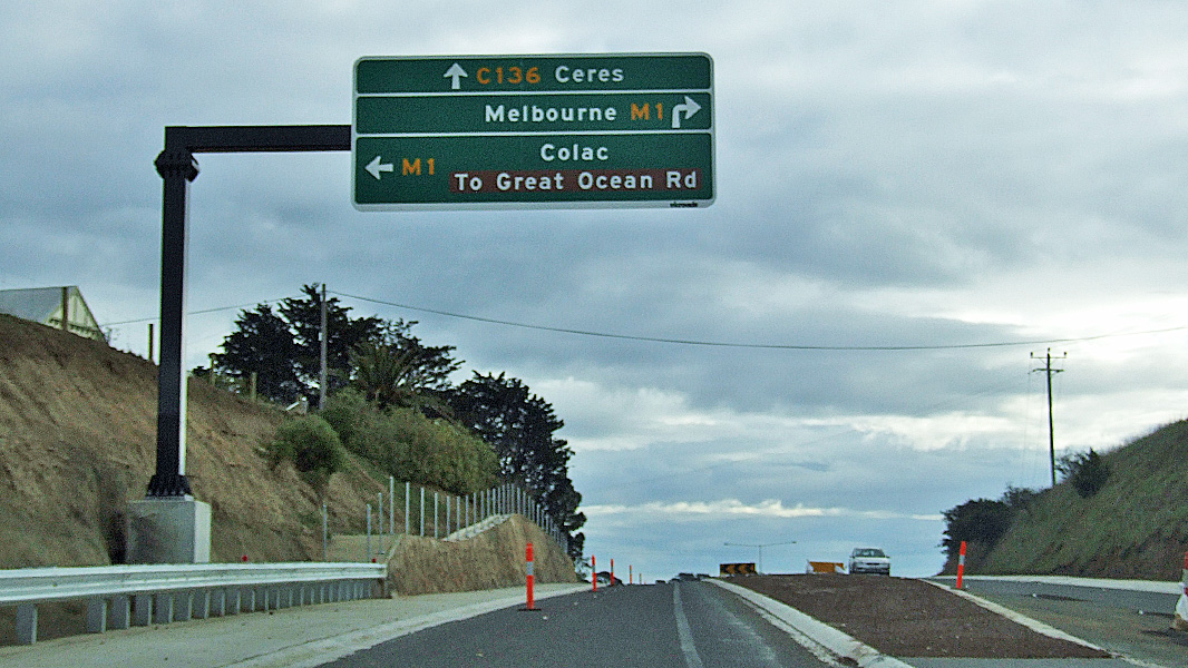
Advance Directional Sign: AD sign at Ceres approaching Princes Fwy (M1), July 2009. Image © Tim Cole |
|
 |
Advance Directional Sign: AD sign on Cox Rd (C136) approaching Thompson Rd (C136) and Cox Rd (C118) at Corio, January 2009. Image © Tim Cole |
 |
Advance Directional Sign: AD sign on Church St at Hamlyn Heights approaching Shannon Av (C136) at Hamlyn Heights, December 2012. Image © Tim Cole |
|
 |
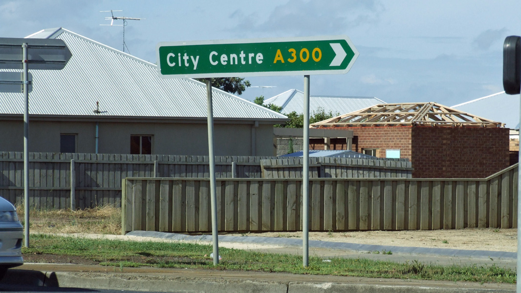
Advance Directional Sign: AD sign at North Geelong, approaching Midland Hwy (A300), December 2008. Image © Tim Cole |
 |
Intersection Directional Sign: ID sign on the corner of Shannon Av (C136) and Midland Hwy (A300) at North Geelong, December 2012. Image © Tim Cole |
|
 |
Advance Directional Sign: AD sign on Scenic Rd at Wandana Heights approaching Barrabool Rd (C136), December 2008. Image © Tim Cole |
 |
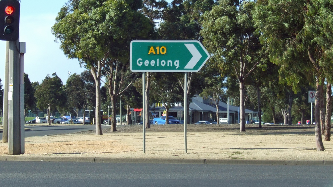
Advance Directional Sign: AD sign Cox Rd at Norlane, approaching Bacchus Marsh Rd (C704), Princes Hwy (A10) and St Georges Rd, July 2009. Image © Tim Cole |
|
 |
Intersection Directional Sign: ID sign facing Cityview Dr at Wandana Heights, December 2008. Image © Tim Cole |
 |
Intersection Directional Sign: ID sign at the corner of Cox Rd (C136), Princes Hwy (M1) and St Georges Rd, Norlane, July 2009. Image © Tim Cole |
|
 |
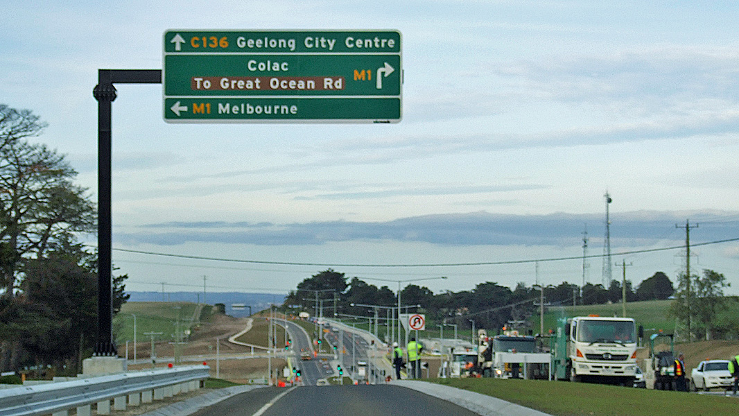
Advance Directional Sign: AD sign at Wandana Heights, approaching Princes Fwy (M1), July 2009. Image © Tim Cole |
 |
Intersection Directional Sign: ID sign at the corner of Cox Rd (C136), Princes Hwy (M1) and St Georges Rd, Norlane, July 2009. Image © Tim Cole |
|
 |
Princes Freeway: Barrabool Rd (C136) at the Princes Fwy (M1) interchange, Wandana Heights, July 2009. Image © Tim Cole |
|||
 |
Entering Ceres: Barrabool Rd (C136) as it enters the town of Ceres, December 2008. Image © Tim Cole |
|||
 |
Ceres: Barrabool Rd (C136) as it passes through Ceres, December 2008. Image © Tim Cole |
|||
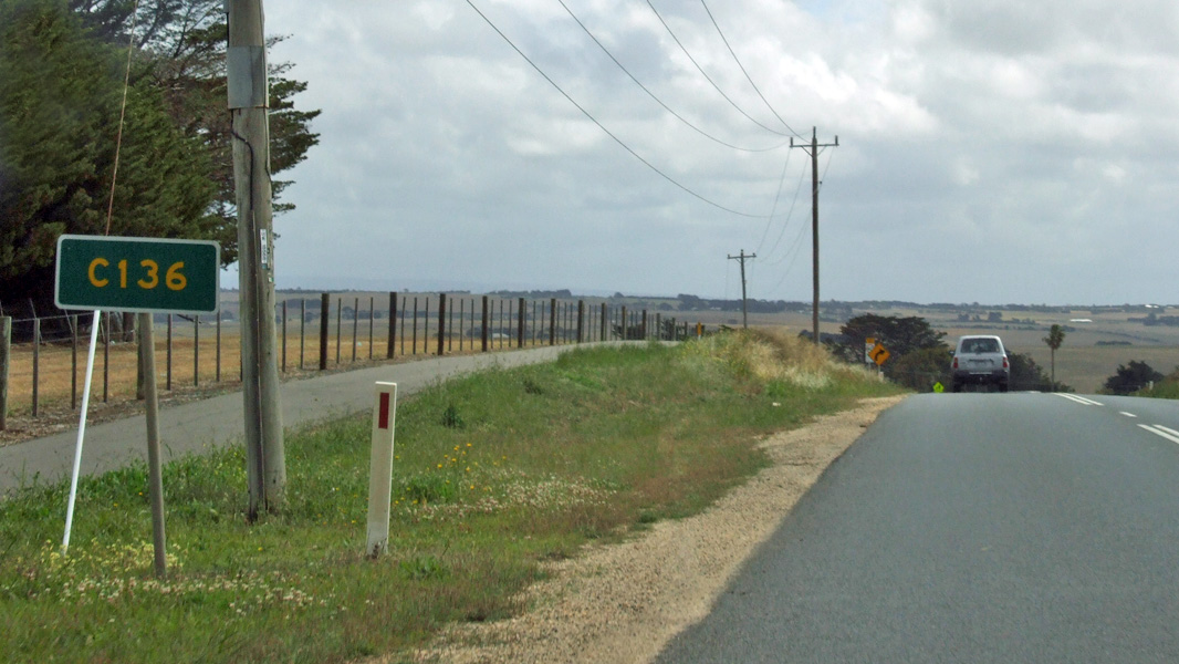 |
Trailblazer: C136 trailblazer at Ceres, December 2008. Image © Tim Cole |
|||
 |
Advance Directional Sign: AD sign approaching Merrawarp Rd (C111), Barrabool Rd (C111) and Honeys Rd at Ceres, December 2008. Image © Tim Cole |
|||
 |
Barrabool Road, Merrawarp Road & Honeys Road: Corner of Barrabool Rd (C136 and C111), Merrawarp Rd (C111) and Honeys Rd at Ceres, December 2008. C136 ends at this junction. Image © Tim Cole |
|||
1 VicRoads Country Directory, First Edition, 1992-1993
2 Victorian Heritage Database Report, Shannon Avenue Heritage Precinct
Last updated: 11-Feb-2019 20:42
This site © Paul Rands. All rights reserved. Some portions © (copyright) by their respective and credited owners. Permission must be obtained before using any images from this site. For details, please email by clicking here.