|
|
|
|
|
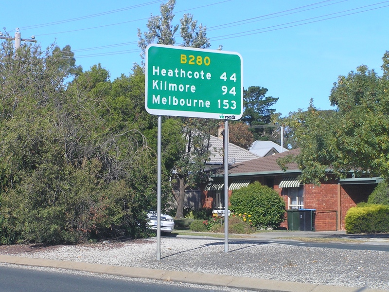
| B280 | McIvor Highway (B280) |
Statistics:
Route Numbering:

General Information:
The McIvor Highway is a connecting route from the city of Bendigo, which connects to the Northern Hwy (B75) then eventually onto Melbourne via the Hume Fwy (M31).
The route is generally a two laned rural highway passing through residential, commercial and agricultural zones.

| Bendigo to Heatcote | Heathcote to Bendigo | |||
| Preview: | Description: | Preview: | Description: | |
 |
Intersection Directional Sign: ID sign at Bendigo at the junction with Midland Hwy (A300) (McCrae St) and Chapel St (C329), October 2006. Image © Rob Tilley |
 |
Intersection Directional Sign: ID sign at the roundabout with Myers St, Lyttleton Tce and Bramble St in Bendigo, April 2006. Image © Rob Tilley |
|
 |
Advance Directional Sign: AD sign at Bendigo on Myers St approaching the roundabout with Lyttleton Tce, Bramble St and McIvor Hwy (Chapel St) (B280), April 2006. Image © Rob Tilley |
|||
 |
Intersection Directional Sign: ID sign at Bendigo on Myers St on the roundabout with Lyttleton Tce, Bramble St and McIvor Hwy (Chapel St) (B280), April 2006. Image © Rob Tilley |
|||
 |
Trailblazer: Trailblazer on McIvor Hwy next to the railway overpass at Bendigo, Arpril 2006. Image © Rob Tilley |
|||
 |
Advance Directional Sign: AD sign at Bendigo approaching Kennedy St & Sternberg St, April 2006. Image © Rob Tilley |
|||
 |
Intersection Directional Sign: ID sign at Bendigo at Kennedy St & Sternberg St, April 2006. Image © Rob Tilley |
|||
 |
Distance Sign: RD sign Kennington after the Kennedy St & Sternberg St intersection, April 2006. Image © Rob Tilley |
|||
 |
Supplemental Advance Directional Sign: Supplemental AD sign at Strathdale, approaching the junction with Strathdale-White Hills Rd (C343) and Reservoir Rd (C353), April 2006. Image © Rob Tilley |
|||
 |
Advance Directional Sign: AD sign at Strathdale, approaching the junction with Strathdale-White Hills Rd (C343) and Reservoir Rd (C353), April 2006. Image © Rob Tilley |
|||
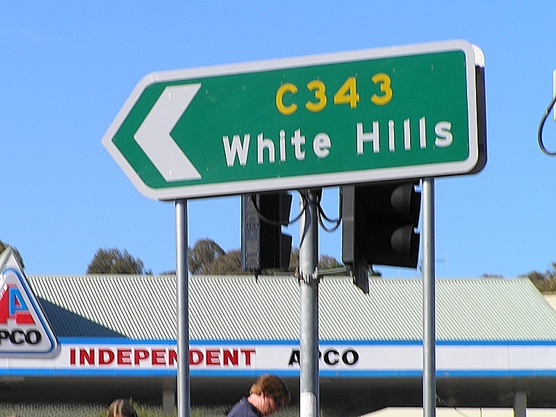 |
Intersection Directional Sign: ID sign at Strathdale, at the junction with Strathdale-White Hills Rd (C343) and Reservoir Rd (C353), April 2006. Image © Rob Tilley |
|||
 |
Intersection Directional Sign: ID sign at Strathdale, at the junction with Strathdale-White Hills Rd (C343) and Reservoir Rd (C353), April 2006. Image © Rob Tilley |
|||
1 Vicroads Road Management Plan, 30 October 2004
Last updated: 11-Feb-2019 17:43
This site © Paul Rands. All rights reserved. Some portions © (copyright) by their respective and credited owners. Permission must be obtained before using any images from this site. For details, please email by clicking here.