|
|
|
|
|
| B180 | Maroona-Glenthompson Road, Mortlake-Ararat Road & Pyrenees Highway (B180) |
Statistics:
Route Numbering:

General Information:
B180 is a significant connector route between Hamilton on Victoria's southwest and Bendigo in central Victoria.
Multiplexes along the route include:
History:

| Glenthompson to Elphinstone | Elphinstone to Glenthompson | |||
| Preview: | Description: | Preview: | Description: | |
 |
Distance Sign: RD sign at Maroona, after the Maroona-Glenthompson Rd (B180) and Mortlake-Ararat Rd (C148) intersection, December 2006. Image © Rob Tilley |
 |
Advance Directional Sign: AD sign at approaching Bendigo-Maryborough Rd (C277) (Tuaggra St) and Napier St, October 2006. Image © Rob Tilley |
|
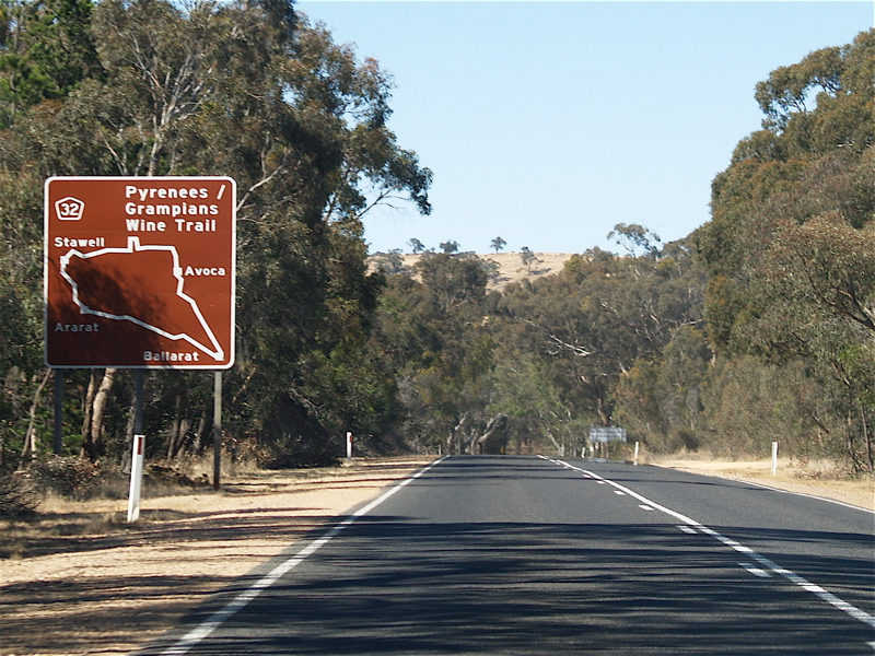 |
Tourist Sign: Sign at Ararat showing TD32, December 2006. Image © Rob Tilley |
 |
Intersection Directional Sign: ID sign assembly at Maroona at the junction with Maroona-Glenthompson Rd (B180) and Mortlake-Ararat Rd (C148), December 2006. Image © Rob Tilley |
|
 |
Advance Directional Sign: AD sign at Ararat approaching Barkly St (C222), December 2006. Image © Rob Tilley |
 |
Distance Sign: RD sign at Maroona, after the Maroona-Glenthompson Rd (B180) and Mortlake-Ararat Rd (C148) intersection, December 2006. Image © Rob Tilley |
|
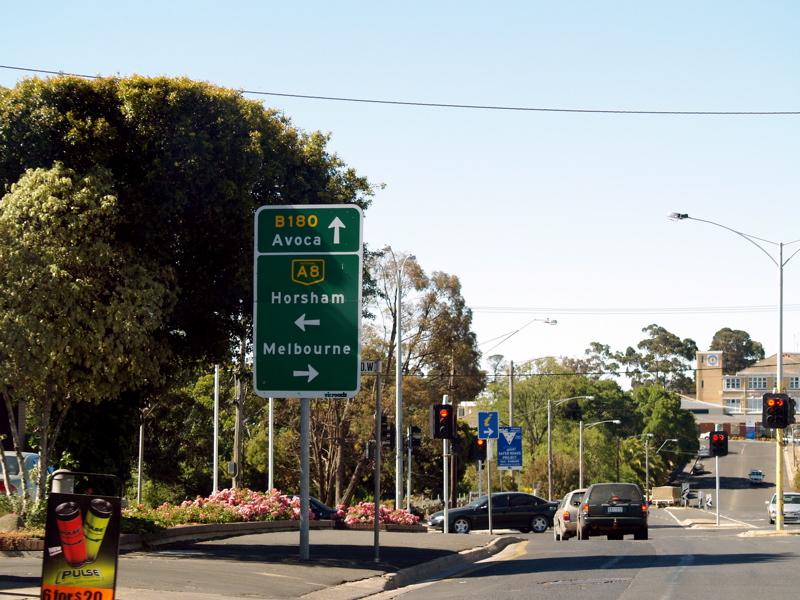 |
Advance Directional Sign: AD sign at Ararat approaching Western Hwy (A8), December 2006. Image © Rob Tilley |
 |
Trailblazer: B180 trailblazer at Maroona, December 2006. Image © Rob Tilley |
|
 |
Intersection Directional Sign: ID sign at Ararat at the Vincent St intersection, December 2006. Image © Rob Tilley |
|||
 |
Distance sign: RD sign as you leave Ararat, October 2006. Image © Rob Tilley |
|||
 |
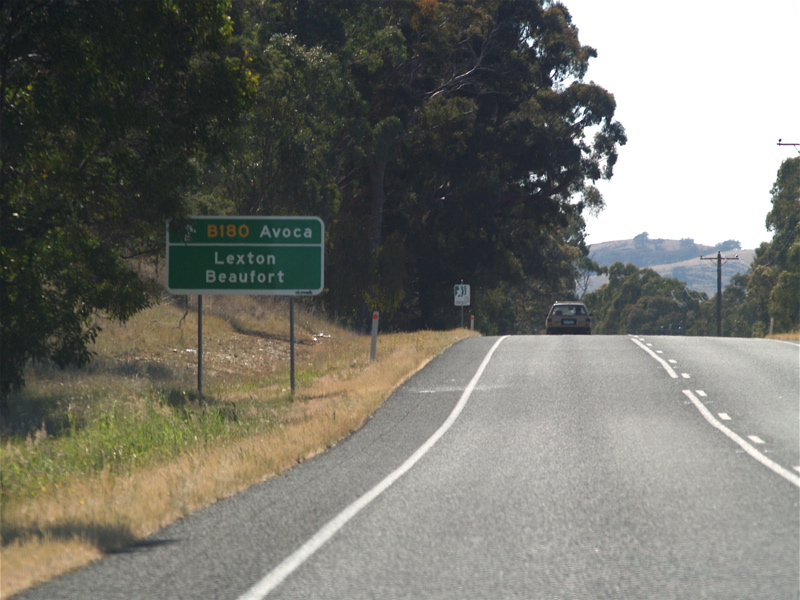
Advance Directional Sign: AD sign at Dunneworthy approaching Ararat-St Arnaud Rd (C241), October 2006. Image © Rob Tilley |
|||
 |
Ararat-St Arnaud Road Intersection: Corner of Pyrenees Hwy (B180) and Ararat-St Arnaud Rd (C241), October 2006. Image © Rob Tilley |
|||
 |
Distance Sign: RD sign after the C241 intersection at Dunneworthy, October 2006. Image © Rob Tilley |
|||
 |
Advance Directional Sign: AD sign missing an arrow approaching Back Amphitheatre Rd at Amphitheatre, October 2006. Image © Rob Tilley |
|||
 |
Advance Directional Sign: AD sign Avoca approaching Sunraysia Hwy (B220), October 2006. Image © Rob Tilley |
|||
 |
Sunraysia Highway Junction: Red flashing light at the stop sign at the junction with Sunraysia Hwy (B220) in Avoca, October 2006. Image © Rob Tilley |
|||
 |
Advance Directional Sign: AD sign on Sunraysia Hwy (B220) approaching Pyrenees Hwy (B180) at Avoca, October 2006. Image © Rob Tilley |
|||
 |
Pyrenees Highway & Sunraysia Highway Junction: Corner of Sunraysia Hwy (B220) and Pyrenees Hwy (B180) at Ararat, October 2006. Image © Rob Tilley |
|||
 |
Distance Sign: RD sign at Ararat, October 2006. Image © Rob Tilley |
|||
 |
Advance Directional Sign: AD sign at Bung Bong approaching Talbot-Avoca Rd, October 2006. Image © Rob Tilley |
|||
 |
Advance Directional Sign: AD sign at Maryborough approaching Maryborough-St Arnaud Rd (C275) (Phelans Rd), October 2006. Image © Rob Tilley |
|||
 |
Maryborough-St Arnaud Road Intersection: ID sign assembly at the junction with Maryborough-St Arnaud Rd (C275) at Maryborough, October 2006. Image © Rob Tilley |
|||
 |
Advance Directional Sign: AD sign at Maryborough approaching Derby Rd (C287), October 2006. Image © Rob Tilley |
|||
 |
Derby Road Intersection: Corner of Pyrenees Hwy (B180) and Derby Rd (C287) in Maryborough, October 2006. Image © Rob Tilley |
|||
 |
Advance Directional Sign: AD sign approaching the Napier and Inkerman St roundabout in Maryborough. B180 is aligned along Inkerman St for a short distance. October 2006. Image © Rob Tilley |
|||
 |
Intersection Directional Sign: ID sign facing Castlemaine-Maldon Rd (C282) at Mackenzie Hill, April 2006. Image © Rob Tilley |
|||
 |
Distance Sign: RD sign at Mackenzie Hill, April 2006. Image © Rob Tilley |
|||
 |
Advance Directional Sign: AD sign at Castlemaine approaching Midland Hwy (A300), April 2006. Image © Rob Tilley |
|||
 |
Intersection Directional Sign: ID sign at the junction with Midland Hwy (A300) in Castlemaine, April 2006. Image © Rob Tilley |
|||
 |
Intersection Directional Sign: Corner of Midland Hwy (A300), Pyrenees Hwy (B180) and Forest St in Castlemaine, October 2006. Image © Rob Tilley |
|||
 |
Intersection Directional Sign: Corner of Midland Hwy (A300), Pyrenees Hwy (B180) and Forest St in Castlemaine, April 2006. Image © Rob Tilley |
|||
 |
Intersection Directional Sign: ID sign at the Pyrenees Hwy (B180) and Forest St split in Castlemaine, October 2006. Image © Rob Tilley |
|||
 |
Distance Sign: RD sign at Castlemaine, October 2006. Image © Rob Tilley |
|||
 |
Calder Highway Interchange: Directional signage at the Calder Hwy (A79) interchange at Elphinstone, October 2006. Image © Rob Tilley |
|||
1 Vicroads Road Management Plan, 30 October 2004
2 Victorian Heritage Database, Glenmona Bridge
Last updated: 11-Feb-2019 17:35
This site © Paul Rands. All rights reserved. Some portions © (copyright) by their respective and credited owners. Permission must be obtained before using any images from this site. For details, please email by clicking here.