|
|
|
|
|
 |
Brooker Highway, Midland Highway & Bass Highway (National Highway 1) - Devonport to Launceston |
Statistics:
Route Numbering:
General Information:
Highway 1 is a circumferential route right around Australia, but there is also a small segment located in Tasmania, which more or less travels down the centre of the state. In Tasmania, National Highway 1 is made up of the Brooker Highway between Granton and Hobart, the Midland Highway between Granton and Launceston, and also the Bass Highway between Burnie and Launceston.
The occurrence of NH1 is a bit of an anomaly and stands out compared to all other routes in the state being alpha-numeric. In the late 1970s when the Tasmanian authorities decided to introduce an alphanumeric numbering system (the first Australian state to do so), the Federal Government who funded National Highways, stopped the Tasmanian government from allocating an alphanumeric number to the route.
The Bass Highway is, like Bass Strait, named after explorer George Bass.
The Bass Highway's highest elevation along its length is 307m and the lowest point is at 0.859m.
The Bass Highway connects with the Castra Road, the Emu Bay Road, the Forth Road, the Illawarra Road, the Lake Highway, the Meander Valley Highway, the Midland Highway, the Mount Road, the Murchison Highway, the Port Sorell Road, the Preston Road, the Stanley Highway and the Stony Rise Road.
History:
| Preview: | Description: |
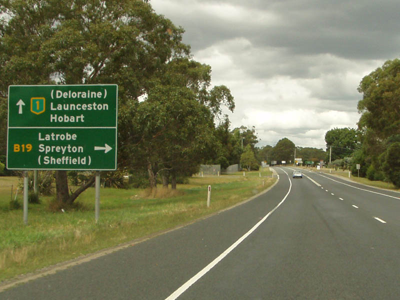 |
Approaching Stoney Rise Road: Eastbound at Don as you approach the intersection with B19: Stoney Rise Road. February 2008. Image © Philip McCallum |
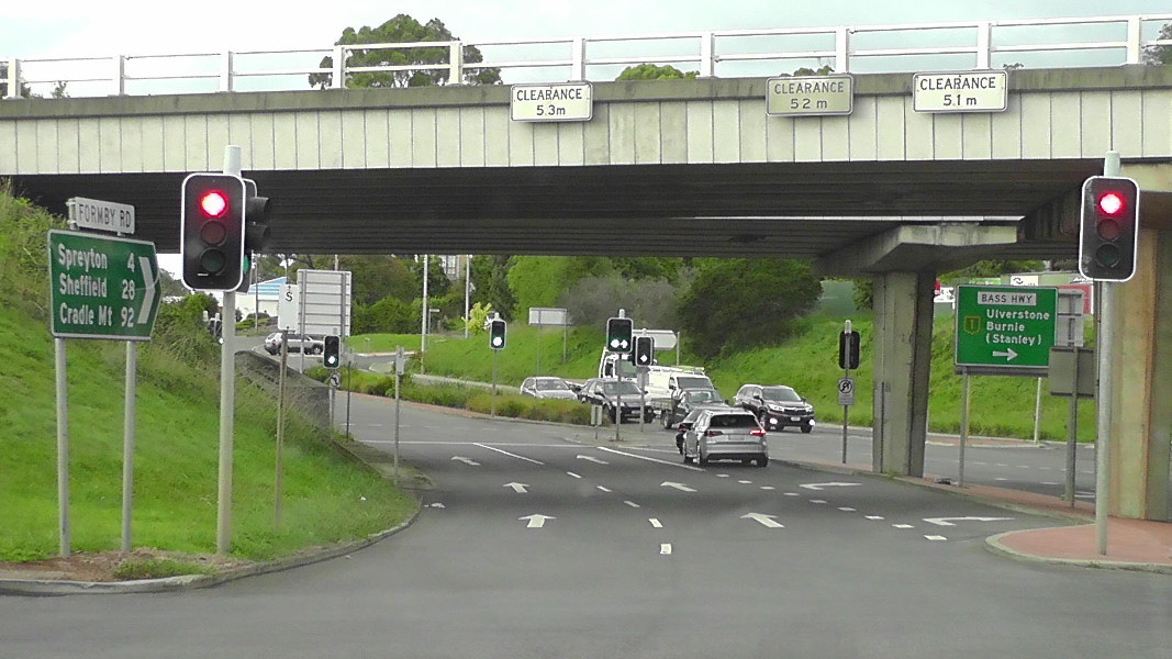 |
Formby Road Interchange: Bass Hwy (NH1) as it crosses Formby Rd at Devonport, March 2016. Image © Garry Coxhead |
 |
Advance Directional Sign: AD sign approaching Wright St, Devonport 2008. Image © Jamie Scuglia |
 |
Advance Directional Sign: AD sign on Wright St, Devonport approaching Tarleton St, August 2006. The NH1 shield should be prefixed with 'To'. Image © Tim Cole |
 |
Distance Sign: Eastbound RD sign at Latrobe. February 2008. Image © Philip McCallum |
 |
AD Sign: Advance directional sign approaching the School Road intersection at Sassafras, eastbound, February 2008. Image © Philip McCallum |
 |
Approaching Smith and Others Road: Eastbound advance directional sign for the intersection with Smith & Others Road at Sassafras, February 2008. Image © Philip McCallum |
 |
Advance Directional Sign: Eastbound AD sign for the Mole Creek Road interchange at Deloraine. February 2008. Image © Philip McCallum |
 |
Mole Ck Road Interchange: Looking eastbound at Mole Creek Road interchange at Deloraine, February 2008. Image © Philip McCallum |
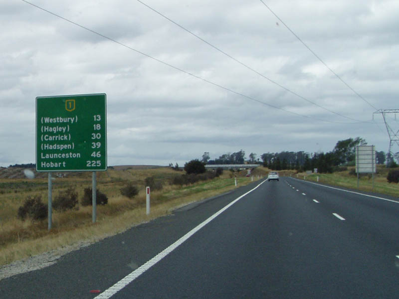 |
Distance Sign: Large RD as you head out of Deloraine, February 2008. Image © Philip McCallum |
 |
Exton: Looking towards Launceston at Exton. Note the additional earthworks for future expansion of the bypass. February 2008. Image © Philip McCallum |
 |
Eastbound at Exton: Heading towards Launcestion at Exton, February 2008. Image © Philip McCallum |
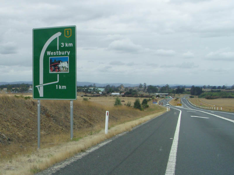 |
Bypassed Town Sign: Advance directional sign on the Westbury Bypass, February 2008. Image © Philip McCallum |
 |
Approaching Birralee Road: Tourist AD sign approaching the interchange with Birralee Rd (B72) at Westbury, February 2008. Image © Philip McCallum |
 |
Approaching Birralee Road: AD sign approaching the interchange with Birralee Rd (B72) at Westbury, February 2008. Image © Philip McCallum |
 |
Birralee Road Interchange: Eastbound at Westbury, February 2008. Image © Philip McCallum |
| Click here for the continuation of NH1 between Launceston and Oatlands | |
Last updated: 01 Sep 2019 19:35
This site © Paul Rands. All rights reserved. Some portions © (copyright) by their respective and credited owners. Permission must be obtained before using any images from this site. For details, please email by clicking here.