|
|
|
|
|
| B12 | Mole Creek Road & Liena Road (B12) |
Statistics:
Route Numbering:
General Information:
B12 is a spur road from the Bass Highway at Deloraine to King Solomons Cave near Liena. It serves the Mole Creek valley, an important dairying district, but also is an important tourist route with a number of attractions including the Trowunna Wildlife Park, Mole Creek and the Marakoopa and King Solomons Caves.

| Preview: | Description: |
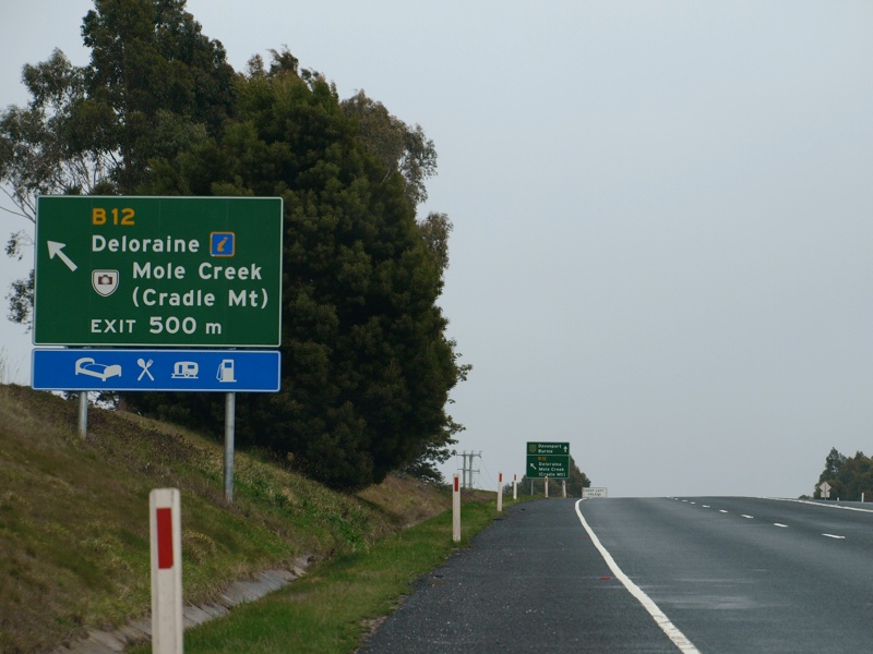 |
Advance Directional Sign: AD sign on the Bass Highway (NH1) at Deloraine, August 2008. Image © Peter Renshaw |
 |
Mole Creek Valley: Mole Creek Rd, looking west down Mole Creek Valley approaching Chudleigh, August 2008. Image © Peter Renshaw |
 |
Western Terminus: End B12 route marker at King Solomons Cave, August 2008. Image © Peter Renshaw |
Last updated: 10-Feb-2019 13:50
This site © Paul Rands. All rights reserved. Some portions © (copyright) by their respective and credited owners. Permission must be obtained before using any images from this site. For details, please email by clicking here.