|
|
|
|
|
| A7 | West Tamar Highway (A7) |
Statistics:
Route Numbering:


General Information:
West Tamar Highway covers the western edge of the Tamar River, from Launceston to the beach town of Greens Beach.
The West Tamar Highway's highest elevation along its length is 137m and the lowest point is at -2.06m. The West Tamar Highway connects with the East Tamar Highway (A8), Batman Highway (B73), Midland Highway (NH1) and the Tasman Highway (A3).
History:

Click here for photos of former alignments
| Launceston to Greens Beach | Greens Beach to Launceston | |||
| Preview: | Description: | Preview: | Description: | |
 |
Advance Directional Sign: AD sign at Launceston approaching Margaret St, July 2018. Image © Paul Rands |
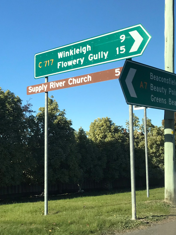 |
Intersection Directional Sign: ID sign at the junction with Winkleigh Rd (C717) at Exeter, June 2019. Image © Paul Rands |
|
 |
Intersection Directional Sign: Intersection directional sign facing traffic on York Street (A7) Launceston, near the southern terminus of the route. April 2007. Image © Peter Renshaw |
 |
intersection Directional Signs: ID signs at Rosevears facing Brady Lookout Track, June 2019. Image © Paul Rands |
|
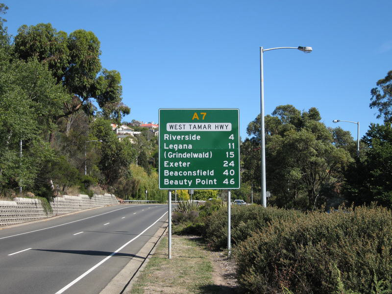 |
Reassurance Directional Sign: Distance sign at Launceston, 2008. Image © Jamie Scuglia |
 |
Advance Directional Sign: AD sign at Legana approaching Freshwater Point Dr and Sunrise Dr, June 2019. Image © Paul Rands |
|
 |
Paterson Bridge: Paterson Bridge carries West Tamar Hwy (A7) over the confluence of the South Esk River and River Tamar in Launceston, July 2018. Image © Paul Rands |
 |
Intersection Directional Sign: ID sign at Legana on the roundabout with Freshwater Point Dr and Sunrise Dr, June 2019. Image © Paul Rands |
|
 |
Paterson Bridge: Underside view of Paterson Bridge, which carries West Tamar Hwy (A7) over the confluence of the South Esk River and River Tamar in Launceston, July 2018. Image © Paul Rands |
 |
River Tamar: West Tamar Hwy (A7) as it crosses the River Tamar at Launceston, 2008. Image © Jamie Scuglia |
|
 |
Intersection Directional Sign: ID sign on the roundabout with Legana Park Dr & Acropolis Dr at Legana, June 2019. Image © Paul Rands |
 |
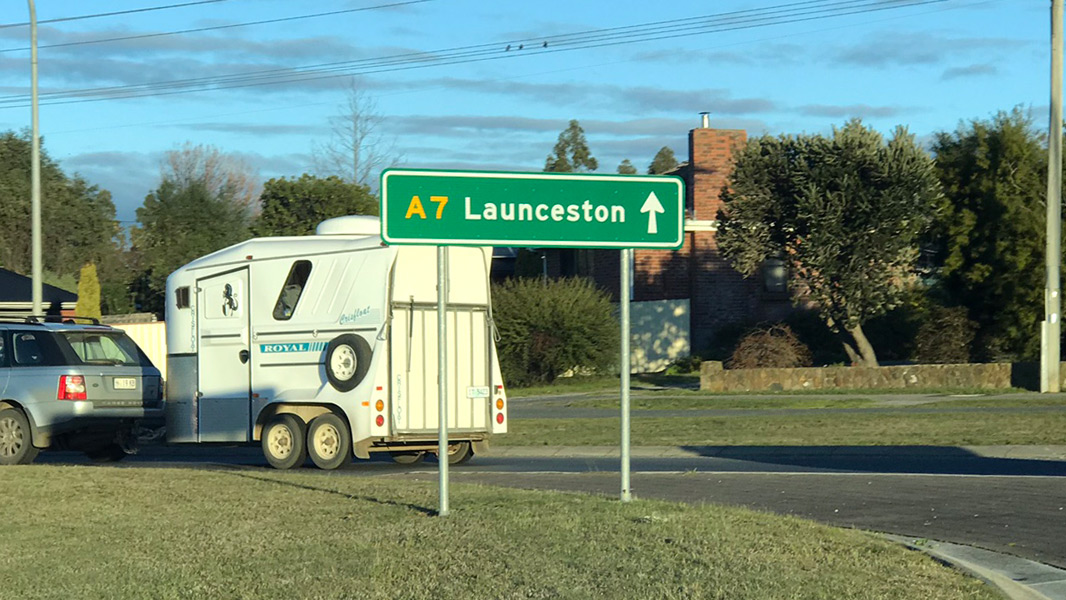
Advance Directional Sign: AD sign showing old SR1 route number at Launceston, August 2006. This sign has since been removed. Image © Tim Cole |
|
 |
Advance Directional Sign: AD sign at Legana approaching Bridgenorth Rd (C732), June 2019. Image © Paul Rands |
 |
Advance Directional Sign: AD sign on Brisbane St (West Tamar Hwy) (A7) at Launceston, approaching Bathurst St (A8), July 2018. Image © Paul Rands |
|
 |
Advance Directional Sign: Northbound AD sign approaching the intersections of Atkinsons Road and Rosevears Drive (C733) at Legana, April 2007. Image © Peter Renshaw |
 |
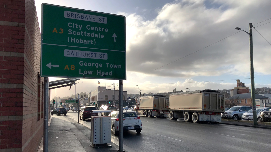
Intersection Directional Sign : ID sign at the junction with Brisbane St (A8) at Launceston, July 2018. Brisbane St becomes A3 at this junction and this is also the southern terminus of A7. Image © Paul Rands |
|
1 ABC Northern Tasmania, Kings Bridge
2 Libraries Tasmania, Paterson Bridge Official opening 2nd November 1973
Last updated: 28 Aug 2019 20:02
This site © Paul Rands. All rights reserved. Some portions © (copyright) by their respective and credited owners. Permission must be obtained before using any images from this site. For details, please email by clicking here.