|
|
|
|
|
| M1 A1 B1 | Princes Highway, South Eastern Freeway, Glen Osmond Road, Fullarton Road, Dequetteville Terrace, Hackney Road, Main Road, Park Road, Robe Terrace, Main North Road, Port Wakefield Road, Port Wakefield Highway, Augusta Highway & Eyre Highway (M1 / A1 / B1) - Poochera to Ceduna |
Statistics:
Route Numbering:


General Information:
Highway 1 runs right around Australia, however with the introduction of alphanumeric routes, highway 1 takes on all different identifications depending on its importance and road design.
In South Australia, it's numbered with several designations:
Named after Edward John Eyre the Eyre Highway is a highway linking Western Australia and South Australia. It forms part of Highway 1 and the Australian National Highway network linking Perth and Adelaide. It is the only sealed road that crosses the SA/WA border.
Access to the spectacular coastline of Great Australian Bight is just a short detour south of the highway in many places. Towns and localites along this section of Highway 1 include Border Village, Nullarbor, Yalata, Nundroo, Penong, Ceduna and Port Augusta.
History:
Eyre Highway (A1):
Click here for the former alignment through Ceduna
| Ceduna to Poochera | Poochera to Ceduna | |||
| Preview: | Description: | Preview: | Description: | |
 |
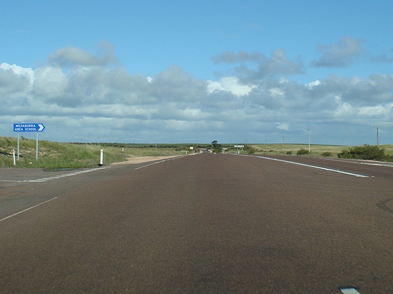
Advance Directional Sign: AD sign at Carawa approaching Miltaburra Road. September 2009. Image © Paul Rands |
 |
Entering Poochera: Entering the town of Poochera, December 2007. Image © Paul Rands |
|
 |
Advance Directional Sign: AD sign near Miltaburra Rd at Carawa. September 2009. Image © Paul Rands |
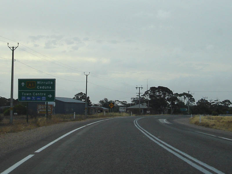 |
Approaching East Terrace: Advance directional sign approaching East Terrace in Poochera, December 2007. Image © Paul Rands |
|
 |
Intersectional Directional Sign: ID sign at the Miltaburra Rd junction in Carawa. September 2009. Image © Paul Rands |
 |
Distance Sign: RD sign as you leave Poochera. December 2007. Image © Paul Rands |
|
 |
Services Sign: Services sign near Wirrulla. September 2009. Image © Paul Rands |
 |
Services Sign: Sign indicating the services available at Wirrulla, December 2007. Image © Paul Rands |
|
 |
Advance Directional Sign: AD sign approaching Davis Terrace at Wirrulla. September 2009. Image © Paul Rands |
 |
Advance Directional Sign: AD sign approaching Hay Tce at Wirrulla, December 2007. Image © Paul Rands |
|
 |
Davis Terrace Junction: Corner of Eyre Hwy and Davis Tce at Wirrulla. September 2009. Image © Paul Rands |
 |
RD Sign: Reassurance distance sign as you leave the town of Wirrulla, December 2007. Image © Paul Rands |
|
 |
Distance Sign: RD sign as you leave Wirrulla. September 2009. Image © Paul Rands |
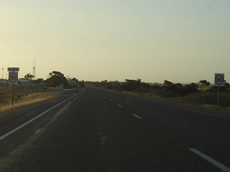 |
Entering Ceduna: Westbound as you enter the last major stop before the Nullarbor Plain, Ceduna. December 2007. Image © Paul Rands |
|
 |
Entering Cungena: Eyre Highway as it enters the small town of Cungena. September 2009. Image © Paul Rands |
 |
Advance Directional Sign: Westbound approaching Kuhlmann Street, Ceduna, December 2007. Image © Paul Rands |
|
 |
Services Sign: Services sign as the Eyre Hwy approaches the town of Poochera. September 2009. Image © Paul Rands |
 |
Mackenzie St Intersection: Approaching Eyre Hwy from Mackenzie Street (former NH1 alignment) in Ceduna. December 2007. Image © Paul Rands |
|
 |
Advance Directional Sign: AD sign at Poochera approaching West Terrace and Streaky Bay Highway. September 2009. Image © Paul Rands |
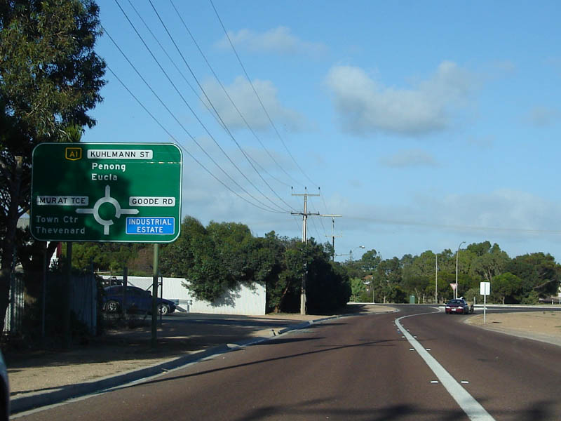 |
AD Sign: Advance directional sign as you approach the intersection with Murat Tce and Goode Rd Ceduna, December 2007. Image © Paul Rands |
|
 |
Entering Poochera: Eyre Hwy as it enters the town of Poochera. September 2009. Image © Paul Rands |
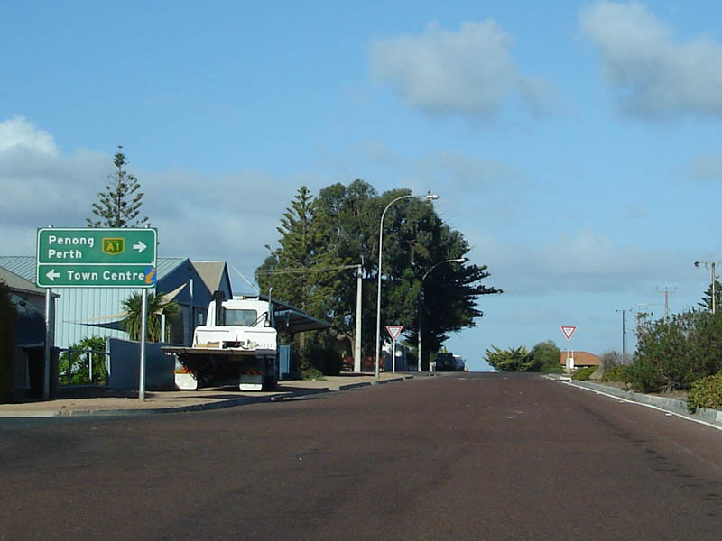 |
Approaching Poynton Street: Advance directional sign for the Poynton Street intersection in Ceduna, December 2007. The highway turns right at this junction. Image © Paul Rands |
|
 |
Poochera: Looking southeast on the Eyre Hwy as it passes through the town of Poochera. September 2009. Image © Paul Rands |
 |
Ceduna Quarantine Inspection
Station: Westbound as you pass the quarantine inspection station at Ceduna. December 2007. Eastbound traffic get stopped here only. Westbound gets stopped at the WA border. Image © Paul Rands |
|
 |
East Terrace Junction: Corner of Eyre Hwy & East Tce at Poochera. September 2009. Image © Paul Rands |
 |
Distance Sign: Westbound RD sign as you leave Ceduna, July 2016. Image © Richard Wardle |
|
 |
RD Sign: Distance sign as you leave the town of Poochera. September 2009. Image © Paul Rands |
 |
Ceduna: The long open road as you leave Ceduna, December 2007. Image © Paul Rands |
|
 |
Services Sign: Services sign as the Eyre Hwy approaches the town of Ceduna. September 2009. Image © Paul Rands |
|||
 |
Exhaust Brakes Sign: Exhaust brakes usage sign as you approach Ceduna. September 2009. Image © Paul Rands |
|||
 |
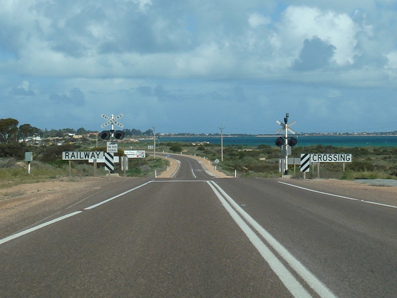
Flashing Warning Sign: Flashing railway crossing warning sign as the Eyre Hwy enters the town of Ceduna. September 2009. Image © Paul Rands |
|||
 |
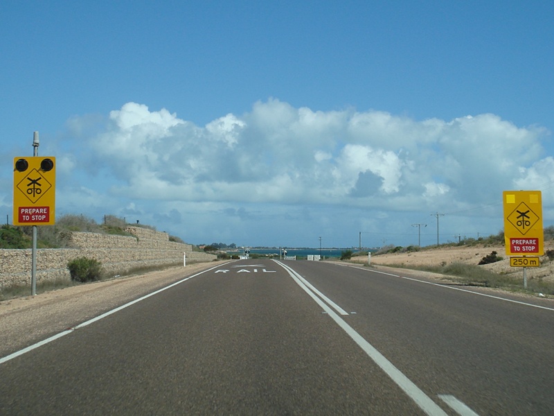
Level Crossing: Railway level crossing as you approach Ceduna. September 2009. Image © Paul Rands |
|||
 |
Entering Ceduna: The Eyre Hwy as it enters the town of Ceduna. September 2009. Image © Paul Rands |
|||
 |
Intersection Directional Sign: ID sign at the junction with Denial Bay Road in Ceduna. September 2009. Image © Paul Rands |
|||
 |
Fruit Fly Inspection Station Sign: Sign indicating the Ceduna Fruit Fly Inspection Station. September 2009. Image © Paul Rands |
|||
 |
Approaching The Fruit Fly Inspection Station: Boom gate warning signs as the Eyre Highway approaches the Fruit Fly Inspection Station at Ceduna. September 2009. Image © Paul Rands |
|||
 |
Fruit Fly Inspection Station: The Fruit Fly Inspection Station at Ceduna. September 2009. Image © Paul Rands |
|||
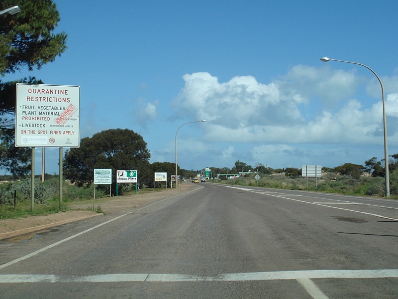 |
Quarantine Sign: Quarantine sign next to the Fruit Fly Inspection Station at Ceduna. September 2009. Image © Paul Rands |
|||
 |
Entering Ceduna: Eyre Highway as it enters Ceduna town centre, looking southbound. September 2009. Image © Paul Rands |
|||
 |
Advance Directional Sign: AD sign as A1 approaches Poynton St and Kuhlmann St. A1 turns left at Kuhlmann St and bypasses the Ceduna CBD. September 2009. Image © Paul Rands |
|||
 |
Poynton St & Kuhlmann St Intersection: Corner of Poynton St & Kuhlmann St (A1) in Ceduna. September 2009. Image © Paul Rands |
|||
 |
AD Sign: Diagrammatic advance directional sign approaching the junction with Murat Terrace and Goode Road in Ceduna. September 2009. Image © Paul Rands |
|||
 |
Supplemental Advance Directional Sign with Old NH1 Shield: Supplemental AD sign at Ceduna on Kuhlmann Tce (A1), showing a faded old NH1 shield. September 2009. Image © Paul Rands |
|||
 |
Advance Directional Sign: Supplemental AD sign at Ceduna on Kuhlmann Tce (A1). September 2009. Image © Paul Rands |
|||
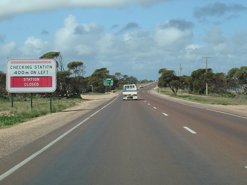 |
Changeable Checking Station Sign: Changeable sign for the heavy vehicle checking station at Ceduna. September 2009. Image © Paul Rands |
|||
 |
Distance Sign: RD sign missing the National Highway shield as you leave Ceduna. September 2009. Image © Paul Rands |
|||
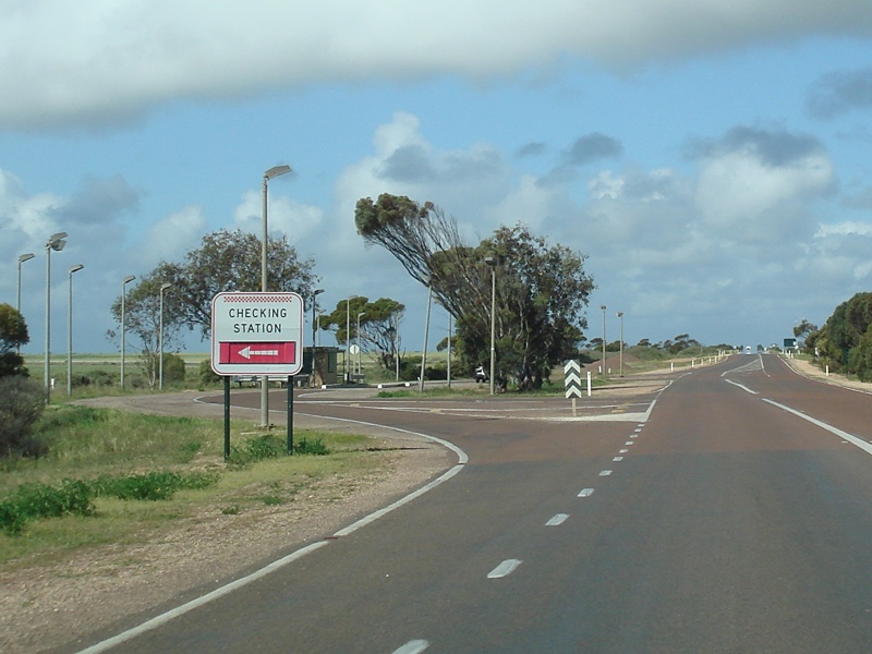 |
Changeable Checking Station Sign: Changeable sign for the heavy vehicle checking station at Ceduna. September 2009. Image © Paul Rands |
|||
 |
Supplemental AD Sign: Supplemental advance directional sign near Ceduna approaching Flinders Hwy (B100). September 2009. Image © Paul Rands |
|||
 |
AD Sign: Advance directional sign near Ceduna approaching Flinders Hwy (B100). September 2009. Image © Paul Rands |
|||
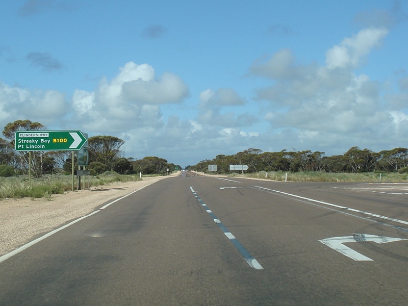 |
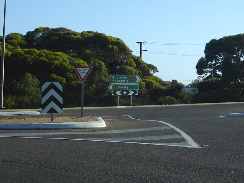
Flinders Highway Junction: Corner of Eyre Hwy (A1) and Flinders Hwy (B100) at Ceduna. September 2009. Image © Paul Rands |
|||
 |
RD Sign: Reassurance directional sign after the Flinders Hwy (B100) junction at Ceduna. September 2009. Image © Paul Rands |
|||
| Click here for the continuation of A1 between Ceduna & Yalata Click here for the continuation of A1 between Kimba & Poochera |
||||
1 Transport SA, State Route Numbers map, May 2003
2 History Trust of South Australia
3 Australian Government's Department of Infrastructure, Transport, Regional Development and Local Government
Last updated: 10-Feb-2019 11:52
This site © Paul Rands. All rights reserved. Some portions © (copyright) by their respective and credited owners. Permission must be obtained before using any images from this site. For details, please email by clicking here.