|
|
|
|
|
| B83 D83 | Flinders Ranges Way, The Outback Highway & Birdsville Track (B83 & D83) |
Statistics:
Route Numbering:


General Information:
B83 is a rural and outback South Australian route, which crosses the Flinders Ranges near Port Augusta. The route services several small communities and the mining centre of Leigh Creek. Between Lyndhurst and Marree, the route alternates between bitumen and gravel road. From Marree to Queensland, most of the route is gravel. D83 is marked on several maps but not shown on signange.
The Birdsville Track traverses three deserts, the Strzelecki Desert, Sturt Stony Desert and Tirari Desert.
History:

| Stirling North to QLD Border | QLD Border to Stirling North | |||
| Preview: | Description: | Preview: | Description: | |
 |
Intersection Directional Sign Assembly: ID signs facing traffic from Sixth Street (B82) in Quorn. June 2008. Image © Darrin Smith |
 |
SA-QLD Border: Birdsville Track (D83) at the SA-QLD Border at Pandie Pandie, November 2016. At this location NR83 (Eyre Developmental Rd) becomes D83 (Birdsville Track) Image © Richard Wardle |
|
 |
Distance Sign: RD sign with old, now defunct route numbering as you leave Quorn. June 2008. Image © Darrin Smith |
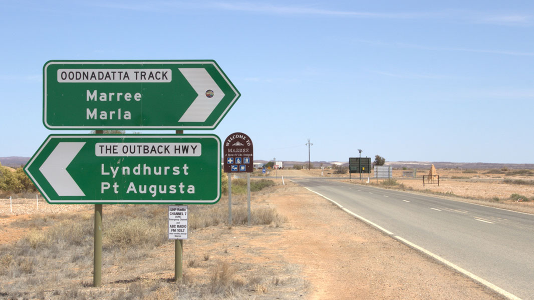 |
Intersection Directional Sign: ID sign approaching Oodnadatta Track at Marree, November 2016. D83 turns left at this location. Image © Richard Wardle |
|
 |
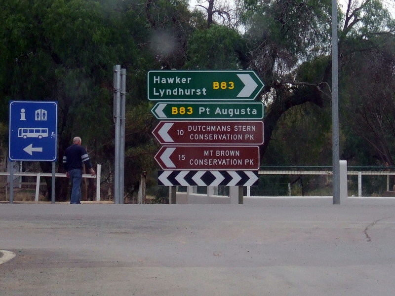
Black ID Sign: Nice old black intersection directional sign on the corner of Cradock and Wilpena Roads in Hawker, June 2008. Image © Darrin Smith |
 |
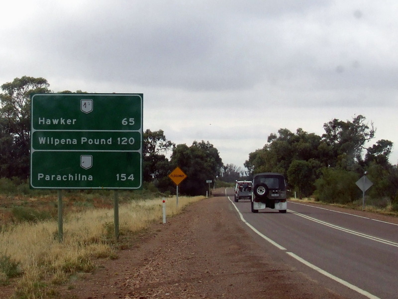
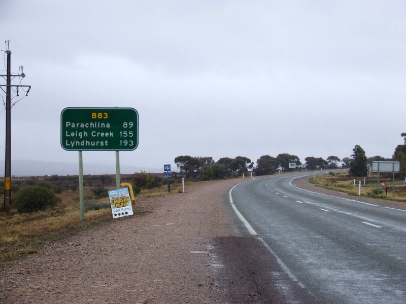
Reassurance Directional Sign: Distance sign at Marree, April 2014. Image © Richard Wardle |
|
 |
ID Sign: Intersection directional sign facing Wilpena Road traffic in Hawker, June 2008. Image © Darrin Smith |
 |
AD Sign: Advance directional sign with old defunct route numbers and a dodgy patch job, approaching Wilpena Road in Hawker. June 2008. Image © Darrin Smith |
|
 |
Distance Sign: RD sign as you leave the town of Hawker, June 2008. Image © Darrin Smith |
 |
Black ID Sign: Black intersection directional sign, with slightly newer ID signs, all with old defunct route numbering. These face Druid Range Drive at Hawker, June 2008. Image © Darrin Smith |
|
 |
Reassurance Directional Sign: Distance sign with remnant NR83 shield at Parachilna, April 2014. Image © Richard Wardle |
 |
Distance Sign: RD sign after Druid Range Drive at Hawker. June 2008. Image © Darrin Smith |
|
 |
Oodnadatta Track: The Outback Hwy (D83) at the junction with Oodnadatta Trk (D95) and Birdsville Trk (D83) at Marree, April 2014. Image © Richard Wardle |
 |
Intersection Directional Sign: Southbound intersection directional sign with old NR47 shield near East Terrace as you travel along Railway Terrace in Quorn, June 2008. Image © Darrin Smith |
|
 |
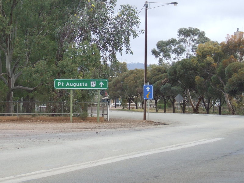
Advance Directional Sign: AD sign on Flinders Ranges Way (Railway Tce) (B83) at Quorn approaching Horrocks Hwy (Sixth St) (B82), April 2014. Image © Richard Wardle |
|||
| Click here for the continuation of the route as Eyre Developmental Rd (NR83) in Queensland | ||||
1 Transport SA, State Route Numbers map, May 2003
2 Transport SA
Last updated: 08-May-2019 9:20
This site © Paul Rands. All rights reserved. Some portions © (copyright) by their respective and credited owners. Permission must be obtained before using any images from this site. For details, please email by clicking here.