|
|
|
|
|
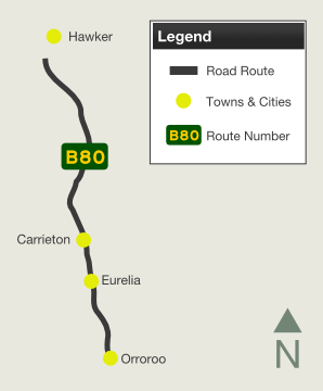
| B80 | RM Williams Way (B80) |
Statistics:
Route Numbering:

General Information:
RM Williams Way major road in South Australia's mid north, which runs between Stanley Flat (near Clare) and Hawker, via Jamestown. The route is named in honour of the bush clothing businessman was born in 1908 in the town of Jamestown, which the route passes through. 2
There are 3 multiplexes along the route, they are as follows:
History:
| Hawker to Orroroo | Orroroo to Stanley Flat |
 |
 |
| Stanley Flat to Hawker | Hawker to Stanley Flat | |||
| Preview: | Description: | Preview: | Description: | |
 |
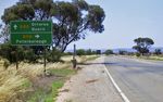
Reassurance Directional Sign: Distance sign at Stanley Flat, October 2012. Image © Michael Greenslade |
 |
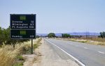
Distance Sign: RD sign as you leave the town of Cradock. June 2008. Image © Darrin Smith |
|
 |
Black Intersection Directional Sign: Black ID sign with remnant NR83 shield at Euromina, at the Andrews Rd intersection, October 2012. Image © Michael Greenslade |
 |
Advance Directional Sign: AD sign on Fourth Street, approaching the intersection with Second Street in Orroroo, June 2008. Click here for a photo of this location by Michael Greenslade from December 2003. Image © Darrin Smith |
|
 |
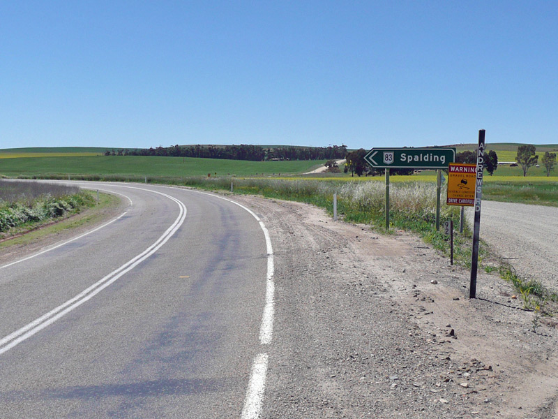
Advance Directional Sign: AD sign at Spalding approaching Goyder Hwy (B64), October 2012. The B64 duplex begins at this junction. Image © Michael Greenslade |
 |
Black Reassurance Directional Sign: Black distance sign at Black Rock, December 2003. Image © Michael Greenslade |
|
 |
Advance Directional Sign: AD sign at Spalding as you approach the Goyder Hwy junction (the northern end of the B64 duplex). October 2012. |
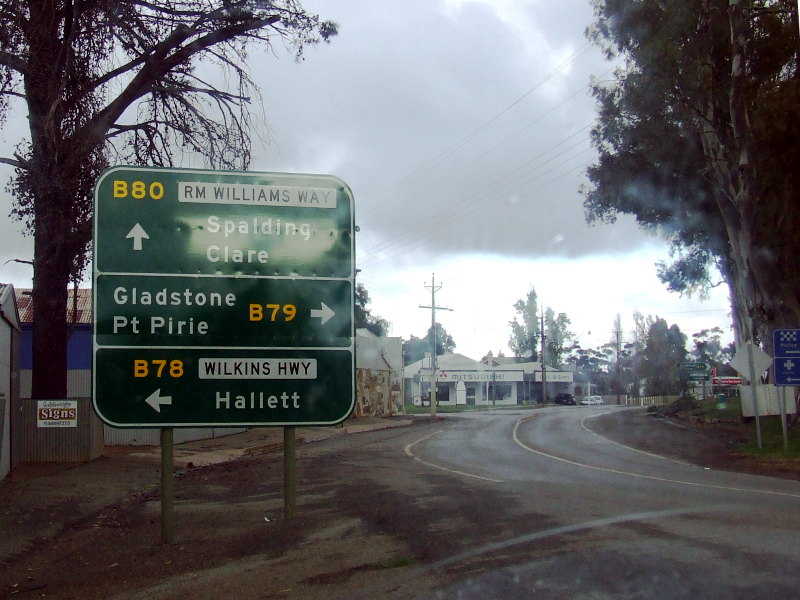 |
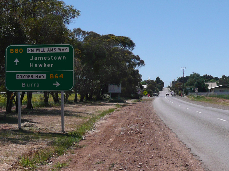
Advance Directional Sign: Southbound through Jamestown as you approach Ayr Street (B78 / B79). June 2008. Image © Darrin Smith |
|
 |
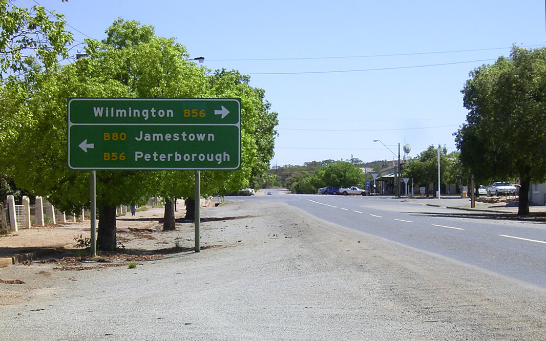
Intersection Directional Sign: ID sign at the corner of Main St and Government Rd at Spalding, November 2016. Note the old fingerboards. Image © Paul Rands |
|
 |
Advance Directional Sign: AD sign at Spalding approaching Goyder Hwy (B64), October 2012. The B64 duplex begins at this junction. Image © Michael Greenslade |
 |
Reassurance Directional Sign: Distance sign at Spalding, November 2016. Image © Paul Rands |
|
 |
Reassurance Directional Sign: Distance sign at Spalding, October 2012. Image © Michael Greenslade |
 |
Reassurance Directional Sign: Distance sign at Spalding, October 2012. Image © Michael Greenslade |
|
 |
Advance Directional Sign: AD sign at Spalding approaching Goyder Hwy (B64), October 2012. The B64 duplex ends at this junction. Image © Michael Greenslade |
 |
Intersection Directional Sign: ID sign at the junction with Goyder Hwy (B64) at Spalding, November 2016. The B64 duplex ends in this location. Image © Paul Rands |
|
 |
Reassurance Directional Sign: Distance sign at Spalding, October 2012. Image © Michael Greenslade |
 |
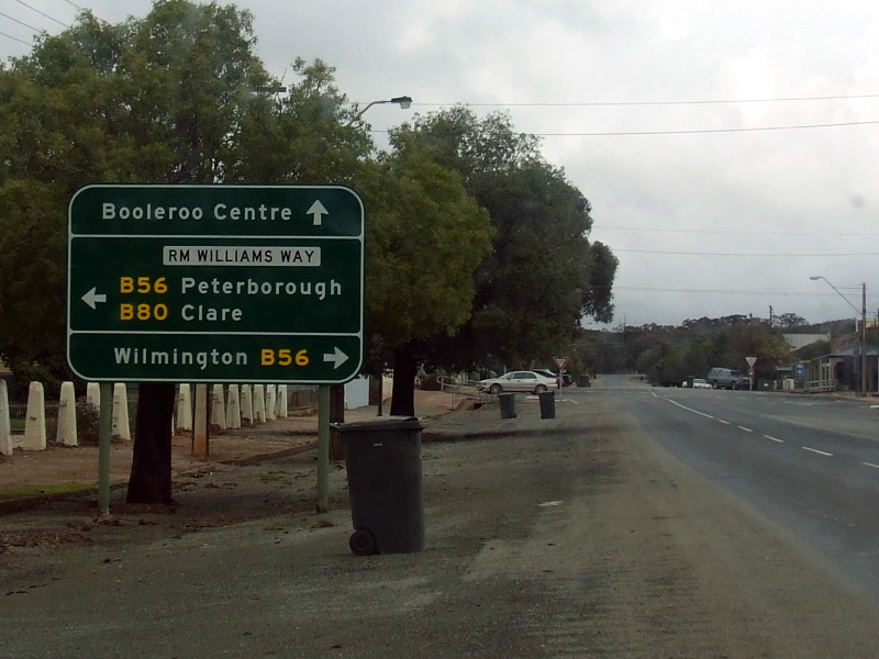
Advance Directional Sign: AD sign at Black Rock approaching Petersburg Rd (B56), December 2003. The B56 duplex starts at this intersection. Note the missing B56 from the top panel. Image © Michael Greenslade |
|||
 |
Black Reassurance Directional Sign: Black distance sign at Black Rock, December 2003. Image © Michael Greenslade |
|||
 |
Entering Orroroo: RM Williams Way (B80) as it enters the town of Orroroo, December 2003. Image © Michael Greenslade |
|||
 |
Reassurance Directional Sign: Distance sign at Orroroo, December 2003. Image © Michael Greenslade |
|||
1 Location SA Map Viewer
2 Australian Broadcasting Corporation
3 SA Government
4 Government of South Australia, Department of Planning, Infrastructure & Transport, News, Mid North and Yorke Peninsula to benefit from major investment in roads, 22 Jun 2015
5 Government of South Australia, Department of Planning, Infrastructure & Transport, News, Safer access to Clare Valley aerodrome, 02 Feb 2015
Last updated: 08-Dec-2020 0:38
This site © Paul Rands. All rights reserved. Some portions © (copyright) by their respective and credited owners. Permission must be obtained before using any images from this site. For details, please email by clicking here.