|
|
|
|
|
| A87 | Stuart Highway (A87) - Coober Pedy to Northern Territory Border |
Statistics:
Route Numbering:


General Information:
The Stuart Highway is named after explorer John McDouall Stuart, the first European to cross Australia from South to North, and it generally follows his route. 2
It is a rural highway, which is very isolated, and acts as part of the main road link between Darwin, Alice Springs and Adelaide.
History:
| Coober Pedy to NT Border | NT Border to Coober Pedy | |||
| Preview: | Description: | Preview: | Description: | |
 |
Services Sign: Sign at Mt Willoughby showing distance to next emergency phone, November 2016. Image © Paul Rands |
 |
SA Welcome Sign: Crossing from NT into SA, southbound. This sign shows South Australia for southbound traffic and Northern Territory for northbound traffic. Marla, November 2016. |
|
 |
Advance Directional Sign: AD sign approaching Pootnoura Rest Area at Pootnoura, November 2016. Image © Paul Rands |
 |
Advance Direction Sign: Southbound approaching Mintabie Road at Marla. September 2008. Image © Kate Pilling |
|
 |
Pootnoura Rest Area: Stuart Hwy (A87) as it passes Pootnoura Rest Area at Pootnoura, November 2016. Image © Paul Rands |
 |
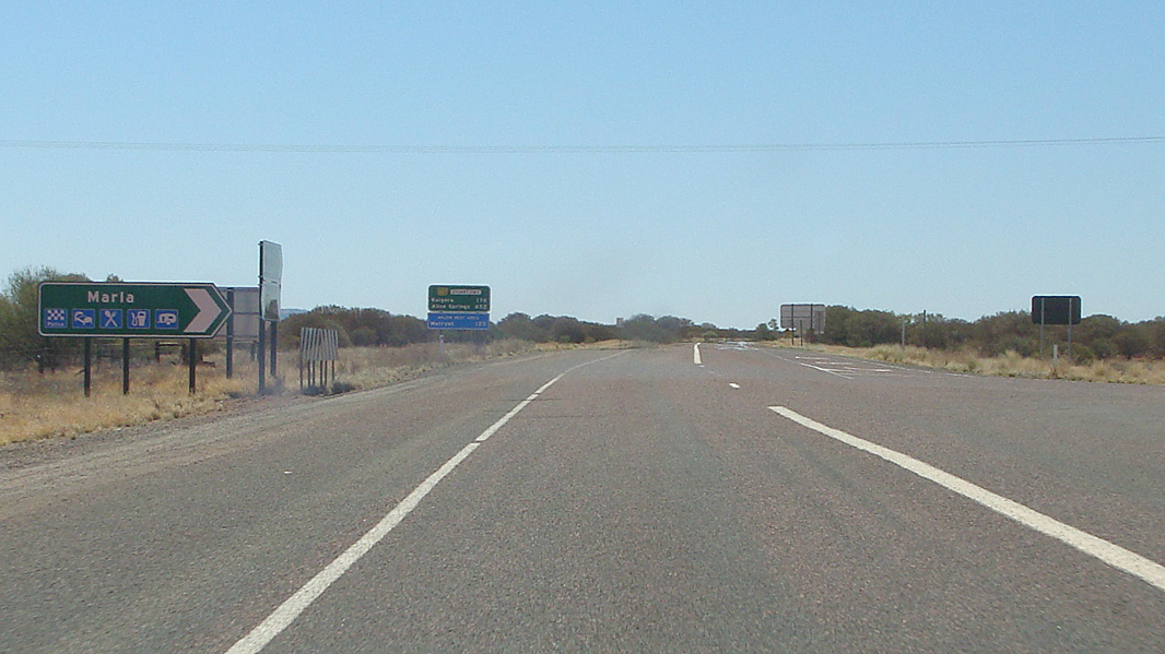
AD Sign: Advance directional sign for the Oodnadatta Track intersection at Marla, September 2008. Image © Kate Pilling |
|
 |
Services Sign: Sign showing distance to next services, Pootnoura, November 2016. Image © Paul Rands |
 |
Intersection Directional Sign Assembly: Signage facing roadhouse traffic on the Oodnadatta Track in Marla, near the Stuart Highway, September 2008. Image © Kate Pilling |
|
 |
Services Sign: Services sign at Cadney Park, November 2016. Image © Paul Rands |
 |
Intersection Directional Sign Assembly: Signage facing traffic on the Oodnadatta Track in Marla, September 2008. Image © Kate Pilling |
|
 |
Approaching Painted Desert Road: ID sign for Painted Desert Rd at Cadney Park being used as an AD sign, November 2016. Image © Paul Rands |
 |
Distance Sign: Southbound RD sign as you leave Marla, September 2008. Image © Kate Pilling |
|
 |
Painted Desert Road: Corner of Stuart Hwy (A87) and Painted Desert Rd at Cadney Park, November 2016. Image © Paul Rands |
|||
 |
Services Sign: Sign at Cadney Park showing distance to next emergency phone, November 2016. Image © Paul Rands |
|||
 |
Black Intersection Directional Sign: Black ID sign at the entrance to Cadney Park Homestead, November 2016. Image © Paul Rands |
|||
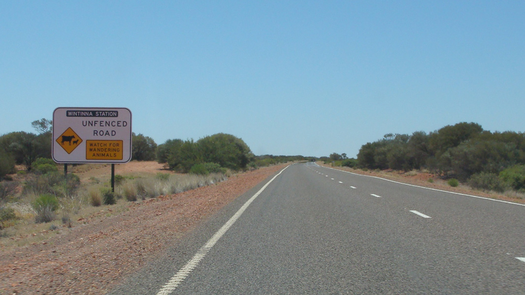 |
Wintinna Station: Sign at Cadney Park as Stuart Hwy (A87) crosses the property boundary for Wintinna Station, November 2016. Image © Paul Rands |
|||
 |
Welbourne Hill Station: Sign at Marla as Stuart Hwy (A87) crosses the property boundary for Welbourne Hill Station, November 2016. Image © Paul Rands |
|||
 |
Services Sign: Services sign at Marla, November 2016. Image © Paul Rands |
|||
 |
AD Sign: Advance directional sign for the Oodnadatta Track (D95) intersection at Marla, November 2016. Click here for a photo of this location by Kate Pilling from August 2008. Image © Paul Rands |
|||
 |
Oodnadatta Track: Corner of Stuart Hwy (A87) and Oodnadatta Trk (D95) at Marla, November 2016. Image © Paul Rands |
|||
 |
Reassurance Directional Sign: Distance sign at Marla, November 2016. Image © Paul Rands |
|||
 |
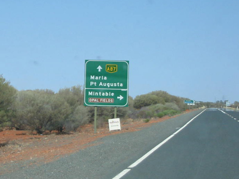
Advance Directional Sign: AD sign at Marla, approaching Mintabie Rd, November 2016. Image © Paul Rands |
|||
 |
Mintabie Road: Corner of Stuart Hwy (A87) and Mintabie Rd at Marla, November 2016. Image © Paul Rands |
|||
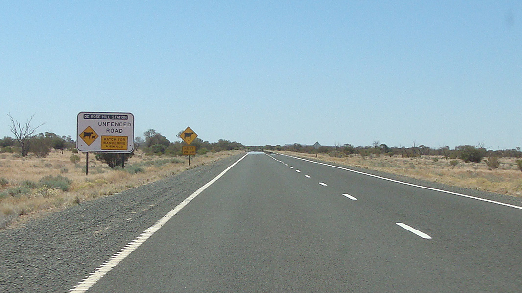 |
De Rose Hill Station: Sign at De Rose Hill as Stuart Hwy (A87) crosses the property boundary for De Rose Hill Station, November 2016. Image © Paul Rands |
|||
 |
Services Sign: Sign at De Rose Hill showing distance to next emergency phone, November 2016. Image © Paul Rands |
|||
 |
Advance Directional Sign: AD sign approaching The Marryat Rest Area at De Rose Hill, November 2016. Image © Paul Rands |
|||
 |
Pootnoura Rest Area: Stuart Hwy (A87) as it passes The Marryat Rest Area at De Rose Hill, November 2016. Image © Paul Rands |
|||
 |
Services Sign: Sign showing distance to next services, De Rose Hill, November 2016. Image © Paul Rands |
|||
 |
Advance Directional Sign: AD sign at Ayers Range South approaching the SA / NT Border, November 2016. Image © Paul Rands |
|||
 |
State Border: Stuart Hwy (A87) as it crosses from South Australia to Northern Territory, November 2016. A87 becomes NH87 at this point. Image © Paul Rands |
|||
 |
State Border: Stuart Hwy (A87) as it crosses from South Australia to Northern Territory, 2001. A87 becomes NH87 at this point. Image © Jamie Scuglia |
|
|
|
| Click here for the continuation of the Stuart Highway as NH87 in the Northern Territory Click here for the continuation of A87 between Pimba and Coober Pedy |
||||
1 Transport SA
2 NT Government Chief Minister's Office
3 Government of South Australia
4 History Trust of South Australia
Last updated: 05 Oct 2019 14:45
This site © Paul Rands. All rights reserved. Some portions © (copyright) by their respective and credited owners. Permission must be obtained before using any images from this site. For details, please email by clicking here.