| |
| |
 |
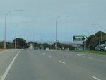
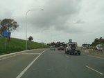
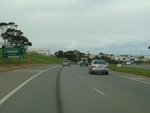
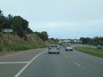
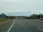
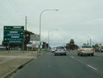
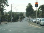
Advance Directional Sign:
AD sign on Dyson Road, approaching Beach Road at Christies Beach, September 2009.
Image © Paul Rands
|
|
 |
Advance
Directional Sign:
Southbound as you approach the intersection with Old Port Road in
Queenstown. December 2004.
Image © Darrin Smith
|
 |
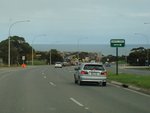
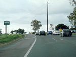
Advance Directional Sign:
AD sign on Dyson Road, approaching the roundabout with Gulfview Road and Flaxmill Road at Christies Beach, September 2009.
Image © Paul Rands
|
|
 |
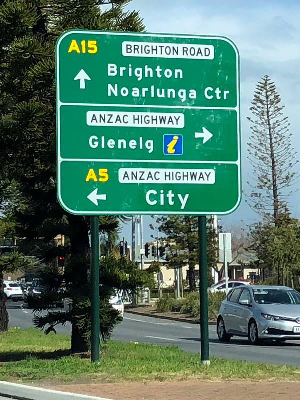
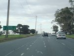
Advance
Directional Sign:
Southbound on Brighton Rd (A15) approaching the intersection with Anzac Hwy (A5 and unnumbered) at Glenelg North, September 2019..
Image © Dean Sherry
|
 |
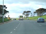
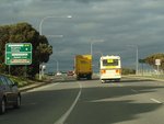
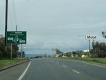
Trailblazer:
A15 trailblazer after the roundabout with Gulfview Road and Flaxmill Road at Christies Beach, September 2009.
Image © Paul Rands
|
|
 |
Distance Sign:
RD
sign on Brighton Rd (A15) at Glenelg North, December 2003.
Image © Michael Greenslade
|
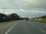 |
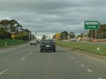
Entering Lonsdale:
Lonsdale Road as it enters Lonsdale, September 2009.
Image © Paul Rands
|
|
 |
Ocean Boulevard:
A15 as it makes its way up the hill at Seacliff Park, September 2009.
Image © Paul Rands
|
 |
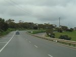
Approaching O'Sullivan Beach Road:
Lonsdale Road in Lonsdale as it approaches the intersection with O'Sullivan Beach Road, September 2009.
Image © Paul Rands
|
|
 |
Distance Sign:
RD
sign on Lonsdale Road in Trott Park, approaching Perry Barr Road,
September 2009. This sign probably pre-dates the introduction of
alphanumeric route numbering in SA.
Image © Paul Rands
|
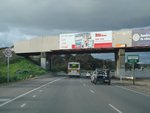 |
Railway Overpass:
The railway overpass near Lonsdale station, approaching Aldenhoven Road, September 2009.
Image © Paul Rands
|
|
 |
Approaching Lander Road:
Lonsdale Rd as it approaches Lander Rd in Sheidow Park, September 2009.
Image © Paul Rands
|
 |
Advance Directional Sign:
AD sign approaching Sherriffs Road in Lonsdale, September 2009.
Image © Paul Rands
|
|
 |
The Cove Road Intersection:
Corner of Lonsdale Rd and The Cove Road in Hallett Cove, September 2009.
Image © Paul Rands
|
 |
Trailblazer:
A15 trailblazer after the Sherrifs Rd junction in Lonsdale, September 2009.
Image © Paul Rands
|
|
 |
Approaching Gretel Crescent:
Lonsdale Road approaching Gretel Crescent in Hallett Cove, with the Gulf of St Vincent in the background, September 2009.
Image © Paul Rands
|
 |
Approaching Meyer Road:
Lonsdale Rd approaching the intersection with Meyer Rd in Lonsdale, September 2009.
Image © Paul Rands
|
|
 |
Entering Lonsdale:
Lonsdale Rd as it enters Lonsdale near Meyer Rd, September 2009.
Image © Paul Rands
|
 |
Lonsdale:
Looking out to the Gulf of St Vincent, as Londsale Road makes its way through the hilly suburb of Lonsdale, September 2009.
Image © Paul Rands
|
|
 |
Approaching Lindsay Road:
Lonsdale Rd approaching Lindsay Rd in Lonsdale, September 2009.
Image © Paul Rands
|
 |
Approaching Gretel Crescent:
Lonsdale Rd as it approaches Gretel Cres in Hallett Cove, September 2009.
Image © Paul Rands
|
|
 |
Advance Directional Sign:
Lonsdale Road as it approaches Sherriffs Road in Lonsdale, September 2009. A15 becomes Dyson Road beyond this junction.
Image © Paul Rands
|
 |
Advance Directional Sign:
AD sign approaching The Cove Road at Hallett Cove, September 2009.
Image © Paul Rands
|
|
 |
Trailblazer:
A15 trailblazer on Dyson Road in Lonsdale, September 2009.
Image © Paul Rands
|
 |
The Cove Road Junction:
Corner of Lonsdale Rd & The Cove Rd in Hallett Cove, September 2009.
Image © Paul Rands
|
|
 |
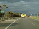
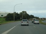
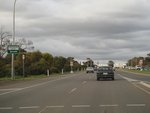
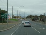
Approaching Aldenhoven Road:
Dyson Road in Lonsdale, approaching Aldenhoven Road, September 2009.
Image © Paul Rands
|
 |
Approaching Lander Road:
Lonsdale Rd as it approaches Lander Road in Hallett Cove, September 2009.
Image © Paul Rands
|
|
 |
Distance Sign:
RD sign with railway overpass in the background, near Lonsdale railway station, September 2009.
Image © Paul Rands
|
 |
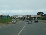
Approaching Barramundi Drive:
Lonsdale Road as it approaches Barramundi Drive in Hallett Cove, September 2009.
Image © Paul Rands
|
|
 |
Approaching O'Sullivan Beach road:
Dyson Rd approaching O'Sullivan Beach Rd in Lonsdale, September 2009.
Image © Paul Rands
|
 |
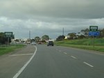
Approaching Perry Barr Road:
Lonsdale Road as it approaches Perry Barr Road in Hallett Cove, September 2009.
Image © Paul Rands
|
|
 |
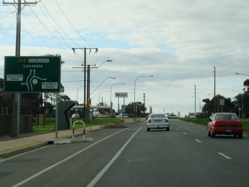
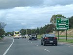
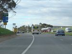
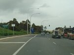
Advance Directional Sign:
AD sign at Christies Beach, approaching the roundabout with Gulfview Road and Flaxmill Road, September 2009.
Image © Paul Rands
|
 |
Advance Directional Sign:
AD
sign approaching the intersection with Majors Road in Hallett Cove,
September 2009. A15 changes name from Lonsdale Road to Ocean Boulevard
from this intersection.
Image © Paul Rands
|
|
 |
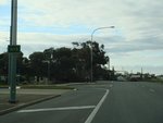
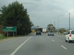
AD Sign:
Advance directional sign approaching the intersection with Beach Road at Christies Beach, September 2009.
Image © Paul Rands
|
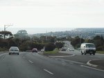 |
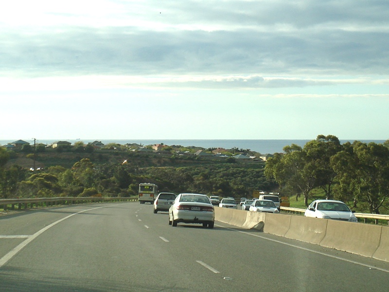
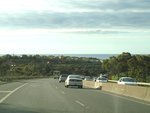
Seacliff Park:
Ocean
Boulevard at Seacliff Park, overlooking the suburbs of Marino, Seacliff
and Kingston Park with Holdfast Bay in the distance, September 2009.
Image © Paul Rands
|
|
 |
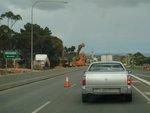
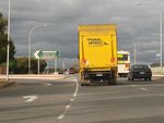
Approaching Goldsmith Drive & Hinton Street:
Dyson Rd at Christies Beach, as it approaches the roundabout with Goldsmith Dr & Hinton St, September 2009.
Image © Paul Rands
|
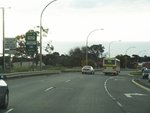 |
Advance Directional Sign:
AD
sign at Seacliff Park, as Ocean Boulevard approaches Sholefield Road.
September 2009. A15 becomes Brighton Road after this junction.
Image © Paul Rands
|
|
|
|
 |
Corner of Brighton & Secombe Roads:
Looking
north towards South Brighton and Brighton, at the signalised junction
of Brighton and Secombe Roads in Seacliff Park, September 2009.
Image © Paul Rands
|
|
|
|