|
|
|
|
|
| Boonah-Fassifern Road, Ipswich-Boonah Road, Beaudesert-Boonah Road, Mount Lindesay Highway, Beaudesert-Nerang Road, Beaudesert-Beenleigh Road, Mundoolun Connection Road, Nerang Connection Road & Nerang-Broadbeach Road (State Route 90) - Bromelton to Fassifern |
Statistics:
Route Numbering:
General Information:
State Route 90 is a collection of roads connecting the Cunningham Highway (and eventually the Darling Downs) with the Gold Coast.
West of Nerang the route is a rural style route, and east of Nerang the route takes on an suburban arterial road design.
Several major routes are connected by SR90, including Cunningham Hwy (NH15), Mt Lindesay Hwy (NR13), Pacific Mwy (M1) and Gold Coast Hwy (SR2).
History:
| Bromelton to Fassifern | Fassifern to Bromelton | |||
| Preview: | Description: | Preview: | Description: | |
 |
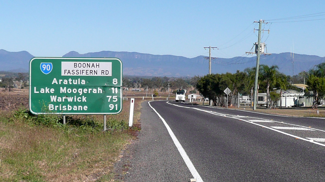
Reassurance Directional Sign: Distance sign at Fassifern, November 2013. Click here for a photo of this location by Michael Greenslade from May 2012. Image © Michael Greenslade |
 |
Reassurance Directional Sign: Distance sign at Coulson, May 2005. Image © Michael Greenslade |
|
 |
Advance Directional Sign: AD sign at Fassifern approaching Lake Moogerah Rd, May 2012. Image © Michael Greenslade |
|||
| Click here for the continuation of State Route 90 between Canungra and Bromelton | ||||
1 Transport
and Main Roads, Queensland state-controlled roads and region maps, South
Coast Region: front
2 Queensland Government, Ministerial
Media Statements, Minister for Infrastructure and Planning, Opportunity
to see Wyaralong Dam Project. 13August 2010.
3 Transport and Main Roads,
Projects, Reynolds Creek Bridge Replacement, June 2010.
Last updated: 21-Oct-2021 19:31
This site © Paul Rands. All rights reserved. Some portions © (copyright) by their respective and credited owners. Permission must be obtained before using any images from this site. For details, please email by clicking here.