|
|
|
|
|
 |
Sunshine Motorway, Emu Mountain Road & Walter Hay Drive (State Route 70) - Marcoola to Noosaville |
Statistics:
Route Numbering:
General Information:
State Route 70 is a major arterial route linking a large number of coastal suburbs along the Sunshine Coast, north of Brisbane.
The route is limited access for its length, and passes through residential, commercial, industrial and bushland areas, and acts as a bypass of the busy local roads around the coast.
State Route 70 is a mix of divided and undivided motorway road, with at-grade access north of the North Shore Connection Road interchange at Pacific Paradise. It is also north of this interchange the route changes from mostly divided to undivided roadway with 1 lane in each direction.
 Sunshine Motorway:
The Sunshine Motorway began life a toll road, with a franchise period of 30 years, after which date, the assets of the company were to revert to the State of Queensland. 2 The tolling period instead ended in 1996 after strong community opposition.
The Sunshine Motorway Company Limited was formed to construct, operate and maintain the Sunshine Motorway. 2 The motorway was originally built in two stages and further upgraded in the first decade of the 21st century.
History:
Click here for photos of the former SR70 alignment between Marcoola and Noosaville
| Marcoola to Noosaville | Noosaville to Marcoola | |||
| Preview: | Description: | Preview: | Description: | |
 |
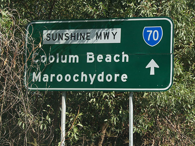
Reaassurance Directional Sign: Distance sign on Sunshine Mwy (SR70) at Coolum Beach, March 2006. Image © Paul Rands |
 |
Advance Directional Sign: AD sign on Murdering Ck Rd approaching the roundabout with Peregian Springs Dr, Sunshine Mwy (SR70) and Emu Mtn Rd (SR70) at Peregian Springs, April 2012. Image © Paul Rands |
|
 |
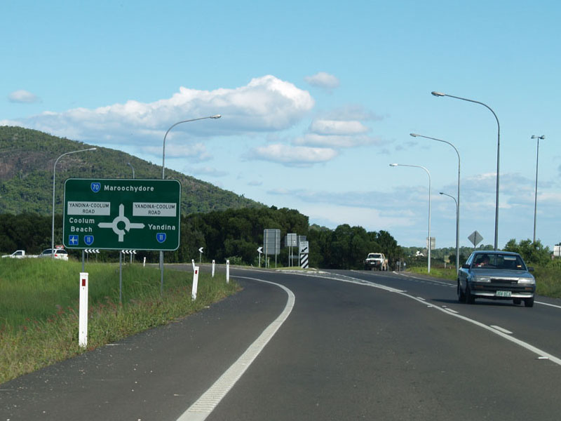
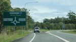
Advance Directional Sign: AD sign approaching Yandina-Coolum Rd (SR11) at Coolum Beach, March 2006. All junctions with SR70 are at-grade from this point onwards. Image © Paul Rands |
 |
Intersection Directional Sign: ID sign at the roundabout with Peregian Springs Dr and the unnumbered section of Emu Mtn Rd at Peregian Springs, April 2008. Image © Rob Tilley |
|
 |
Yandina-Coolum Road: Intersection directional sign at the roundabout with Yandina-Coolum Rd (SR11) at Coolum Beach, March 2006. Image © Paul Rands |
 |
Distance Sign: RD sign on Sunshine Mwy (SR70) at Peregian Springs, April 2008. Image © Rob Tilley |
|
 |
Yandina-Coolum Road: Intersection directional sign at the roundabout with Yandina-Coolum Rd (SR11) at Coolum Beach, March 2006. Image © Paul Rands |
 |
Advance Directional Sign: AD sign approaching Yandina-Coolum Rd (SR11) at Coolum Beach, April 2008. Image © Rob Tilley |
|
 |
Advance Directional Sign: AD sign on Sunshine Mwy (SR70) approaching Peregian Springs Dr and Emu Mtn Rd (unnumbered section), March 2006. SR70 becomes Emu Mtn Rd from this junction Image © Paul Rands |
 |
Yandina-Coolum Road: Intersection directional sign at the roundabout with Yandina-Coolum Rd (SR11) at Coolum Beach, April 2008. Image © Rob Tilley |
|
 |
Intersection Directional Sign: ID sign on the roundabout with the unnumbered section of Emu Mountain Rd and Perigian Springs Dr at Peregian Springs, April 2012. Image © Paul Rands |
 |
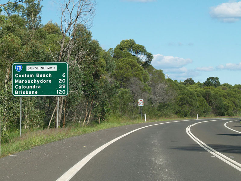
Distance Sign: RD sign on Sunshine Mwy (SR70) at Coolum Beach, April 2008. Image © Rob Tilley |
|
 |
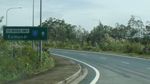
Distance Sign: RD sign on Emu Mountain Rd (SR70) at Peregian Springs, April 2012. Image © Paul Rands |
|||
 |
Advance Directional Sign: AD sign on Emu Mountain Rd (SR70) approaching Perigian Springs Rd (formerly Doonan Bridge East Rd) and Murdering Ck Rd at Peregian Springs, April 2012. Click here for a photo by Paul Rands of this location from March 2006. Image © Paul Rands |
|||
 |
Intersection Directional Sign: ID sign on the roundabout with Peregian Springs Dr and Murdering Ck Rd at Peregian Springs, April 2012. Image © Paul Rands |
|||
 |
Intersection Directional Sign: ID sign on the roundabout with Peregian Springs Dr and Murdering Ck Rd at Peregian Springs, April 2012. Image © Paul Rands |
|||
 |
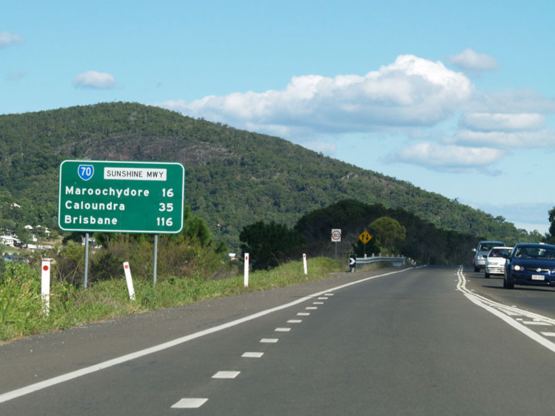
Distance Sign: RD sign on Emu Mtn Rd (SR70) at Peregian Springs, March 2006. Image © Paul Rands |
|||
 |
Advance Directional Sign : AD sign at Weyba Downs, approaching Emu Mtn Rd (unnumbered despite showing SR12 on the sign) and Eumarella Rd, April 2012. SR70 becomes Walter Hay Dr at this junction. Image © Paul Rands |
|||
 |
Intersection Directional Sign : ID sign at Weyba Downs, on the roundabout with Emu Mtn Rd (unnumbered despite showing SR12 on the sign) and Eumarella Rd, April 2012. Image © Paul Rands |
|||
| Click here for the continuation of State Route 70 between Tanawha and Marcoola | ||||
1 Transport & Main Roads, Queensland state-controlled roads and region maps, North Coast Region: front
2 Sunshine Motorway Company, Annual Report for the year ended 30 June 1996
3 Tyler Bullock
4 Sunshine Motorway Company, Annual Report for the year ended 30 June 1992
Last updated: 18-Nov-2018 12:20
This site © Paul Rands. All rights reserved. Some portions © (copyright) by their respective and credited owners. Permission must be obtained before using any images from this site. For details, please email by clicking here.