|
|
|
|
|

|
|
Mount Cotton Road (State Route 45) |
Statistics:
Route Numbering:


General Information:
State Route 45 is mostly a rural route servicing residential, commercial and rural areas. The route passes through significant koala habitat and bushland.
Multiplexes along the route include:
History:

| Cornubia to Capalaba | |
Capalaba to Cornubia | ||
| Preview: | Description: | |
Preview: | Description: |
 |
Reassurance
Directional Sign: Distance sign at Cornubia, March 2006. Image © Michael Greenslade |
|
 |
Reassurance
Directional Sign: Distance sign at Sheldon, March 2006. Image © Michael Greenslade |
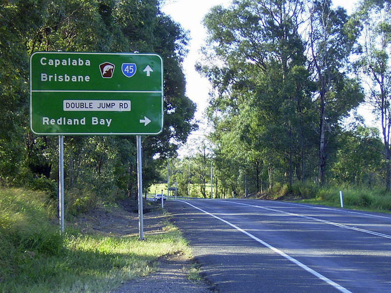 |
Advance Directional
Sign: AD sign at Mt Cotton approaching Double Jump Rd, March 2006. Image © Michael Greenslade |
|
 |
Advance
Directional Sign: AD sign at Sheldon approaching Woodlands Dr, March 2006. Image © Michael Greenslade |
 |
Black Reassurance
Directional Sign: Black distance sign at Mt Cotton, March 2006. Image © Michael Greenslade |
|
 |
Black
Advance Directional Sign: Black AD sign on Woodlands Dr at Mt Cotton, March 2006. Image © Michael Greenslade |
| |
 |
Black Intersection
Directional Sign: Black ID sign facing Woodlands Dr at Mt Cotton, March 2006. Image © Michael Greenslade |
||
| |
 |
Advance Directional
Sign: AD sign Beenleigh-Redland Bay Rd (SR47) and Skinner Rd at Cornubia, March 2006. This is the southern terminus of SR45. Image © Michael Greenslade |
||
1 Queensland
Government, Transport and Main Roads, Metropolitan Road Region East Map,
September 2011
2 Queensland Government, Transport and
Main Roads, Mount Cotton Road-Wuduru Road intersection Fact Sheet, March
2013
Last updated: 02 Nov 2019 19:33
This site © Paul Rands. All rights reserved. Some portions © (copyright) by their respective and credited owners. Permission must be obtained before using any images from this site. For details, please email by clicking here.