|
|
|
|
|
 |
Burke Developmental Road (State Route 27) |
Statistics:
Route Numbering:

General Information:
State Route 27 in Far North Queensland is an inland rural route, west of Cairns. It connects remote towns and settlements west of the Atherton Tablelands with the eastern coastal regions around Cairns.
The route is a undivided single carriageway, with continuous seal to the town of Almaden. Beyond Almaden, the route is a mix of mostly gravel and small sealed sections. 3
The themed Wheelbarrow Way route is named after the pioneers who wheeled their belongings through the area in the 1800s. 4
Multiplexes along the route include:

| Chillagoe to Mareeba | Mareeba to Chillagoe | |||
| Preview: | Description: | Preview: | Description: | |
 |
Reassurance Directional Sign: Distance sign at Chillagoe, January 2014. Image © Terry Siva |
 |
Trailblazer: Faded SR27 trailblazer at Tabacum, January 2014. Image © Terry Siva |
|
 |
Advance Directional Sign: AD sign approaching Almaden-Gingerella Rd at Almaden, January 2014. Image © Terry Siva |
 |
Intersection Directional Sign: AD sign acting as an ID sign at Dimbulah, corner of Dimbulah-Chillagoe Rd, January 2014. Image © Terry Siva |
|
 |
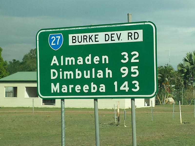
Distance Sign: RD sign at Almaden, January 2014. Image © Terry Siva |
 |
Distance Sign: Reassurance directional sign at Dimbulah, January 2014. Image © Terry Siva |
|
 |
Advance Directional Sign: AD sign at Petford approaching Herberton-Petford Rd, January 2014. Image © Terry Siva |
|||
 |
AD sign: Advance directional sign approaching Almaden-Gingerlla Rd at Almaden, January 2014. Image © Terry Siva |
|||
 |
RD sign: Distance sign at Almaden, January 2014. Image © Terry Siva |
|||
 |
Distance sign: RD sign at Chillagoe, January 2014. Image © Terry Siva |
|||
 |
Distance sign: RD sign at Howitt, June 2018. Image © Dean Sherry |
|||
1 Department of Transport and Main Roads, Map of Far North Road Region, 2011
2 Department of Transport and Main Roads, Map of North West Road Region, 2011
3 Terry Siva
4 Mission Beach Tourism, Tropical North Queensland Hidden Secrets Handbook, Page 19
Last updated: 07-Jul-2020 10:13
This site © Paul Rands. All rights reserved. Some portions © (copyright) by their respective and credited owners. Permission must be obtained before using any images from this site. For details, please email by clicking here.