|
|
|
|
|
| Gold Coast Highway (State Route 2) - Surfers Paradise to Helensvale |
Statistics:
Route Numbering:


General Information:
The Gold Coast Highway is the former Pacific Highway route between the NSW border and Helensvale.
The route is a mix of divided and undivided urban highway, which passes mostly along the coast, right through the heart of the Gold Coast. The route passes through light industrial areas, as well as commercial, residential and tourist areas.
History:
Click here for the former alignment between Surfers Paradise and Helensvale
Click here for construction photos of
the upgrade to 4 lanes between Southport and
Labrador
| Surfers Paradise to Helensvale | Helensvale to Surfers Paradise | |||
| Preview: | Description: | Preview: | Description: | |
 |
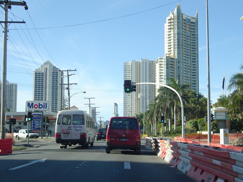
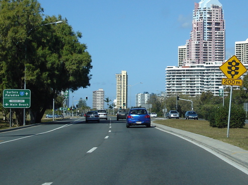
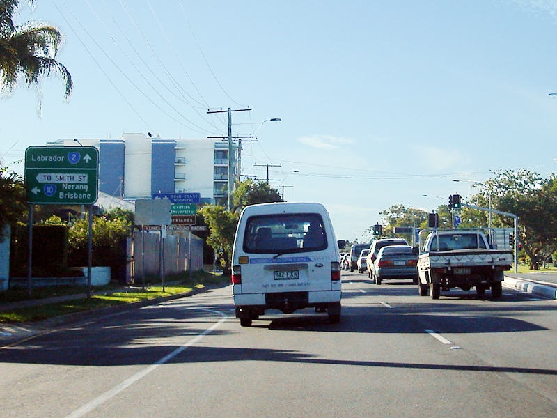
Entering
Surfers Paradise: Gold Coast Hwy (SR2) as it enters Surfers Paradise, March 2006. Image © Paul Rands |
 |
Heslop
Road: Intersection directional sign at Gaven facing Pacific Mwy (M1) off-ramp at the junction with Heslop Rd, July 2007. The sign should have 'To' prefixed to the SR2 shield. Image © Paul Rands |
|
 |
Monaco
Street: Old rounded mast arm signal at the Monaco St junction in Surfers Paradise, March 2006. Image © Paul Rands |
 |
Advance
Directional Sign: AD sign on Heslop Rd at Gaven approaching Binstead Way and the Pacific Mwy (M1) interchange, July 2007. Image © Paul Rands |
|
 |
Advance
Directional Sign: AD sign approaching Ferny Av in Surfers Paradise, March 2006. Image © Paul Rands |
 |
Advance
Directional Sign: AD sign approaching the Binstead Way, Heslop Rd and Pacific Mwy (M1) interchange in Gaven, March 2006. Image © Paul Rands |
|
 |
Ferny Avenune: Gold Coast Hwy (SR2) at the Ferny Av junction, Surfers Paradise, March 2005. Image © Michael Greenslade |
 |
Pacific
Motorway, Binstead Way & Heslop Road: Interchange with Binstead Way, Heslop Rd and Pacific Mwy (M1) interchange in Gaven, March 2006. Image © Paul Rands |
|
 |
Intersection Directional Sign: ID sign at Admiralty Dr Surfers Paradise, July 2018. Image © Rob Tilley |
 |
Pacific
Motorway, Binstead Way & Heslop Road: Interchange with Binstead Way, Heslop Rd and Pacific Mwy (M1) interchange in Gaven, March 2006. Image © Paul Rands |
|
 |
Advance
Directional Sign: AD sign approaching Tedder Av in Surfers Paradise, July 2018. Click here for a photo of this location by Paul Rands from March 2006. Image © Rob Tilley |
 |
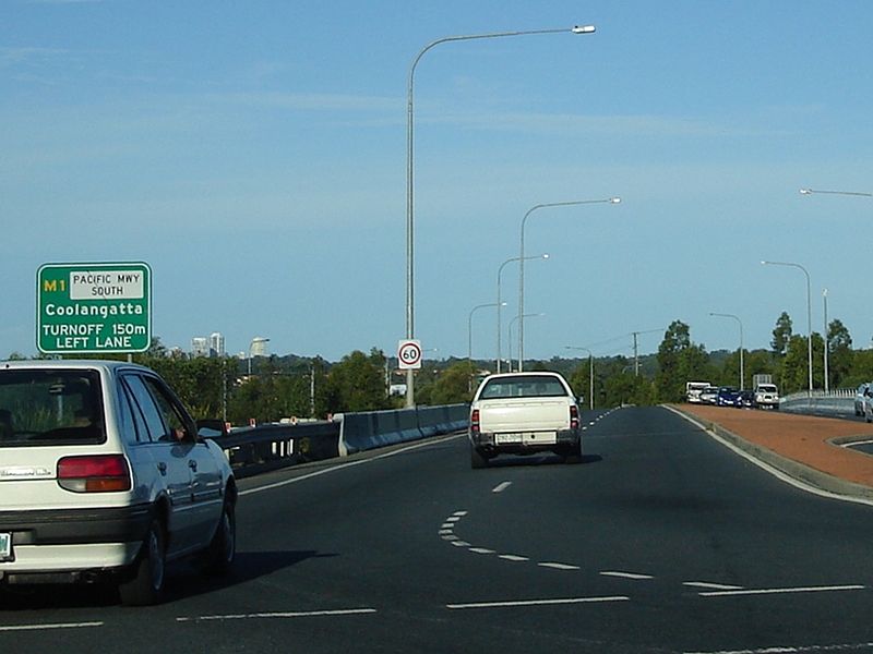
Pacific
Motorway: Southbound on Pacific Mwy (M1) at the interchange with Gold Coast Hwy (SR2), March 2006. Image © Paul Rands |
|
 |
Reassurance
Directional Sign: RD sign at Surfers Paradise, July 2018. Click here for a photo of this location by Paul Rands from March 2006. Image © Rob Tilley |
 |
Advance
Directional Sign: AD sign of the Pacific Mwy (M1) off ramp to Gold Coast Hwy (SR2), approaching Millaroo Dr, March 2009. Image © Rob Tilley |
|
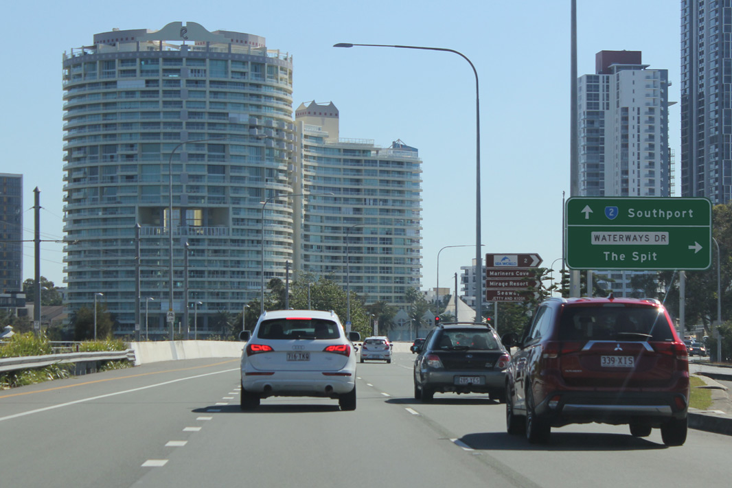 |
Advance Directional Sign: AD sign at Main Beach approaching Waterways Dr, July 2018. Image © Rob Tilley |
 |
Millaroo
Drive: Gold Coast Hwy (SR2) at Millaroo Dr in Helensvale, March 2009. Image © Rob Tilley |
|
 |
Intersection Directional Sign: ID sign at Main Beach near Waterways Dr, July 2018. Image © Rob Tilley |
 |
Advance
Directional Sign: AD sign approaching Discovery Dr and Town Centre Dr in Helensvale, March 2009. Image © Rob Tilley |
|
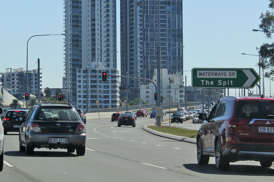 |
Waterways Drive: Corner of Gold Coast Hwy (SR2) and Waterways Dr, Main Beach, July 2018. Image © Rob Tilley |
 |
Discovery
Drive & Town Centre Drive: Gold Coast Hwy (SR2) approaching Discovery Dr and Town Centre Dr at Helensvale, March 2009. Image © Rob Tilley |
|
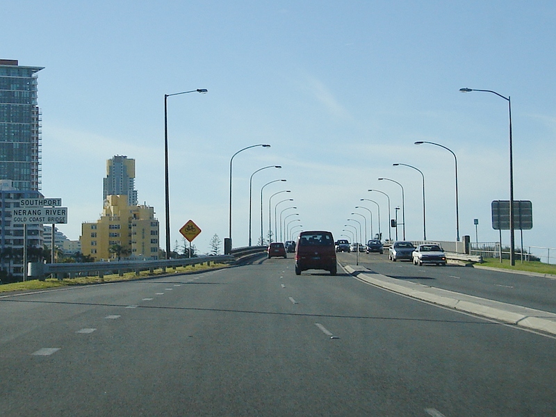 |
Nerang
River: Gold Coast Hwy (SR2) as it enter Southport and crosses the Nerang River via Gold Coast Bridge, March 2006. Image © Paul Rands |
 |
Entering
Coombabah: Gold Coast Hwy (SR2) as it enters the suburb of Coombabah, March 2006. Image © Paul Rands |
|
 |
Advance Directional Sign: AD sign approaching Ada Bell Way (SR20) at Southport, July 2018. Image © Rob Tilley |
 |
Advance
Directional Sign: AD sign approaching Arundel Dr at Arundel, March 2009. Image © Rob Tilley |
|
 |
Ada
Bell Way: Corner of Gold Coast Hwy (SR2) and Ada Bell Way (SR20) at Southport, July 2018. Click here for a photo of this location by Paul Rands from March 2006. Image © Rob Tilley |
 |
Arundel
Drive: Gold Coast Hwy (SR2) at the Arundel Dr junction at Arundel, July 2007. Image © Paul Rands |
|
 |
Advance
Directional Sign: AD sign approaching Marine Pde at Southport, March 2005. Image © Michael Greenslade |
 |
Advance
Directional Sign: AD sign approaching Pine Ridge Rd and Captain Cook Dr at Arundel, March 2009. Image © Rob Tilley |
|
 |
Distance
Sign: RD sign at Southport, March 2006. Image © Paul Rands |
 |
Advance
Directional Sign: AD sign at Biggera Waters approaching Oxley Dr (SR4) and Olsen Av (SR4), March 2009. Image © Rob Tilley |
|
 |
Advance
Directional Sign: AD sign at Southport approaching North Street (SR10), July 2018. Click here for a photo of this location by Paul Rands from March 2006. Image © Rob Tilley |
 |
Oxley
Drive & Olsen Avenue: Gold Coast Hwy (SR2) at the junction with Oxley Dr (SR4) and Olsen Av (SR4), March 2009. Image © Rob Tilley |
|
 |
Supplemental Advance
Directional Sign: Supplemental AD sign at Southport approaching North Street (SR10), July 2018, July 2018. Image © Rob Tilley |
 |
Oxley
Drive & Olsen Avenue: Gold Coast Hwy (SR2) at the junction with Oxley Dr (SR4) and Olsen Av (SR4), March 2009. Image © Rob Tilley |
|
 |
North
Street: Corner of Gold Coast Hwy (SR2) and North St in Southport, July 2018. Click here for a photo of this location by Paul Rands from March 2006. Image © Rob Tilley |
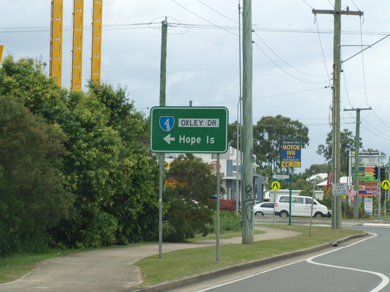 |
Oxley
Drive & Olsen Avenue: Gold Coast Hwy (SR2) at the junction with Oxley Dr (SR4) and Olsen Av (SR4), March 2009. Image © Rob Tilley |
|
 |
Advance
Directional Sign: AD sign approaching Captain Cook Dr and Pine Ridge Rd at Biggera Waters, February 2009. Image © Rob Tilley |
 |
Oxley
Drive & Olsen Avenue: Gold Coast Hwy (SR2) at the junction with Oxley Dr (SR4) and Olsen Av (SR4), March 2009. Click here for for a photo from July 2007 of the previous sign at this location Image © Rob Tilley |
|
 |
Discovery
Drive: Gold Coast Hwy (SR2) approaching Discovery Dr, February 2009. Image © Rob Tilley |
 |
Advance
Directional Sign: AD sign approaching Waterways Dr at Main Beach, July 2007. Image © Paul Rands |
|
 |
Advance
Directional Sign: AD sign approaching Town Centre Dr at Helensvale, February 2009. Image © Rob Tilley |
 |
Advance
Directional Sign: AD sign approaching Tedder Av in MaiN Beach, July 2007. Image © Paul Rands |
|
 |
Town
Centre Drive: Corner of Gold Coast Hwy (SR2) and Town Centre Dr, February 2009. Image © Rob Tilley |
 |
Advance
Directional Sign: AD sign at Southport approaching North St (SR10), July 2007. Image © Paul Rands |
|
 |
Advance
Directional Sign: AD sign approaching the interchange with Pacific Mwy (M1) at Helensvale, February 2009. Image © Rob Tilley |
 |
North
Street (Smith Street Connection): Corner of Gold Coast Hwy (SR2) at the North St junction in Southport, July 2007. Image © Paul Rands |
|
 |
Advance
Directional Sign: AD sign approaching the interchange with Pacific Mwy (M1) at Helensvale, February 2009. Image © Rob Tilley |
 |
Advance
Directional Sign: AD sign approaching Nerang St in Southport, July 2007. Image © Paul Rands |
|
 |
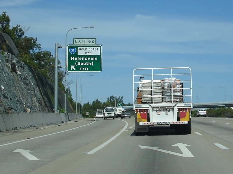
Pacific
Motorway Interchange: Signage at the Pacific Mwy (M1) interchange at Helensvale, February 2009. Image © Rob Tilley |
 |
Advance
Directional Sign: AD sign approaching Ada Bell Way (Southport-Nerang Rd) (SR20) , March 2005. Image © Michael Greenslade |
|
 |
Advance
Directional Sign: AD sign approaching Ada Bell Way (Southport-Nerang Rd) (SR20) at Southport, July 2007. Image © Paul Rands |
|||
 |
Reassurance
Directional Sign: Distance sign at Southport, July 2007. Image © Paul Rands |
|||
 |
Nerang River: Gold Coast Hwy (SR2) as it crosses Nerang River via Gold Coast Bridge at Southport, July 2007. Image © Paul Rands |
|||
 |
Advance Directional Sign: AD sign at Main Beach approaching Ferny Av, March 2005. Image © Michael Greenslade |
|||
 |
Surfers
Paradise: Gold Coast Hwy (SR2) at the junction with Surfers Paradise Blvd in Surfers Paradise, July 2007. Click here for a photo by Michael Greenslade of this location from March 2005. Image © Paul Rands |
|||
| Click here for the continuation of State Route 2 between NSW Border and Surfers Paradise | ||||
1 Transport
and Main Roads, Queensland state-controlled roads and region maps, South Coast Region: front
2 Transport and Main Roads,
From Bulldust to Beef Roads and Beyond: Main Roads –The first 50 years
3 Transport and Main Roads,
Head Office Mapping Section, via email correspondence.
4
Transport and Main Roads,
Projects, Gold Coast Highway - Labrador Government Road to Stevens Street Upgrade
Last updated: 04-Aug-2019 0:52
This site © Paul Rands. All rights reserved. Some portions © (copyright) by their respective and credited owners. Permission must be obtained before using any images from this site. For details, please email by clicking here.