|
|
|
|
|
 |
Beaudesert Road & Mount Lindesay Highway (National Route 13) |
Statistics:
Route Numbering:
General Information:
National Route 13 forms part of what was once a major route between northern New South Wales and south eastern Queensland.
The highway used to extend to Tenterfield but that section of the road, which included some unpaved portions, was decommissioned as a highway by the New South Wales Government.
The route passes suburban and rural areas at the northern end and to the south it passes through rural areas and mountainous terrain, linking the Gold Coast hinterland with the Richmond and Clarence Valleys in New South Wales. The route was once part of the main inland road route between Sydney and Brisbane. Used together with Summerland Way (SR91) on the NSW side of the border, the route is promoted as an alternative to the Pacific Highway.
The Mount Lindesay Highway section is named after Mount Lindesay, the residue of a solidified magma core, that is part of the Mount Warning volcanic area and is situated in the western extreme of Border Ranges National Park.
Multiplexes along the route include:
History:

Click here for photos of the former alignment at Beaudesert
| Rathdowney to Moorooka | Moorooka to Rathdowney | |||
| Preview: | Description: | Preview: | Description: | |
 |
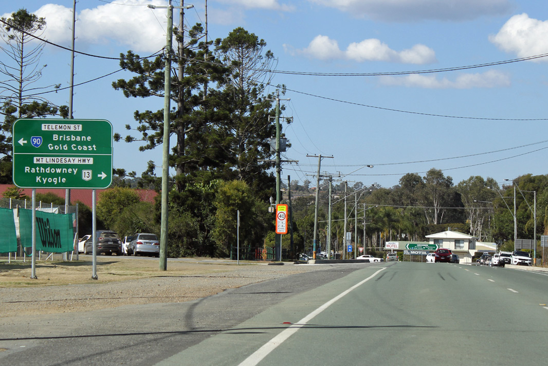
Intersection Directional Sign: ID sign at the junction with Telemon St (SR90) at Beaudesert, July 2018. Image © Rob Tilley |
 |
Reassurance Directional Sign: RD sign on Beaudesert Rd (NR13) at Calamvale, March 2010. Image © Rob Tilley |
|
 |
Advance
Directional Sign: AD sign on Stoney Camp Rd at Greenbank approaching the interchange with Mt Lindesay Hwy (NR13) and Granger Rd, June 2010. Image © Rob Tilley |
 |
Advance Directional Sign: AD sign approaching Illaween St and Algester Rd at Calamvale, March 2010. Image © Rob Tilley |
|
 |
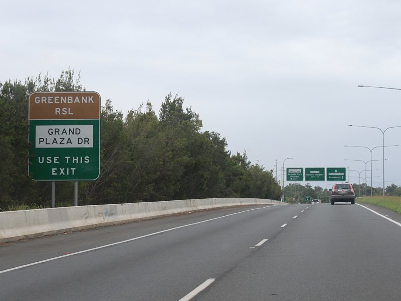
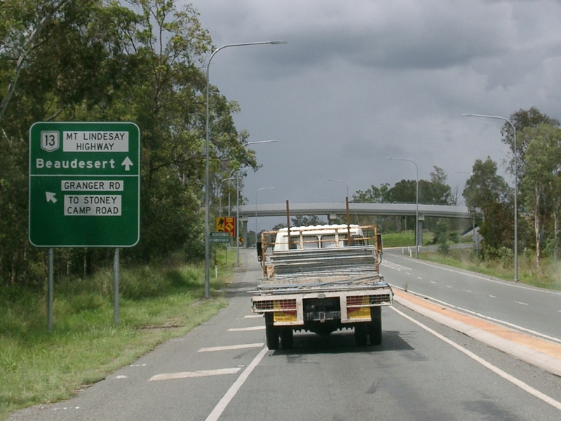
Stoney Camp Road
& Granger Road: The interchange of Mt Lindesay Hwy (NR13), Stoney Camp Rd and Granger Rd at Greenbank, June 2010. Image © Rob Tilley |
 |
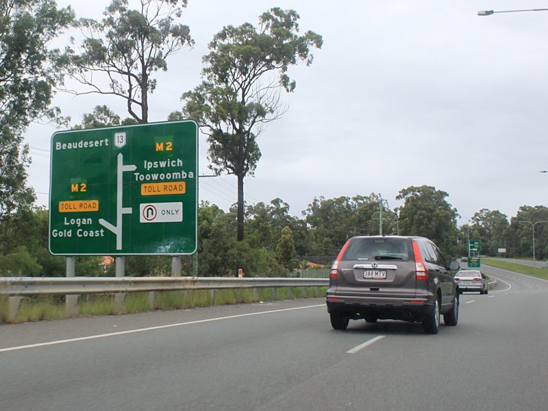
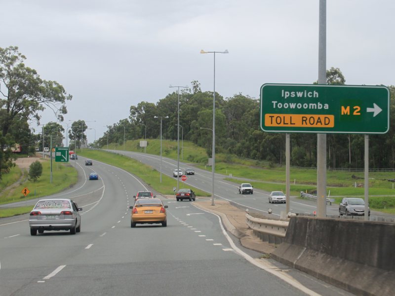
Freeway
Green Sign: Freeway green advance directional sign on Beaudesert Rd (NR13) approaching Logan Mwy (M2) at Parkinson, October 2005. Image © Paul Rands |
|
 |
Stoney
Camp Road & Granger Road: The interchange of Mt Lindesay Hwy (NR13), Stoney Camp Rd and Granger Rd at Greenbank, June 2010. Image © Rob Tilley |
 |
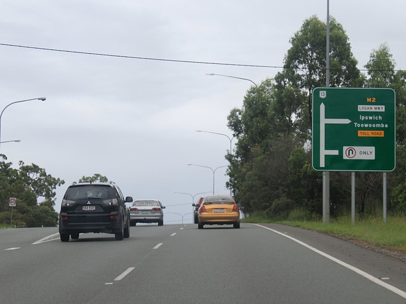
Advance Directional Sign: Advance directional sign on Beaudesert Rd (NR13) approaching Logan Mwy (M2) at Parkinson, March 2010. Click here for a photo of this sign prior to coverplating, from October 2005. Image © Rob Tilley |
|
 |
Intersection Directional Sign: ID sign at the Logan Mwy (M2) interchange at Parkinson, March 2010. Click here for a photo from October 2005 of the previous freeway green coloured sign. Image © Rob Tilley |
|||
 |
Advance Directional Sign: Advance directional sign on Beaudesert Rd (NR13) within the Logan Mwy (M2) interchange at Parkinson, March 2010. Image © Rob Tilley |
|||
 |
Advance
Directional Sign: AD sign on Mt Lindesay Hwy (NR13) at Parkinson for the interchange with Acacia St, Janita Dr, Browns Plains Rd (SR94) and Johnson Rd, March 2010. Image © Rob Tilley |
|||
 |
Intersection Directional Sign: ID sign at the Logan Mwy (M2) interchange at Parkinson, March 2010. Image © Rob Tilley |
|||
 |
Advance Directional Sign: AD sign on Mt Lindesay Hwy (NR13) approaching the service road to Acacia St and Janita Dr, March 2010. Image © Rob Tilley |
|||
 |
Advance
Directional Sign: AD sign on Mt Lindesay Hwy (NR13) at Drewvale for the interchange with Browns Plains Rd (SR94) and Johnson Rd, March 2010. Image © Rob Tilley |
|||
 |
Browns
Plains Road & Johnson Road: Mt Lindesay Hwy (NR13) at the interchange with Browns Plains Rd (SR94) and Johnson Rd at Browns Plains, March 2010. Image © Rob Tilley |
|||
 |
Advance Directional Sign: AD sign at Browns Plains approaching Vansittart Rd and Anzac Av, March 2010. Image © Rob Tilley |
|||
 |
Supplemental Advance Directional Sign: Supplemental AD sign at Browns Plains approaching Vansittart Rd and Anzac Av, March 2010. Image © Rob Tilley |
|||
 |
Vansittart
Road & Anzac Avenue: Mt Lindesay Hwy (NR13) at the interchange with Vansittart Rd and Anzac Av in Browns Plains, October 2005. Image © Paul Rands |
|||
 |
Vansittart
Road & Anzac Avenue: The interchange of Mt Lindesay Hwy (NR13), Vansittart Rd and Anzac Av in Browns Plains, March 2010. Image © Rob Tilley |
|||
 |
Advance Directional Sign: AD sign at Regents Park, approaching Middle Rd, July 2018. Image © Rob Tilley |
|||
 |
Advance Directional Sign: AD sign on Middle Rd at Regents Park, July 2018. Image © Rob Tilley |
|||
 |
Middle
Road: Mt Lindesay Hwy (NR13) at the Middle Rd interchange in Regents Park, October 2005. Image © Paul Rands |
|||
 |
Regents
Park: Mt Lindesay Hwy (NR13) as it passes through Regents Pk, October 2005. Image © Paul Rands |
|||
 |
Advance
Directional Sign: AD sign approaching Park Ridge Rd and Crest Rd at Park Ridge, May 2019. Click here for a photo of this location by Paul Rands from October 2005. Image © Dean Sherry |
|||
 |
Distance
Sign: RD sign as Mt Lindesay Hwy (NR13) leaves Park Ridge, October 2005. Image © Paul Rands |
|||
 |
Advance Directional Sign: AD sign at Park Ridge South approaching Granger Rd and Stoney Camp Rd, July 2018. Image © Rob Tilley |
|||
 |
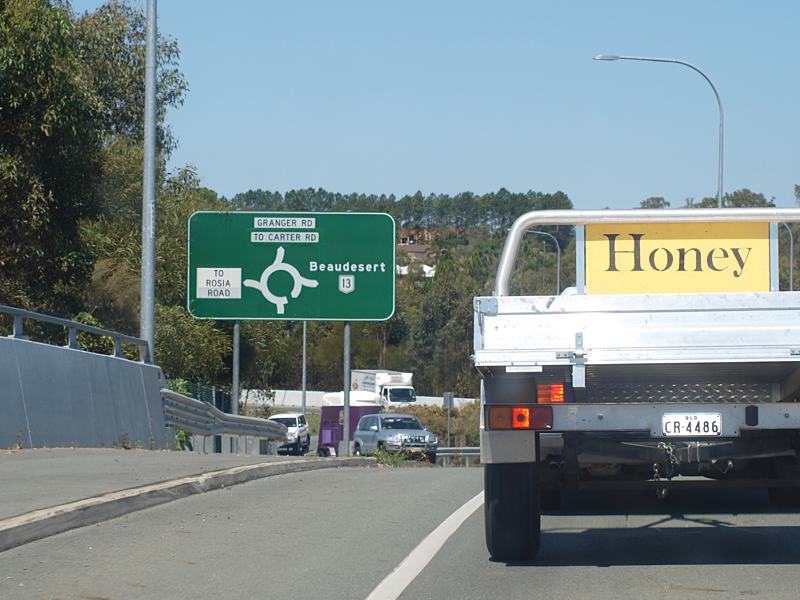
Advance
Directional Sign: AD sign on Mt Lindesay Hwy (NR13) approaching the Granger Rd & Stoney Camp Rd interchange at Park Ridge South, July 2018. Click here for a photo of this location by Paul Rands from October 2005. Image © Rob Tilley |
|||
 |
Advance
Directional Sign: AD sign on Stoney Camp Rd approaching the Mt Lindesay Hwy (NR13) and Granger Rd interchange at Park Ridge South, October 2009. Image © Rob Tilley |
|||
 |
Intersection
Directional Sign: ID sign on the Mt Lindesay Hwy (NR13), Granger Rd and Stoney Ck Rd interchange at Park Ridge South, October 2009. Image © Rob Tilley |
|||
 |
Intersection
Directional Sign: ID sign on the Mt Lindesay Hwy (NR13), Granger Rd and Stoney Ck Rd interchange at Park Ridge South, October 2009. Image © Rob Tilley |
|||
 |
Distance
Sign: RD sign at Munruben, July 2018. Image © Rob Tilley |
|||
 |
Advance Directional Sign: AD sign at Munruben approaching Chambers Flat Rd & Crowson Ln, July 2018. Image © Rob Tilley |
|||
 |
Chambers Flat Road & Crowson Lane: Mt Lindesay Hwy (NR13) at the interchange with Chambers Flat Rd & Crowson Ln at Munruben, July 2018. Image © Rob Tilley |
|||
 |
Advance
Directional Sign: AD sign approaching Camp Cable Rd (SR88) at Jimboomba, July 2018. Click here for a photo of this location by Rob Tilley from October 2009. Click here for a photo from October 2005 of the previous sign. Image © Rob Tilley |
|||
 |
Camp
Cable Road: Corner of Mt Lindesay Hwy (NR13) and Camp Cable Rd (SR88) at Jimboomba, July 2018. Click here for a photo of this location by Rob Tilley from October 2009. Image © Rob Tilley |
|||
 |
Distance
Sign: RD sign at Jimboomba, October 2009. Image © Rob Tilley |
|||
 |
Advance Directional Sign: AD sign at North Maclean approaching St Aldwyn Rd, July 2018. Image © Rob Tilley |
|||
 |
Undullah Road: Mt Lindesay Hwy (NR13) at Undulla Rd in Wood Hill, July 2018. Image © Rob Tilley |
|||
 |
Trailblazer: NR13 trailblazer in the Wood Hill area, July 2018. Image © Rob Tilley |
|||
 |
Trailblazer: NR13 trailblazer at Gleneagle, July 2018. Image © Rob Tilley |
|||
 |
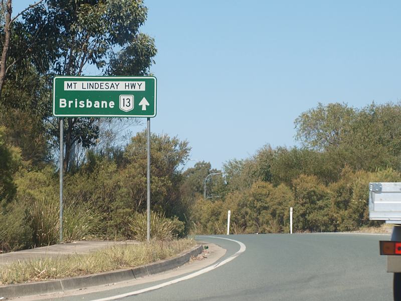
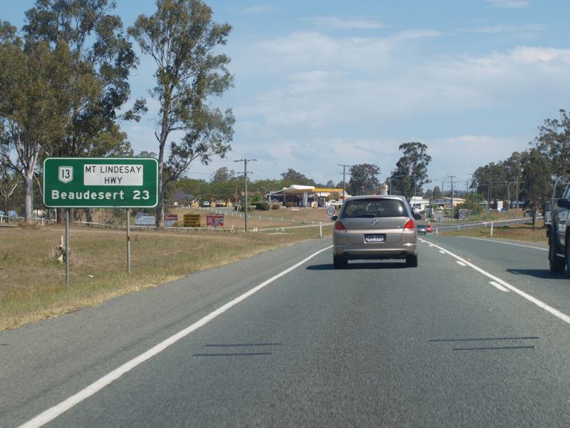
Entering
Beaudesert: Mt Lindesay Hwy (NR13) as it enters the town of Beaudesert, October 2005. Image © Paul Rands |
|||
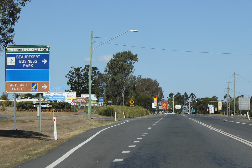 |
Advance
Directional Sign: AD sign approaching Enterprise Dr in Beaudesert, July 2018. Click here for a photo of this location by Paul Rands from October 2005. Image © Rob Tilley |
|||
 |
Advance Directional Sign: AD sign approaching Brisbane St & Helen St at Beaudesert, July 2018. Brisbane St is the former NR13 alignment. Image © Rob Tilley |
|||
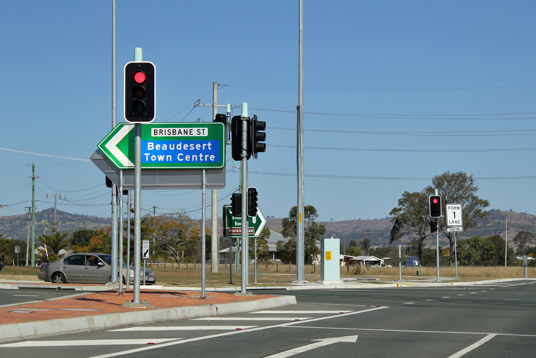 |
Intersection Directional Sign: ID sign at the corner of Mt Lindesay Hwy (NR13), Brisbane St and Helen St at Beaudesert, July 2018. Image © Rob Tilley |
|||
 |
Intersection Directional Sign: ID sign facing Brisbane St at Beaudesert, July 2018. Image © Rob Tilley |
|||
 |
Fishers Gully: Mt Lindesay Hwy (NR13) as it crosses Fishers Gully, July 2018. Image © Rob Tilley |
|||
 |
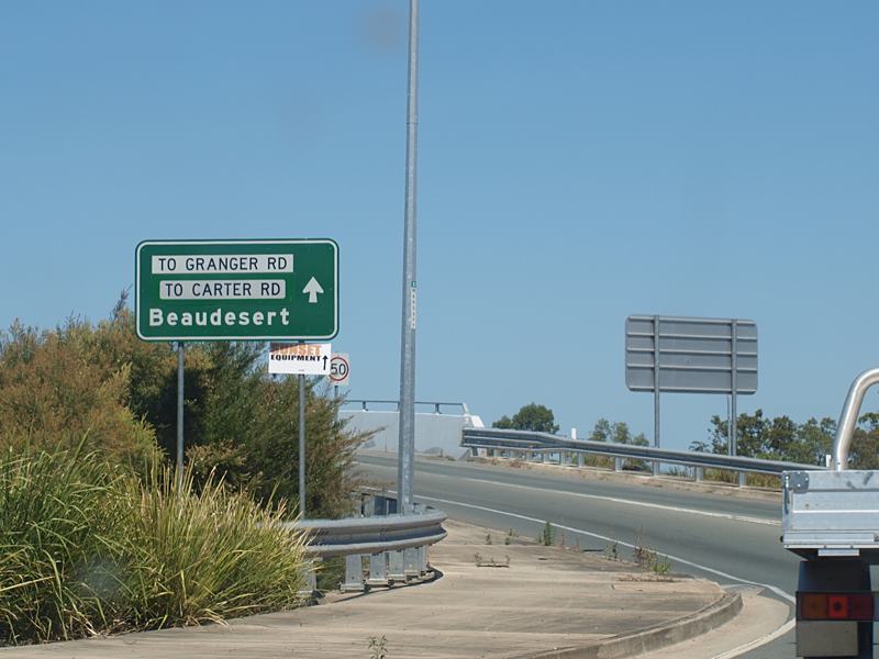
Advance Directional Sign: AD sign at Beaudesest approaching Beaudesert-Boonah Rd, July 2018. NR13 turns left at this location, despite not shown on the sign. Image © Rob Tilley |
|||
 |
Intersection Directional Sign: ID signs at Beaudesest at the junction with Beaudesert-Boonah Rd, July 2018. NR13 turns left at this location, despite not shown on the sign. The SR90 duplex starts at this location. Image © Rob Tilley |
|||
 |
Advance Directional Sign : AD sign approaching Telemon St at Beaudesert, July 2018. Image © Rob Tilley |
|||
 |
Intersection Directional Sign: ID sign at the junction with Telemon St in Beaudesert, July 2018. NR13 turns right here and the SR90 duplex ends at this location. Image © Rob Tilley |
|||
 |
Reassurance
Directional Sign: RD sign on Mt Lindesay Hwy (NR13) at Beaudesert, July 2018. Image © Rob Tilley |
|||
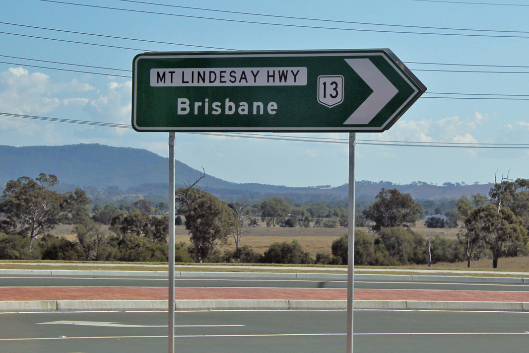
 |
Reassurance
Directional Sign: RD sign on Mt Lindesay Hwy (NR13) as it leaves Beaudesert, July 2018. Click here for a photo of this location by Paul Rands from October 2005. |
|||
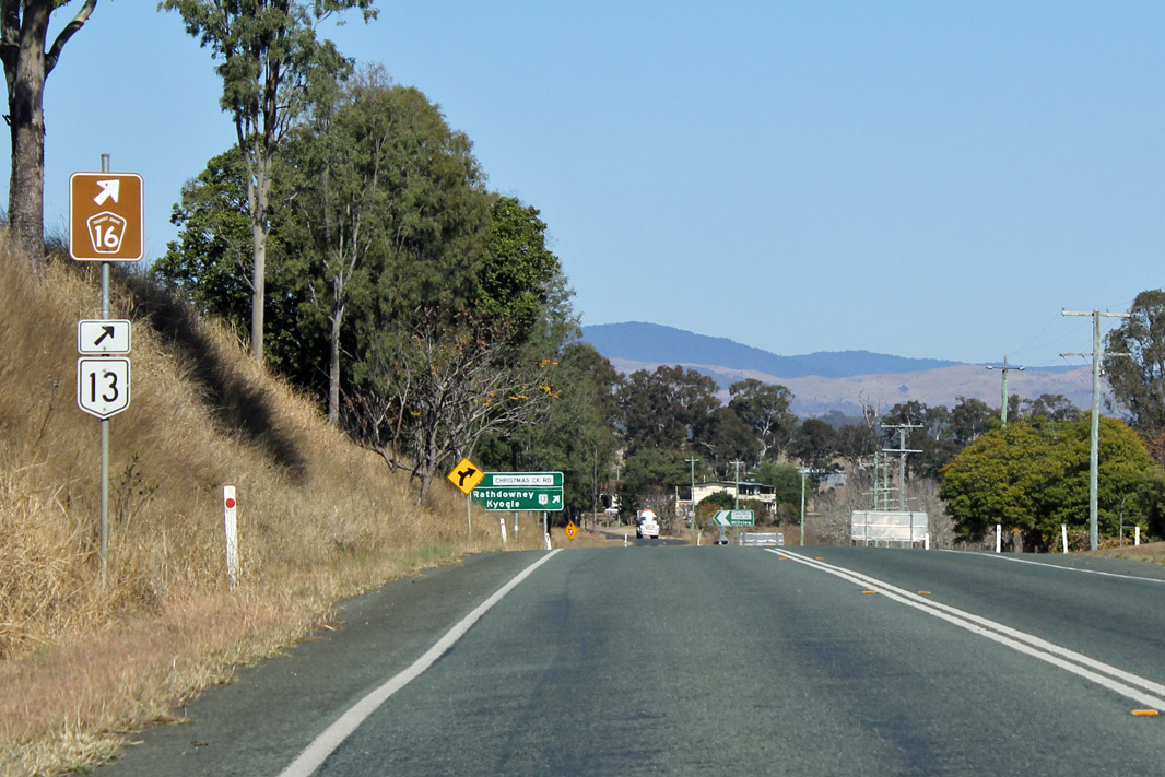 |
Trailblazer: NR13 / TD16 trailblazer approaching Christmas Ck Rd at Laravale, July 2018. Image © Rob Tilley |
|||
 |
Advance
Directional Sign: AD sign at Laravale approaching Christmas Creek Rd, July 2018. Image © Rob Tilley |
|||
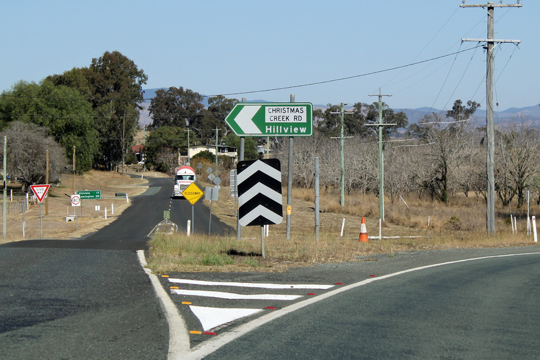 |
Christmas Creek Road: Corner of Mt Lindesay Hwy (NR13) and Christmas Ck Rd at Laravale, July 2018. Image © Rob Tilley |
|||
 |
Reassurance Directional Sign: Distance sign at Laravale, July 2018. Image © Rob Tilley |
|||
 |
Entering Tamrookum: Mt Lindesay Hwy as it enters the town of Tamrookum, July 2018. Image © Rob Tilley |
|||
 |
Advance
Directional Sign: AD sign at Tamrookum approaching Kooralbyn Rd, July 2018. Click here for a photo of this location by Paul Rands from October 2005. Image © Rob Tilley |
|||
 |
Advance Directional Sign: AD sign at Tamrookum at the Kooralbyn Rd junction, July 2018. Image © Rob Tilley |
|||
 |
Trailblazer: NR13 trailblazer at Innes Plain, July 2018. Image © Rob Tilley |
|||
 |
Entering
Rathdowney: Mt Lindesay Hwy (NR13) as it enters Rathdowney, October 2005. Image © Paul Rands |
|||
 |
Rathdowney: Mt Lindesay Hwy (NR13) as it passes through the town of Rathdowney, October 2005. Image © Paul Rands |
|||
 |
Advance
Directional Sign: AD sign at Rathdowney approaching Boonah-Rathdowney Rd (SR93), October 2005. Note the SR91 shield, this has sign has since been replaced with one showing NR13. Image © Paul Rands |
|||
 |
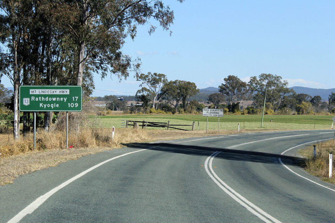
Distance Sign: RD sign at Rathdowney, October 2005. Note the SR91 shield, this has sign has since been replaced with one showing NR13 and the same distances. Image © Paul Rands |
|||
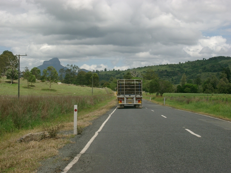 |
Palen Creek: Mt Lindesay Hwy (NR13) as it passes through Palen Creek, with Mt Lindesay in the distance, October 2005. Image © Paul Rands |
|||
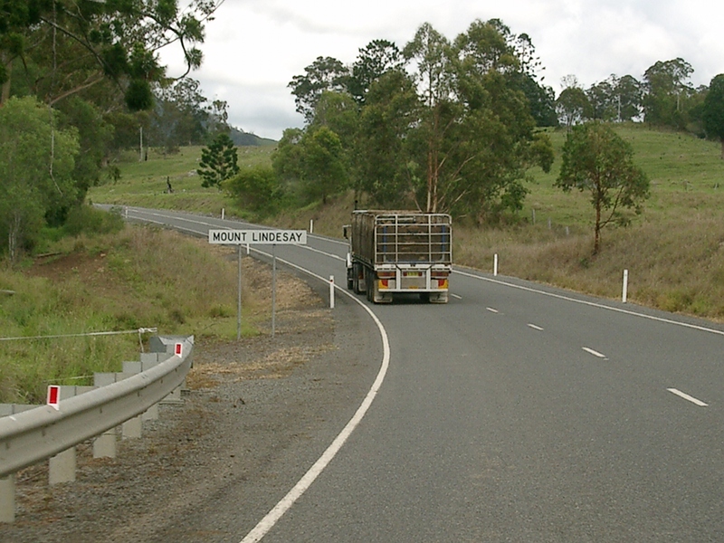 |
Entering Mount Lindesay: NR13 as it enters Mt Lindesay, October 2005. Image © Paul Rands |
|||
 |
Road Slips Sign: Sign on Mt Lindesay Hwy (NR13) indicating possible debris on road, Mt Lindesay, October 2005. Image © Paul Rands |
|||
 |
Mt Lindesay: Mt Lindesay Hwy (NR13) as it winds its way through the Mt Lindesay area, October 2005. Image © Paul Rands |
|||
 |
Mt Lindesay: Mt Lindesay Hwy (NR13) as it winds its way through the Mt Lindesay area, October 2005. Image © Paul Rands |
|||
| Click here for the continuation of the route in New South Wales as State Route 91 (Mt Lindesay Road) | ||||
1 Transport
and Main Roads, Queensland state-controlled roads and region maps, South Coast Region: front
2 Tyler Bullock
3 Queensland Government,
Ministerial Media Statements, Mt Lindesay Highway on-ramp upgrade, 8 November
2006.
4 Transport
and Main Roads, Newsletters, Acacia Ridge rail crossing overpass, November 2008.
5 Queensland Government,
Ministerial Media Statements, Road works will widen Mt Lindesay Highway near
Rathdowney, 11 August 2006.
6 Transport and Main Roads,
Projects, Beaudesert Road and Learoyd Road intersection
improvement works
Last updated: 22-Dec-2019 1:37
This site © Paul Rands. All rights reserved. Some portions © (copyright) by their respective and credited owners. Permission must be obtained before using any images from this site. For details, please email by clicking here.