|
|
|
|
|
 |
Gore Highway (NH85) (Decommissioned) |
Statistics:
Route Numbering:


General Information:
The Gore Highway is a major highway route linking the Darling Downs farming area, and the city of Toowoomba with Goondiwindi and New South Wales.
Consisting of mostly rural highway standard, the route passes through mostly farming, residential and commercial zones.
The Gore Highway is named after two brothers, George & Ralph Gore. They established Yandilla station between Pittsworth and Millmerran, which the highway passes through. 2
Multiplexes along the route include:
History:

| Goondiwindi to Toowoomba | Toowoomba to Goondiwindi | |||
| Preview: | Description: | Preview: | Description: | |
 |
Advance Directional Sign: AD sign approaching Leichhardt Hwy (A5) at Goondiwindi, October 2005. Click here for a photo by Rob Tilley from April 2005 of this sign prior to the A5 coverplate. Image © Paul Rands |
 |
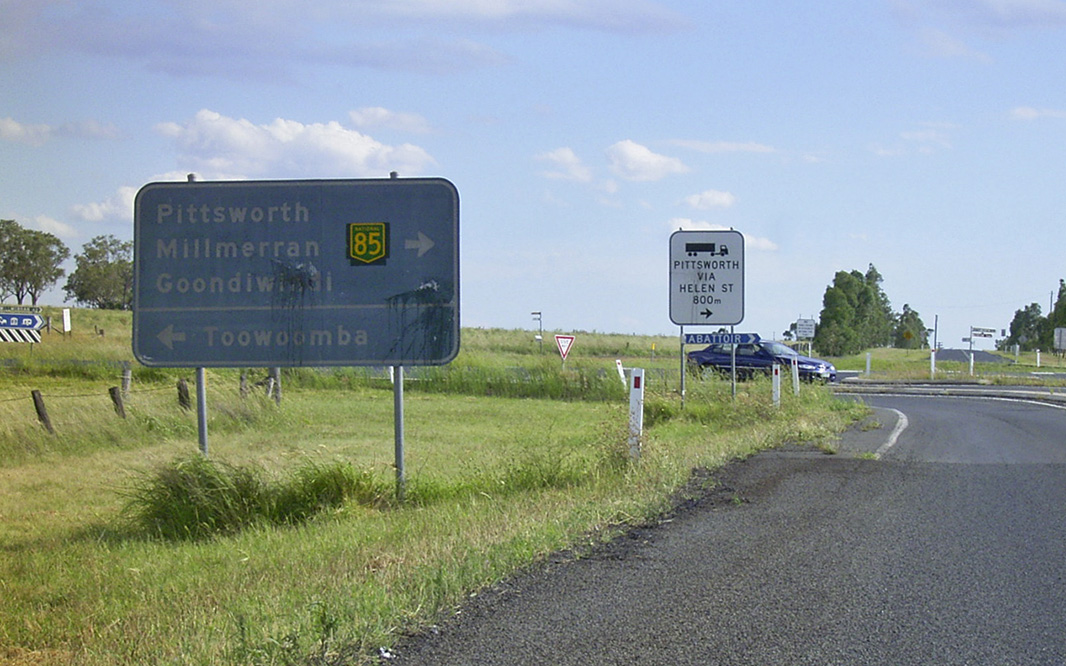
Advance Directional Sign: AD sign approaching Helen St in Pittsworth, April 2005. Image © Rob Tilley |
|
 |
Intersection Directional Sign: ID sign at the Leichhardt Hwy junction showing former NR39 route number, Goondiwindi, April 2005. Image © Rob Tilley |
 |
Advance Directional Sign: Images © Michael Greenslade |
|
 |
Reassurance Directional Sign: RD sign as Gore Hwy leaves Goodiwindi, January 2004. Click here for a photo of this location by Michael Greenslade from January 2003. Image © Michael Greenslade |
 |
Advance Directional Sign: AD sign approaching Leichhardt Hwy (NR39 / NH39 / SR85), January 2003. NH85 ends at this intersection. Image © Michael Greenslade |
|
 |
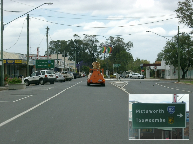
Advance Directional Sign: AD sign approaching Campbell St (SR82) in Millmerran, October 2005. Image © Paul Rands |
|||
 |
Advance Directional Sign: AD sign approaching the unnumbered section of Campbell St in Millmerran, October 2005. Image © Paul Rands |
|||
 |
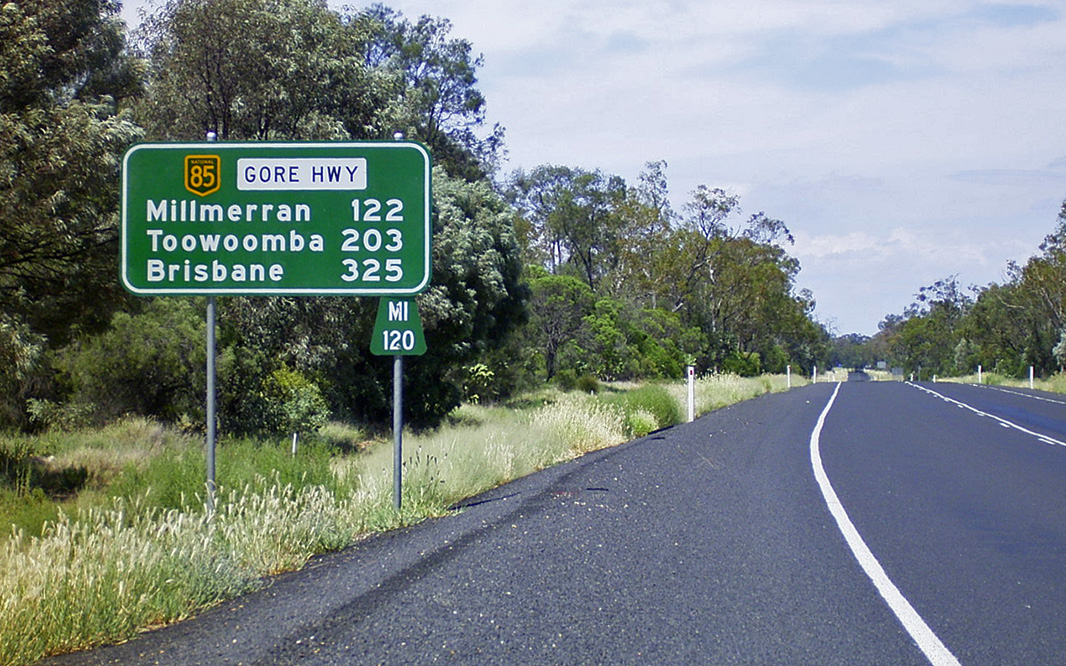
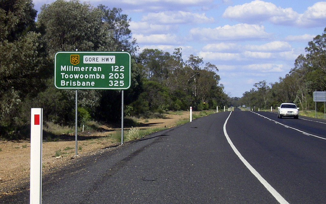
Distance Sign: Reassurance directional sign as Gore Hwy leaves Millmerran town centre, January 2004. Image © Michael Greenslade |
|||
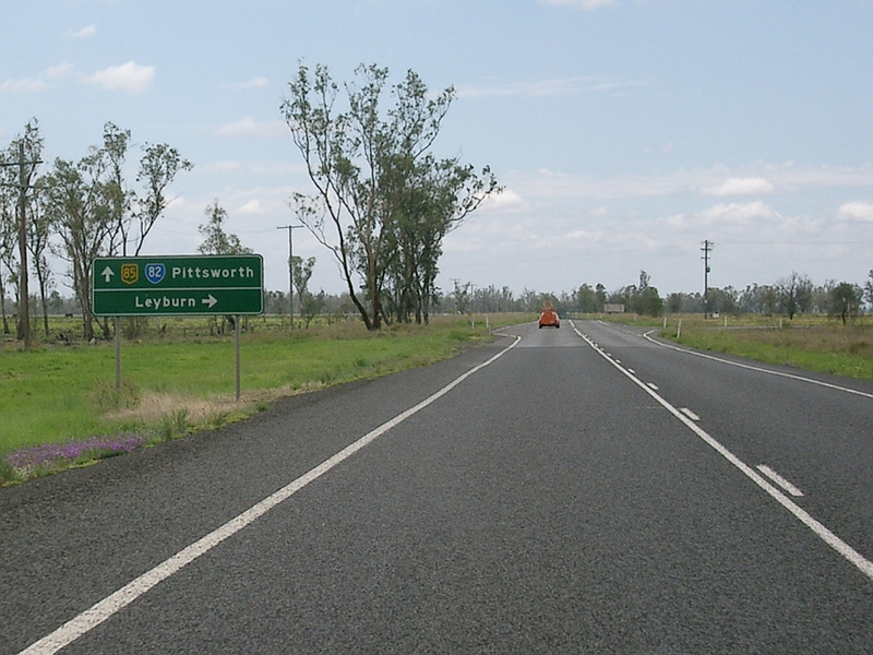 |
Advance Directional Sign: AD sign at Yandilla approaching Millmerran-Leyburn Rd, October 2005. Image © Paul Rands |
|||
 |
Advance Directional Sign: AD sign approaching Pampas-Horrane Rd (SR82) in Pampas, October 2005. Image © Paul Rands |
|||
 |
Trailblazer: NH85 trailblazer at Pampas, October 2005. Image © Paul Rands |
|||
 |
Advance Directional Sign: AD sign at Pittsworth approaching Gap Rd, October 2005. Image © Paul Rands |
|||
 |
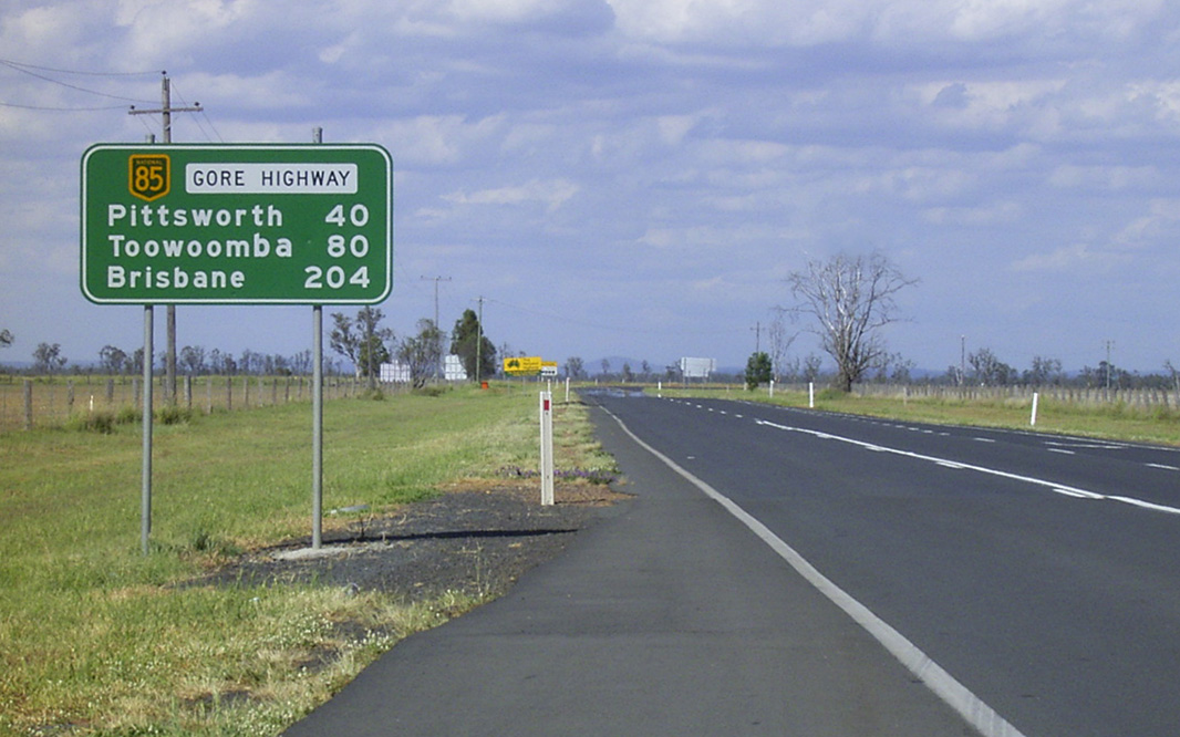
Distance Sign: RD sign near Dallman Rd in Pittsworth, April 2005. Note the black fingerboard in the distance. Image © Rob Tilley |
|||
 |
Advance Directional Sign: AD sign with incorect font on the name patch approaching Oakey-Pittsworth Rd and Pittworth-Felton Rd in Pittsworth, April 2005. Image © Rob Tilley |
|||
 |
Advance Directional Sign: AD sign approaching Lochaber Rd in Pittsworth, April 2005. Image © Rob Tilley |
|||
 |
Black Advance Directional Sign: Black AD sign Lochaber Rd approaching Gore Hwy (NH85) in Pittsworth, January 2004. Image © Michael Greenslade |
|||
1 Transport and Main Roads, Queensland state-controlled roads and region maps, Darling Downs Region: back
2 Michael Greenslade, Australian Towns, Cities & Highways, Gore Highway
Last updated: 25-Oct-2021 0:18
This site © Paul Rands. All rights reserved. Some portions © (copyright) by their respective and credited owners. Permission must be obtained before using any images from this site. For details, please email by clicking here.