|
|
|
|
|
 |
Bruce Highway (National Highway 1) (Decommissioned) - Bald Hills to Beerburrum |
Statistics:
Route Numbering:

General Information:
The Highway 1 corridor is the main coastal route from the NSW border to the northern tip of the east coast of Australia, and links major cities and towns with Brisbane, and beyond the NSW border, Sydney.
Bruce Highway is named after former Minister of Public Works, Henry Bruce and connects Brisbane with all coastal regions north of the city.
The route is freeway standard from the Gateway Motorway interchange to Curra, north of Cooroy. From there, the route alternates between single and dual carriageway, and passes through rural, residential, industrial and commercial areas.
History:
| Bald Hills to Beerburrum | Beerburrum to Bald Hills | |||
| Preview: | Description: | Preview: | Description: | |
 |
Start of Bruce Highway: Sign north of the Gateway Mwy (Metroad 1) and Gympie Arterial Rd (Metroad 3) interchange and the North Pine River bridge at Murrumba Downs indicating the beginning of Bruce Hwy, May 2005. Image © Michael Greenslade |
 |
Reassurance Directional Sign: Distance sign at Elimbah, May 2005. Image © Rob Tilley |
|
 |
Reassurance Directional Sign: Distance sign at Kallangur, May 2005. Image © Michael Greenslade |
 |
Pumicestone Road: Bruce Hwy (NH1) at the Pumicestone Rd interchange at Elimbah, April 2005. Image © Rob Tilley |
|
 |
Freeway Green Advance Directional Sign: Freeway Green AD sign at Burpengary approaching Progress Rd interchange, October 2004. Image © Michael Greenslade |
 |
Freeway Green Reassurance Directional Sign: Image © Rob Tilley |
|
 |
Morayfield Road: Bruce Hwy (NH1) as passes under Uhlmann Rd & Morayfield Rd (SR60) at Burpengary, March 2006. Image © Paul Rands |
 |
Advance Directional Sign: AD sign at Caboolture approaching Bribie Island Rd (SR85) and D'Aguilar Hwy (SR85), May 2005. |
|
 |
Reassurance Directional Sign: Distance sign at Beerburrum, November 2005. Image © Michael Greenslade |
 |
Bribie Island Road / D'Aguilar Highway Interchange: Bruce Hwy (NH1) at the Bribie Island Rd (SR85) and D'Aguilar Hwy (SR85) interchange at Caboolture, May 2005. Image © Michael Greenslade |
|
 |
Service Centre: Bruce Hwy (NH1) at the Service Centre at Morayfield, March 2006. Image © Paul Rands |
 |
Freeway Green Sign: Freeway green and standard green ID signs at the Deception Bay Rd interchange at Burpengary, May 2005. Image © Michael Greenslade |
|
 |
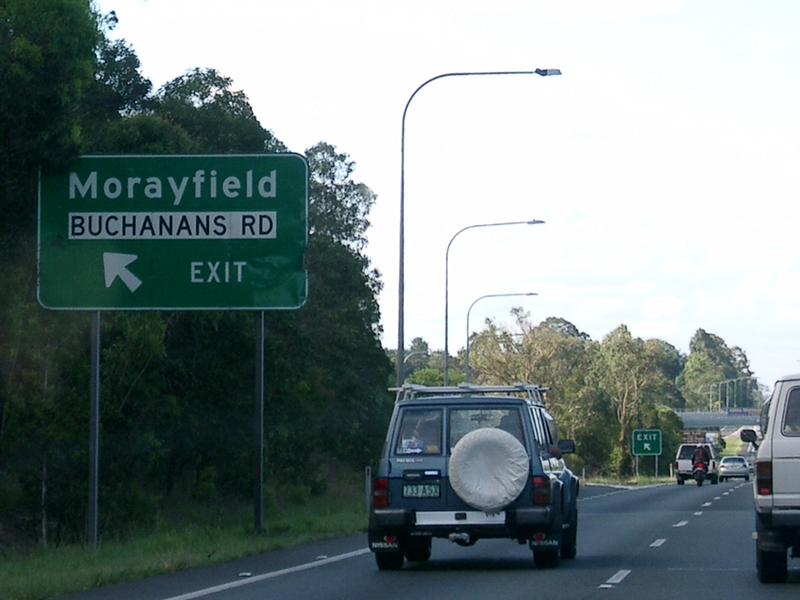
Advance Directional Sign: AD sign at Morayfield approaching Buchanans Rd, March 2006. Image © Paul Rands |
 |
Advance Directional Sign: AD sign on Deception Bay Rd approaching Bruce Hwy (NH1) interchange at Burpengary, May 2005. Image © Michael Greenslade |
|
 |
Buchanans Road: Bruce Hwy (NH1) at the Buchanans Rd interchange, Morayfield, October 2005. Image © Rob Tilley |
 |
Advance Directional Sign: AD sign on Deception Bay Rd on Bruce Hwy (NH1) interchange at Burpengary, May 2005. Image © Michael Greenslade |
|
 |
Advance Directional Sign: AD sign at Caboolture approaching Bribie Island Rd (SR85) and D'Aguilar Hwy (SR85), March 2006. Image © Paul Rands |
 |
Intersection Directional Sign: ID sign assembly facing Old Gympie Rd at Burpengary at the junction with Deception Bay Rd, New Settlement Rd and Bruce Hwy (NH1) interchange, May 2005. Image © Michael Greenslade |
|
 |
Supplemental Advance Directional Sign Supplemental AD sign at Morayfield approaching Bribie Island Rd (SR85) and D'Aguilar Hwy (SR85), March 2006. Image © Paul Rands |
 |
Advance Directional Sign: AD sign at Mango Hill approaching Anzac Av (SR71), May 2005. Image © Michael Greenslade |
|
 |
D'Aguilar Highway / Bribie Island Road Interchange: D'Aguilar Hwy (King St) (SR85) at the interchange with Bruce Hwy (NH1) and Bribie Island Rd (SR85) at Caboolture, July 2004. Image © Michael Greenslade |
 |
Reassurance Directional Sign: Distance sign at Mango Hill, May 2005. Image © Michael Greenslade |
|
 |
Advance Directional Sign: AD sign at Caboolture approaching the Pumicestone Rd interchange, March 2006. Image © Paul Rands |
 |
Advance Directional Sign: AD sign at Griffin, approaching Gateway Mwy (Metroad 1) and Gympie Arterial Rd (Metroad 3), May 2005. Image © Michael Greenslade |
|
 |
Pumicestone Road: Bruce Hwy (NH1) at the Pumicestone Rd interchange, Caboolture, March 2006. Image © Paul Rands |
 |
Freeway Green Advance Directional Sign: Freeway Green AD sign at Griffin, approaching Gateway Mwy (Metroad 1) and Gympie Arterial Rd (Metroad 3), May 2005. Image © Michael Greenslade |
|
 |
Advance Directional Sign: AD sign on Pumicestone Rd at Caboolture approaching Bruce Hwy (NH1), May 2005. Note the incorrect font for the town names, it should be identical to the Nambour legend. Image © Michael Greenslade |
|||
 |
Advance Directional Sign: AD sign on Pumicestone Rd at Caboolture approaching Bruce Hwy (NH1), May 2005. Note the incorrect font for the town names, it should be identical to the Nambour legend. Image © Michael Greenslade |
|||
 |
Black & Freeway Green Intersection Directional Sign: Black and freeway green ID signs on Pumicestone Rd at the Bruce Hwy (NH1) interchange in Caboolture, May 2005. Image © Michael Greenslade |
|||
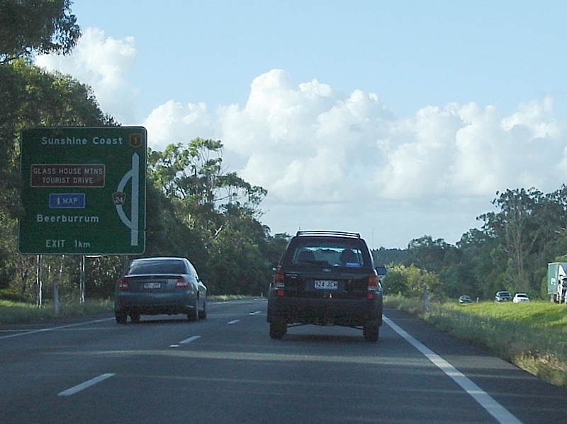 |
Advance Directional Sign: AD sign at Elimbah approaching Glass House Mountains Rd (TD24), March 2006. TD24 is now named Steve Irwin Way and is a former alignment of Bruce Hwy. Image © Paul Rands |
|||
 |
Advance Directional Sign: AD sign at Glenview approaching Caloundra Rd (SR6) and Glass House Mountains Rd (SR 6 / TD24), March 2006. Image © Paul Rands |
|||
 |
Glass House Mountains Road & Caloundra Road: Bruce Hwy (NH1) at the interchange with Caloundra Rd (SR6) and Glass House Mountains Rd (SR 6 / TD24) at Glenview, March 2006. Image © Paul Rands |
|||
 |
Advance Directional Sign: AD sign on the off ramp to Glass House Mountains Rd (SR6 / TD24) and Caloundra Rd (SR6) at Glenview, April 2005. Image © Rob Tilley |
|||
 |
Intersection Directional Sign: ID sign on the northbound on ramp to Bruce Hwy (NH1) from Glass House Mountains Rd (SR6 / TD24) and Caloundra Rd (SR6) at Glenview, April 2005. Image © Rob Tilley |
|||
| Click here for the continuation of NH1 between Beerburrum and Nambour | ||||
1 Department of Transport and Main Roads, The State Road Network of Queensland, 30 June 2010
2 Nambour Chronicle, 4 October 1929
3 Nambour Chronicle, 8 November 1929
3 Nambour Chronicle, 26 October 1934
4 Nambour Chronicle, 23 November 1934
5 Department of Environment and Heritage Protection, North Coast Roadside Rest Areas
6 Tyler Bullock
7 Caboolture in the 70s
Last updated: 24-Oct-2021 20:46
This site © Paul Rands. All rights reserved. Some portions © (copyright) by their respective and credited owners. Permission must be obtained before using any images from this site. For details, please email by clicking here.